| |
 |
Fig. 1 Vicinity of Lencois
Lencois (kmz, 3.76MB, Low Resolution) as seen on Google Earth. |
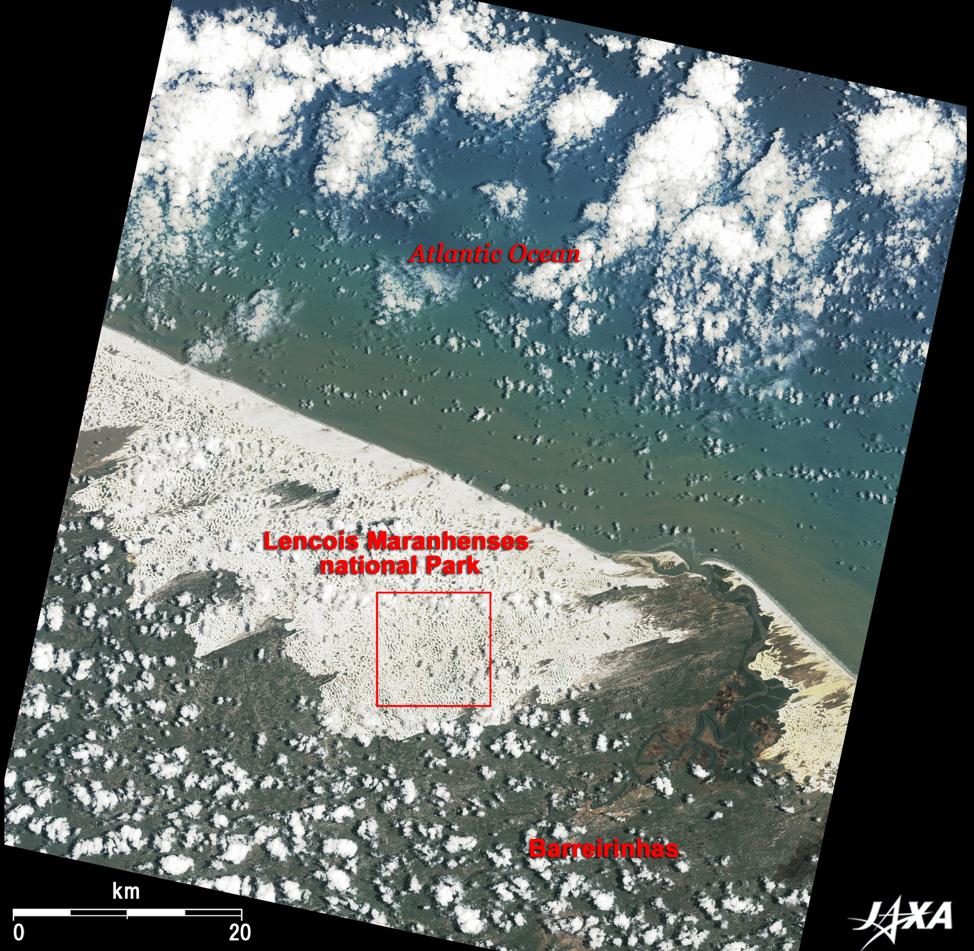
Figure 1 depicts the large sand dune of Lencois (Lençóis in Portuguese) located on the northern coast of Brazil as observed in October 2006. Though some dotted clouds disturb the image, the upper half of the image is the Atlantic Ocean, and the lower half is the Maranhao (Maranhão) state of Brazil. It is located 700km east from the mouth of the Amazon River and is 260km east from the state capital, Sao Luis (São Luís). (The old city of Sao Luis was added to the list of the World Heritage of the United Nation's Educational, Scientific and Cultural Organization (UNESCO) as Historic Centre of São Luís in 1997.) Barreirinhas, visible in the lower right, is the tourist gateway to Lencois.
The easterly wind blowing from the low-latitude Atlantic Ocean created a 50km-long pure-white sand dune along the coast. This large sand dune reaches tens of kilometers inland and occupies an area of 1,550km square (2.5 times larger than the 23 districts of Tokyo). In 1981, Lencois Maranhenses National Park (Parque Nacional dos Lençóis Maranhenses) was designated to protect the nature of the area covering this large sand dune. Lencois means "sheet" in Portuguese. The white clear and fine sand spread like a sheet all around. Since the sand is made of pure quartz, which is the ingredient of crystal and was ground over many years, it strongly reflects the sunlight and shines.
 |
 |
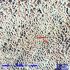
Fig. 2 Close-up of the Sand Dune
(Rainy Season (Left Image) and Dry Season (Right Image)) |
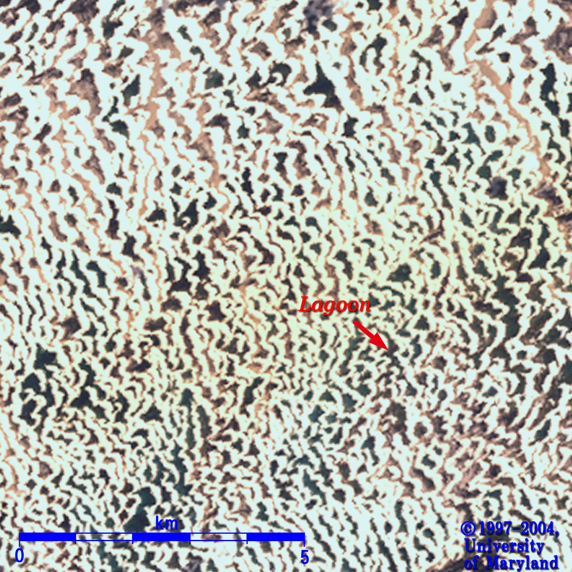
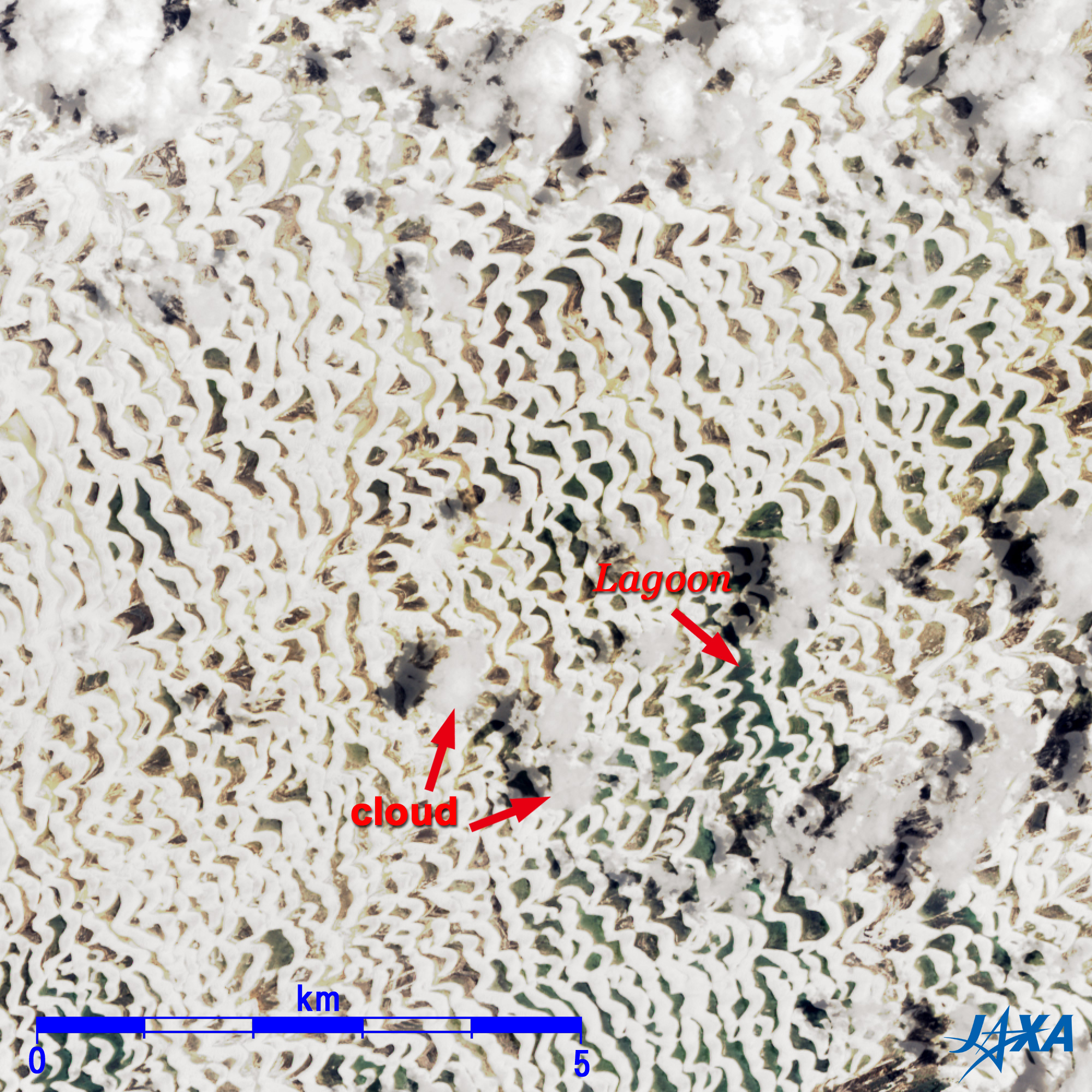
Figure 2 presents a close-up image of the sand dune. Strong wind and abundant sand supplied from the coast have created countless crescent-shaped sand dunes (refer to Barchan) covering many kilometers. The convex surface of the barchan faces upwind and the concave surface faces downwind as illustrated in the referenced site. Thus, the direction of the sand dune in Fig. 2 indicates that an easterly wind dominates Lencois. Barchans usually cluster together and collide through interaction over a period of a few years to tens of years.
The left image of Fig. 2 was captured in May (rainy season), and the right image, in October (dry season). Rainfall in Lencois is about 2,000mm each year, but strong winds and blowing sand do not allow any plants to grow. Many hollows are visible in Fig. 2 between the white sand dunes. Numerous temporary lakes (lagoons) emerge here in the rainy season. It is believed that water flows under the dune and that lakes appear in the rainy season. The rainfall is concentrated from January to July, and lakes disappear gradually afterwards. The blue-green areas in the figure are filled with water. Comparison of the two images reveals the many lakes that appear in the rainy season.
The lakes in the sand dune appear deep emerald green, and they are sometimes 2km wide and 5m deep. Surprisingly, small fish can be seen in the water. Eggs laid in sand endure the dry season and hatch when water returns to the sand dunes in the rainy season.
Explanation of the Images:
Fig. 1 and right image of Fig. 2. Images can be expanded twice by clickings.
AVNIR-2 has four observation bands. The composite images are produced by assigning red to Band 3 (610 to 690nm), green to Band 2 (520 to 600nm), and blue to Band 1 (420 to 500nm).
Left image of Fig. 2. Image can be expanded twice by clickings.
Imagery of ETM+ was downloaded from the Global Land Cover Facility (GLCF) Earth Science Data Interface of the University of Maryland, USA. In the same way as AVNIR-2, the composite image is produced by assigning red to Band 3 (630 to 690nm), green to Band 2 (520 to 600nm), and blue to Band 1 (450 to 520nm).
The resulting images have natural coloring as if seen by the naked eye. Thus, the ground objects are distinguished by the following colors.
| Dark green: |
Forests |
| Light green: |
Grass fields, farmlands |
| Brown: |
City area |
| Bluish green: |
Water surfaces |
| White: |
Sand dunes, clouds |
|
 |
|