Seen from Space 2004
Mangrove forest in Iriomote Island observed by synthetic aperture radar
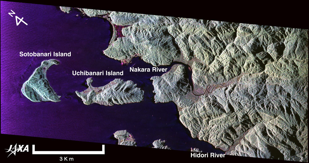
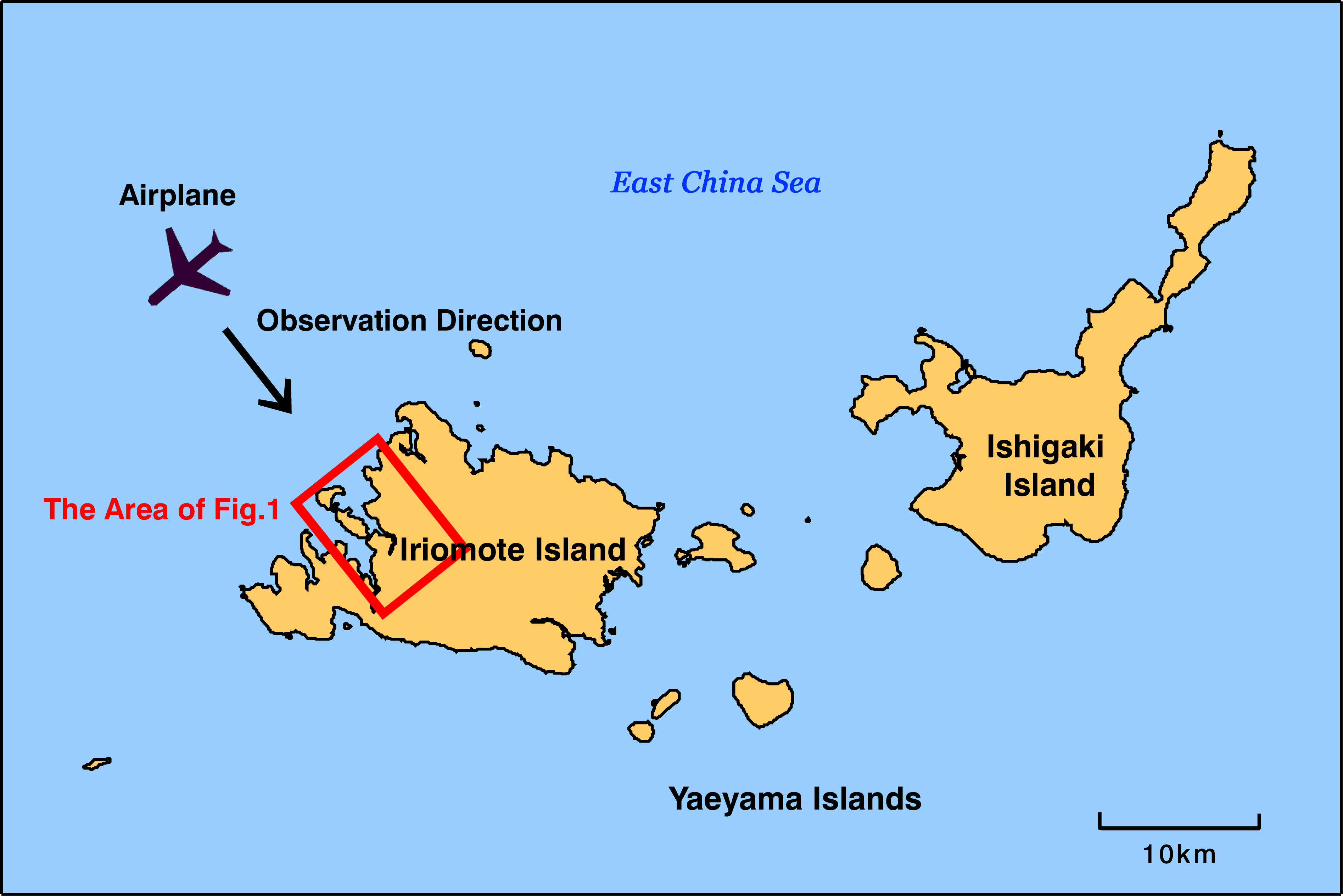
Figure 1 depicts western Iriomote Island observed by Airborne L-band SAR radar (PiSAR *1). This image was made from a radar signal that was emitted from the antenna, illuminated the area, reflected back in the radar antenna direction, and received by the antenna. The configuration is illustrated in Fig. 2. The black area in Fig. 1 represents water or mountain shadows, the green area with shade indicates the mountain covered with trees, and the pinkish area denotes the mangrove forest.
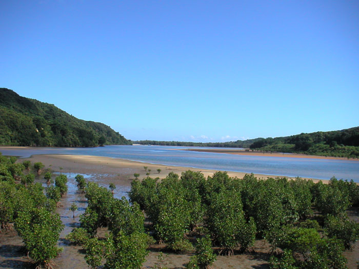
Mangrove forests are periodically inundated with seawater and support many active life forms. Many fries, crabs, and shrimps gather in the nutrition-rich soil and water, which is made by a mixture of dead mangrove leaves, water and air. The complex structure of mangrove roots extends even on the ground and forms a jungle in the sea, providing a suitable environment for small fish to hide from their enemies. The environment of many small fish, crabs, and so on is also an attractive place for birds. Not only do local birds affect the mangrove forest, but migratory birds also visit. For instance, Iriomote mangrove forest is an important place for snipe and plover to take a rest and satisfy their appetite on their 7000 to 10,000km flight from south-east Asia to Siberia.
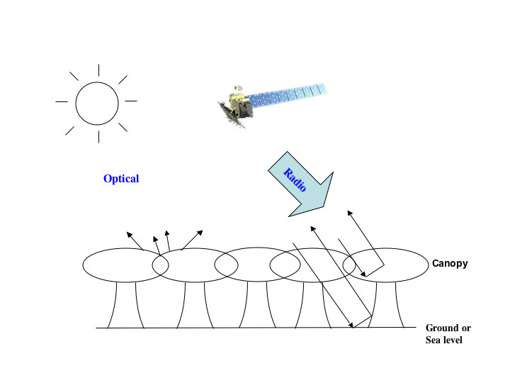
When a forest is observed by an optical sensor (wavelength several hundred nm), the sensor acquires sunlight reflecting from the ground and then detects the leaves of the trees. In contrast, an L-band radar signal (wavelength 23.6cm) transits the forest in some degree and interacts with the canopy, ground and tree trunks, and is reflected back in the antenna direction as shown in Fig. 4. The Nakara River and Hidori River look dark because little radar signal is scattered in the antenna direction at the water surface. In contrast, the mangrove area is inundated with seawater and looks pink. This is because the radar signal is strongly reflected in one of four radio wave components. L-band SAR (PALSAR) is going to be carried aboard the Advanced Land Observing Satellite (ALOS), which is scheduled to be launched next year by JAXA. Using the L-band SAR characteristics described above, the Kyoto & Carbon Initiative project is planned to detect or monitor changes in forests including the mangrove forests and wetlands. (*1) Pi-SAR is an airborne synthetic aperture radar. It consists of X-band SAR operated by the National Institute of Information and Communications Technology (NICT) and L-band SAR operated by the Japan Aerospace and Exploration Agency (JAXA). Details and the image library acquired by SAR are shown here.
Three of four Pi-SAR polarization modes are used, and are presented in a color-composite image (HH polarization, red; HV polarization, green; and VV polarization, blue). Polarization represents a radio-signal component oscillating in a specific plane. In H (V) polarization, the radio-signal component oscillates parallel (perpendicular) to the ground. HV indicates that an H polarized signal is emitted from the antenna and is returned as a V polarized signal due to scattering by the ground. The shading seen on the mountain doesn't represent illumination and reflection of sunlight, but rather the difference of angle and direction of the ground illuminated by the SAR signal. The spatial resolution of the original image is about 3m. Related sites: - What We Can Learn from Optical Sensor and Synthetic Aperture Radar Images - |