 |
There is an animal's paradise in the coves of the Bay of Bengal, a great wetland that stretches across West Bengal in India and Bangladesh.
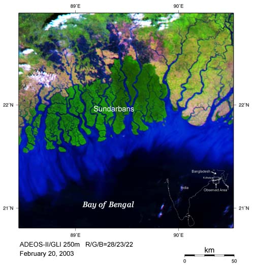
This area is called "Sundarbans" and is located in a part of delta area of the mouth of the Ganges River and the Brahmaputra River. These rivers wind back and forth, and pour into the Bay of Bengal as countless rivers with various widths or as intricate channels. These land features are considered to have been formed by the decrease in the volume of the Ganges River caused by its mainstream's movement in the sixteenth century. Seawater penetrates the depths of the channels as the tide ebbs and flows. The water level differs by more than five meters between high tide and low tide. This area accommodates the world's largest mangrove (*) forests.
The above image of the mouths of the Ganges River and the Brahmaputra River was acquired by GLI on February 20, 2003 in the dry season. The dark green area around the river mouth is the mangrove forest "Sundarbans." Various kinds of animals, such as endangered species like Bengal tiger and estuarine crocodile, deer, boar, and birds, are living in the forests. It was designated a World Natural Heritage site in 1997.
Flesh colored and yellow-green areas around the mangrove forests are rice fields. Color differences indicate differences of rice. The mangrove forests, which are the territory of wild animals, are situated close to man's biosphere. The dark blue area around the seashore indicates muddy water flowing to the sea.
This area has one of the world's heaviest rain rates in upstream areas, and always suffers from great floods in the rainy season from June to September and from high water levels caused by cyclones coming from the Bay of Bengal. The forests near the seashore are recognized as important for disaster prevention, and people are trying to regenerate forests by planting trees.
The above image was generated from GLI spectral channel 28 (1640nm) in the short-wavelength infrared band (red), channel 23 (825nm) in the near-infrared band (green), and channel 22 (660nm) in the visible band (blue).
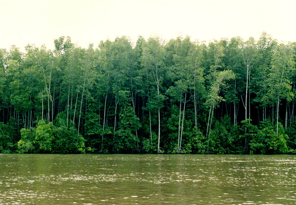
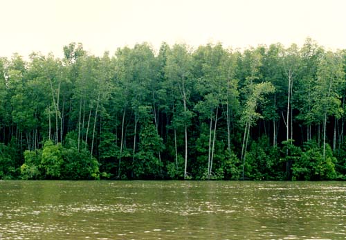
(*)A mangrove is a forest of trees and bushes growing in the seashore in tropical and subtropical areas where seawater and freshwater mix. There are ninety or a hundred kinds in the world. In Japan, mangroves are found in the southwest islands. The mangrove trees and bushes have adopted an unique style of growing to live in the seawater; some of them breathe by extending roots into the air, and some of them breed by dropping seeds, which came out on the trees, in the mud.
 |
|
Mangrove forest (This forest is in Malaysia.)
|
|