0. Introduction
JASMES Image Archive is a web page that integrates the function of SGLI Standard monitor and JASMES Climate Monitor.
Using GCOM-C/SGLI Standard data, Terra Aqua/MODIS data, Suomi NPP VIIRS data, and AMSR data, it is possible to display a calendar of map-projected images of physical quantities related to climate change.
In addition, by registering as JASMES user, you can download the data shown in "2. About Data".
1. Web page
Please refer to the following for the operation of JASMES Image Archive. How to Use JASMES Image Archive
2. About Data
GCOM-C/SGLI Standard data (JASMES format) is netCDF4 format data, which is resampled GCOM-C/SGLI Standard product (HDF5 format) on the JASMES grid.
For details, please refer to the following.
About JASMES SGLI Standard data
For more information on SGLI Standard Product & Algorithms, please refer to the following.
SGLI Standard Product & Algorithms
For more information on Terra・Aqua/MODIS data, please refer to the following.
JASMES Datalist
2-1. Area and resolution
The target areas are Global, Japan, Thai, Gobi/Taklamakan, Polar(north and south). The area and resolution are as follows.
Global
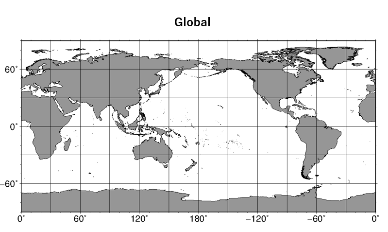
| Area | Sensor | Pixel size | Latitude and Longitude (pixel center value) |
|---|---|---|---|
| Global | GCOM-C/SGLI | 0.05deg | Lon:0.0deg.E, Lat:90.0deg.N |
| Lon:360.95deg.E (-0.05deg.W), Lat:90.0deg.S | Terra・Aqua/MODIS | 0.05deg | Lon:0.0deg.E, Lat:90.0deg.N |
| Lon:360deg.E, Lat:90.0deg.S | S-NPP/VIIRS | 0.05deg | Lon:0.0deg.E, Lat:90.0deg.N |
| Lon:360deg.E, Lat:90.0deg.S |
Japan・Thai
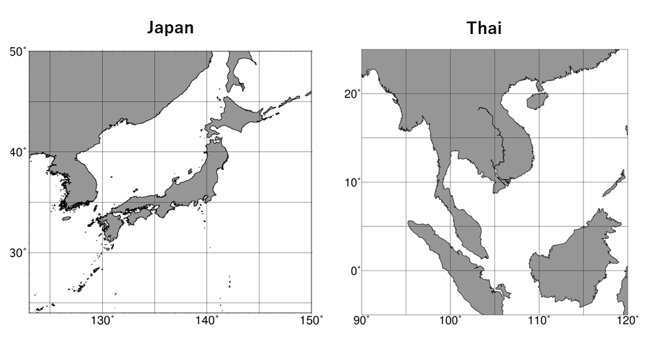
| Area | Sensor | Pixel size | Latitude and Longitude (pixel center value) |
|---|---|---|---|
| Japan | GCOM-C/SGLI | 0.0025deg | Lon:123.00125deg.E, Lat:49.99875deg.N |
| Lon:149.99875deg.E, Lat:24.00125deg.N | |||
| Terra・Aqua/MODIS | 0.01deg | Lon:123deg.E, Lat:50deg.N (CSF Lon:123deg.E, Lat:49deg.N) |
|
| Lon:150deg.E, Lat:24deg.N (CSF Lon:148deg.E, Lat:24deg.N) |
|||
| S-NPP/VIIRS | 0.0075deg | Lon:123deg.E, Lat:50deg.N | |
| Lon:150deg.E, Lat:24deg.N | |||
| Thai | Terra・Aqua/MODIS | 0.01deg | Lon:90deg.E, Lat:25deg.N |
| Lon:120deg.E, Lat:-5deg.N |
Gobi・Taklamakan
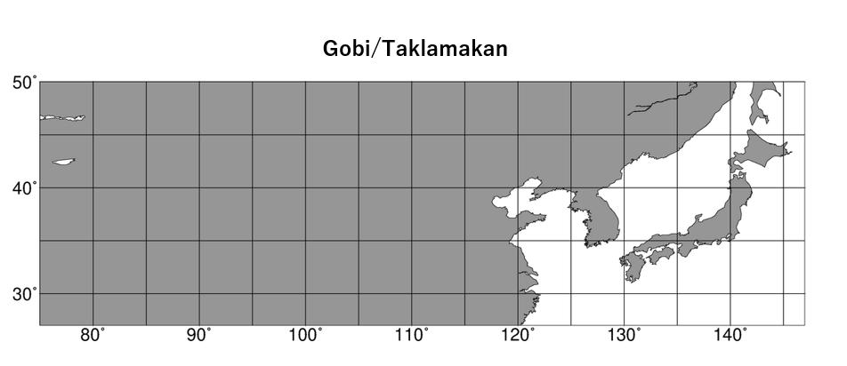
| Area | Sensor | Pixel size | Latitude and Longitude (pixel center value) |
|---|---|---|---|
| Gobi・ Taklamakan |
Terra・Aqua/MODIS | 0.05deg | Lon:75deg.E, Lat:50deg.N |
| Lon:147deg.E, Lat:27deg.N |
Polar Stereo
Latitude and Longitude information at each pixel is stored in netCDF.
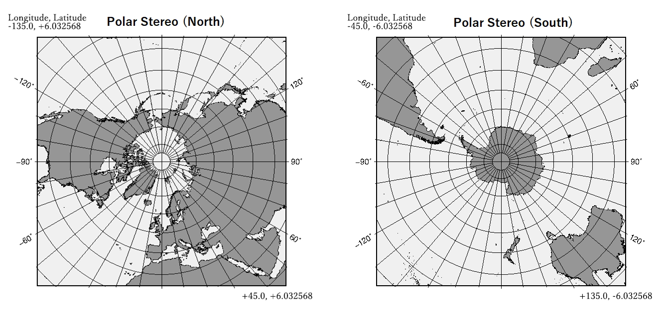
| Area | Sensor | Pixel size | Latitude and Longitude (pixel center value) |
|---|---|---|---|
| Polar(North) | GCOM-C/SGLI | (See netCDF) | Lon:-135.0deg, Lat:+6.032568deg |
| Lon:+45.0deg, Lat:+6.032568deg | |||
| Terra・Aqua/MODIS | (See netCDF) | Lon:-135.0deg, Lat:+6.032568deg | |
| Lon:+45.0deg, Lat:+6.032568deg | |||
| Polar(South) | GCOM-C/SGLI | (See netCDF) | Lon:-45.0deg, Lat:-6.032568deg |
| Lon:+135.0deg, Lat:-6.032568deg | |||
| Terra・Aqua/MODIS | (See netCDF) | Lon:-45.0deg, Lat:-6.032568deg | |
| Lon:+135.0deg, Lat:-6.032568deg |
2-2. Product
Whether data can display on monitor page and be provided depends on the physical quantity.
For details, please refer to the JASMES SGLI Standard monitor Data list.
JASMES Image Archive Data list
For more information on JASMES product documatation, please refer to the following.
(Photosynthetically Available Radiation, Snow Cover Extent, Sea Surface Temperature, Water Stress Trend)
JASMES Document
2-3. Use of Data
JASMES User Registration is required to use observation data.
Please also refer to "Terms of Use of Research Data (JAXA)".
JASMES User Registration
Terms of Use of Research Data (JAXA)
2-4. Restrictions
・Japan area of Terra・Aqua/MODIS data is missing from 2023/4/28 due to problem with a domestic receiving station.
3. FAQ
Regarding the use of JASMES-related Web pages/data, including SGLI Standard monitor, the following is list of frequently asked questions and answers. Please check the following FAQ before asking questions.
if your question is not resolved, please contact the listed in the "Contact" section.
JASMES FAQ
4. How to use data
4-1. View Data
・View JASMES SGLI Near-realtime data in SeaDAS
See below for instructions on how to use SeaDAS to read and display netCDF data.
View JASMES SGLI Near-realtime data in SeaDAS
4-2. Convert to GeoTiFF and netCDF
・How to convert JASMES data to GeoTiFF and netCDF
The script in the tutorial will use Python3(netCDF4, NumPy, GDAL library).
In addition, software (SeaDAS、ncdump, etc.) to check the contents of netCDF is required.
・JASMES GCOM-C/SGLI, VIIRS data Convert to GeoTiFF
This is tutoial for converting GCOM-C/SGLI data in netCDF format to GeoTiFF.
How to convert JASMES SGLI data to GeoTiFF
・JASMES MODIS Convert to GeoTiFF
This is tutoial for converting JASMES MODIS data in binary format to GeoTiFF.
How to convert JASMES MODIS data to GeoTiFF
・JASMES MODIS Convert to netCDF
This is tutoial for converting JASMES MODIS data in binary format to netCDF.
How to convert JASMES MODIS data to netCDF
4-3. Operational information
For satellite operation information such as Onboard calibration, pleae see here.
4-4. Satellite event information
For satellite missing event information, pleae see here.
4-5. TIR event list
Stripes may apper in the SGLI products shown below due to temporary performance changes of the TIR sensor.
- Land Surface Temperature
- Sea Surface Temperature
- Sea and Ice Physical Properties
Please see here for the period when the stripes are most visible.
5. Contact
If you have any comment or questions about JASMES services, please contact us at the address below.
<Contact>
Earth Observation Research Center / JAXA
GCOM Secretariat(formerly ADEOS/OCEAN Secretariat)
2-1-1 Sengen, Tsukuba, Ibaraki 305-8505 Japan
FAX: +81-29-868-2961
E-mail: