Seen from Space 2011
Fire in Seto Inland Sea of Japan Captured by MODIS
|
In the afternoon of August 9, 2011, a fire started in the forests of Ishima Island , located between Kagawa and Okayama prefectures in west Japan. An evacuation counsel for disasters was sent to all 38 households on the island off Tamano City, Okayama Prefecture, and the residents spent the night in fear. The fire was still burning and had spread across 75 percent of island, approximately 200 ha, as of August 10. The images below were taken on August 10, 2011, at 10:34 a.m. (JST) by MODIS, which is installed on TERRA, and were processed by JAXA. Image 1 is composed with MODIS’s three bands and is the closest image to human vision. You can see smoke rising to the east from Ishima Island in light purple. The difference between the smoke and the white clouds is easy to see. Image 2 is composed with MODIS’s two bands and is a pseudo-color image. Vegetation is shown in red and the smoke clearly visible. Image 3 shows the observation width around Japan, and as you can see, the sensor can cover the entire Japanese archipelago at once. JAXA has been developing GCOM-C1 and plans to launch it in Japanese fiscal year 2014. SGLI, which is planned to be installed on GCOM-C1, is an observation device modified to provide performance superior to that of MODIS. It also has a wide-range/high-frequency observation function that can observe the entire Earth with 250m resolution once every 2 days. The SGLI is expected not only to monitor climate change but also to be used to directly support various aspects of life, including forest fire detection. 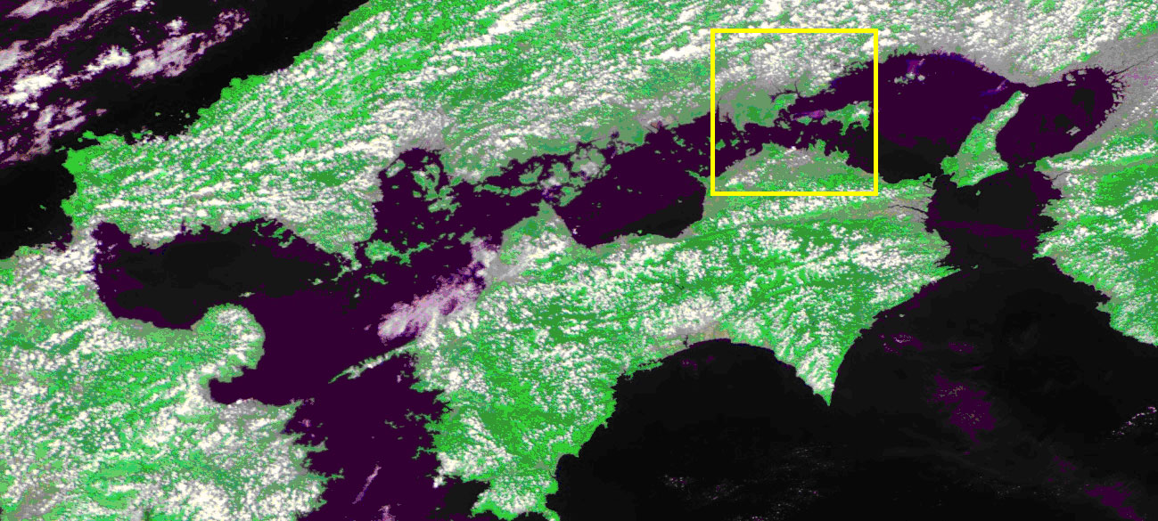 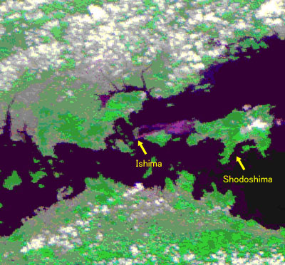 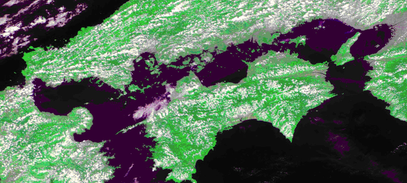 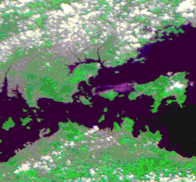 Fig. 1. Image of the Inland Sea of Japan (above) and Ishima Island (below)
The image inside the yellow frame is Ishima Island 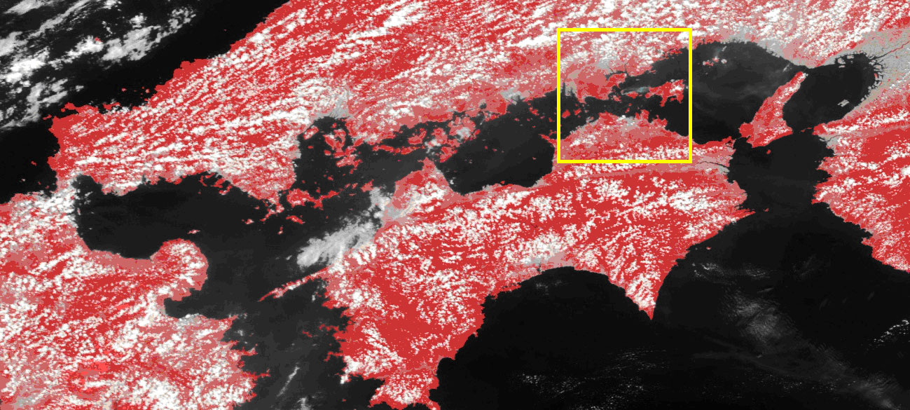 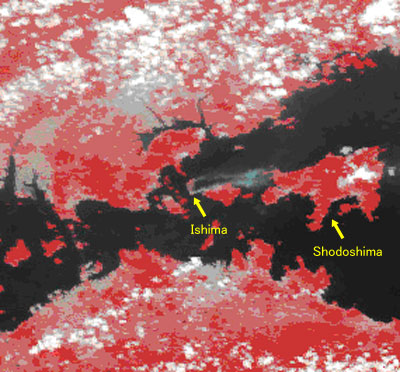
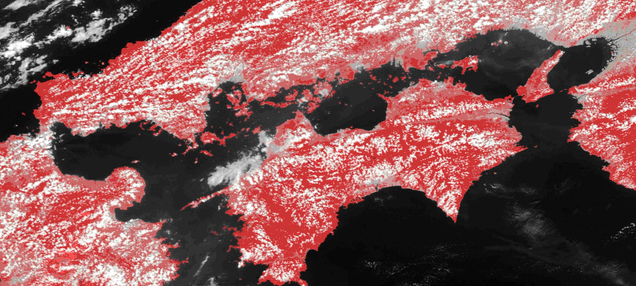 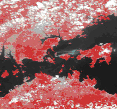
Fig. 2. Image of the Inland Sea of Japan (above) and Ishima Island (below)
The image inside the yellow frame is Ishima Island 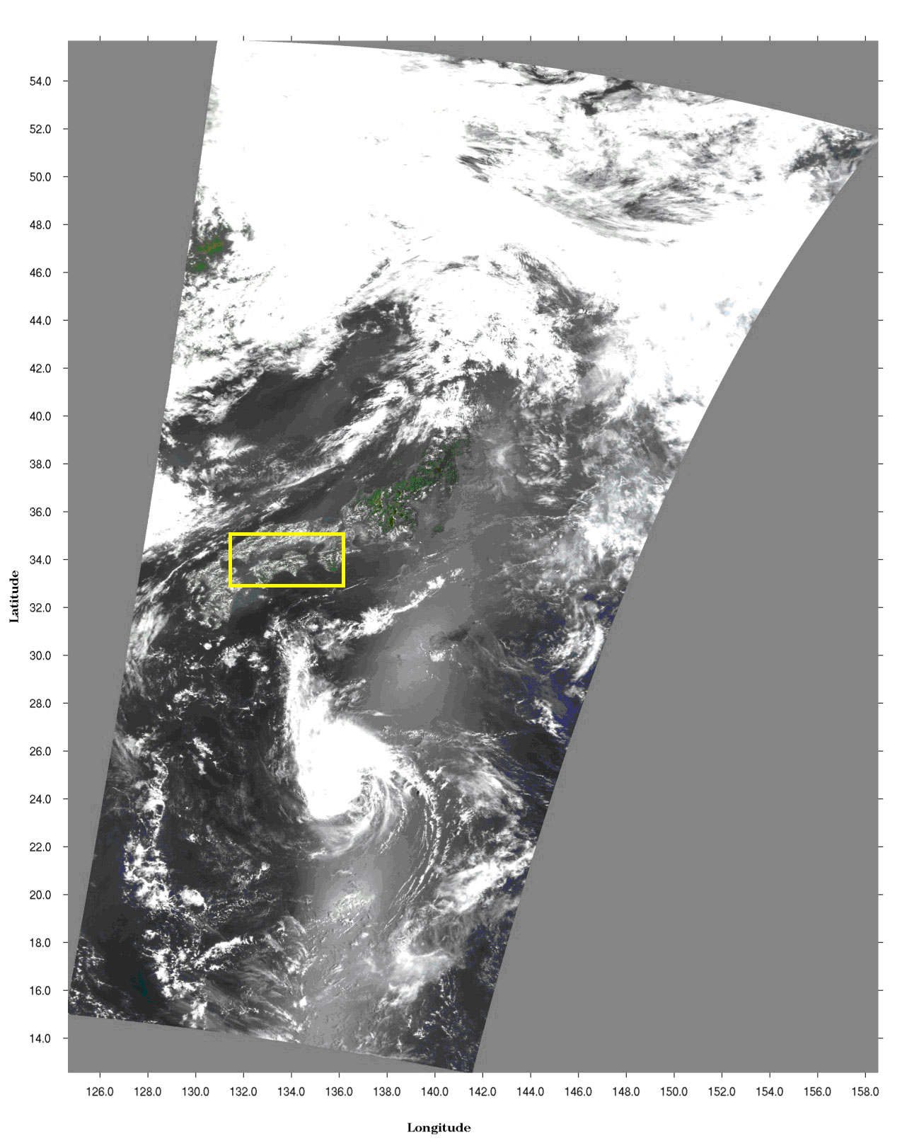 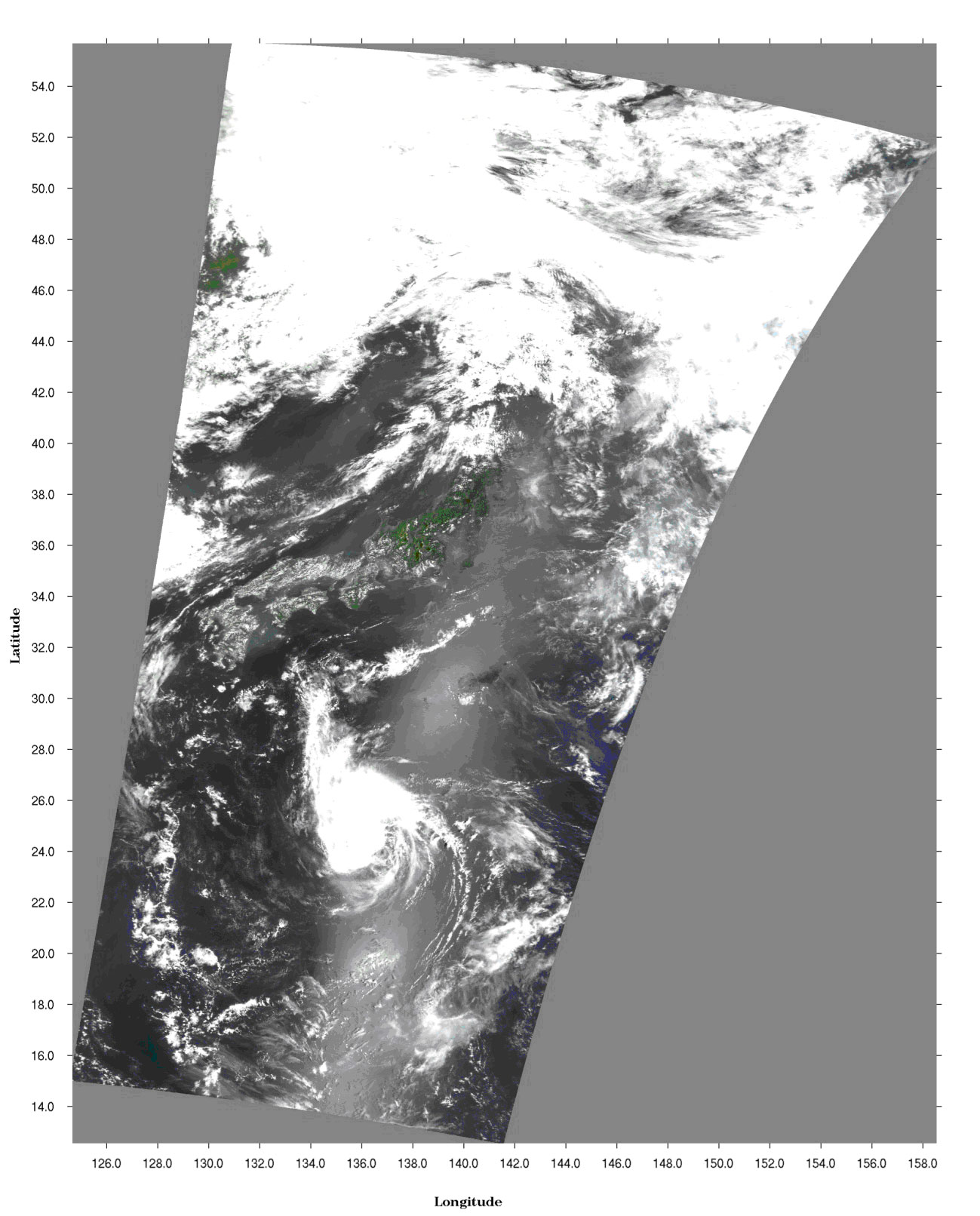 Fig. 3. Observation range around Japan
The image inside the yellow frame is the Inland Sea of Japan Explanation of the Images:
|