Seen from Space 2010
East Meets West: “The City on Seven Hills” – Istanbul, Turkey
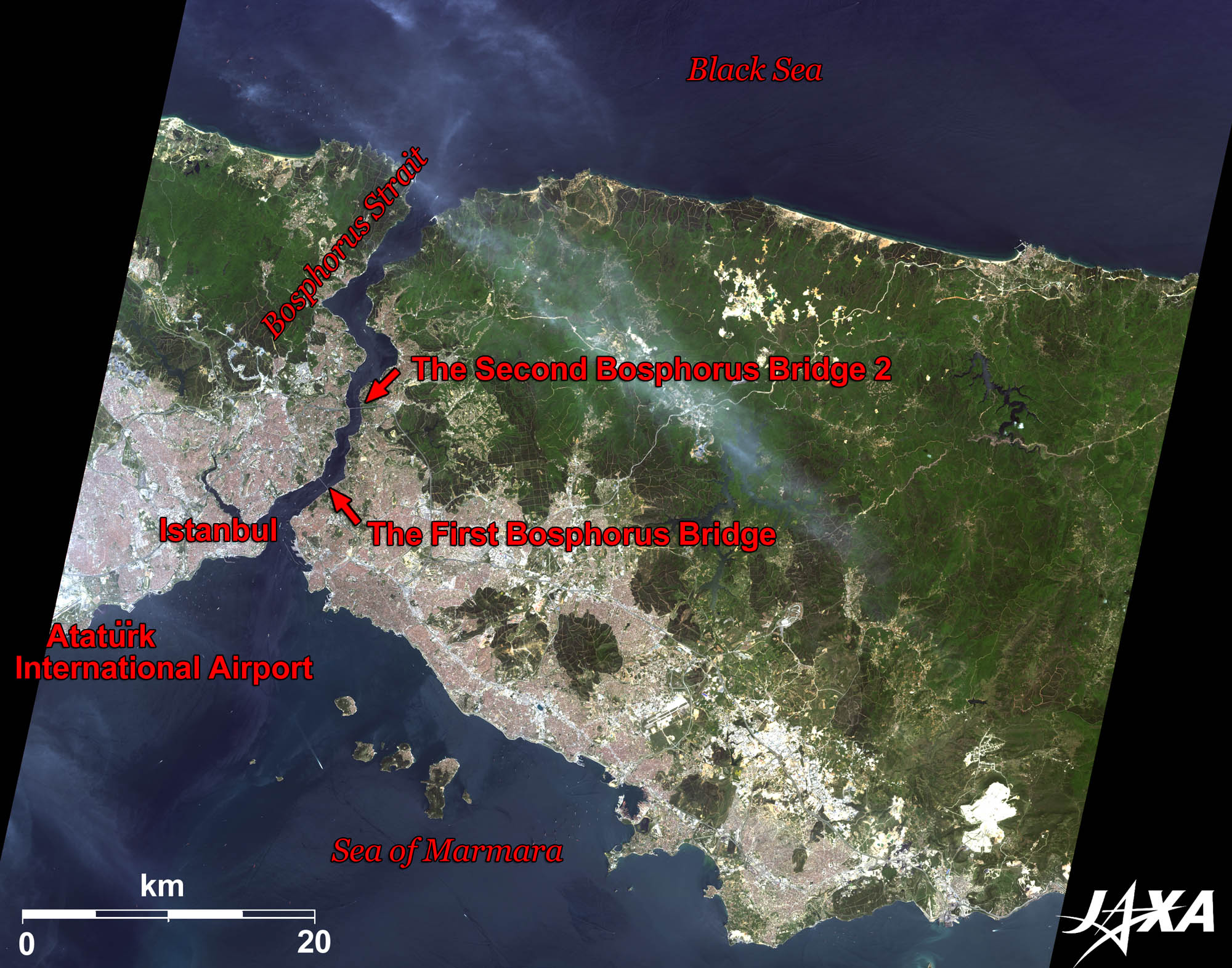 
Fig. 1. Istanbul and Its Vicinity
Figure 1 depicts Istanbul and its vicinity as observed by ALOS (“Daichi”) in May 2010. Istanbul, the largest city of the Republic of Turkey, is located on the Bosphorus Strait, which separates the Anatolian Plateau of Asia (the eastern side of the image) and the Balkan Peninsula of Europe. The reddish-grey area in the figure extending over the two continents across the strait is the urban area of Istanbul. * Towers supporting the main cable of the bridge.  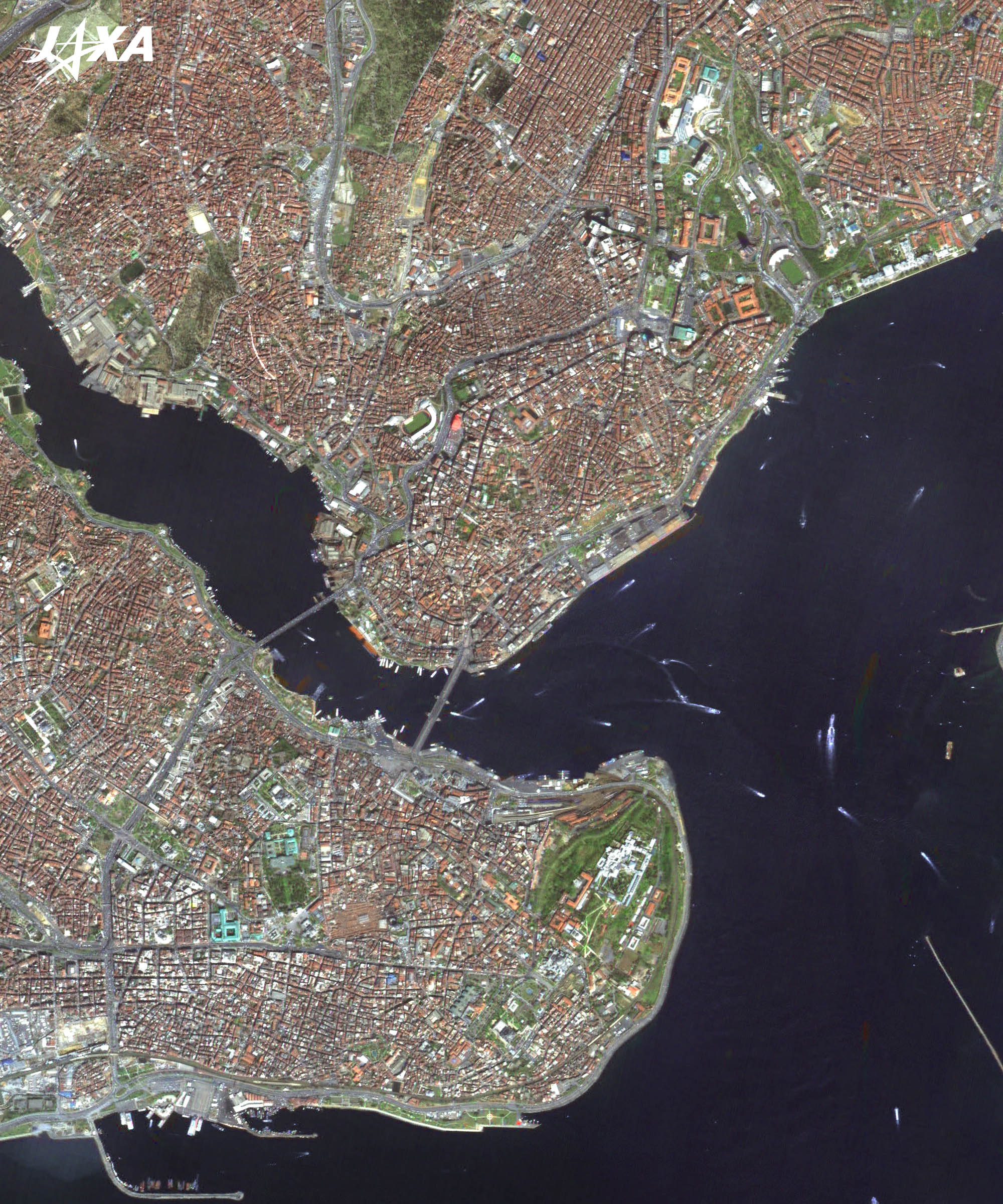
Fig. 2. Close-up Image of Istanbul
Istanbul (kmz, 5.41 MB, High Resolution) as seen on Google Earth The European side of Istanbul encompasses the natural harbor known as the Golden Horn. Here, the southern part is known as the old city and the northern part is the new city. The old city, once surrounded by city walls, covers roughly the same area as Constantinople (the older name of Istanbul,), which served and prospered as the capital city of the Byzantine Empire (Eastern Roman Empire) for about 1,000 years. Many historical buildings are located in this area. **An Islamic mosque is called “Camii” in Turkish. The new city, which stretches across the upper part of the Figure, forms a business center in which exclusive hotels and shopping areas are located. Contrary to appearances, its history is quite old; merchants of Genoa established the city’s autonomy in the Byzantine period. 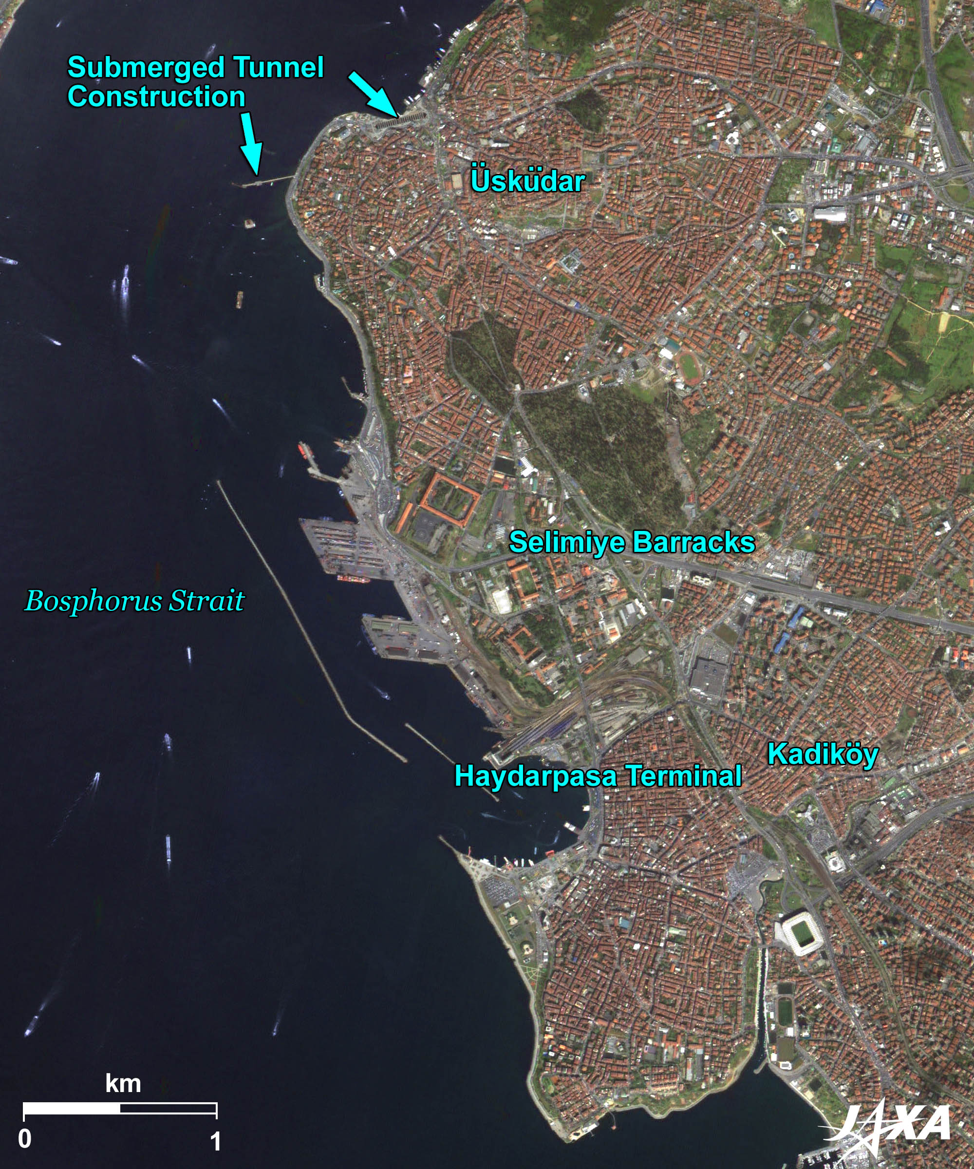 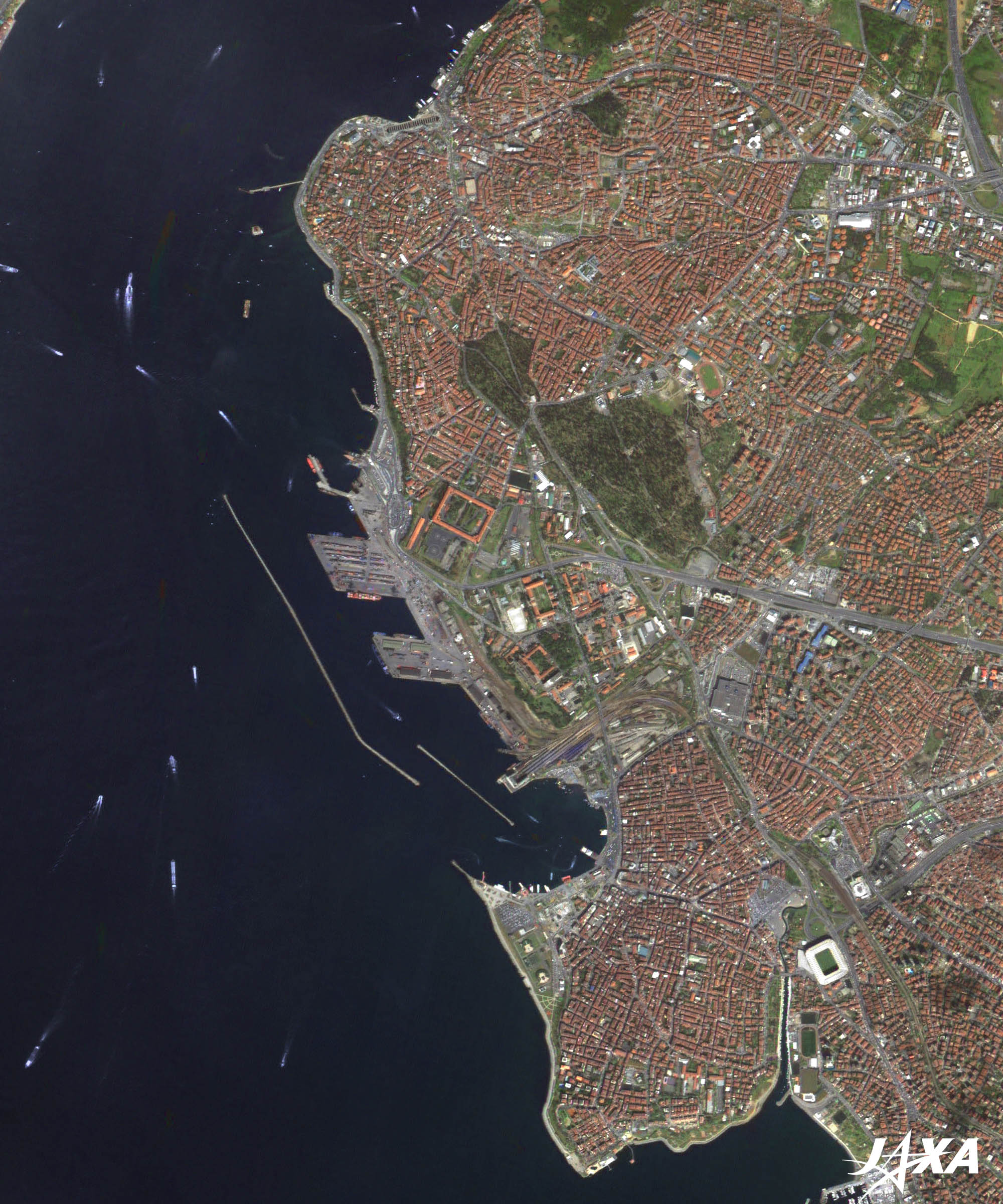
Fig. 3. Close-up Image of Istanbul on Asian Side
The Asian side of Istanbul, visible as reddish-brown in the figure, is a new residential area. Nevertheless, Uskudar (Üsküdar) and Kadikoy (Kadıköy) have long histories, where old townscapes with traditional houses still remain. Since the cities were not shielded by ramparts, they were invaded and destroyed many times. *** The war between the Russian Empire and the Ottoman Empire, which broke out in 1853 and escalated to the war between the Russian Empire on one side and an alliance of France, the United Kingdom, the Kingdom of Sardinia (which would be absorbed into Italy in 1861), and the Ottoman Empire on the other. 
Bosphorus Strait Undersea Crossing Railroad Tunnel ProjectA Japanese enterprise is now undertaking the construction of the Bosphorus Strait undersea crossing railroad tunnel (the Marmaray Project). It was conceived in the time of the Ottoman Empire, 150 years ago, and many civil engineers of the world have planned its construction. Yet, none could overcome the problems due to the rapid current (maximum 5 knots per hour) and bad ground conditions (close to the Anatolian Fault). However, the Japan Bank for International Cooperation (JBIC) and the European Investment Bank (EIB) provided major financing for the project, and the government of Turkey ordered a Japanese company to proceed with construction. The strait tunnel was completed in October 2008 and connected to the eastern continent in March 2010. The geometrical pattern that looks like a bar code near the wharf of Uskudar at the upper left of Figure 3 is the station at Uskudar under construction. The straight structure jutting out into the strait is the facility used to bury tunnel blocks made on the ground at the bottom of the sea. Completion of the project is estimated in October 2013.
120-year Anniversary of Japanese-Turkish FriendshipOn September 16, 1890, the Ottoman frigate Ertuğrul encountered a typhoon while returning from a goodwill voyage from Japan and sank off the coast of Kushimoto, Wakayama Prefecture. The accident took 587 lives, but 69 sailors and officers were saved and carefully nursed by the local people. Later, they were safely returned home by Japanese ships. This accident and rescue operation created a strong friendship between Japan and Turkey. Reference Sites:Explanation of the Images:(Click the images twice to enlarge.)
AVNIR-2 has four observation bands. The composite images are usually produced by assigning red to Band 3 (610 to 690 nm), green to Band 2 (520 to 600 nm), and blue to Band 1 (420 to 500 nm). The resulting images have natural coloring as if seen by the naked eye. Thus, the following colors designate ground objects:
(Fig. 2 and 3) |


