| |
 |
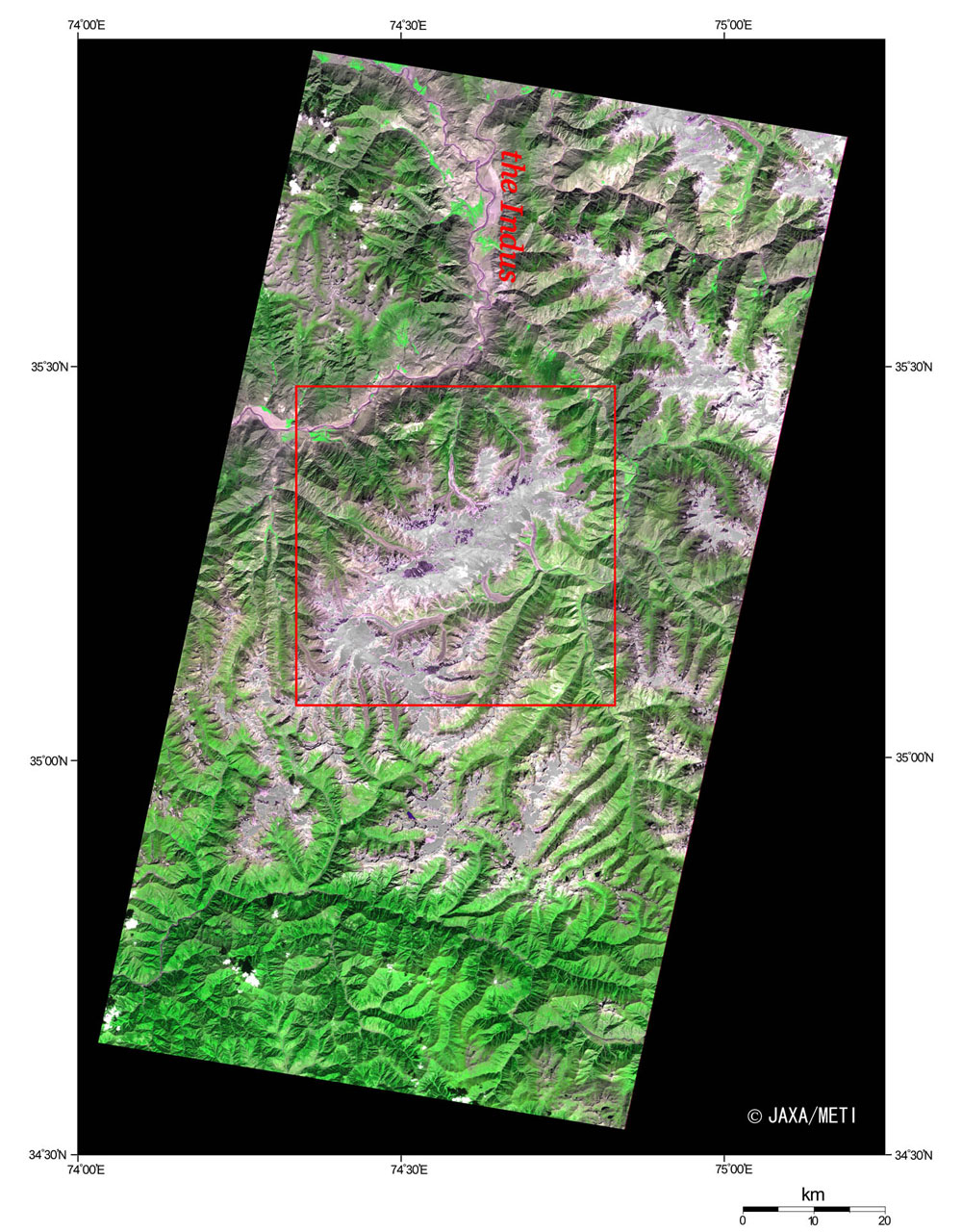
| Fig. 1 Nanga Parbat and Vicinity |
Figure 1 depicts mountains including Nanga Parbat (8,126 m), one of the 8,000-m peaks in the Himalayas, as observed by the optical sensor aboard the Japanese Earth Resources Satellite-1 (JERS-1). The world's ninth highest mountain is located in the Pakistan-Kashmir District, and it is called "The Naked Mountain" in Sanskrit as it is a lonely high peak in this area. People on the west side of the foot of the mountain call it Diamir meaning "The King of Mountains." It has quite a steep landscape that was created through erosion by glaciers. The height difference of the "Rupal" slope on the southern side is approximately 4,500 m, and it is one of the most difficult walls to climb in the world. Many lives had been lost before the first climbers reached the summit, so the mountain is called "The Devil's Mountain" by climbers. One hundred and eighty-five km northeast of Nanga Parbat , there is K2 (8,611m), the world's second loftiest peak, in the Karakoram that extends in a northwest - southeast direction. The Indus River that has its source in the Tibetan Plateau flows northwest to separate the Nanga Parbat mountain group from Karakoram and makes Nanga Parbat a huge isolated peak.
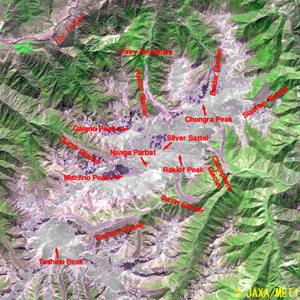 |
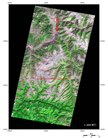
Fig. 2. Expanded Image of the Center of Fig. 1
Nanga Parbat (kmz, 2.28 MB, Low Resolution) as seen on Google Earth. |
Figure 2 is the expanded image of the center of Fig. 1. The white areas indicate the summits of the mountains covered with snow or ice. The sunlight illuminating from the southeast produces shade over some geographical features, and the steep summits of the mountains cast their own shadows toward the upper left. The mountain ridge continues from Nanga Parbat to Rakiot Peak (7,074 m) and Chongra Peak (6,824 m) to the north, and many glaciers can be seen here and there.
Three deep valleys carved out by the glaciers are located in Nanga Parbat. There is a peaceful meadow in the North Rakiot Valley, one of these three valleys, and it is surrounded by pinewoods. It is called Die Maerchen Wiese in German (Fairy Meadows) where, literally, a beautiful, peaceful scene like the world of fairly tales spreads over the land.
Along the Indus River Valley, seen in the upper left of the figure, runs the mountain road named the Karakoram Highway, which is blessed with the most prominent and finest view in the world. This 1,300-km-long highway connecting Rawalpindi in Pakistan and Kashgar in the Hsinchiang Uighur Autonomous Region of China was opened in 1978 after 20 years of construction through cooperation between China and Pakistan. It is said that the valley along the Indus is deep and steep, and construction was extremely difficult. This route connecting China and Pakistan is one of the Silk Roads across Pamir, and, although it is rough, it was a historic main traffic route. Many Buddhist monks, as well as Faxian and Hsuan Tsang and other caravans, passed along this route. If you look at Nanga Parbat from afar, Gandhara, which is the gateway to the holy place of Buddhism in India, is just around the corner.
Reference:
Himalaya Meihou Jiten (in Japanese), Heibonsha Ltd., 1996
|
Explanation of the images:
| Satellite: |
Japanese Earth Resources Satellite-1 (JERS-1)(Fuyo-1) |
| Sensor: |
Visible and Near Infrared Radiometer (VNIR),Short Wavelength Infrared Radiometer (SWIR) |
| Date: |
0558 (UT) on September 27, 1993 |
| Ground Resolution: |
18.3 m x 24.2 m |
| Map Projection: |
UTM (Universal Transversal Mercator) |
|
The composite figures were produced by assigning green to the near-infrared channel (760 to 860 nm), red to the visible channel (630 to 690 nm), and blue to the visible channel (520 to 600 nm). The resulting figures have natural coloring with a slightly emphasized green for vegetation and a purplish white for snow and ice, appearing as if seen by the naked eye. In these images, the forests are dark green, the grasslands are light green, and the glaciers are dark reddish purple. Since the data of these three channels are saturated (overcome by the intense light) near the summit areas of the mountains, the gray monochrome picture was created from the non-saturated data from 2.27 to 2.40 μm band in short infrared wavelength and substituted for the saturated data. The area with no data is shown in black. |
|
 |
|