Seen from Space 2005
Striped Clouds Crossing over the Sea of Japan
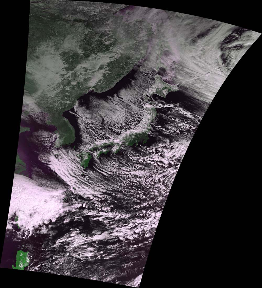
The MODIS sensor, aboard NASA's Earth observation satellite Terra, captured the features around Japan as shown in Figure 1. As you see the typical cloud distribution around the Japanese Islands in winter shows cloud cover over the Sea of Japan side and clear skies on the Pacific side. According to the weather chart on that day, there was an intensely developed low pressure in the Sea of Okhotsk. There was also a high pressure near the Yellow Sea. The isobar made lines in a north and south direction in the vicinity of Japan. This made up a typical winter type of atmospheric pressure pattern called "seikou-toutei" in Japanese, meaning the high pressure is to the west and the low pressure is to the east. The northwestward monsoon blowing from the Siberian Continent is very cold and dry. While the monsoon crosses over the Sea of Japan, it warms the air above the sea surface and is replenished with water vapor. The lower layer of the air becomes wet and warm and the state of the atmosphere becomes unstable. As the result, convection happens in the atmosphere, and the cumulus crossing the Sea of Japan (striped clouds) develops and becomes cumulonimbus as shown in Figure 1. Then it snows on the Sea of Japan side of the Japanese Islands. The clouds linger around the high mountains (mountainous backbone), and the monsoons that pass over the mountains bring dry fine weather. The geographical features show that part of the Kanto region is protected from large amounts of snow by the Southern Alps and the Mikuni Mountains (mountain range existing in Gunma, Nagano, and Niigata Prefectures) although it becomes cold by the blowing monsoon and radiate cooling.
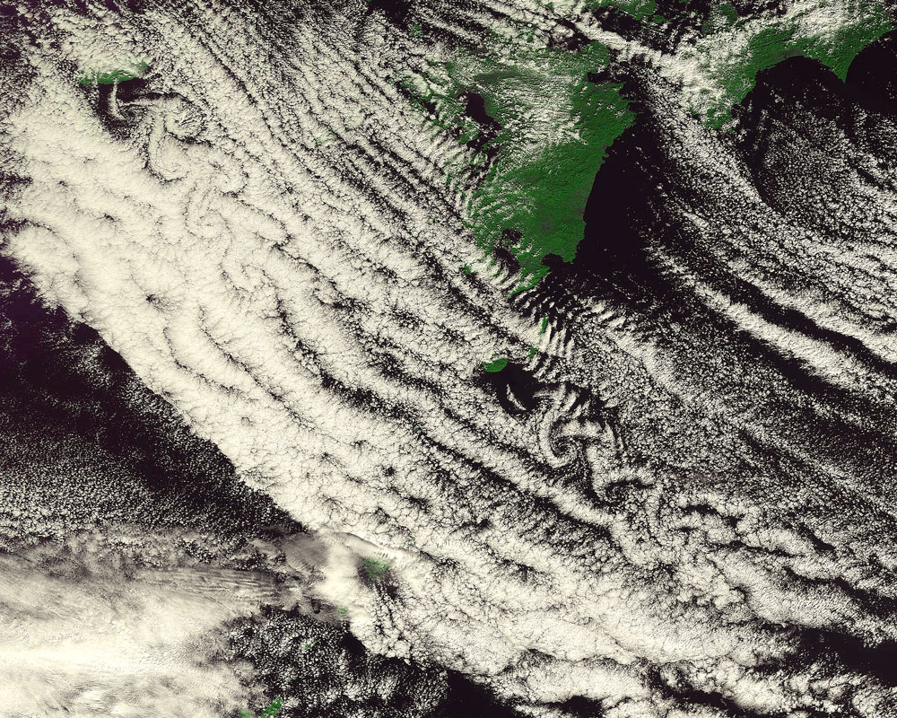
The clouds whirling in two places, lower left of Figure 1, often appear at this time every year. They indicate that the air currents fall into disorder on the leeward of Cheju Island of the Republic of Korea and on Yakushima Island of Japan. The two arrays of vortices are generated on the leeward of an obstacle in the flow. The isolated peak blocks the airflow over the sea and the arrays of vortices are generated. The electric wires and branches of trees also block the blowing air creating arrays of vortices, causing the wires and branches to vibrate and make howling sounds on the days with strong winds.
Related sites: |
|||||||||||||||||||||