Seen from Space 2004
The Visible "Claw mark" of the Niigata Chuetsu Earthquake as Seen from Space
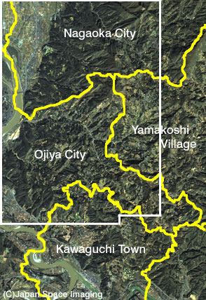
A major earthquake, in the Yamakoshi Village area, Niigata, Japan, (October 23, 2004), caused many landslides and slope failures, and it was reminiscent of the landslide of 1980 in Yamakoshi Village, particularly the landslide of the Mushigame area, which was quite well-known. This landslide disrupted roads and paddy fields and dammed up rivers. In this recent earthquake, another landslide occurred in the Mushigame area. From the enlarged view image, Frame E, you can see that the road is covered with the collapsed sediment. There were many landslides classified into a Tertiary (note) layer landslide throughout Yamakoshi Village. In general, a Tertiary layer consists of soft rock that has been weathered by rainwater and melted snow. Three days before the earthquake, a huge Typhoon No. 23 brought heavy rainfall to the whole area of Niigata. In Nagaoka City, located near Yamakoshi Village, precipitation was well over 100 mm/day. With this amount of rain, it's conceivable that ground pore water pressure was high; a condition due to higher than usual ground water levels. This means that the ground was loose. In addition, due to the seismic motion, ground pore water pressure increases and causes the ground to become looser and looser like liquefaction. This could be the reason why many landslides occurred throughout Yamakoshi Village. Slope failure occurred in several parts of this same area. A slope failure of a rock slope is shown in an enlarged view in Frame A. Such slope failures occurred due to rock instability caused by seismic motion. Yamakoshi Village and Ojiya City are famous as the birthplace of Nishikigoi, and they are also famous for bullfighting, which is a well known tourist attraction of this district and registered as an important and intangible cultural heritage of Japan. The snow lies thick over the Chuetsu district in winter, and brings abundant groundwater in the spring. It supports many distillers of famous Japanese sake, serves as a production location for the top-grade Japanese rice "Uonuma Koshihikari," and supplies water to sustain the local people. However, abundant groundwater can sometimes bring about a landslide. There is an age-old piece of wisdom from the mountain area that recommends making a paddy field or a field from the flat land caused by the landslide. Such wisdom has helped to support the life of the people. Our heartfelt sympathy goes out to all the sufferers of this earthquake, and we pray that recovery from the disaster will be soon. Note -- Tertiary: The geologic age from 65,000,000 to 1,650,000 years ago, following the extinction of the dinosaur. Tertiary layer landslides are widely distributed throughout Japan, from Hokkaido to Hokuriku.
Related site: Appendix: landslides Landslides are divided into four types, collapse, flow, block, and creep landslides. From the Tertiary layer landslide, many blocked and creep landslides occur, which are slower than the other types. These are landslides in which the ground has collapsed in the past, and the ground became clayish. Usually, it is not possible to actually notice these landslides as they move very slowly. However, if much rain water and snow melt water are soaked into the ground, the ground pore water pressure rises, the soil grains collapse easily, and a landslide can occur. The landslide is divided into factors and causes. The main factor is the rock and its geographical features. A cause is the trigger of a landslide, which can include such things as rain, snow melt, an earthquake, river erosion, and temperature change. Usually, the main causes of a Tertiary layer landslide are rain and snow melt. As for the flowed and collapsed types of landslides, earthquake and temperature change are the main causes. However, a Tertiary layer landslide can also turn into a landslide of a collapsed type or a flowed type that slides very quickly, from an external force such as an earthquake. This then becomes a composite-cause landslide. The landslide in the Niigata Chuetsu Earthquake was a composite-cause type. |
|||||||||||||||