Seen from Space 2004
Typhoon No. 21 (MEARI), the 8th to strike this year, sets a record for the number of annual landings.
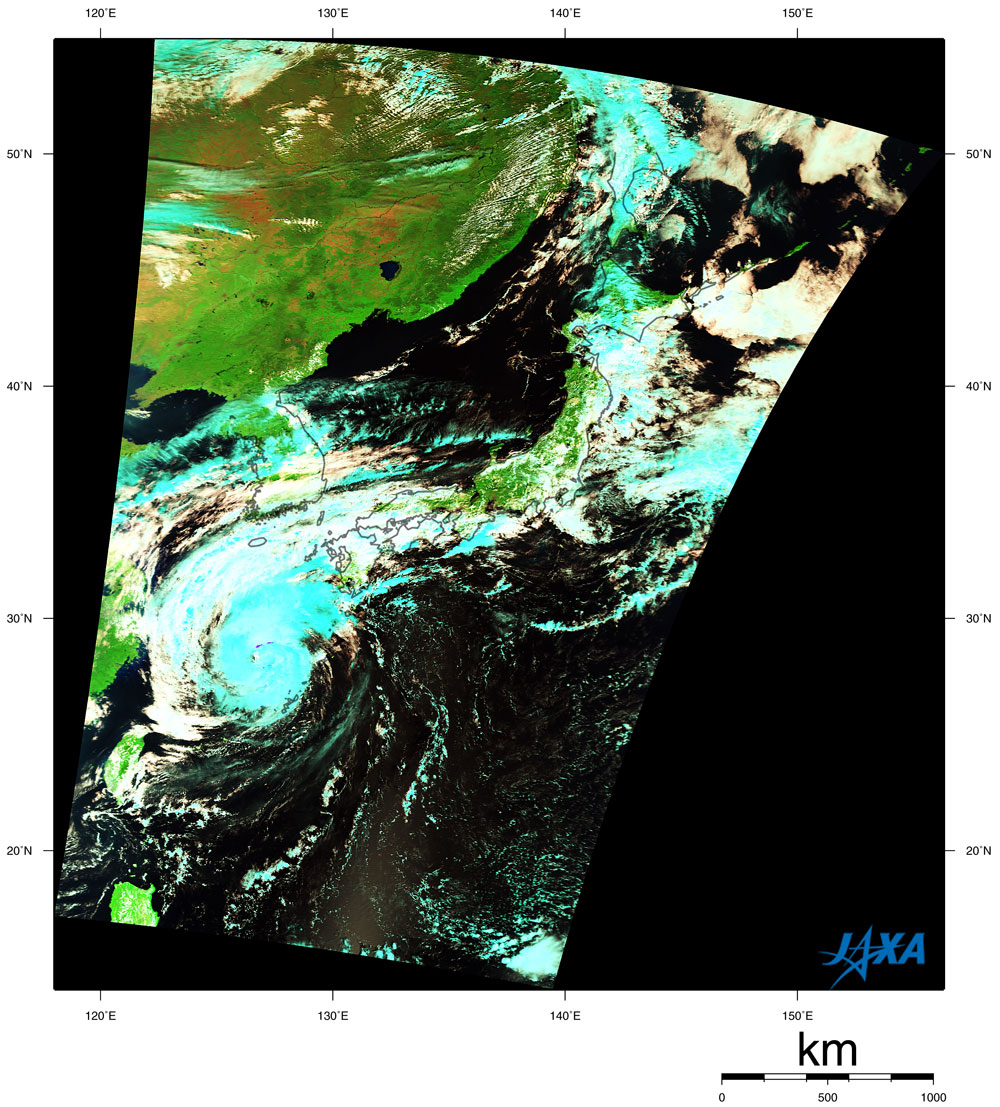
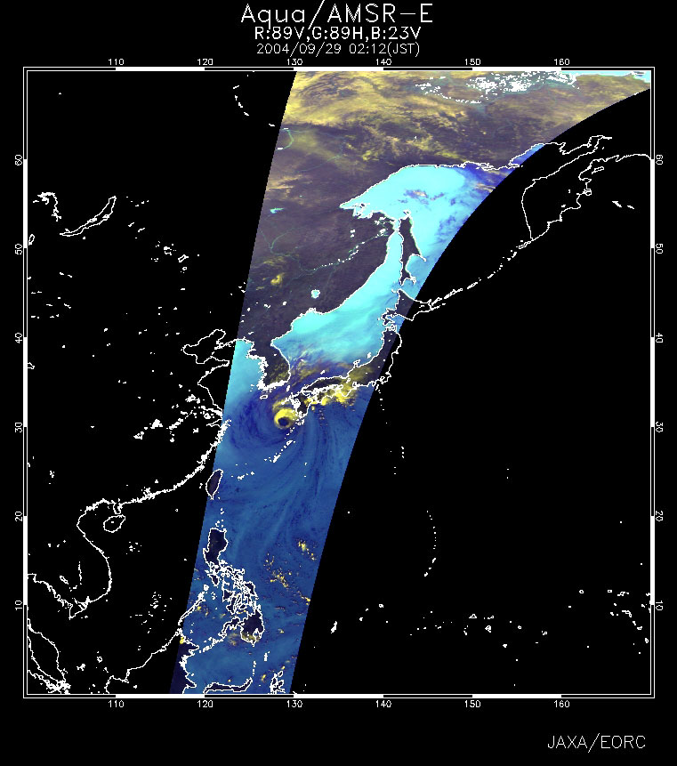
Typhoon No. 21 (MEARI) struck near Kushikino, Kagoshima, around 0830 on September 29. Figure 1 shows typhoon No. 21 as observed by MODIS on board the Terra satellite at 0152 on September 28 (JST). Ice, represented in blue, formed in the high-altitude clouds caused by the typhoon. Figure 2 is an AMSR-E near-real-time image observed at 0212 (JST) on September 29. The dark blue on the sea surface indicates a large volume of water vapor in the atmosphere. A large volume of water vapor flow can be seen at the center of the typhoon. Yellow represents the well-developed clouds, and, as you can see, heavy rain fell on the east side and the central north side of the typhoon.
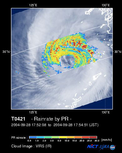
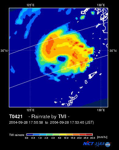
Figure 3 indicates the rain rate near the surface observed at 1753 (JST) on September 28 by the Precipitation Radar (PR) on board the Tropical Rainfall Measuring Mission (TRMM) satellite overlaid with cloud images derived from the Visible Infrared Scanner (VIRS). Figure 4 indicates precipitation acquired by the TRMM Microwave Imager (TMI) on board the TRMM satellite at the same time. Red represents intense rain. There is no rain in the center of the typhoon. This typhoon was the eighth to strike this year, setting the record for the number of annual landings (six in 1990 and 1993). Compared with a normal year, the influence of the Pacific anticyclone is very strong this year. As the typhoon was traveling, it was able to turn around the edge of the Pacific anticyclone. It is suspected this caused the number of landing typhoons to increase. Typhoon No. 21 formed near Guam on September 21 and was traveling northwest with the ability to turn around the edge of the Pacific anticyclone. It passed around Kume Island, although it stalled temporarily near Miyako Island. The course temporarily changed toward the northeast due to the influence of westerlies near Japan, and the typhoon struck near Kushikino. The course is expected to pass over the Japanese Islands. It is therefore necessary to be alert for heavy rain and landslides along the course. Since the spring tide occurs at the same time, it is also necessary to be alert for high tides as the typhoon approaches .
Color composition was made by using three out of 36 channels on MODIS; channel 7 of the short-wavelength infrared band (2,105 - 2,155 nm) to red, channel 2 of the near-infrared band (841 - 876 nm) to green, channel 1of the visible region (620 - 670 nm) to blue, resulting in the figures below.
Related sites: |