Seen from Space 2004
Western Australia, the Red Continent, narrates the Earth's history
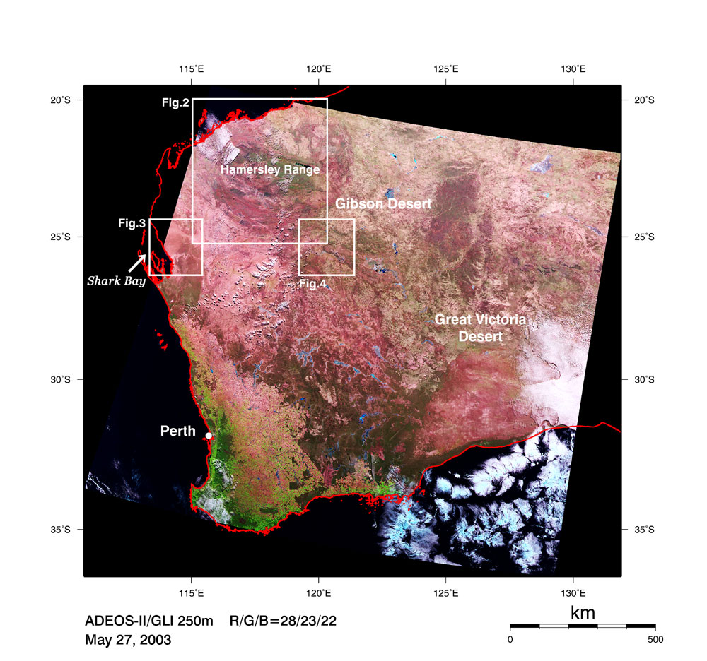
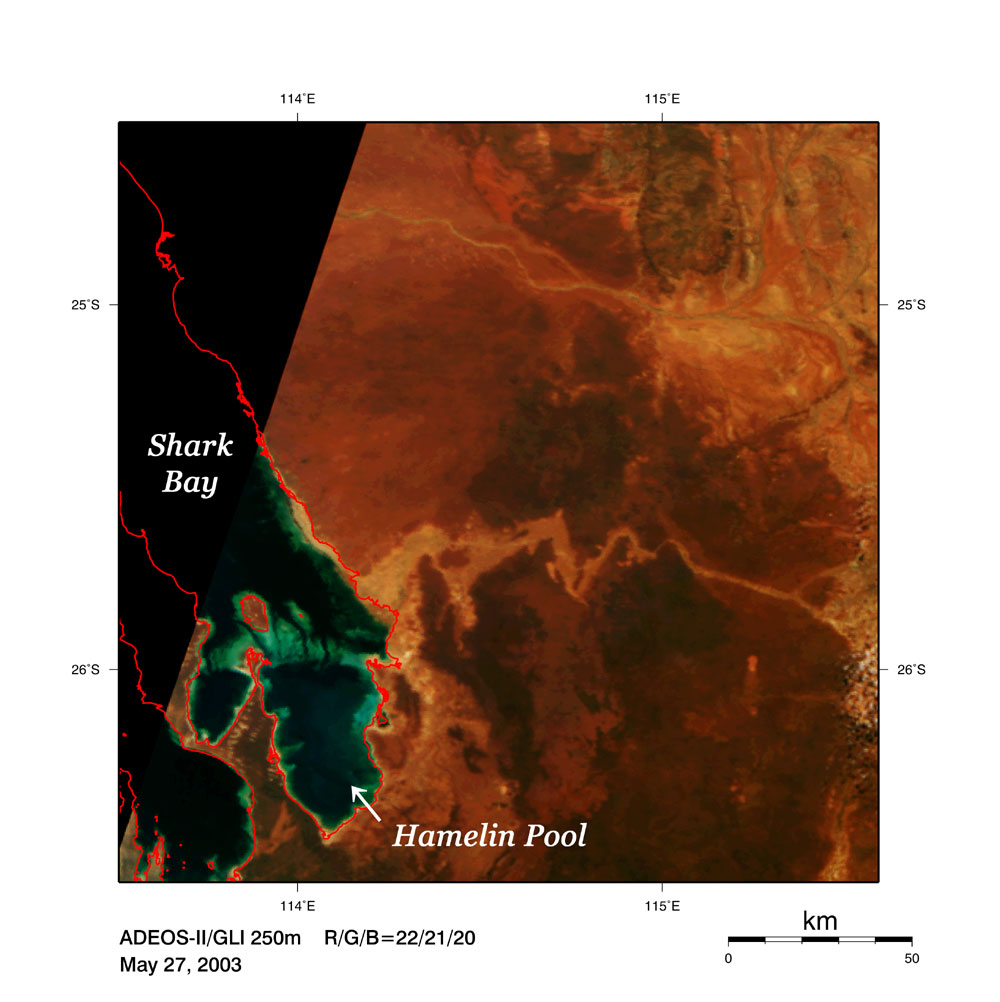
Figure 1 covers almost all of Western Australia except for the northern part. The image indicates that there are vast, arid deserts in the greater part of Western Australia. There sparse vegetation in the savannas (reddish brown or pale brown) is wide spread with lakes (dark blue or black) and salt lakes (light blue) scattered among them. The forests (dark green) and the grassland or farmland (yellowish green) in the southwest suggest abundant vegetation. These districts, including Perth, the state capital, enjoy warm weather with the proper rainfall throughout the year due to the Mediterranean climate. The greenish dark-brown area in the south indicates savannas or savannas with short trees, and some linear vegetation boundaries can be detected (the maximum length reaches almost 150 km). It impresses us that these boundaries were artificially shaped. White represents clouds, black is water surface such as sea, lake, or river. Black may also indicate no data. Earth was born about 4.6 billion years ago, and 3.5 billion-year-old rocks have been found near the Hamersley Range (Fig. 2). Also found were the micro fossils of the bacteria called "cyanobacteria" (*1) performing photosynthesis in the 2.7 billion-year-old sedimentary rocks "stromatolite." Living stromatolite exist in the Hamelin Pool deep in Shark Bay, which has been designated as a World Natural Heritage site . This rock grows in a shallow sea by attaching solid micro-particles of lime with cyanobacteria-secreting mucus.
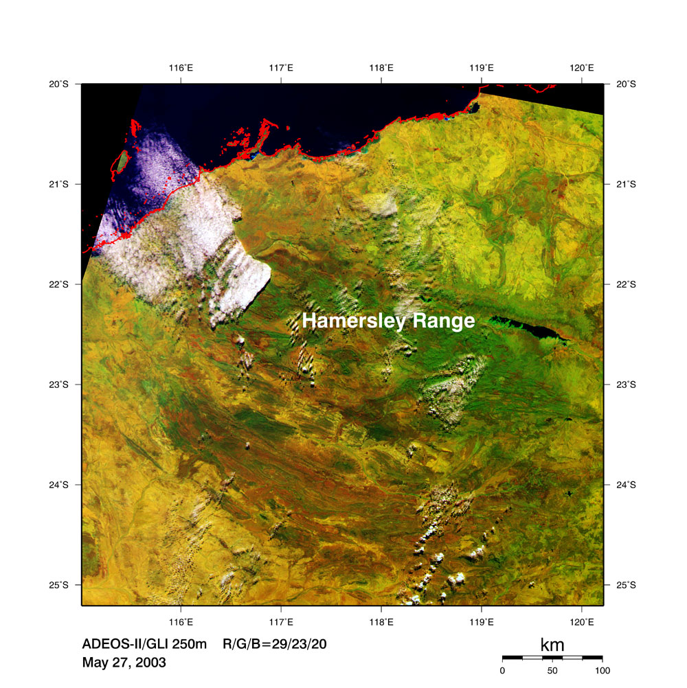
The cyanobacteria generated oxygen by photosynthesis with internal chlorophyll. The oxygen was subsequently consumed for oxidizing massive volumes of iron ions dissolved in the sea at that time. In this way, oxidized iron precipitated on the bottom of the sea, and huge iron deposits were formed all over the world 2.5 to 1.9 billion years ago. Hamersley Range has one of the world largest iron deposits. The high-quality iron ore mined there is exported to Japan via train and ship. The oxygen generated by cyanobacteria entered into the atmosphere with a time delay. The oxygen concentration in the atmosphere increased abruptly 2.3 to 1.9 billion years ago, and the ozone layer that blocks harmful ultra-violet light was formed 1.0 billion years ago. This was followed by the birth and evolution of various creatures 600 to 500 million years ago (the Cambrian period).
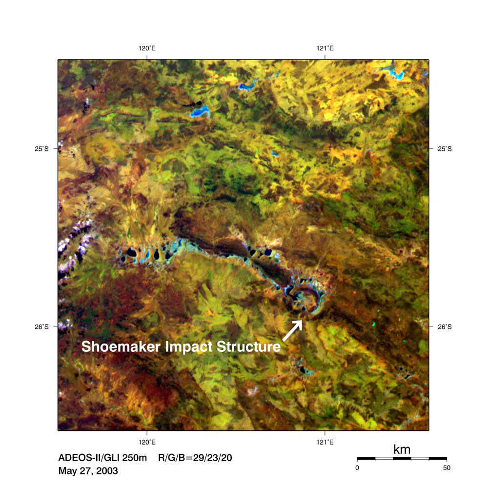
Tracing the events of that time, one discovers an impact crater. Figure 4 is an expanded view of the Shoemaker Impact Structure (30 km diameter) formed 1.63 billion years ago. The crater was formerly referred to as the Teague Ring. It was later renamed in honor of Dr. Eugene Shoemaker (*3) who, while visiting in 1977 to research the impact crater, was tragically killed in a car accident in northern Australia. (*1) The composition of the Earth's atmosphere has become oxygen-rich, due to the activity of cyanobacteria, differing greatly from the atmospheres of other planets. (*2) This iron ore deposit is 100,000 square km in area (nearly equal to the areas of Hokkaido and Shikoku combined) and 1,500 m deep. (*3) Shoemaker was an American geologist and astronomer and was also known as one of the discoverers of "comet Shoemaker-Levy 9" that crashed into the planet Jupiter in July of 1994. Explanation of the image Sensor: Global Imager (GLI) Date of observation: May 27, 2003 Fig. 1 This is a composite image generated from GLI spectral channel 28 (1,640 nm) in the short-wavelength infrared band (red), channel 23 (825 nm) in the near-infrared band (green), and channel 22 (660 nm) in the visible band (blue). This channel combination is often used for land cover surveys such as vegetation classification. The original resolution is 250 m. Fig. 2 This is a composite image generated from GLI spectral channel 29 (2,210 nm) in the short-wavelength infrared band (red), channel 23 (825 nm) in the near-infrared band (green), and channel 20 (460 nm) in the visible band (blue). This channel combination is often used for geological resource surveys. The original resolution is 250 m. Yellow-green or brown linear areas are generally sedimentary rock, rich in iron oxide. Green typically indicates vegetation, while yellow denotes desert or savannas. Fig. 3 This is a composite image generated from GLI's three visible spectral channels, channel 22 (660 nm; red), channel 21 (545 nm; green), and channel 20 (460 nm; blue). The image renders colors similar to those as seen by the human eye. The original resolution is 250 m. Fig. 4 This is a composite image generated from the same channels and same coloring as those of Fig. 2. Related topics: |