Seen from Space 2003
| Whirl Structure and Phytoplankton off the San Francisco Coast |
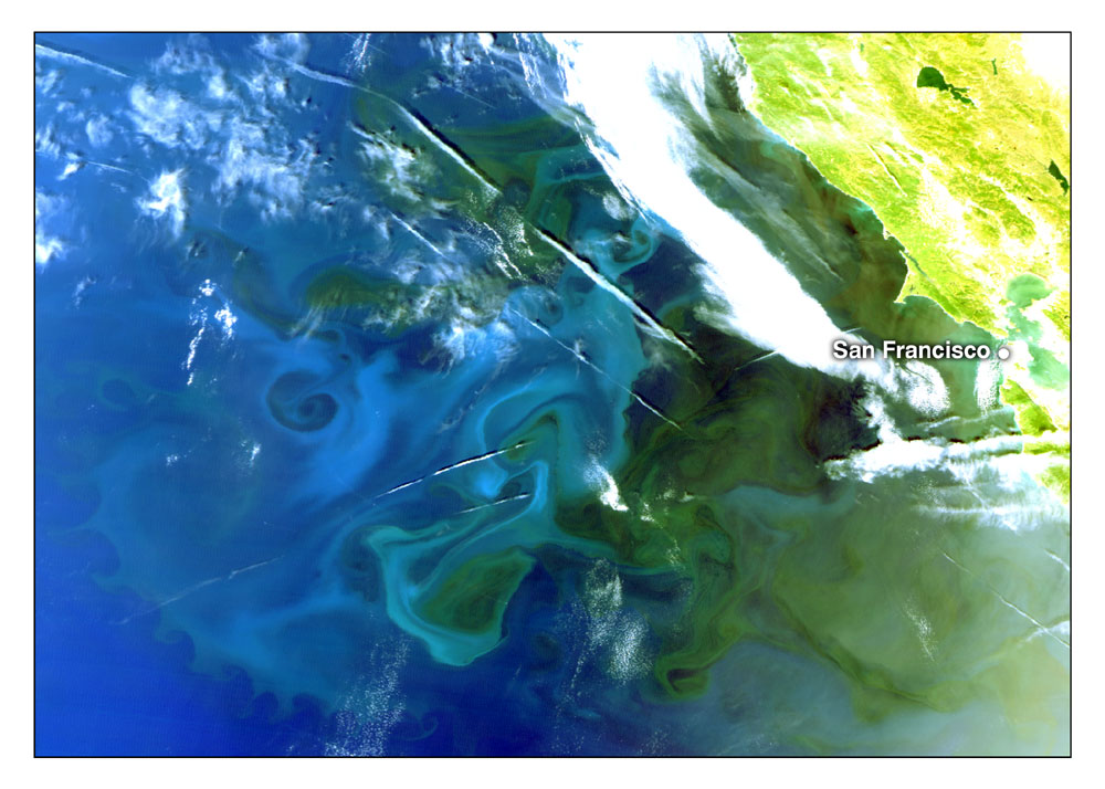
GLI acquired this high-resolution (250m) image of a whirl structure and phytoplankton off the San Francisco coast in North America on May 26, 2003 (*1). Greenish yellow in the upper right of the image indicates land; white, cloud; and the other parts, sea. In this image, we can see a developed whirl structure and characteristic color of the sea off the San Francisco coast. Green and blue of the sea are caused by phytoplankton in the sea. In this area, seawater is carried off the coast by the wind, and water is upwelling around the coast to cover it. That supplies abundant nutrient salts, so the phytoplankton concentration remains high year-round. The whirl structure seen in the left of the image 1 represents the dynamic flow of seawater and phytoplankton distribution.
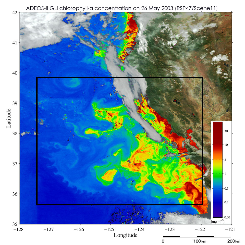
Image 2(*2) presents the chlorophyll-a concentration in phytoplankton off the San Francisco coast acquired at the same time by GLI with a 1km resolution. Red indicates a high concentration, and blue, a low concentration. The enclosed area is the area of image 1. Dark green, light blue, blue, and dark blue in image 1 indicate a range of chlorophyll-a concentration from high to low. On this day, an area of high chlorophyll-a concentration (exceeding 1mg/m 3 ) extended 400km off the coast. Also, a whirl structure and an airplane contrail, which are difficult to see in image 2 with 1km resolution are clearly visible in image 1 with 250m resolution. In contrast, the cloudy area in image 1 can be seen as chlorophyll-a concentration in image 2 after atmospheric correction(*3). (*1) Image 1 is generated from GLI 250m resolution channel 22 (red), channel 21 (green), and channel 20 (blue). This image is before atmospheric correction, and the color of the sea was emphasized so the sea could be seen clearly uninfluenced by the atmosphere. (*2) Image 2 has been improved by atmospheric correction, and the concentration of chlorophyll-a was derived using a previously developed algorithm. (*3) Particulate matter in the atmosphere called aerosols cause distant scenes to look hazy even if the weather is fine. When we observe the Earth from a satellite, light from the land surface or sea surface is absorbed or scattered by the aerosols and become weak. Light reaching the satellite is also scattered by the aerosols in the atmosphere. Atmospheric correction estimates the strength of the original light from land or sea surfaces without these influences. In particular, when we view the sea from a satellite, the sea appears much darker than the land because 80 to 90% of the observed light is scattered by the atmosphere. Atmospheric correction is thus very important for accurate observation of the sea. |