ページの先頭です。
本文へジャンプする。
【Important Notices】This page is an archive page of information published in the past. Since the update has been completed, it may contain broken links or outdated information. For the latest information, please use the new site Earth-graphy (earth.jaxa.jp).
ここからサイト内共通メニューです。
サイト内共通メニューを読み飛ばす。
サイト内共通メニューここまで。
ここから本文です。

Seen from Space 2003

Observation of Amazon River


This image of the Amazon River running eastward through northern Brazil was acquired by GLI on April 8, 2003. Although tropical areas along rivers are often covered with clouds, we were able to acquire a full view this time from Manaus located on the east bank of the Negro River, one of the Amazon tributaries to the river mouth. Black indicates water areas like rivers or oceans; yellow, land with vegetation; reddish brown, land with little vegetation like bare ground, land after deforestation or forest fires; and white, clouds. We can see more than a thousand tributary rivers spread in a meshed pattern. The tons of earth and sand transported by the Amazon and deposited around the river mouth are depicted in blue in the upper right of the image.

200km upstream from Manaus (High-water season)

The headstream of the Amazon River is located in the Andes Mountains, which are continuously covered with snow. Many streams of melting snow combine to form a major flow, that runs across South America and finally into the Atlantic Ocean near the town of Belem. The Amazon River is 6,300km long and the world's largest in area and volume of water because it is deep and has many tributary rivers. Due to its depth, even deep-sea vessels can sail to Manaus. In the high-water season (from December to May), it is 8 to 10 m deeper than in the low-water season (from June to November). The river is 480 km wide at the river mouth and 10 km wide 1600 km from the mouth. If we sail on a boat, the river seems to be a soil-colored sea extending all around.

High-water season

Low-water season

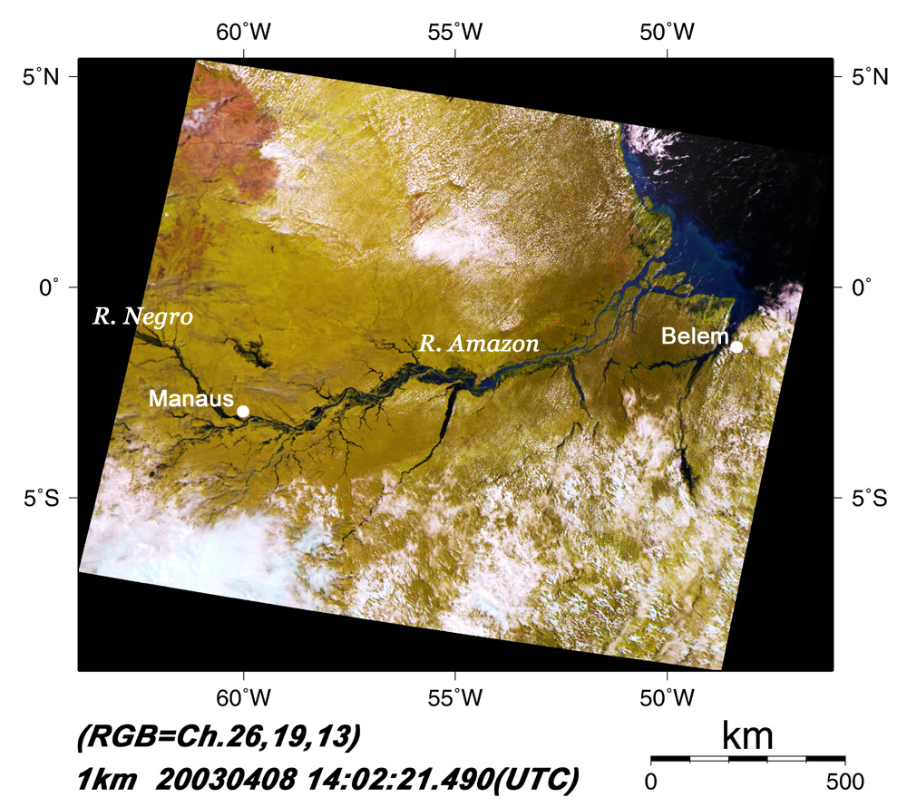
The sea sometimes becomes higher than the Amazon River, and sea water from the Atlantic Ocean flows upstream across hundreds of kilometers, mainly during spring tide (from February to April), because the vertical drop between upstream and mouth is very small. The back-flow is called "Pororoca" and can be over 6 m high and run at 15 to 20 km/h.

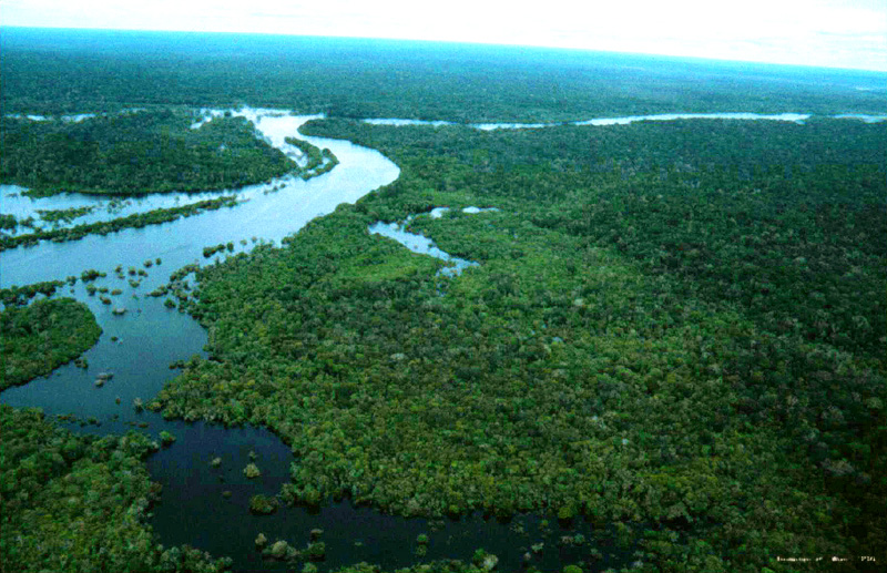
The area along the Amazon River is very old, going back to the Palaeozoic Era 0.2 to 0.5 billion years ago. For this reason, we can see various kinds of creatures in the tropical forest (called "Selva"(*)) and in the water. Over 2000 kinds of fish, more than in the Atlantic Ocean, have been found in this area, including ancient fish that have maintained the same shape for over 100 million years. Pirarucu, a representative ancient fish, can survive in drastically changing environments, such as flow-back of sea water and changing water levels, because it is capable of pulmonary respiration.

*Selva: Large tropical forest mainly growing along the Amazon River. Sunlight is almost blocked by trees, so it has little bottom weed. In contrast, jungles such as in Southeast Asia and Africa are penetrated by sunlight so weeds grow on the ground.

本文ここまで。
image:Satellite Navigator
image:Satellite Applications and Operations Center(SAOC)
Earth Data Collection by JAXA Satellites
image:ページTOP