ページの先頭です。
本文へジャンプする。
【Important Notices】This page is an archive page of information published in the past. Since the update has been completed, it may contain broken links or outdated information. For the latest information, please use the new site Earth-graphy (earth.jaxa.jp).
ここからサイト内共通メニューです。
サイト内共通メニューを読み飛ばす。
サイト内共通メニューここまで。
ここから本文です。

Seen from Space 2003

Whereabouts of Giant Iceberg (Sequel)


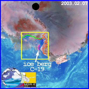
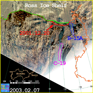
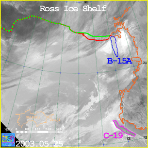
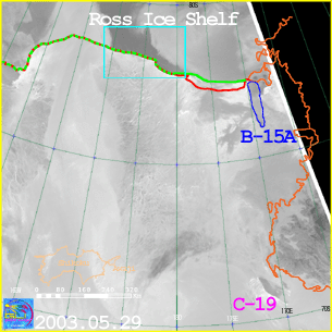
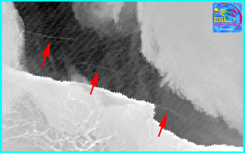
MIDORI-II (ADEOS-II)/GLI observed a giant iceberg, which broke off from the Ross Ice Shelf in May of last year (2002). The iceberg is 17 by 109 nautical miles. The image from AMSR-E in Fig. 1 shows Antarctica on February 7, 2003. On the same day, MIDORI-II (ADEOS-II)/GLI observed the Ross Sea area (Fig. 2), indicated by the yellow line in Fig. 1. The change of coastline becomes clear by comparing the GLI image (Fig. 2) with the MODIS image, which was obtained before the iceberg broke off from the Ross Ice Shelf. MODIS is a US sensor aboard NASA's Terra satellite. The coastline before the iceberg outflow is shown in red, and the coastline after the iceberg outflow is shown in green. Iceberg C-19 can be observed under the thin cloud. Additionally, iceberg B-15, which broke off from Ross Ice Shelf in March 2000, was observed in the same image (Fig. 2). Both icebergs are very big, as can be understood by comparing them with Shikoku and Awaji islands, which are drawn to the same scale in the lower left of Fig. 2 - 4.


(Fig. 1)


(Fig. 2) See larger image.


Iceberg C-19, which is flowing offshore, was observed by the infrared channel on May 25, 2003 (Fig. 3).


(Fig. 3) See larger image.


The Ross Ice Shelf, the source of iceberg C-19, was observed between the clouds on May 29, 2003 (Fig. 4).
The area circled in light blue in Fig. 4 is magnified in Fig. 5. Three lines were confirmed in the Ross Ice Shelf (Fig. 5). The lines could be cracks, and the iceberg could calve. Continual monitoring by earth-observation satellites is needed.


(Fig. 4) See larger image.


(Fig. 5)
To see the first part of "Whereabouts of Giant Iceberg"

本文ここまで。
image:Satellite Navigator
image:Satellite Applications and Operations Center(SAOC)
Earth Data Collection by JAXA Satellites
image:ページTOP