|
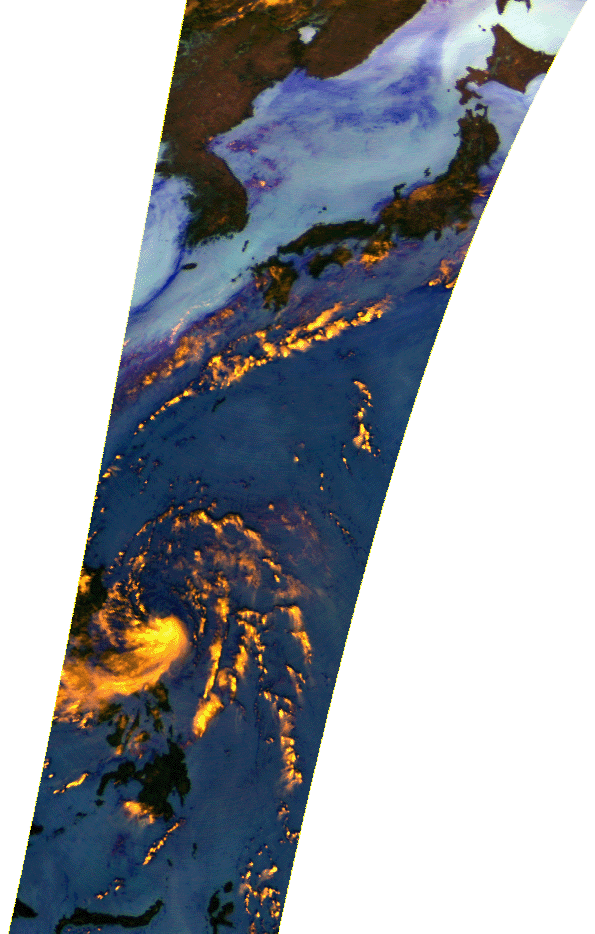
This AMSR-E image was acquired at around two o'clock on June 16, 2003 (JST) and covers typhoon No.6(SOUDELOR) in 2003 and seasonal rain front. The image is color composite using brightness temperatures of 89.0-GHz (both vertical and horizontal polarization) and 23.8-GHz (vertical polarization) channels. Over the oceans, possible strong precipitation areas are highlighted by bright yellow; colors varying from aqua to dark blue correspond to increases of water vapor and clouds.
Typhoon No.6 is located over the sea just east off Luzon Island of the Philippines, and possible strong precipitation areas by seasonal rain front are located along west Japan and Nansei islands.
AMSR-E developed by NASDA is the instrument onboard NASA's Aqua spacecraft launched in May 2002. |