Report of the SAFE Workshop in APRSAF-22,
Bali, Indonesia
< Last Update: Dec. 11, 2015 >
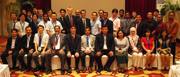
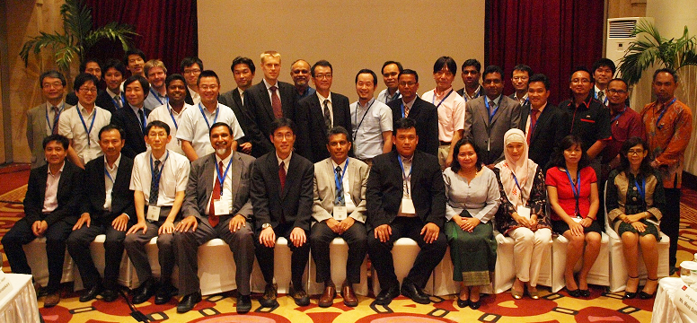
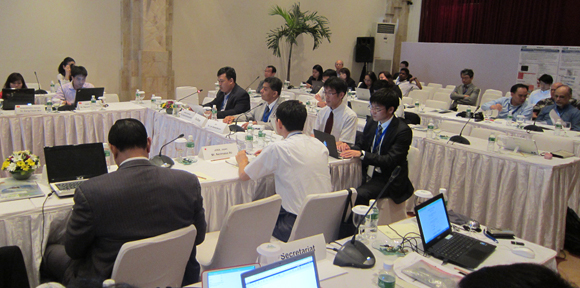
The SAFE Workshop at APRSAF22 was successfully and fruitfully completed at the Discovery Kartika Plaza Hotel in Bali, Indonesia on November 30, 2015. After the workshop, the result was reported to the Space Applications Working Group (SAWG) and the plenary session which was held continuously from Dec 1 to 4.
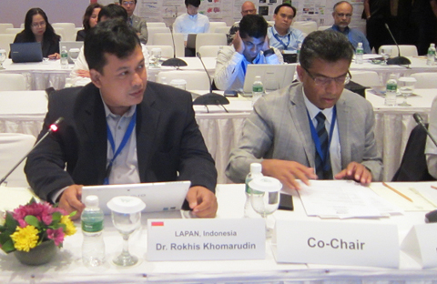
The workshop was led by co-chairs, Dr. Lal Samarakoon, Director of Geoinformatics Center (GIC), Asian Institute of Technology (AIT) and Dr. Muhammad Rokhis Khomarudin, Director, Remote Sensing Application Center, LAPAN, Indonesia. The total number of participants was 60 from several countries and international organizations including ADB, AFSIS, ICHARM, and MRC.
During the workshop, four new SAFE prototype proposals were reviewed and the status of two on-going prototypes was reported. At the same time, final reports of HCMIRG/Vietnam (Rice Crop Monitoring), ICALRD/Indonesia (Rice Crop Monitoring), NCHMF/NHMS/MONRE/Vietnam (Flood Forecasting), KLORCE/VAWR/Vietnam (Coast Erosion Assessment) were presented.
The summary recommendations of SAFE initiative are given below;
RECOMMENDATIONS
[SAFE (Space Applications For Environment)]
- To accept the new SAFE follow-up activity framework and implement two of the completing cases (Indonesia and Vietnam Rice related) as follow-up cases for sustainable use of SAFE accomplishments at local levels after the completion of their two-year activities, while expanding cooperation with relevant user organizations and development aid agencies;
- To continue finalizing SAFE follow-up activities and revise TOR before next SAFE workshop.
Workshop Report from Secretariat
- 4 new prototype proposals reviewed:
- Promote rice planted area and production estimation using space based technologies (DPS, MAFF, Cambodia)
- Mapping and Monitoring Oil Palm Plantations Using Optical and SAR Space borne Data (LAPAN, Indonesia)
- Developing and Implementing an Operational Prototype for Advanced Flood Forecasting, Early Warning, and Data Sharing System in the Kalu Ganga Basin, Sri Lanka (Irrigation Department, Sri Lanka)
- Promote a Department of Agricultural Land Management and Statistics (DALMS) system through using Innovative rice crop area mapping and yield monitoring with space based technologies (DALMS, MOAI, Myanmar)
- Progress reports from on-going prototypes:
- Deploying GSMaP for Decision Support in Transboundary Catchments in the Lower Mekong Basin (IKMP, MRC)
- Efficient Oil Palm Management Prototyping Using 3D GIS (FASSB, Malaysia)
- Final reports:
- Rice Crop Monitoring in the Mekong Delta, Vietnam (HCMIRG, Vietnam)
- SAR Technology Application for Paddy Crop Monitoring in Central Area of Paddy Production, in Indonesia (ICALRD, Indonesia)
- Utilizing satellite data, numerical rainfall forecasts, combining with ground observations in flood forecasting for the Thai Binh river system (NCHMF/NHMS/MONRE, NCHMF, Vietnam)
- Assessment and evaluation of the erosion on the coast around Ma river estuary in Vietnam (KLORCE, VAWR, Vietnam)
Result of Reviewing New Proposals
-
Promote rice planted area and production estimation using space based technologies (DPS, MAFF, Cambodia)
Decision: Approved with considering the reviewers comments / suggestions before having the kick off meeting
-
Mapping and Monitoring Oil Palm Plantations Using Optical and SAR Space borne Data (LAPAN, Indonesia)
Decision: Approved with considering the reviewers comments / suggestions before having the kick off meeting
-
Developing and Implementing an Operational Prototype for Advanced Flood Forecasting, Early Warning, and Data Sharing System in the Kalu Ganga Basin, Sri Lanka (Irrigation Department, Sri Lanka)
Decision: Approved with considering the reviewers comments / suggestions before having the kick off meeting
-
Promote a Department of Agricultural Land Management and Statistics (DALMS) system through using Innovative rice crop area mapping and yield monitoring with space based technologies (DALMS, MOAI, Myanmar)
Decision: Approved with considering the reviewers comments / suggestions before having the kick off meeting
Reviewer's comments
1. Cambodia (Rice Crop)
- Output is too broad
- Strength of RS of the current method is not clearly visible (e.g. Very important topic but need more R/D to validate physical relationship between rice yield and SAR backscatter, How do you assess the rice crop maps?, How can the maps be used?, Be better info than agricultural census data?)
- There should be a strong technical supporter to help capacity building since there is no new development of models in this prototype
- Collaborate with AFSIS and MRC as well as existing rice prototype in Viet Nam
- Fertilizer application and management can be handled for more scientifically as outcome of the prototype (precision farming, too)
2. Indonesia (Oil Palm)
- Wide scope and ambitious goal -> should concentrate. Focus is too broad. Need to be arrived to practical application
- It seems that there are many things to do. Workflow should be more clear for the next two years period, not three years
- It is very interesting for the production estimation by plant age, however, it would be proper method. The classification of plant age by Remote Sening would be enough with catergories (less than 5 years and older than that)
- Need collaboration with U-Tokyo and SAFE prototyping in Malaysia (e.g. Missing tree should be considered)
- More contribution can be done to focus on emission reduction action plan rather than biomass mapping
3. Sri Lanka (GSMaP)
- Completing in 2 years is a question and need to consider implementation and capacity development to focus only flood forecasting
- GSMaP resolution compared to the river basin in the hilly terrain are challenges
- GSMaP is a new data that region will have a new finding on how to use GSMaP for flood analysis
- Prototype sounds focused and justified. Challenge may be in the follow up, scale up, implementation of the prototype
- Show clear transition plan of system development in Sri Lanka after verifying prototyping with DIAS
4. Myanmar (Rice Crop)
- Target area is not define (test site)
- Future direction is not clear. How to use in after the prototyping need to explain (How do you assess the rice crop maps from satellite data?, The current survey system of Myanmar will not change easily conserving existing farm survey system)
- Strength of Remote Sensing of the current method is not clearly visible (e.g. Very important topic but need more R/D to validate physical relationship between rice yield and SAR backscatter, How do you assess the rice crop maps?, How can the maps be used?, Be better info than agricultural census data?)
- Possibility to combine technical support with the Cambodia project?
- Fertilizer application and management can be handled for more scientifically with the outcome of the prototye
Results of progress reports and final reports
Completing prototyping
1. Vietnam (RICE)
- Confirm good completeness to develop a method for practical implementation
- Suggestions / comments
- Consider extend to work for Mekong delta as a test case of SAFE prototyping "follow up" implementation and request to submit one year work plan
- May collaborate with potential Cambodia SAFE prototyping for rice crop monitoring
2. Indonesia (RICE)
- Confirm good completeness to develop method and implementation
- Suggestions / comments
- Consider extend to work for main rice crop provinces as a test case of SAFE prototyping follow up implementation and request to submit one year work plan
- May collaborate with Vietnam SAFE prototyping for rice crop monitoring to improve
3. Vietnam (Flood)
- Confirm good completeness to develop method and implementation
- Suggestions / comments
- Hold a stakeholder meeting with finishing remain A/I within a few months
4. Vietnam (Coastal)
- Confirm good completeness to develop method and implementation
- Suggestions / comments
- Promote this accomplishment to use stakeholders
On-going prototyping
1. MRC (GSMaP)
- Accelerate prototyping activity to finish within two years
- Consider various type of GSMaP product utilization
2. Malaysia (Oil Palm)
- GIS system development and operation with developing interface with GNSS and RS data
SAFE follow up
Accepted SAFE follow up activity framework and implement 2 follow up test case activities (Vietnamese and Indonesian rice crop monitoring) from 4 complete SAFE prototyping with scale up
As a result of the workshop, prototyping line-up was updated: