Vietnam (VAWR) -201312
< Last Update: Jan. 15, 2016 >
SAFE Prototyping Status: December 2013 - December 2015 <Completed>
Assessment and evaluation of the erosion and sedimentation on the coast around Ma river estuary in Vietnam
Vietnam Academy for Water Resources (VAWR)
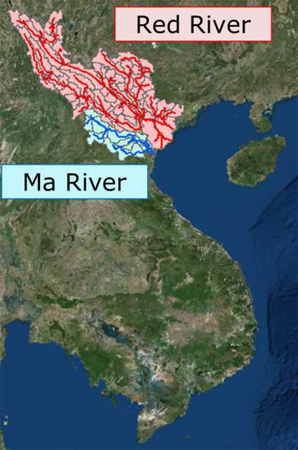
Northern coastal region of Vietnam has a lot of valuable estuaries and had tremendous economic and environmental development. Thanh Hoa is one of major cities along the northern coast of Vietnam and now faces to severe coastal erosion problems especially around the Ma River mouth, where is around 80 km southwest of the Red River mouth.
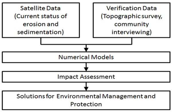
Causes of the erosion may be from decrease of sediment discharge from Ma river but it may also be significantly affected by the Red river. Satellite data is essential to capture the characteristics of macro-scale morphology changes, and to design the optimum counter measures against such severe coastal erosion problems. The following are the prototype’s specific objectives:
1) Determine the availability, accessibility and reliability of data and scientific tools for assessment of coastal erosion and sedimentation around the Ma river estuary,
2) Develop the monitoring system for evaluation of current and future coastal vulnerability around the Ma river estuary,
3) Understanding physical mechanisms of severe and localized coastal erosion and sedimentation problems for sustainable natural resources and environmental management and sand mining,
4) Propose practical solutions for mitigation of erosion and sedimentation,
5) Apply the remote sensing technology and information technology on the management of erosion and sedimentation damages.
6) Apply the remote sensing technology and information technology on the management of erosion and sedimentation damages.
Study Area
Coastal area around the Ma river mouth, located around 80km south-west of the Red river mouth, now faces to severe erosion problem. The erosion may be mainly due to the decrease of sediment discharge from the Ma River but may also be affected by the Red river. Thanh Hoa dike department is in charge of coastal protection and needs to find an optimum solution to mitigate the coastal erosion.
Final Results
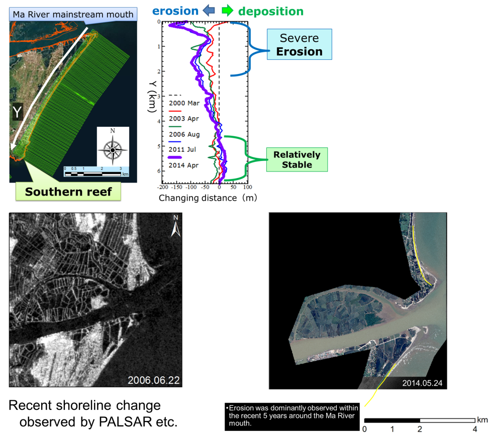
1) Shoreline Change Characteristics

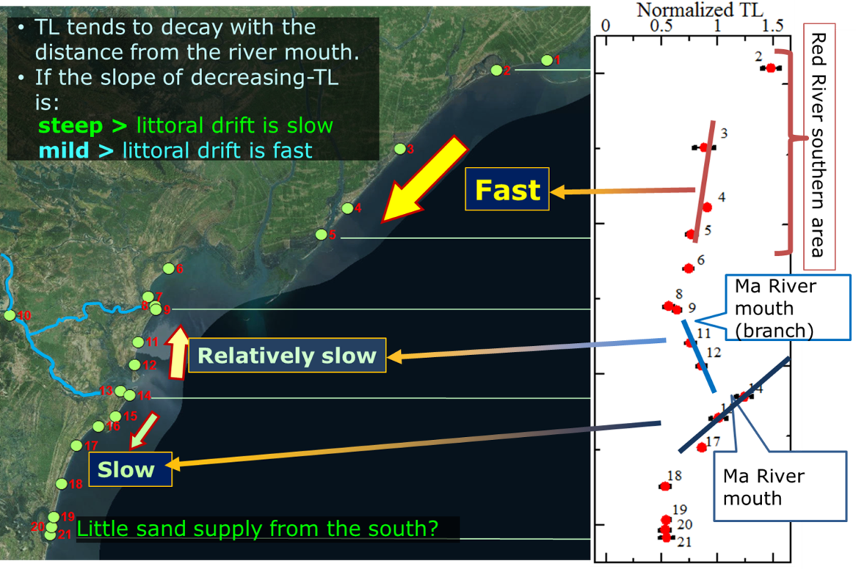
2) Thermo Luminescence Analysis Result around Ma River

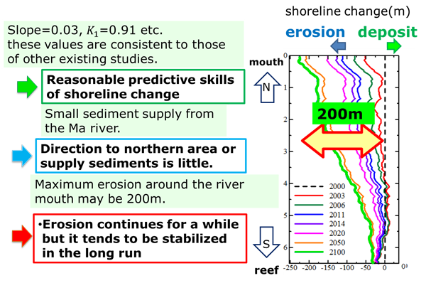
3) Future Shore Line Prediction using Shoreline Model
Developed System / Application
Expected Operational Usage
1) VAWR continues to use the developed system for monitoring of coastal erosion along the coast of Thanh Hoa province.
2) Based on newly found littoral characteristics around the coast of Thanh Hoa province, VAWR and Thanh Hoa dike department designs counter measures of coastal erosion problems.
3) Based on these findings and continuous monitoring system, the impact of sand mining around the river mouth is evaluated and evaluated results are used to limit of the volume of sand minings.
Formation
1) Prototyping Executor
Vietnam Academy for Water Resources (VAWR), Vietnam
2) Technical Supporter
- University of Tokyo
- Geo Informatics Center (GIC) / Asian Institute of Technology (AIT)
3) Data & Application Provider
- Japan Aerospace Exploration Agency (JAXA): High resolution satellite data (ALOS PALSAR, AVNIR-2, PRISM)