Sri Lanka -201201
< Last Update: 5 Aug. 2014 >
SAFE Prototyping Status: December 2011 - December 2013 <Completed>
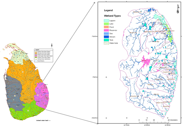
Mapping and Detecting Wetlands in River Basin
Geo-Informatics Unit, Central Environmental Authority (CEA)
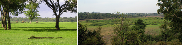
Healthy wetland ecosystems have a wide range of functions in terms of climate regulation, disaster reduction, biological diversity, and so on. As many wetland ecosystems in Sri Lanka have been, a large extent still is indiscriminately exploited for a commercial, agricultural, residential and industrial development and dumping of waste. As such many wetlands are under threat. Therefore, it must need to take immediate action to protect important wetlands under the National Environment Act of Sri Lanka.
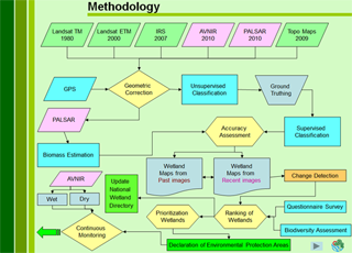
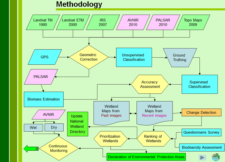
To fulfill above task, mapping and change detection of wetland in the selected region is a key requirement. To use of satellite images and previous aerial photographs along with the remote sensing and GIS techniques will be the tool for this project. The objective of this prototype is to identify the important wetland in the Eastern River Basin Region in Sri Lanka to declare as environmental protection areas under the National Environmental Act.
In-situ / Validation Data
1) Place and Date Acquired Data
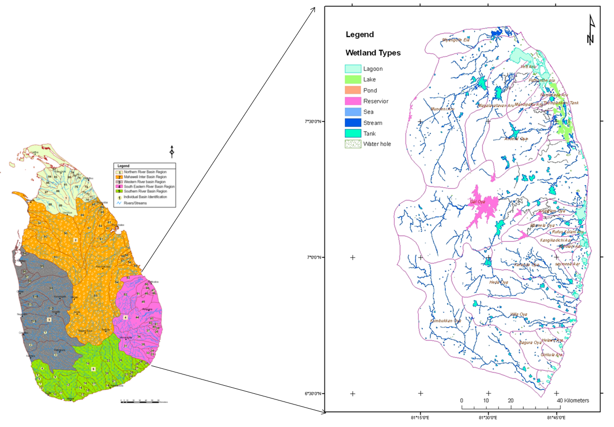
South- Eastern River basin
Ampara District, 6-10 August 2012
Batticaloa District, 4-7 September 2012
Both areas, 1-5 October 2012
2) Type of Parameter
a) Location Information (Latitude, Longitude, Altitude)
b) Acquired Time
c) Land Cover Type (Identifying 5 different types of wetland)
d) Ecosystem parameres
Expected Results
1) Products
Final Map Production
42 wetlands Identified and evaluated and 7 proposed for development of as protection areas
2) Biomass Estimation
3) Change Detection
4) Wetland Ranking and Assessment
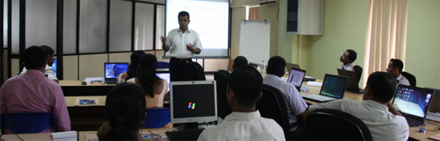
5) Capacity Building
On-the-job training: Training on Optical and SAR Analysis on Wetland mapping (May 2012)
- Hands on Training
Covered Theory and Practical
- Software Used
ERDAS, PolsarPro, ASF Map Ready, NEST 4A
- Data Used
ALOS PALSAR ,AVANIR-2
Prospect for Utilization
1) Taking action to protect important wetlands under the National Environment Act of Sri Lanka
Developemnt of buffer zone for wetlands to restrict some development activities for
- Conservation for biological diversity
- Increase the productivity of the particular wetlands
- To reduce the cumulative impacts of the agrochemicals in the wetlands
- To reduce the industrial waste in wetlands
- To reduction of flood and erosion risk
2) Updating the National Wetland Directory