Seen from Space 2011
The Longest Cable Suspension Bridge in the World
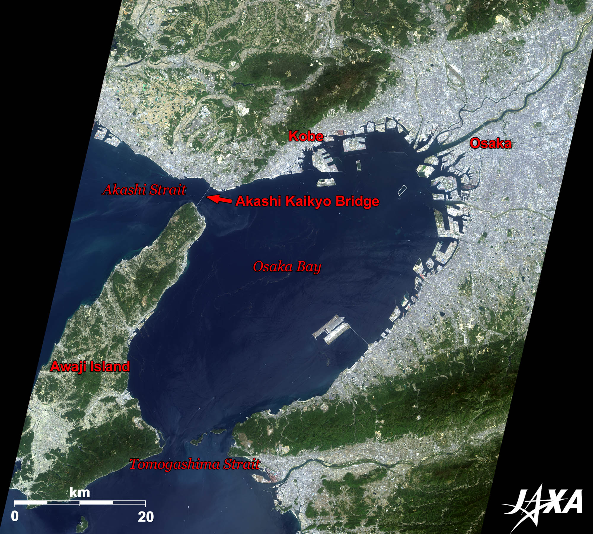 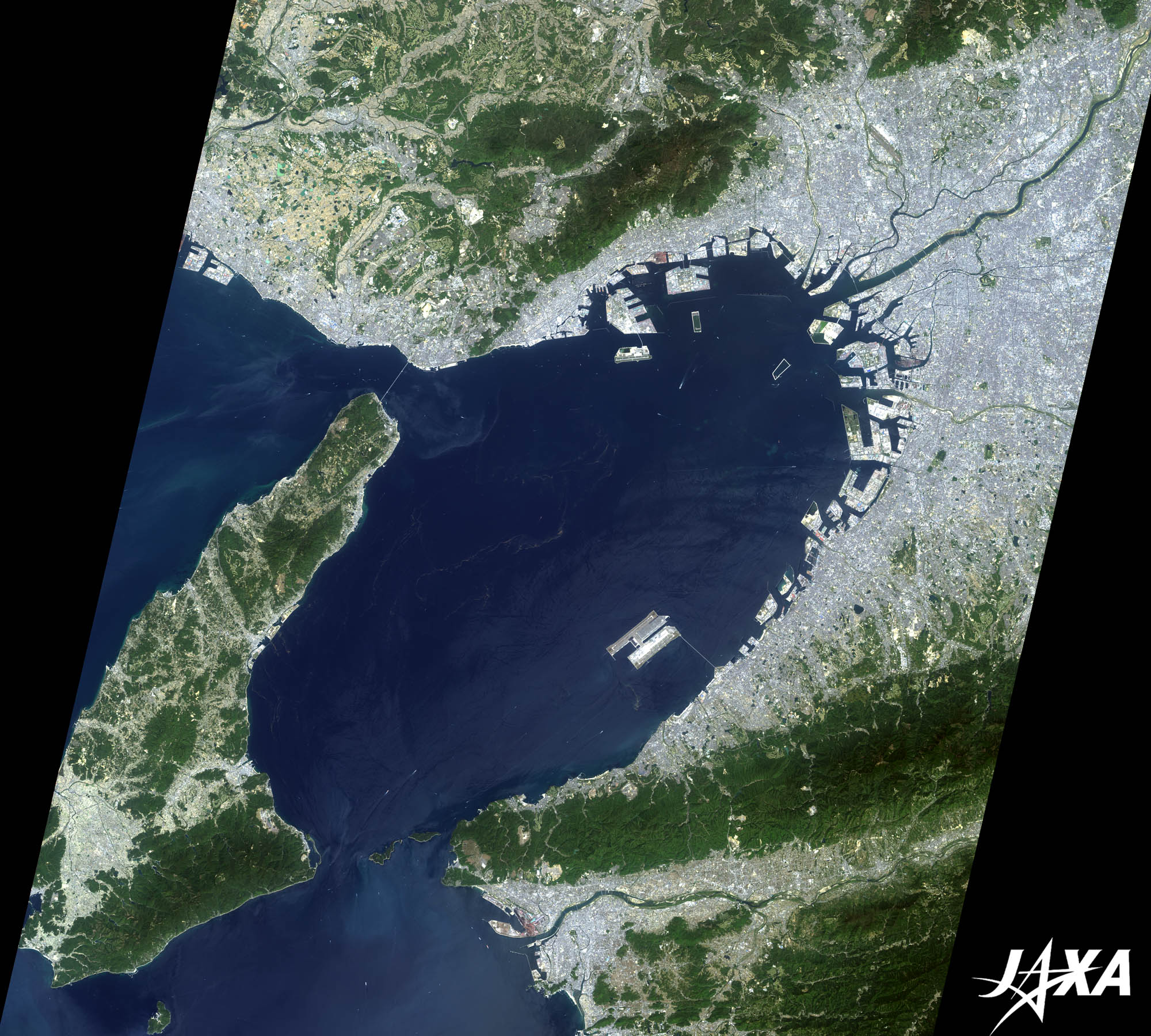 Fig. 1. Osaka Bay and Its Surroundings
Figure 1 is an image of Osaka Bay and its surroundings taken by ALOS (“Daichi”) in April 2009. Osaka Bay is connected to the Pacific Ocean through the Tomogashima Strait (otherwise called the Kitan Strait) in the south and to the Harima Sea through the Akashi Strait in the west. The land seen bluish-gray in the northeastern part of the image is the cities of Osaka and Kobe. Awaji Island borders Osaka Bay to the west. 
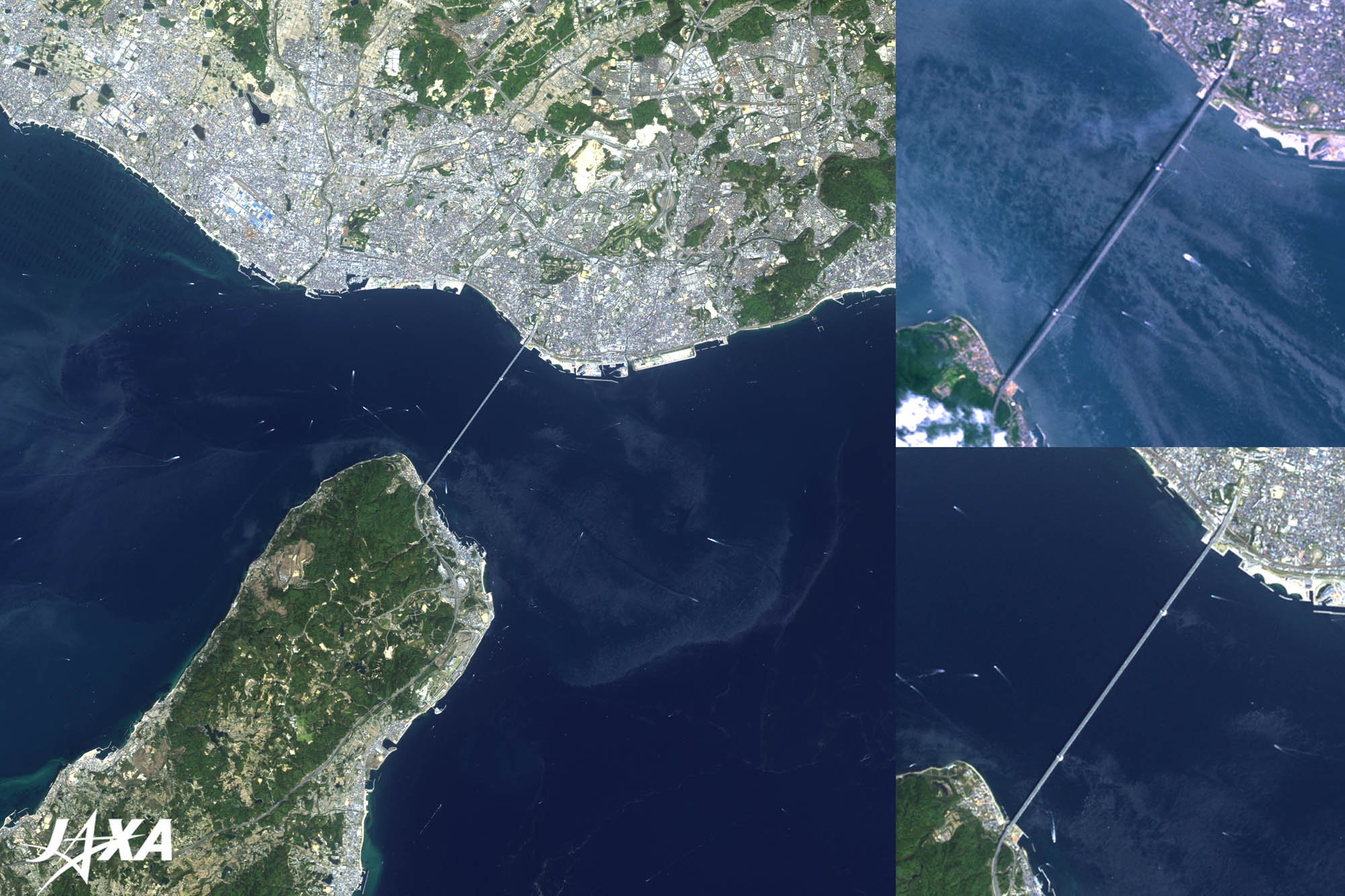
Fig. 2. Akashi-Kaikyo (Strait) Bridge
(Lower right is a nadir image and upper right is a 35-degree oblique image seen from the west) Akashi-Kaikyo Bridge (kmz, 4.16 MB, Low Resolution) as seen on Google Earth. Figure 2 is an enlarged image of Akashi-Kaikyo Bridge. The Akashi Strait is located between Awaji Island and Akashi City. The strait is 3.6 kilometers wide at its narrowest and 100 meters deep at its deepest. At the time of spring tide, large rises and drops of the sea level produce a strong ocean current of over 7 knots (around 13 km/h). The light bluish whirlpools generated by the strong current are visible in the left and upper right images. Akashi-Kaikyo Bridge, built over the strait, is 3,911 meters long. The distance between the towers (main span) is 1,991 meters, making it the longest cable suspension bridge in the world. The main tower, at 300 meters tall, is the third tallest in Japan behind Tokyo Sky Tree (634 m when completed) and Tokyo Tower (333 m). The lower right image shows the bridge observed at the nadir, and the upper right image shows the suspension structure observed obliquely from the west. 
The One Meter ExtensionThe Akashi-Kaikyo Bridge was originally designed to be 3,910 meters long with a distance of 1,990 meters between the towers. However, on January 17, 1995, a big earthquake struck the area, causing a landslide. As a result, the total length of the bridge and the tower’s span extended one meter. About 1.4 million cubic meters of concrete and 200,000 tons of steel were used to build this bridge.
Akashi City of the Japan Standard Time MeridianJapan follows Japan Standard Time (JST), which is 9 hours ahead of Universal Time. JST is determined using the 135th meridian east longitude, which passes over twelve cities including Akashi City. Akashi City is called “A City of the Meridian” because it built the first meridian sign of Japan in 1910. Akashi Municipal Planetarium sits right on the meridian and has become the symbol of the city. 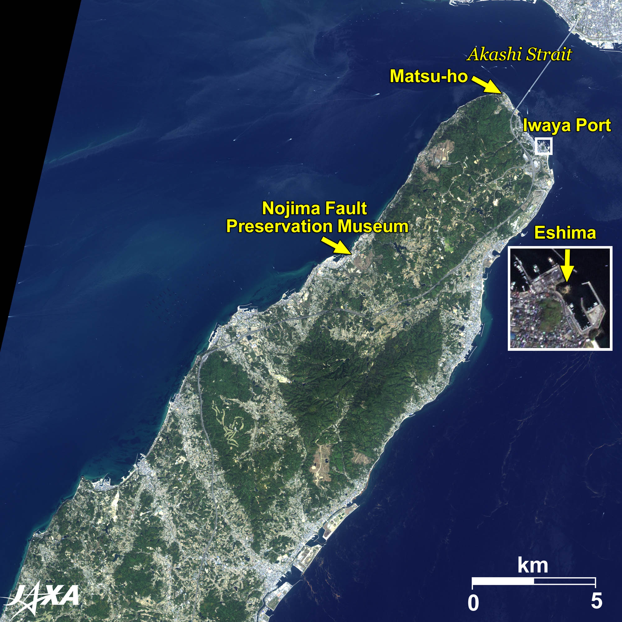  Fig. 3. Northern Part of Awaji Island
Figure 3 is an enlarged image of the northern part of Awaji Island. The northernmost coast is called Matsu-ho (pine tree wood coast) and is a spot made famous by its presence in many poems since the ancient times. The small island visible in Iwaya Port about 2 km southeast of Matsu-ho is called Eshima. The island, known as a scenic spot since ancient times, has appeared in various old tales. The Nojima Fault Preservation Museum and Park is located on the western coast of the island in the middle of the image. This point was the epicenter of the Great Hanshin-Awaji Earthquake that occurred in 1995. The museum displays the Nojima Fault (national monument), which emerged during the earthquake. Reference Sites:Explanation of the Images:
AVNIR-2 has four observation bands. The color composite images are produced by assigning red to Band 3 (610 to 690 nm), green to Band 2 (520 to 600 nm), and blue to Band 1 (420 to 500 nm). The resulting images have natural coloring as if seen by the naked eye. Each color indicates the following ground objects:
(Fig. 2) |