Seen from Space 2010
Tuvalu: Islands in Danger of Submerging
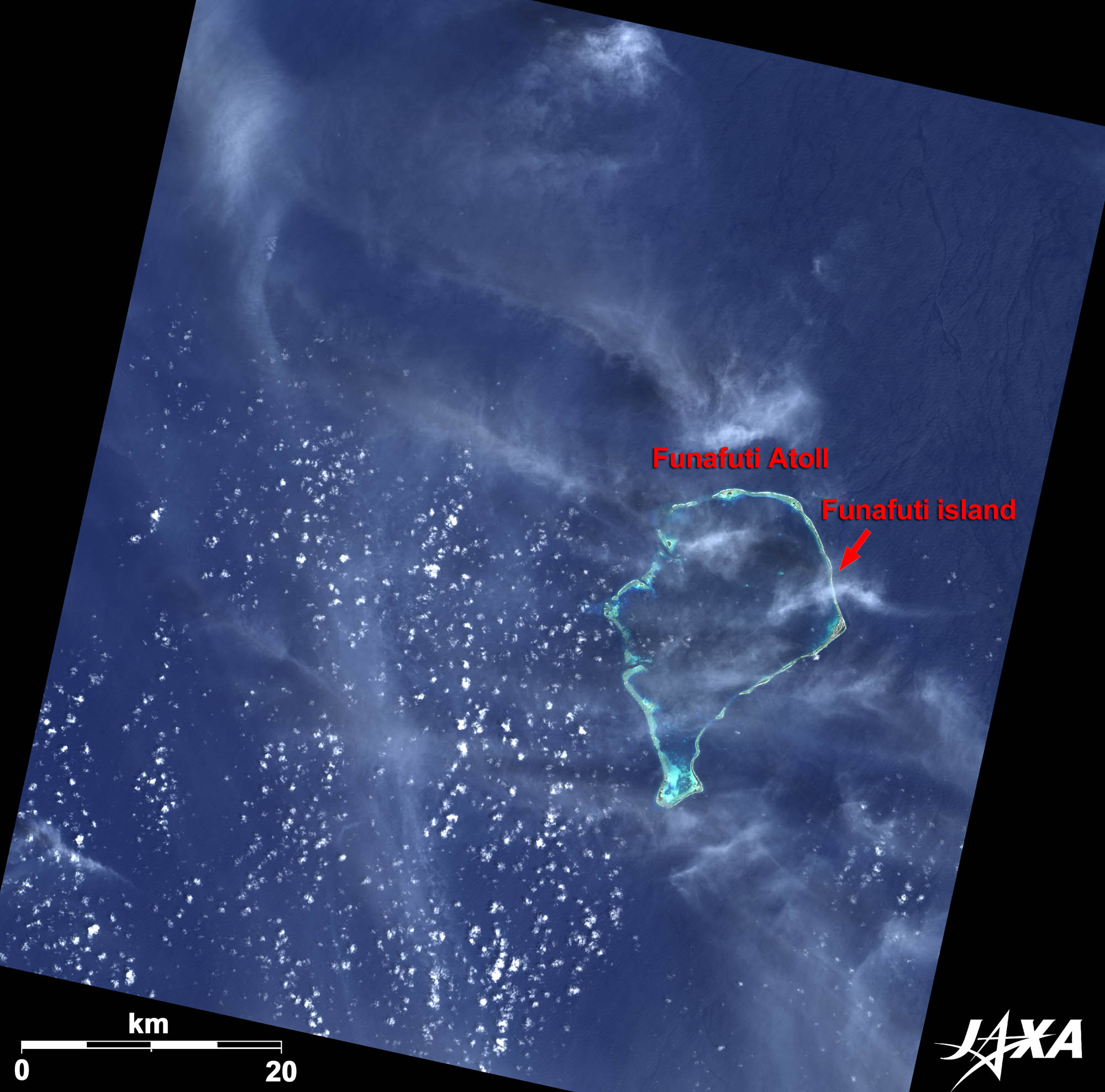 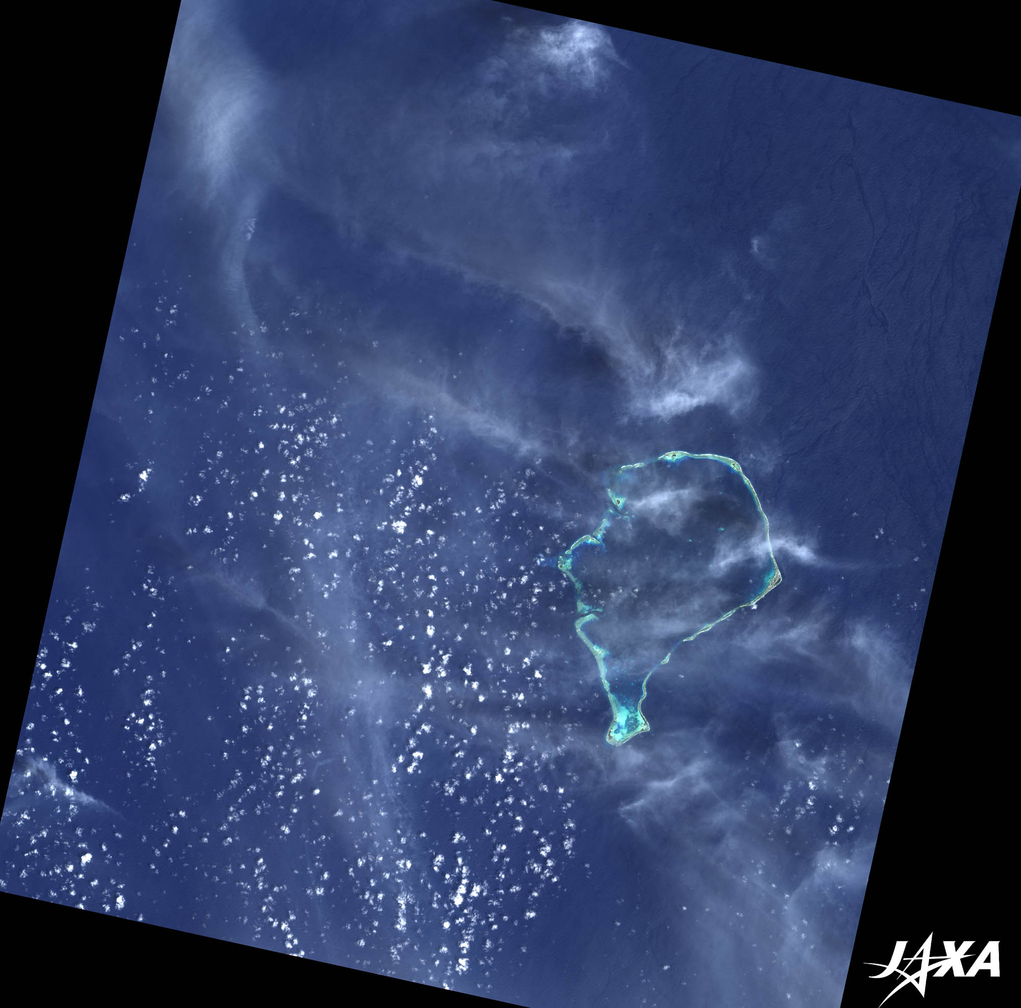 Fig. 1. Funafuti Atoll in the Tuvalu Islands
Figure 1 depicts the largest Funafuti Atoll in the Tuvalu Islands (formally known as the Ellice Islands), as observed by ALOS (“Daichi”) on January 18, 2009. It is a coral-reef lagoon 25 km north-to-south, 18 km east-to-west, and surrounded by small islets. Funafuti, visible on the rightmost end of the lagoon, is the largest islet and the capital of the island nation of Tuvalu. 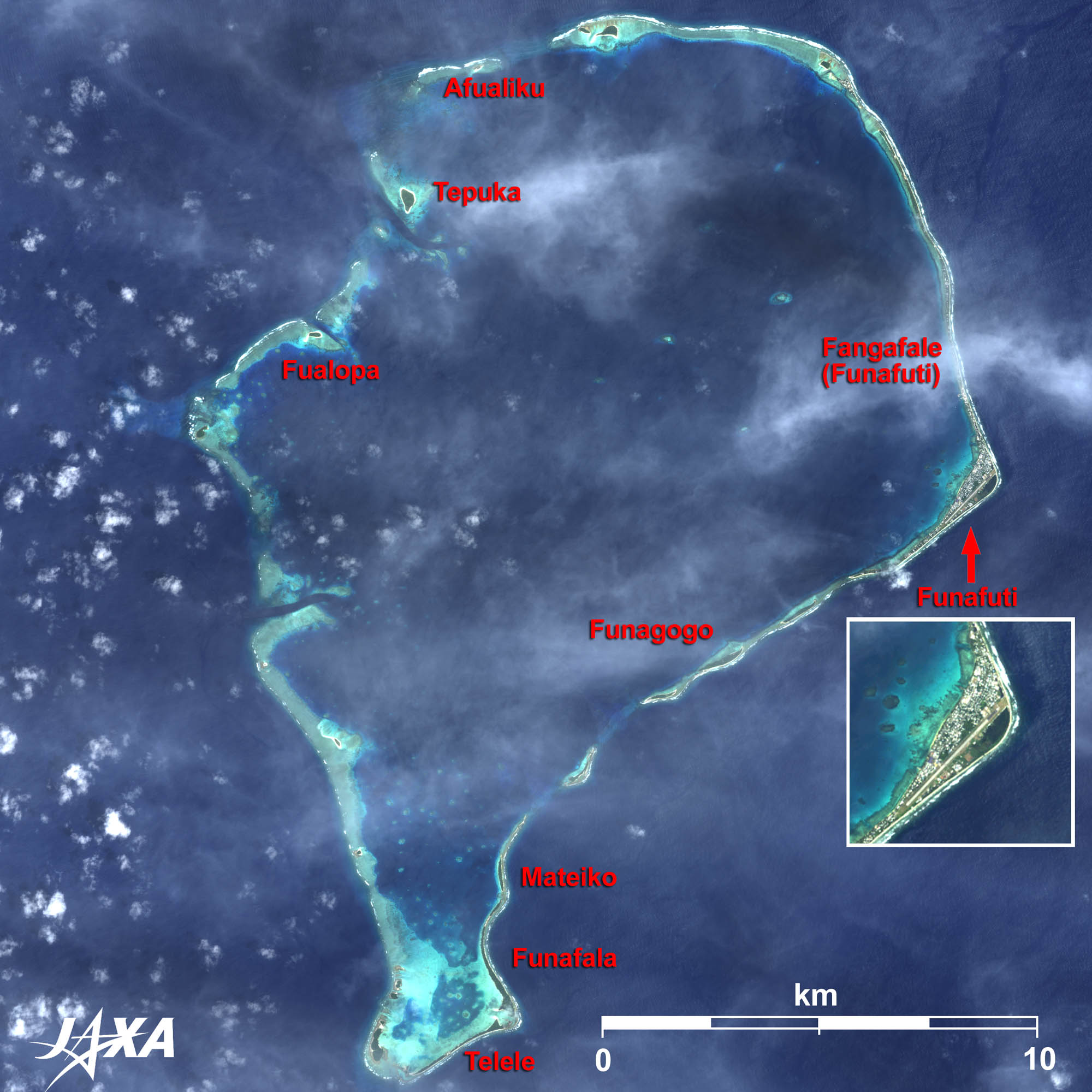 
Fig. 2. Enlarged Image of Funafuti Atoll
Funafuti Atoll (kmz, 3.02 MB, Low Resolution) as seen on Google Earth Figure 2 is an enlarged image of Funafuti Atoll. The capital, Funafuti, is located at the easternmost bend (right) of the atoll and it possesses the only airport in Tuvalu, the airstrip of which is slightly wider than a road and has no kind of lighting or guidance lights. Air Pacific operates two flights per week between it and Suva, the capital of Fiji. Since this airstrip is the only open space in the atoll, it is also used as a playground and a football field by the people. 
Economy of TuvaluThe population of the Tuvalu Islands is about 10,000. Rain is the main source of water for daily life. Since Tuvalu has almost no natural resources, much of the government revenue depends on overseas remittances from emigrant mariners. The substantial budget deficit is covered by the investment return of the Tuvalu Trust Fund, which was established in 1978 by Australia, the United Kingdom, New Zealand, and Tuvalu. Payment from the U.S. government according to the treaty on fisheries and the sale of Tuvalu’s Internet domain name “.tv” are other sources of income. However, Tuvalu is in a state of difficulty due to worldwide economical flagging.
Submergence CrisisAs a result of the sea level rising, like the Republic of Kiribati (South Pacific) and Maldives (Indian Ocean), Tuvalu is also in danger of submerging. Water gushes out from the ground, and houses and roads are flooded during high tide. Spring water from dents that were made during construction of the airfield, lowlands where people tend to live, and contaminated wastewater dramatically decreasing foraminifers, which are responsible for forming sands, are suspected as the causes of this phenomenon. However, in Tuvalu, since the highest point is only 4.5 meters above sea level, it is a land easily affected by rises in the sea level. The nation has already begun evacuating some of its residents to New Zealand. Japan is cooperating in coastal protection, disaster prevention, and developing alternative energy sources. Explanation of the Images:
AVNIR-2 has four observation bands. The color composite images are usually produced by assigning red to Band 3 (610 to 690 nm), green to Band 2 (520 to 600 nm), and blue to Band 1 (420 to 500 nm). The resulting images have natural coloring as if seen by the naked eye. Thus, following colors designate ground objects:
|


