Seen from Space 2010
The World Natural Heritage of Vietnam: Halong Bay
|
Halong Bay, in the northwest of the Gulf of Tonkin in northern Vietnam, is an exceptionally scenic spot. It is the largest tourist resort in Vietnam, located about 150 km east of Hanoi (the capital). Halong Bay, praised by foreign tourists as "Guilin on the Sea," is also a very special place for the people of Vietnam. 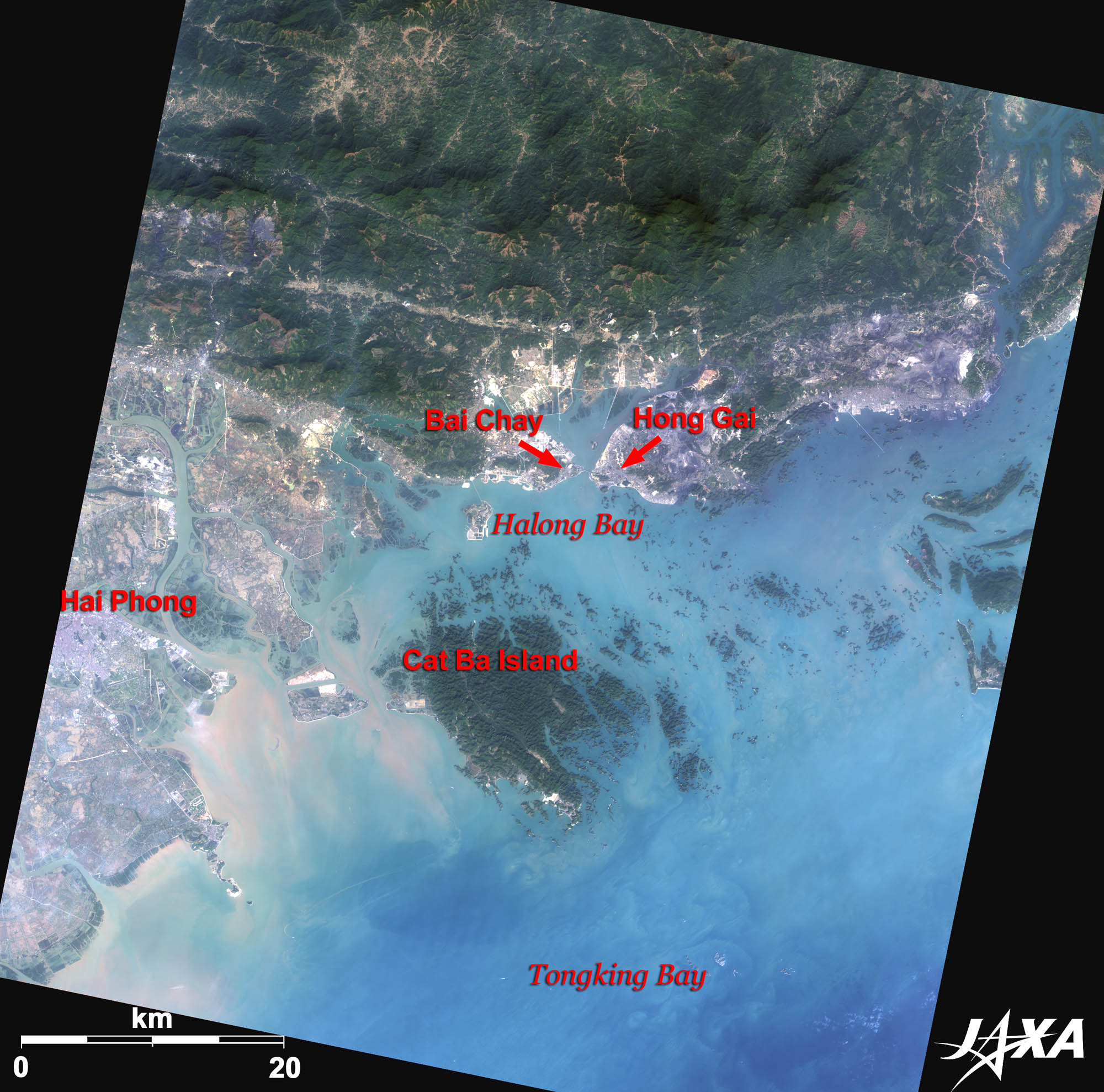  Fig. 1. Full Image of Halong Bay
Figure 1 depicts the full image of Halong Bay as observed by ALOS (“Daichi”) in December 2009. The big island in the center of the image, surrounded by small islets, is Cat Ba Island. There are about 2,000 islets in the bay and most of them are uninhabited. This geographical landform is part of a limestone plateau that begins in Guilin, China, to the north, and was submerged for millions of years, which created its unusual landscape. Many uniquely shaped islands and rocks were formed through erosion and local people endearingly gave them names such as “Elephant Islet,” “Fighting Cock Islet,” etc. Since these islets consist of limestone, several of them are hollow, forming enormous caves. Halong Bay was listed as a World Heritage Site by UNESCO for its natural beauties in 1994.  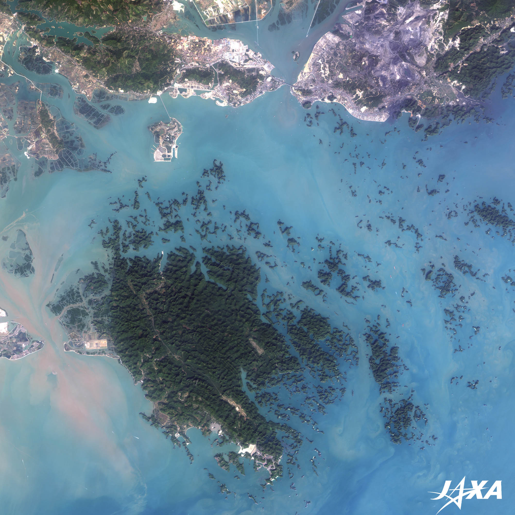
Fig. 2. Enlarged Image of Halong Bay
Halong Bay (kmz, 4.28 MB, Low Resolution) as seen on Google Earth Figure 2 presents an enlarged image of Halong Bay. The Halong Bay cruise departs from Bai Chay Port and visits the islets around Cat Ba Island. As seen from the image, untouched nature is reserved in and around the northwest part of the island; however, some white areas surrounding it indicate land development in progress. 
National Parks in VietnamVietnam has 30 national parks and about 100 jungles scattered all over the country. Many rare species of animals and plants inhabit the tropical forest of Vietnam.
Environment of Halong BayHalong Bay is one of the most popular tourist sites in the world and many cruise ships and boats have been seen there in recent years. Fuel, oil, and discharge water, along with tourist litter, have created a pollution problem in the bay. Nearby northern Vietnam is also the leading coal production area and thus, rapid industrialization with plants built of cement, bricks, and electric power generation has threatened the environment. 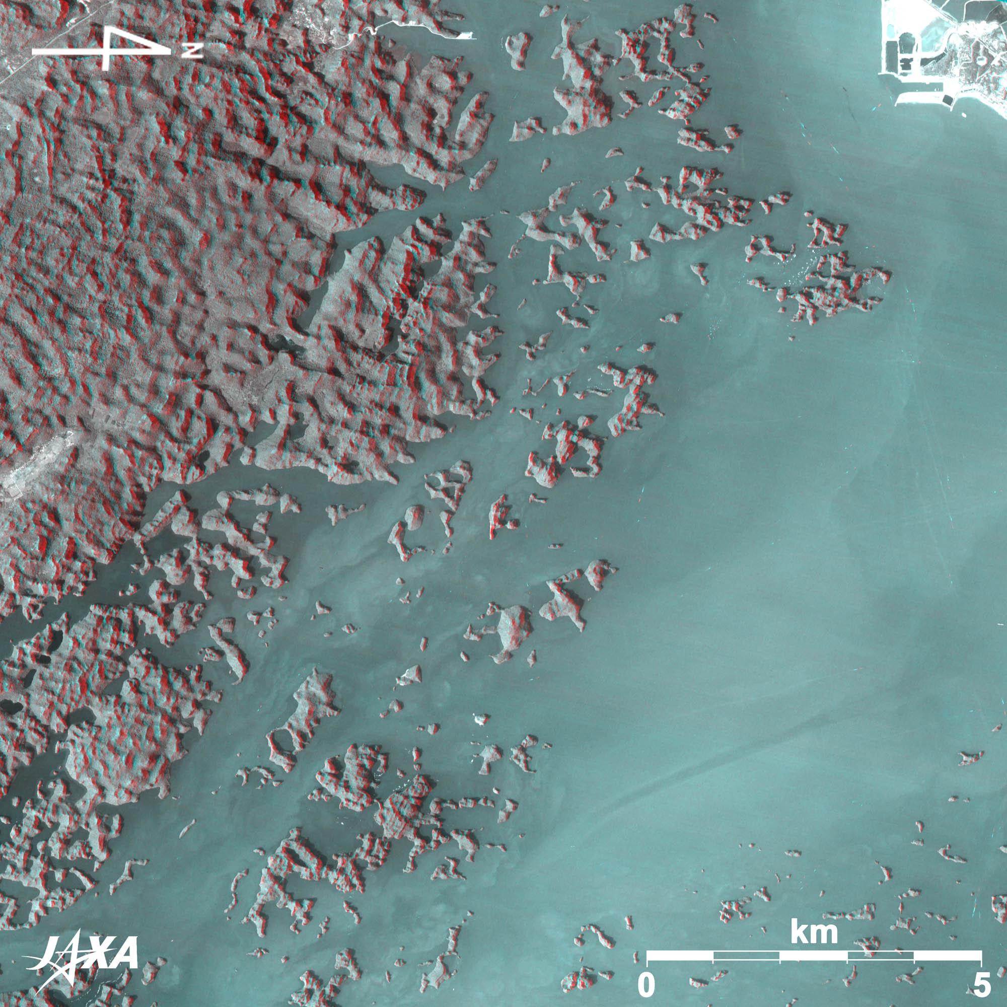
Fig. 3. Three-Dimensional View of Halong Bay
(Staring at the image for a long time may cause eyestrain. Colored prints are available in PDF. PDF files for the left and right eyes are also available.) When viewing Figure 3 with red glass over the left eye and blue glass over the right eye, you can see an anaglyphic image of the small islands popping out from the sea surface. Note that upward is north in Fig. 1 and 2, whereas the right hand side is north in Fig. 3, a result of the satellite’s flight direction. Reference Sites:
Explanation of the Images:
AVNIR-2 has four observation bands. The composite images (Fig. 1 and 2) are usually produced by assigning red to Band 3 (610 to 690 nm), green to Band 2 (520 to 600 nm), and blue to Band 1 (420 to 500 nm). The resulting images have natural coloring as if seen by the naked eye. Thus, the following colors designate ground objects:
PRISM is an optical sensor for observing ground surfaces with visible and near-infrared signals in the 520- to 770-nanometer (one-billionth of a meter) band. The acquired image is monochrome. PRISM has three independent optical systems (telescopes) to acquire images for nadir, forward, and backward views simultaneously. |


