Seen from Space 2009
Pink Lake Natron, Tanzania
Pink Lake Natron, Tanzania
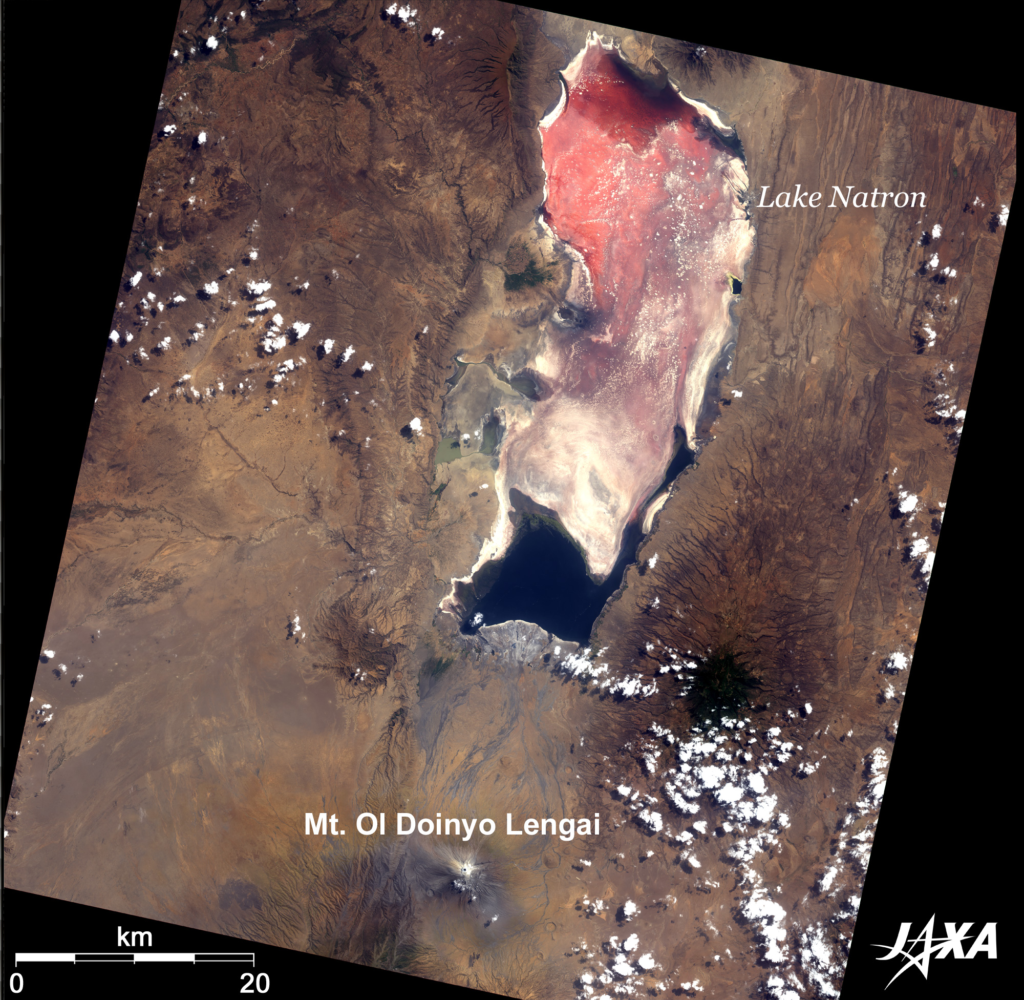 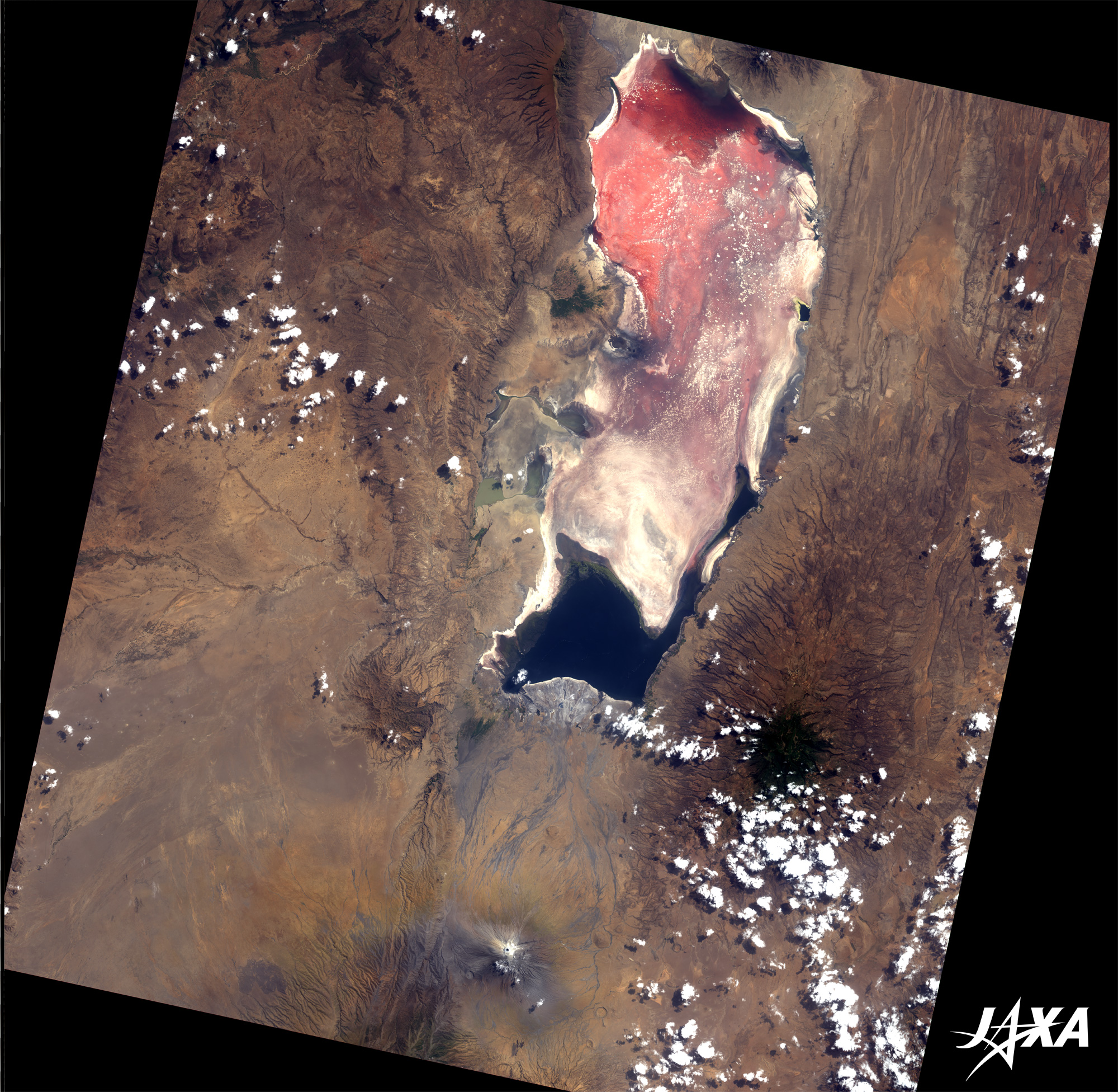 Fig. 1. Lake Natron
Lake Natron, Tanzania(kmz, 3.42MB, Low Resolution) as seen on Google Earth. Figure 1 is an image of Lake Natron in United Republic of Tanzania in central east Africa, as observed by the Advanced Land-Observing Satellite "Daichi" in August 2008. The lake is located 120 km south of Nairobi, the capital city of Kenya, and near the border of Kenya and Tanzania. Note that the color of the lake is pink. This is a characteristic of the algae. Blue-green algae are common in many lakes and marshes, but the algae in Lake Natron are vivid red. Lake Natron is a salt lake strong in alkalinity. Spirulina, salt-loving microorganisms in the lake, have a red pigment, and the pigment produces multiple colors: red, pink, and orange. A huge flock of flamingoes lives in the lake. The flamingo population is estimated at 2.5 million. They live in a special environment: a dry area surrounding an alkaline salt lake, where temperatures exceed 40 degrees C in the daytime. Few predators live here and the flamingoes can breed as a result. Lake Natron is the only breeding area for lesser flamingoes, a smaller species in the flamingo family. The lesser flamingoes live on the algae. Their plumage is pink due to the red pigment in the algae and it fades to white when there is a shortage of food. Ol Doinyo Lengai Mountain south of Lake Natron is now an active volcano. Ol Doinyo Lengai means "Mountain of God" in the language of the native Masai people. This mountain is precipitous and takes after Mt. Fuji in Japan. The lava spew is not commonly black lava, but gray, and it is rich in sodium and potassium. 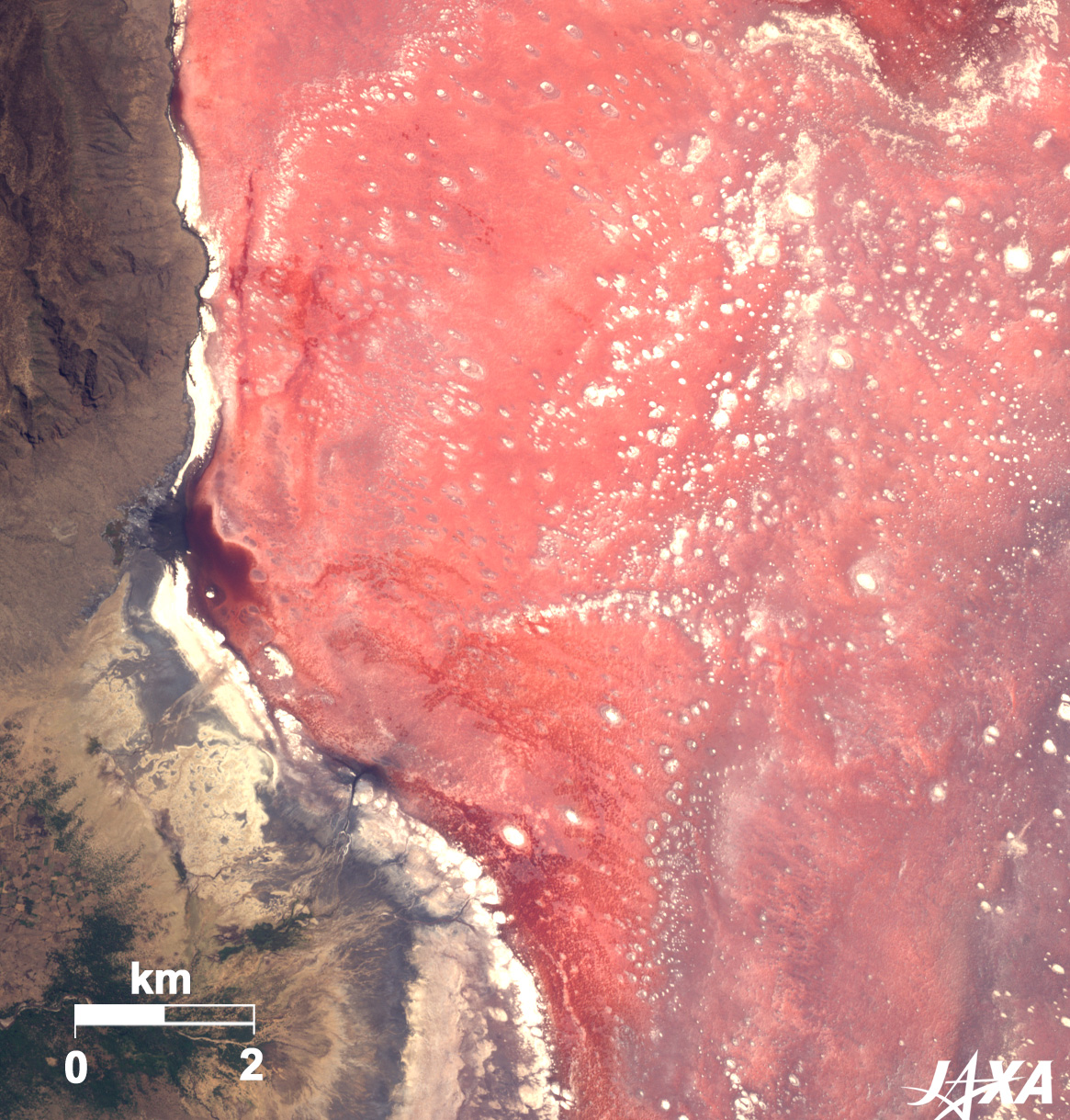 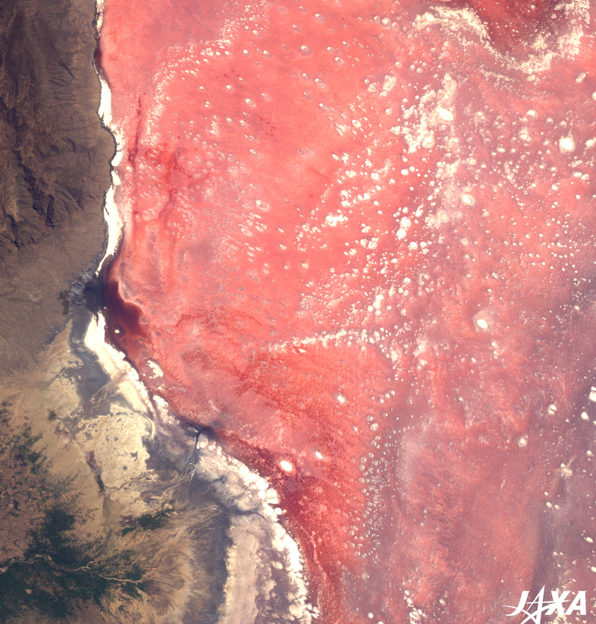 Fig. 2. Close-up of Lake Natron
Figure 2 is a close-up image of a part of Lake Natron. Lake Natron is not only a salt lake, but also a soda lake, spouting sodium carbonate from its bottom. The whirls on the surface are crystallized soda; some reaching up to 20 m. The unique organism diversity of the lake prompted its addition to the Ramsar List of Wetlands of International Importance in 2001. Lake Natron is a big lake: 50 km long, 20 km wide, and 3 m deep. However, it has continued to shrink due to desertification. Feeding stations for flamingoes may disappear in the near future. To save these rare flamingoes from extinction, we must stop global warming. Explanation of the Images: (Click the images twice to enlarge.)
AVNIR-2 has four observation bands. Composite images are usually produced by assigning red to Band 3 (610 to 690nm), green to Band 2 (520 to 600nm), and blue to Band 1 (420 to 500nm). The resulting images have natural coloring, as if seen by the naked eye. Thus, the following colors designate ground objects.
|


