| |
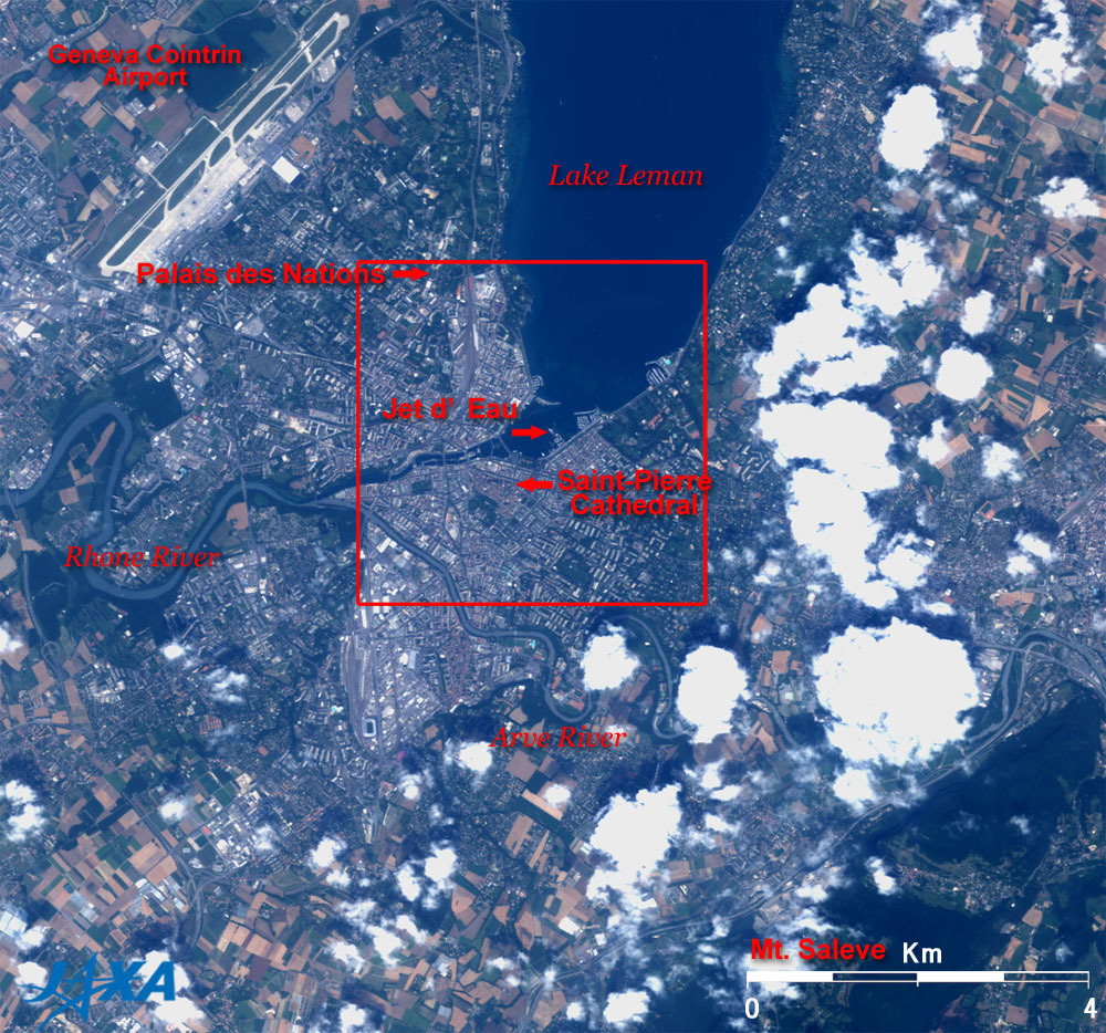
Figure 1 presents a close-up image of Geneva, Switzerland, as observed by the Advanced Visible and Near Infrared Radiometer-2 (AVNIR-2) on board the Advanced Land Observing Satellite (ALOS) "Daichi" in July 2006. Geneva is located to the southwest of the crescent Lake Leman (also known as Lake Geneva) and along the Rhone River flowing out from the lake. Geneva is like an enclave of Switzerland, surrounded by the French mountains in all directions except for the lake side.
Switzerland has a federal system like the United States of America. Geneva was an independent republic before joining Switzerland in 1815, and its official name is République et Canton de Genéve (Republic and Canton of Geneva). The National Monument commemorating its union with Switzerland consists of two ladies, the left lady symbolizing Geneva and the right, Switzerland. They seem insisting that they are standing on an equal footing.
The landmark of the city is the large fountain, the Jet d'Eau (water-jet), that shoots a column of water high above Lake Leman. The origin of the fountain was the utilization of the excess water pumping capability not needed by industry or domestic users. Industries are closed on holidays, so the water pumps were used for the fountain in order to avoid having to stop the pumps, establishing the practice.
Geneva is the second most populous city in Switzerland, with a 180,000 population, and is a cosmopolis due to the presence of the headquarters and offices of numerous international organizations, including the United Nations High Commissioner for Refugees (UNHCR), the World Health Organization (WHO), the World Meteorological Organization (WMO), and the International Committee of the Red Cross (ICRC).
Geneva was part of the area called Gallia in the Roman era. As such, it is a cultural city having historical links with Julius Caesar. Recently, prices in Geneva have soared because of the influx of sightseers and people coming from all over the world to work for the international organizations there. Many famous Japanese also call Geneva home, including actresses and the translator of the Harry Potter series.
In addition, Geneva boasts the most spacious park areas in Switzerland, and grape fields that produce the third most wine in Switzerland and the forest of Rhone are distributed throughout the suburbs.
The Geneva Cointrin Airport, the second largest airport in Switzerland and shared by France, is visible in the north of Fig. 1. If you travel 200km south, you will reach Turin, Italy (not shown), which hosted the 20th winter Olympic Games in 2006.
The Saint-Pierre Cathedral, famous for the Protestant Reformation by John Calvin, and the Palais des Nations, which is the European headquarters of the United Nations, symbolize the cosmopolis and are visible in the center of Fig. 1.
The Rhone River, which flows out from the Lake Leman on the left of Fig. 1, looks relatively clear and green. In contrast, the Arve River that flows from the Alps at the bottom of Fig. 1 looks brownish. The Arve River joins the Rhone River in central Geneva in the center of Fig. 1.
 |
 |
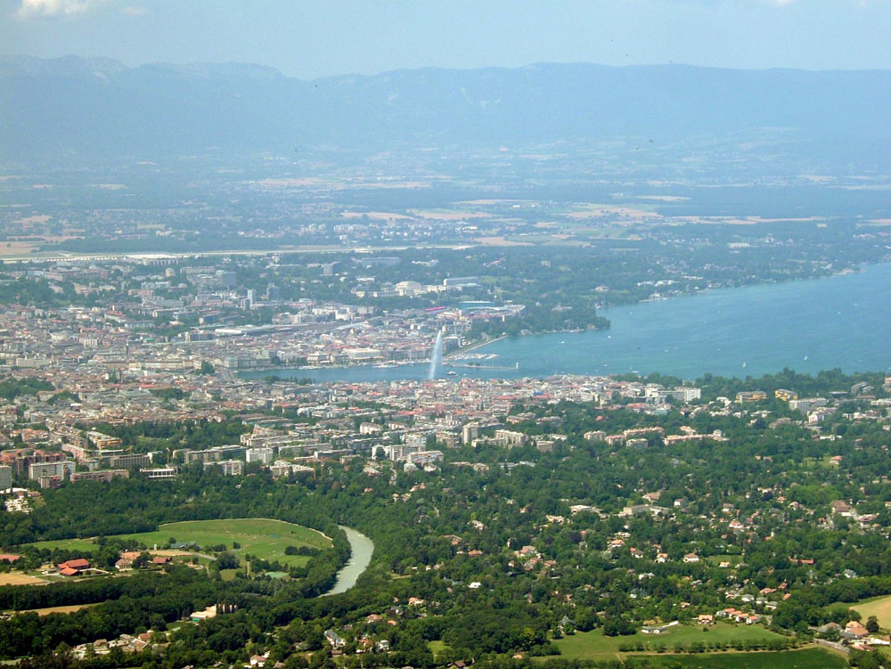
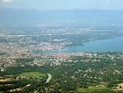
| Fig. 2 Geneva seen from Mt. Saleve (1) |
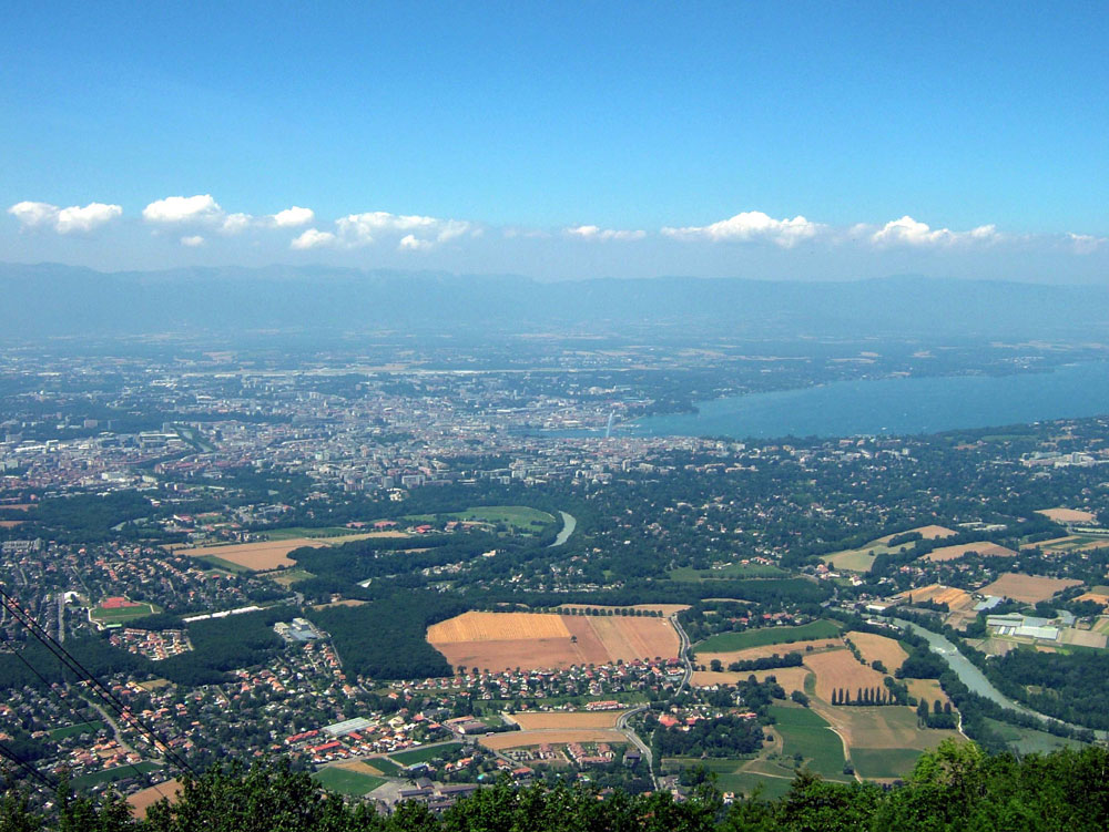
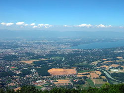
Fig. 3 Geneva seen from Mt. Saleve (2) |
Figures 2 and 3 depict the city area of Geneva seen from Mt. Saleve in France, in the suburbs of Geneva.
 |
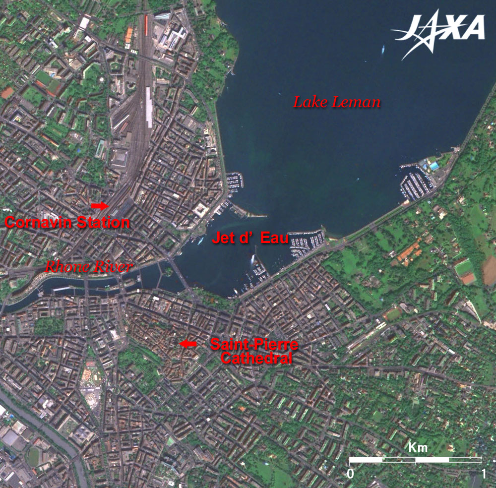
Fig. 4 Central Geneva
Geneva (kmz,1.42MB,Low Resolution) is seen from Google Earth. |
Figure 4 is a pan-sharpened image produced from images acquired by the Advanced Visible and Near Infrared Radiometer-2 (AVNIR-2; July 2006) and the Panchromatic Remote-sensing Instrument for Stereo Mapping (PRISM; September 2006) on board the Advanced Land Observing Satellite (ALOS) "Daichi."
The world's highest fountain (140m high) is visible in the center of Fig. 2. The fountain inclines southward due to the blowing wind.
 |
 |
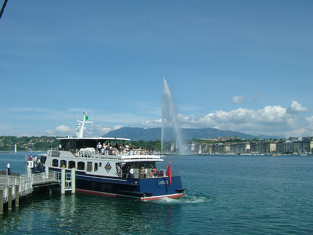
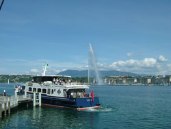
| Fig. 5 Jet d'Eau fountain (water-jet) (1) |
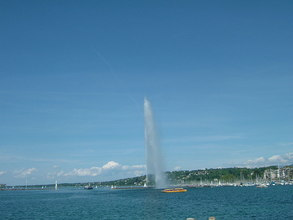
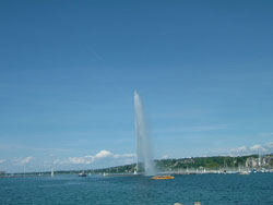
Fig. 6 Jet d'Eau fountain (water-jet) (2) |
The photographs in Figs. 5 and 6 were taken near the Jet d'Eau (water-jet) fountain. Cornavin Station, the central station of Geneva, is visible on the north shore of the Rhone River. This station and the Lyon Station in Paris are connected via the TGV in three-and-a-half hours.
Explanation of the Images:
Figs. 1 and 4
PRISM is an optical sensor for observing ground surfaces with visible and near-infrared signals in the 520 to 770 nano-meters (one-billionth of a meter) band.
The acquired image is monochrome. PRISM has three independent optical systems (telescopes) to simultaneously acquire images for nadir, forward, and backward views. Only the nadir image was used in this article.
AVNIR-2 is equipped with a pointing function by which it can shift its observation area perpendicular to the ALOS's moving direction, and it can observe ground surfaces with four spectral bands.
The color image was first produced by assigning red to Band 3 (610 to 690nm), green to Band 2 (520 to 600nm), and blue to Band 1 (420 to 500nm). The image was then transformed into Hue, Saturation and Intensity components, and the Intensity component was replaced by the PRISM image. The Hue, Saturation and Intensity data were then reversed into a color image. As a result, a virtual 2.5m ground-resolution color image was obtained. This kind of high-resolution color image, composed by combining the higher resolution monochrome image and the lower resolution color image, is called a pan-sharpened image. The resulting image has natural coloring as if seen by the naked eye. In this image, forests are deep green, grass fields or farms are light green, bare ground is ocher, roads are grey, and roofs appear as they are.
Figure 1 and the full image are the original AVNIR-2 data used for producing the pan-sharpened images. The coloring is white for clouds, blue for rivers or lakes, khaki or brown for farms, grey for urban areas, and black for areas with no data.
|
 |
|