Overview
"Diagnosis of Earth Environment by Satellite Remote Sensing"
 Recently, human life on Earth e.g. clothing, food, and housing
are affected by global environmental issues, such as climate change,
global warming, El Nino, etc.
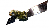
Research Group of Informatics for Remote Sensing
has two objectives. The first is studying algorithm
development to monitor distribution and variation of geophysical
parameters, which consist of the global environment (e.g.,
clouds and their properties, snow, hydrological parameters, vegetation,
sea ice, sea surface temperature, and carbon dioxide). The second
is methodology development to evaluate and predict the stress on the
global environment by spatial and temporal distributions of the
geophysical parameters.
Recently, human life on Earth e.g. clothing, food, and housing
are affected by global environmental issues, such as climate change,
global warming, El Nino, etc.
Research Group of Informatics for Remote Sensing
has two objectives. The first is studying algorithm
development to monitor distribution and variation of geophysical
parameters, which consist of the global environment (e.g.,
clouds and their properties, snow, hydrological parameters, vegetation,
sea ice, sea surface temperature, and carbon dioxide). The second
is methodology development to evaluate and predict the stress on the
global environment by spatial and temporal distributions of the
geophysical parameters.
For example, clouds in the sky have a cooling effect on the Earth's surface by blocking solar radiation. At the same time, the surface can be kept warm by absorbing energy as infrared radiation by clouds from the surface to space. The spatial and temporal variations of clouds are therefore an important parameter that affects the global climate system. As the result, meteorological phenomena on the local scale, which are most important to human activity, are decided. The recent decreasing of sea ice in the Arctic Ocean during the summer season is an important issue, which might be related to decreased cloud cover in the summer season. Low-cloud cover adversely effected the production of rice in Japan in 2003. The concentrated heavy rain in the summer season in Japan sometimes causes flooding.
The environmental parameters consist not only of clouds but also of snow and sea ice that cover the Earth's surface with warm and cold currents in the ocean, aerosol distribution in the atmosphere, inhomogeneous distributions of vegetation, and water conditions on the surface. Each of them has inherent temporal and spatial scales. The Earth observing satellite can track these parameters globally, finding spatial and temporal distributions, and recognizing the interactions between them.
This chair studies the technology of remote sensing by Earth observing satellite and the variation of the geophysical parameters derived by the satellite, and then develops methodologies to evaluate and predict them.