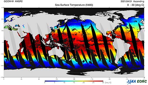
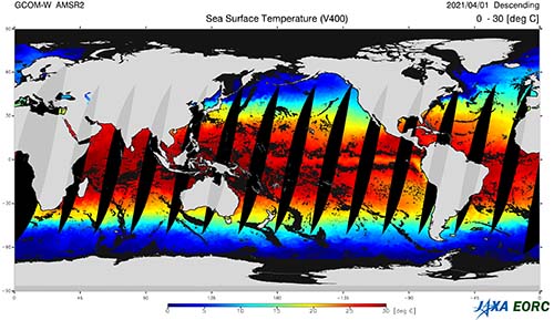
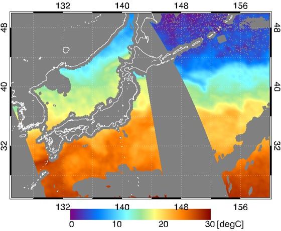
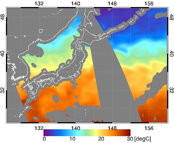
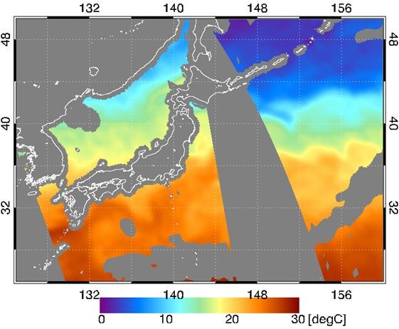
Sea Surface Temperature
(Standard Product)
Product Overview
Product Overview
| Product Name | Sea Surface Temperature DOI |
|||
|---|---|---|---|---|
| Product Type | Standard Product | |||
| Processing Level | L2 (Swath data *2) and L3 (Grid data: EQR) | |||
| Product ID | SST | |||
| Satellite | AMSR3 | AMSR2 | AMSR-E | |
| Spec. *1 | Area | Global over ocean | Global over ocean | |
| Spatial Resolution | 6GHz SST: approx. 50 km 10GHz SST: approx. 30 km Multi-band SST: approx. 30 km |
approx. 50 km | ||
| Standard accuracy | 6GHz SST: 0.5℃ *3 10GHz SST: 0.6℃ Multi-band SST: 0.6℃ |
6GHz SST: 0.5℃ *3 | ||
| Range | -2 〜 35 ℃ | -2 〜 35 ℃ | ||
| Latest Version | In preparation | AMSR2: ver. 4.400.400 (2 July 2012 - 27 July 2022) 2020-10-13 release
ver. 4.410.410 (27 July 2022 - 17 April 2024)*4 2022-07-27 release
ver. 4.411.411 (18 August 2023 - 01 September 2023, 17 April 2024 - present)*4 2024-04-17 release
|
AMSR-E: ver.8.300.300 2019-07-05 release |
|
| Product Period | AMSR3: August 11, 2025 〜 (Not provided) |
AMSR2: July 3, 2012 〜 |
AMSR-E: July 1 ,2002 〜 October 4, 2011 | |
| Data Download | In preparation | Globe Portal System (G-Portal) |
Globe Portal System (G-Portal) |
|
| Data Format |
NetCDF AMSR3 L2 Format
NetCDF AMSR3 L3 Format |
HDF5 AMSR2 Higher Level Format
2.7MB
|
AMSR-E Level2 Format description
757KB
AMSR-E Level3 Format description 1.03MB |
|
| Stored Data | AMSR3: (1) 6GHz SST [℃], (2) 10GHz SST [℃], (3) Multi-band SST [℃] *5 |
AMSR2: (1) 6GHz SST [℃], (2) 10GHz SST [℃], (3) Multi-band SST [℃] *6 |
AMSR-E: (1) 6GHz SST [℃], (2) 10GHz SST [℃] *7 | |
| Data Quality Flag | In preparation | AMSR2 L2 SST Quality Flag
289KB |
||
| Algorithm Version | In preparation | AMSR2 v4.1 (Algorithm Description,
3.9MB PDF page 33
) |
||
| Validation Result | In preparation |
Update of AMSR2 SST, 10GHz and Multiband SST to Ver4.1
3.5MB |
||
- The specifications are defined in the AMSR3 Mission Requirement (In preparation) and AMSR2 Mission Requirement.
- Swath data is a format in which data for each footprint is stored in a two-dimensional array (observation points in scanning direction x number of scanning lines) in order of observation time.
- Except sea ice and precipitating areas. Goal accuracy is defined as monthly mean bias error in 10 degrees latitudes.
- For climate change analysis, version 4.11 (2 July 2012 – present) is available via the GHRSST server.
- The second and third layers of the AMSR3 standard product "6GHz SST" contain the standard products "10GHz SST" and "Multi-band SST".
- The second and third layers of the AMSR2 standard product "6GHz SST" contain the research products "10GHz SST" (ver. 2.1 or later) and "Multi-band SST" (ver. 4.0 or later).
- The second layer of the AMSR-E standard product "6GHz SST" contain the research products "10GHz SST" (ver. 2.0 or later).
