A magnitude 7.0 (10km depth of epicenter) earthquake occurred at Haiti in the Central America at 6:53 on January 13, 2010 (JST) or at 21:53 of January 12, 2010 (UTC). This caused great damage like collapse of building. The Japan Aerospace Exploration Agency (JAXA) had performed the observations to monitor the recovery state by Panchromatic Remote-sensing Instrument for Stereo Mapping (PRISM) and Advanced Visible and Near Infrared Radiometer type 2 (AVNIR-2) onboard the Advanced Land Observing Satellite (ALOS, "Daichi") at 0:28 on June 11, 2010 further to May 13, 2010 (JST).
Fig. 1 shows an observed image of AVNIR-2 at 0:28 on June 11, 2010 (JST). Although there are several clouds seems by white color in the image, there is no cloud in the capital Port-au-Prince and that ground could be seen. Fig. 1 assigned by channel 3, 2, 1 for red, green, blue colors as true color composite.
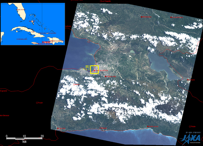
Fig.1: AVNIR-2 image with 0.0 degree pointing angle acquired at 0:28 on June 11, 2010 (JST).
A yellow square shows location of Fig.2.
(Click to View Enlarged Image)
Fig. 2 shows the pan-sharpened images produced by both PRISM and AVNIR-2 images that were taken on June 11, 2010 (left) and January 24, 2010 (right), which was eleven days after earthquake.
Blue points shown by a red circle as example in left image taken on June 11, 2010 seem residential areas temporary housings of refugees build up. The yellow squared areas show that the places have large difference as shown in Figs. 3 and 4.
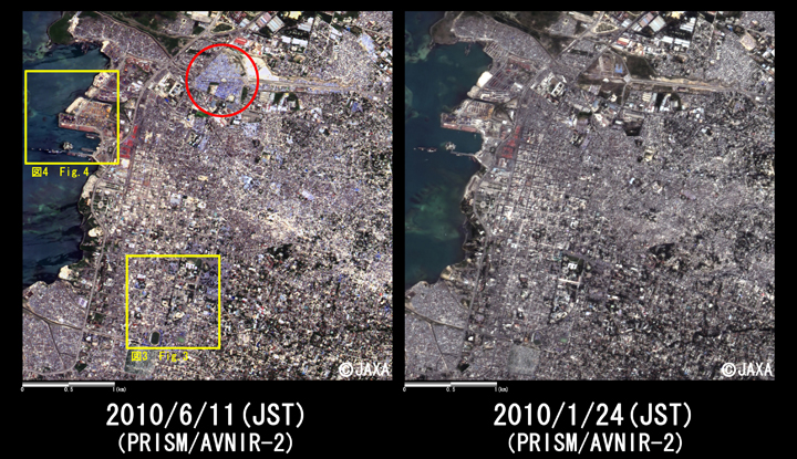
Fig.2: Enlarged pan-sharpened image around center of Port-au-Prince
(4km square, left: June 11, 2010; right: January 24, 2010).
Yellow squares show location of Figs. 3 to 4.
(Click to View Enlarged Image)
Fig. 3 shows enlarged images (1 km squares) around presidential palace, and upper red mark is presidential palace and lower red mark is a stadium near the palace. Several new buildings next to presidential palace were built, and temporary housings seem to thicken at the neighboring the place. The people taking shelters in the stadium move to the temporary housings built near the stadium. Tightly-packed blue points in Fig. 3 seem to be tightly-packed temporary housings as well as Fig. 2.
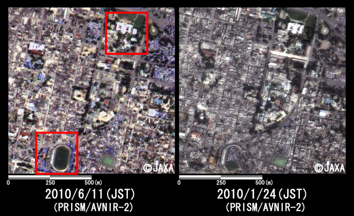
Fig.3: Enlarged image around presidential palace in Haiti
(1km squares, left: June 11, 2010; right: January 24, 2010).
(Click to View Enlarged Image)
Fig. 4 shows the enlarged images of the harbor at Port-au-Prince. The red mark indicates that pier broken by the earthquake has been repaired. Also it shows that new docks were built and several ships docked. These are denoting that the land at the coast was reclaimed and new buildings were built thus Port-au-Prince recovers from the earthquake steadily.
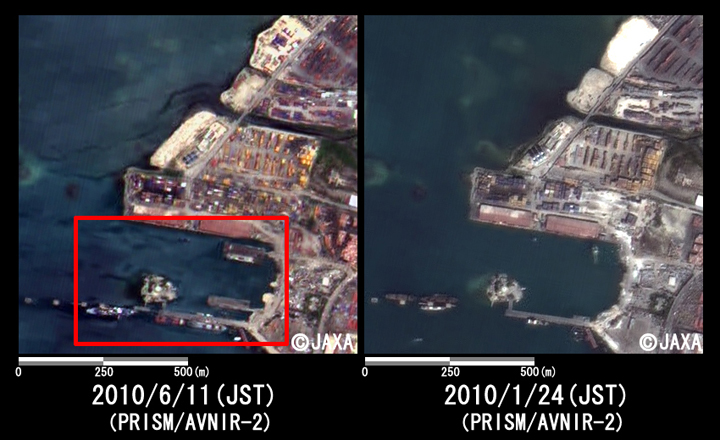
Fig.4: Enlarged image of the harbor at Port-au-Prince
(1km squares, left: June 11, 2010; right: January 24, 2010).
(Click to View Enlarged Image)
Fig. 5 is animation of two images same with Fig. 2 taken on June 11, 2010 and January 24, 2010, and two images switch among one second. It indicates developments for five months from the earthquake in detail.
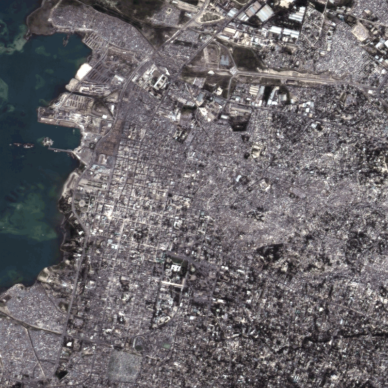
Fig.5: Animation of Fig. 2
(two images taken on June 11, 2010 and January 24, 2010 switch among one second).
JAXA plans continuous observation of this area.
* The pan-sharpened image by both PRISM and AVNIR-2 image is pseudo-color one of 2.5 m ground resolution that is produced by PRISM with a 2.5-m spatial resolution and AVNIR-2 with a 10-m spatial resolution in multispectral region.
[Reference]
2010/5/21: Follow-up Observation of Haiti Earthquake by PRISM and AVNIR-2 onboard "Daichi" (ALOS) (1).
2010/1/28: Observation Results of ALOS/PALSAR Relating to the Magnitude 7.0 Earthquake in Haiti (2).
2010/1/22: Observation Results of ALOS/PALSAR Relating to the Magnitude 7.0 Earthquake in Haiti (1).
©JAXA EORC
Copyright©1997- JAXA EORC All rights reserved.