Seen from Space 2011
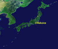
Choke Point under the Sun: Mt. Hakone, Japan
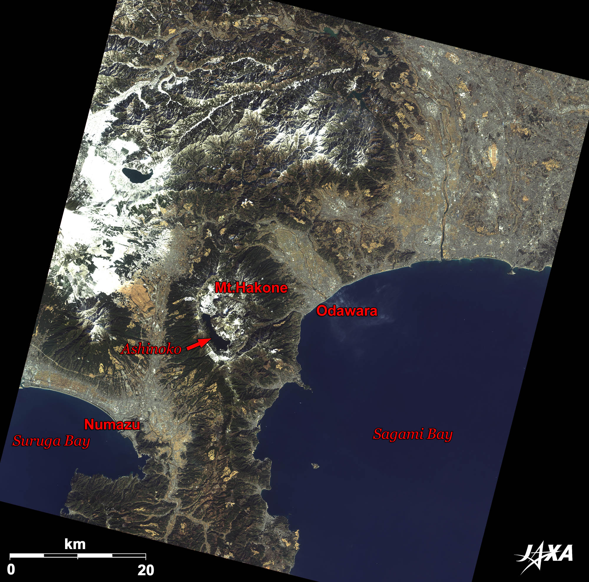 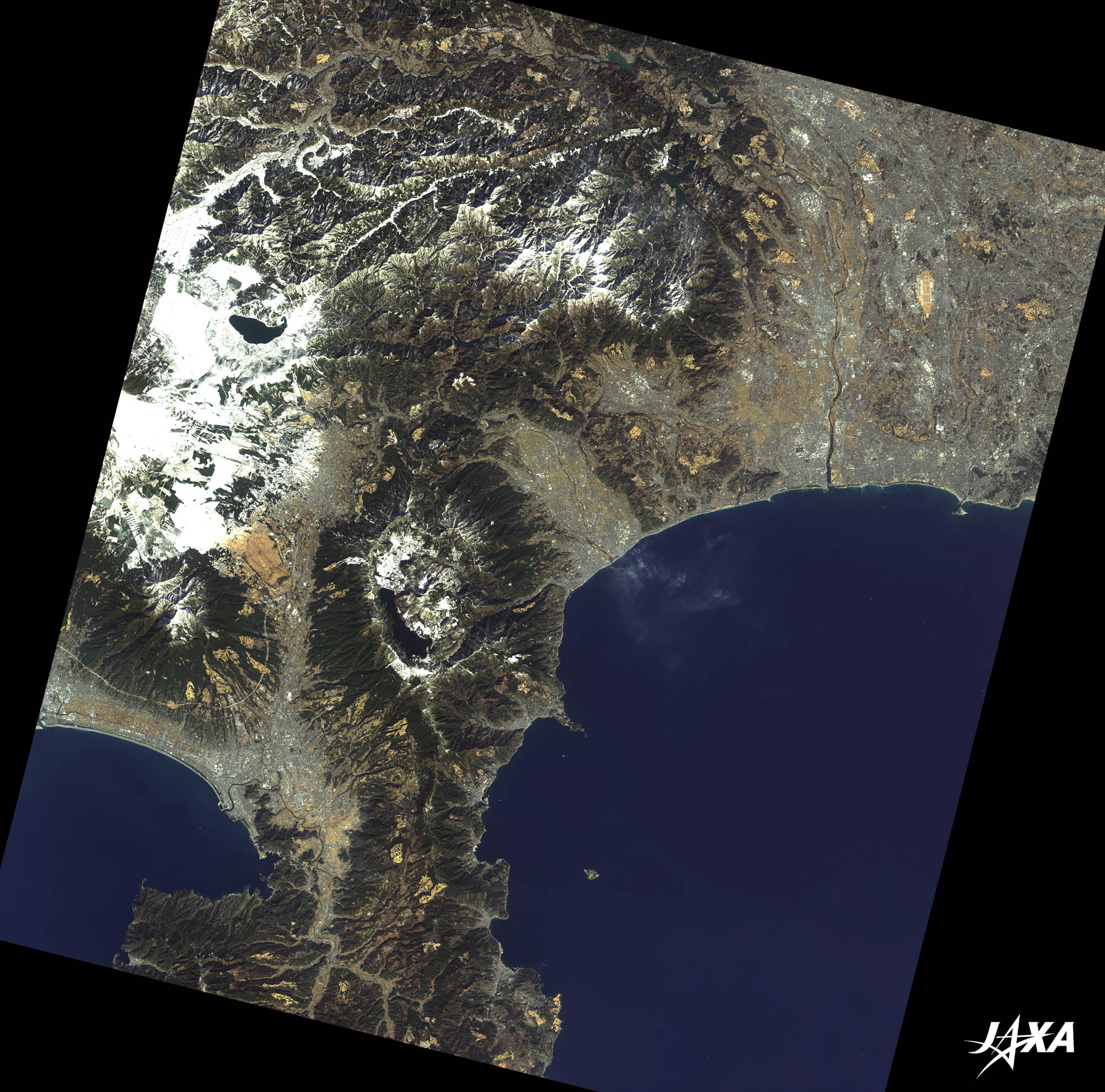 Fig. 1. Mt. Hakone and Its Vicinity
Figure 1 depicts Mt. Hakone and its vicinity as observed by ALOS (“Daichi”) in February 2010. Volcanic activity at Mt. Hakone began about 400,000 to 500,000 years ago and created a huge circular caldera when the central body collapsed about 200,000 years ago. The diameter of the caldera is about 10 km. * A Japanese author, writer, teacher, translator, entrepreneur, political theorist, and the founder of Keio University. He is regarded as one of the founders of modern Japan. 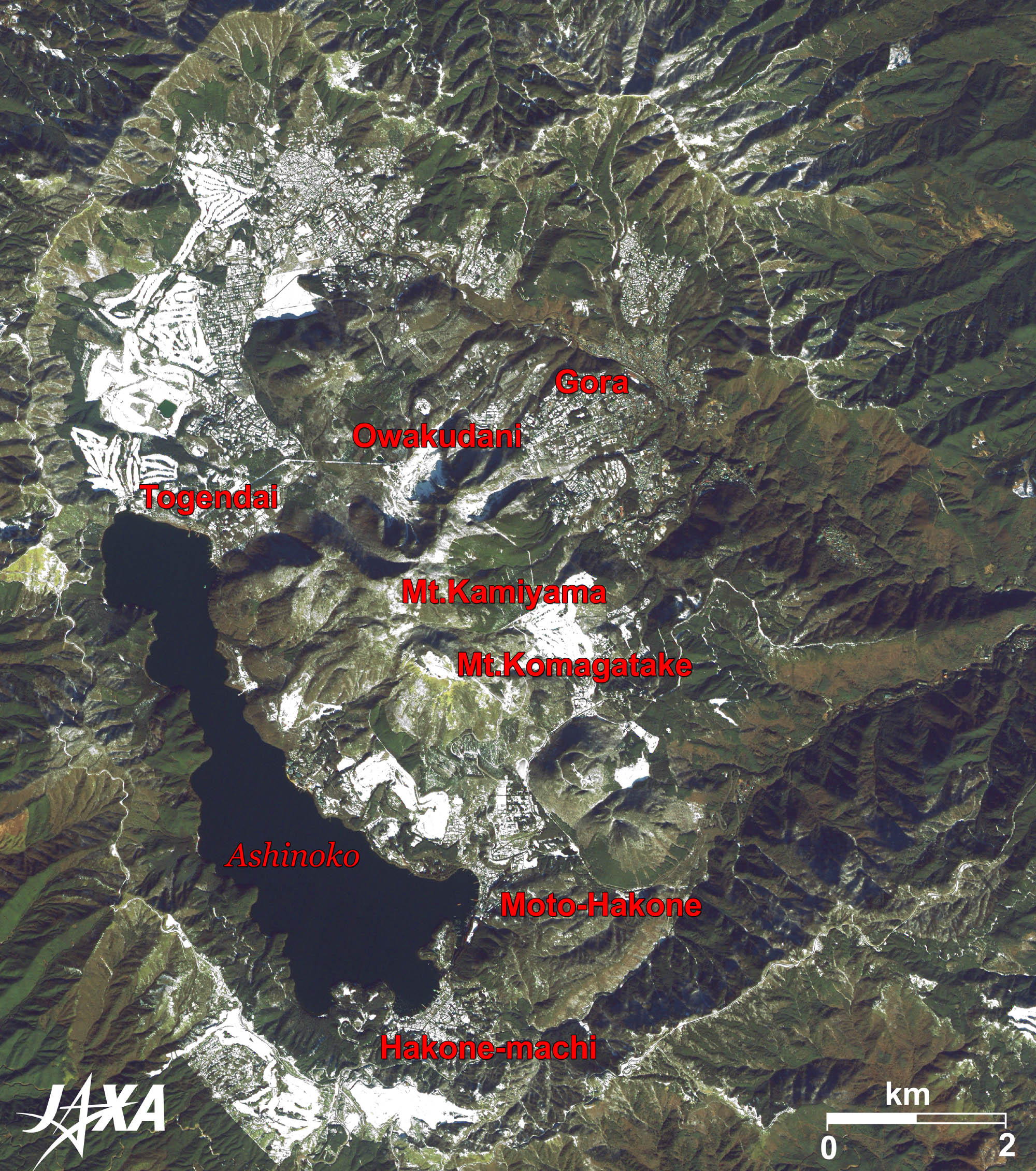
Fig. 2. Enlarged Image of the Summit Area
Summit Area of Hakone (kmz, 5.98 MB, Low Resolution) as seen on Google Earth. Figure 2 is an enlarged image of the summit area of Hakone. The large elliptical caldera, clearly visible in the figure, contains typical central cone** (Mt. Kamiyama and Mt. Komagatake) and a caldera lake*** (Ashinoko). There are many old spas and golf courses in this area. Since this image was taken in February, the flat areas look white with snow. Most of the white areas in the upper left are snow-covered golf courses. ** They are also called central peaks or central uplifts. 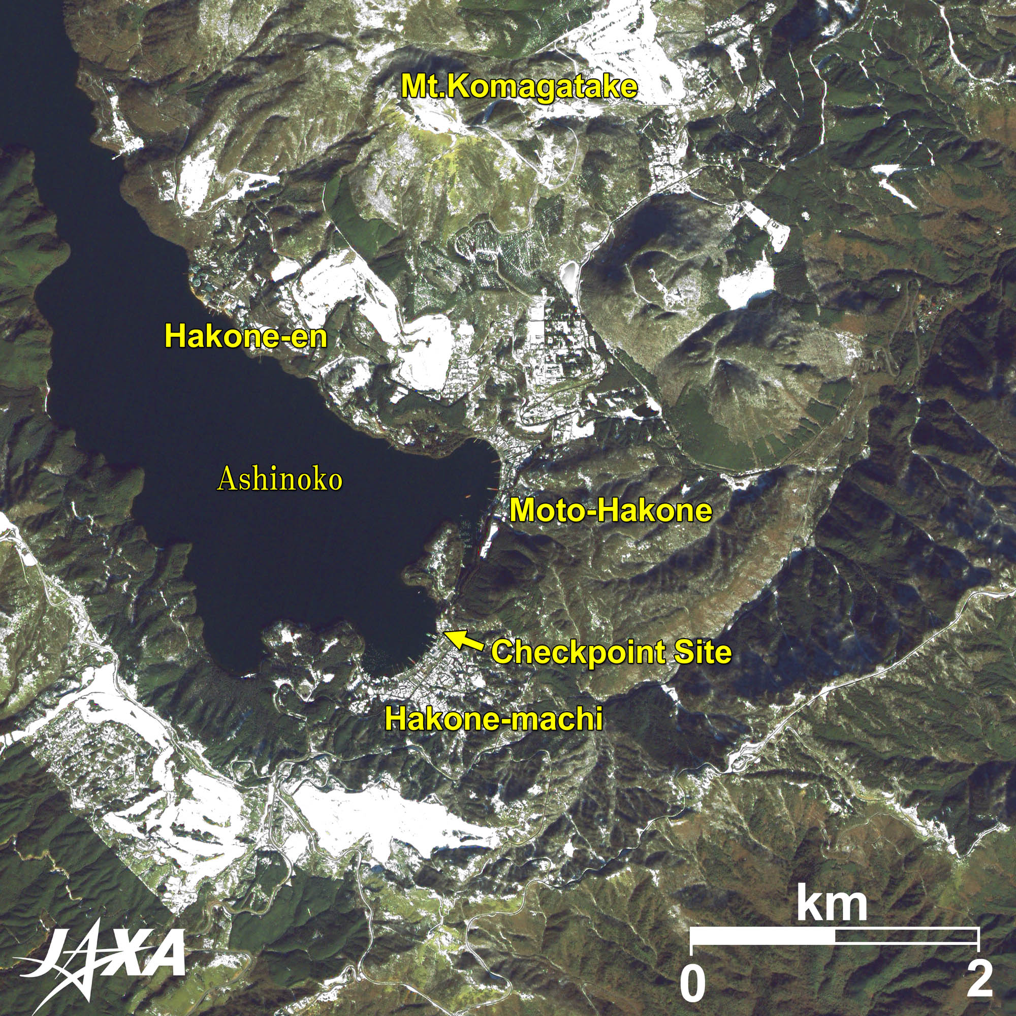  Fig. 3. Enlarged Image of Hakone Town

Choke Point under the SunHakone is located between Mt. Fuji to the northwest and Sagami Bay to the southeast. It was known as a choke point on the Tokaido route (the main route between Edo (Tokyo) and Kyoto in the Edo period (1603-1968)). “Choke point under the Sun” is an opening line of a famous lyric written by Rentaro Taki (1879-1903), a renowned composer in the Meiji period. Even today, the Tokaido Main Line goes around the south side of Mt. Hakone and the Tomei Highway goes around the north side. In the Edo period, there was a strict checkpoint at Hakone to prevent free traffic between Edo and western Japan****. The site of the old checkpoint remains at the lakeside of Ashinoko near Hakone Town. **** In the Edo period, the Edo Shogunate took the wives of local lords as hostages to prevent the governments from rebelling. Thus, this checkpoint prevented the escapes of wives from Edo and the smuggling of guns into Edo. 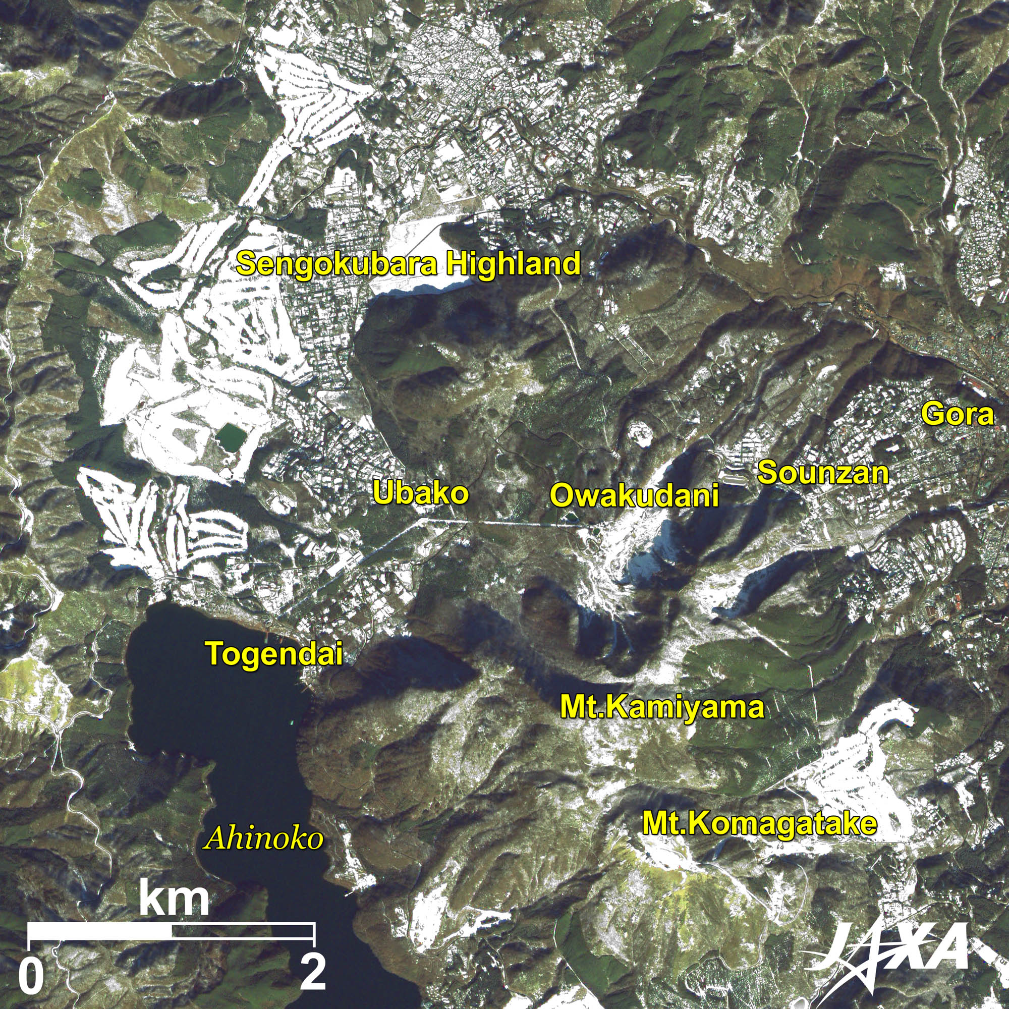 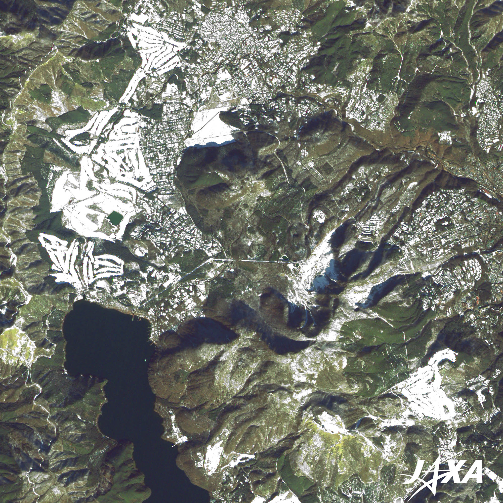 Fig. 4. Enlarged Image of Owakudani
OwakudaniThe central depression in Figure 4 is Owakudani, a valley north of the central cone that was created by the partial collapse of Mt. Kamiyama during a large-scale eruption at its north slope. Hydrogen sulfide gas and water vapor are still vented even today. An aerial tramway service is available between Sounzan Station in the east and Togendai Station in the west of Owakudani. Passengers must transfer at Owakudani Station in the middle and can enjoy the dynamic plumes there up close. Explanation of the Images:
AVNIR-2 has four observation bands. The color composite images are produced by assigning red to Band 3 (610 to 690 nm), green to Band 2 (520 to 600 nm), and blue to Band 1 (420 to 500 nm). The resulting images have natural coloring as if seen by the naked eye. Each color indicates the following ground objects:
(Figs. 2, 3, and 4) The above AVNIR-2 color composite image is decomposed into, hue, saturation, and intensity. The intensity portion is replaced by PRISM data. The hue, saturation, and intensity data are then reversed into a color image. This color image has a virtual 2.5-m resolution. Figures 2-4, composed by combining higher resolution monochromatic images and a lower resolution color images, are called pan-sharpened images. |