Seen from Space 2010
Hachijo Island, Japan: A Volcanic Island in the Western Pacific Ring of Fire
 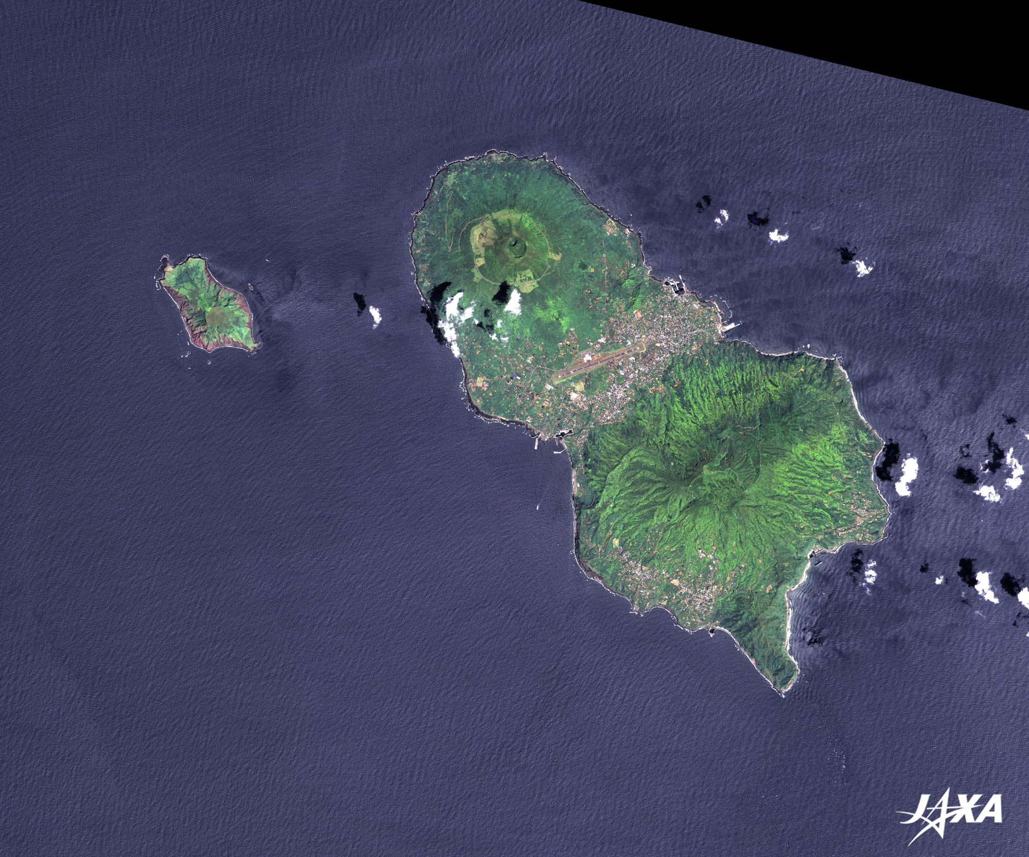
Fig. 1. Hachijo Island
Hachijo Island (kmz, 3.94 MB, Low Resolution) as seen on Google Earth Figure 1 is an image of Hachijo Island, Japan, as observed by ALOS (“Daichi”) on May 15, 2007. Hachijo Island is located about 290 km south of Tokyo, right in the middle of the Kuroshio Current (also known as the Japan Current or Black Current). The temperate climate and heavy rainfall produce a flora dominated by subtropical plants. 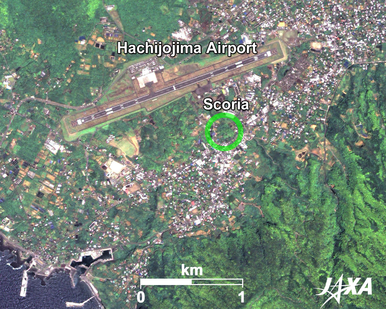 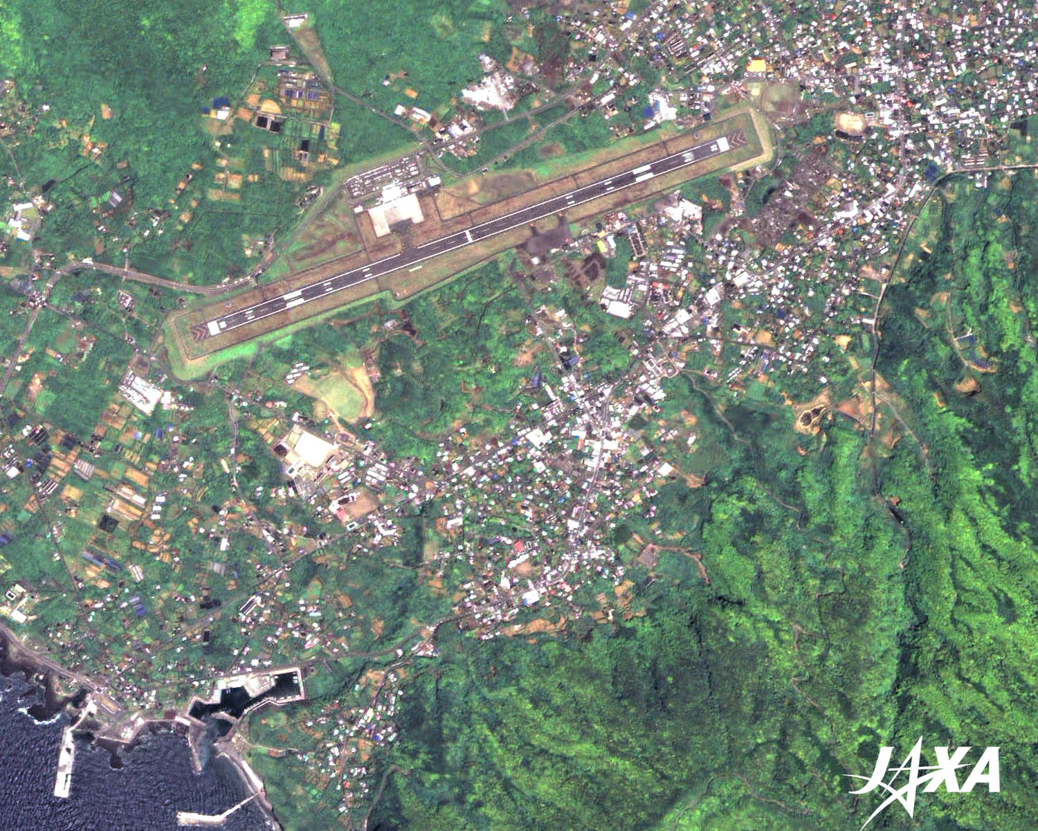
Fig. 2. Scoria Cones

Hachijo-fuji, The Younger VolcanoHachijo-fuji is a relatively young volcano that became active thousands of years ago. Successive liquid lava flows created a conical terrain. Eruptions continued until the Edo era, about 400 years ago. The eruptions formed pebbles from the solidification of splashed lava called “scoria.” Later, scoria cones, derived from the sedimentation of scoria, were formed in the area. Figure 2 shows an example of scoria cones. Scoria cones are usually recognized as slightly hilly surfaces and are sometimes the site of shrines. Scoria cones are a volcanic geographic feature often seen at places of erupted liquid lava, i.e., basaltic lava. Some typical cones are at Omuro-yama in the Izu Peninsula, Komezuka on Mt. Aso, and around the summit of Mauna Kea, the Big Island, Hawaii. 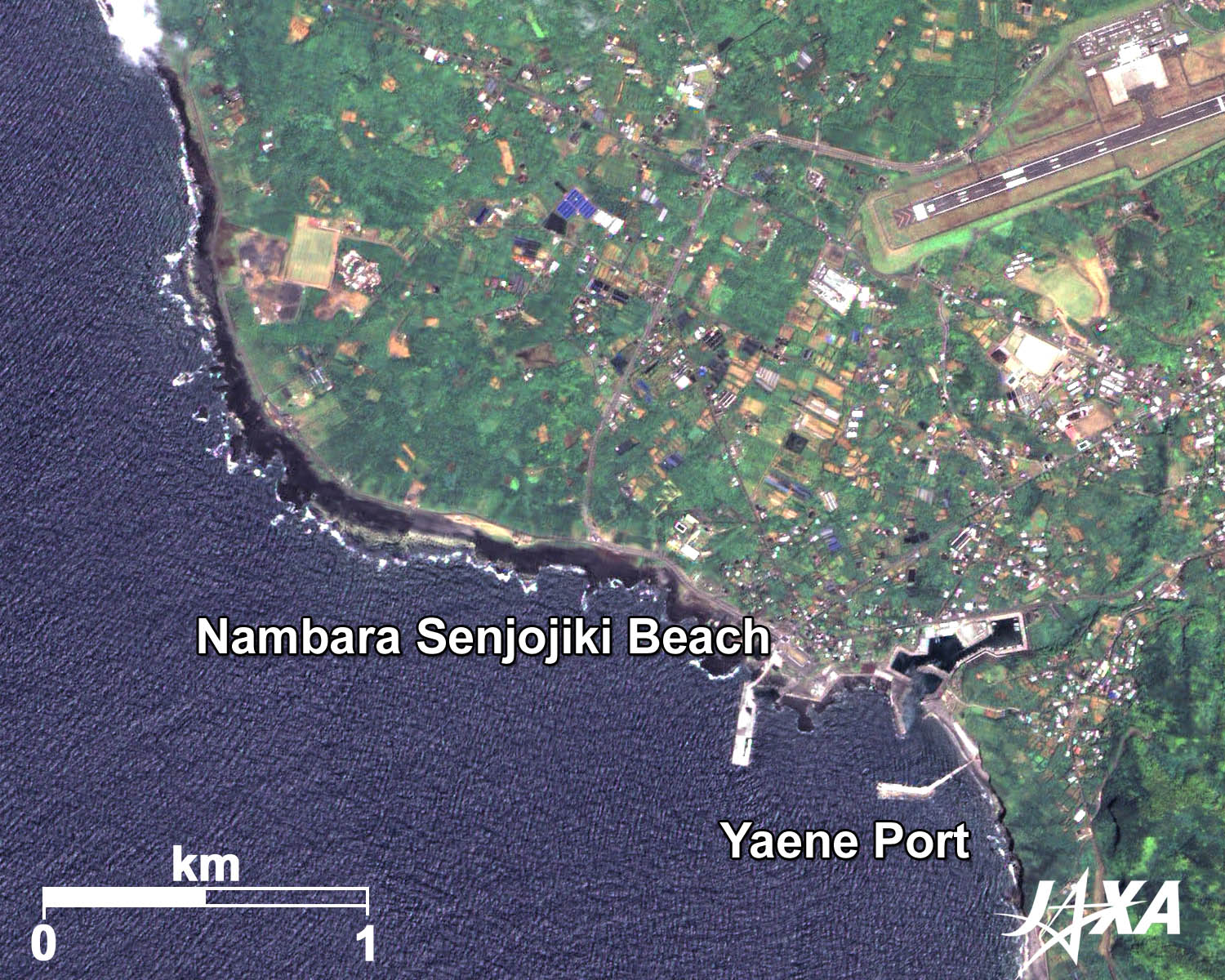 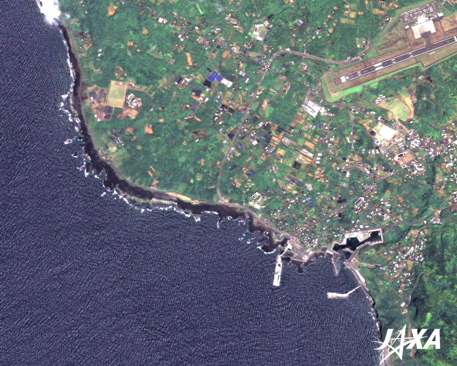
Fig. 3. Nambara Senjojiki Beach
Black lava appears along the coastline of Hachijo-fuji, where liquid basaltic lava made black rocks when it solidified. Nambara Senjojiki beach, typical of basaltic lava coasts, is a geographical feature called a lava plateau, where a large amount of lava has accumulated. The landscape, which looks like big waves sweeping over the black lava flow, is dynamic and majestic. Pioneer plants have already started to extend their habitation sturdily onto the black and ropy bedrock which reveals fierce lava flow. 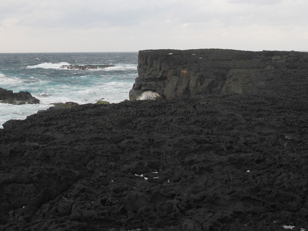 Fig. 4. A View of Nambara Senjojiki Beach, A Lava Plateau
Mihara-yama, Historic Volcano Benefitting PeopleCompared with Hachijo-fuji, Mihara-yama is an old volcano that began its activity more than a hundred thousand years ago. Scoria cones were also formed there. Figure 5 shows a sea-facing outcrop of scoria sedimentation. A large caldera developed on the top of the volcano. On the mountainside, many complicated valleys and gorges were formed through various volcanic activities and long-term erosion. Vegetation dominated by forests, including subtropical plants, and a rich groundwater system have developed. The abundant groundwater has fostered many villages and communities. The satellite image indicates the differences when compared to Hachijo-fuji. 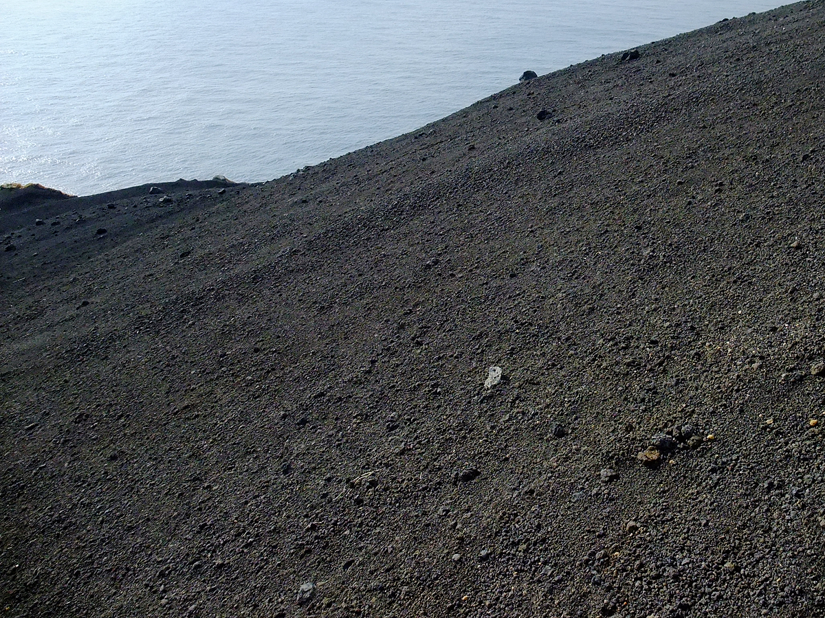 Fig. 5. Dune of Black Sand, Sedimentation of Scoria
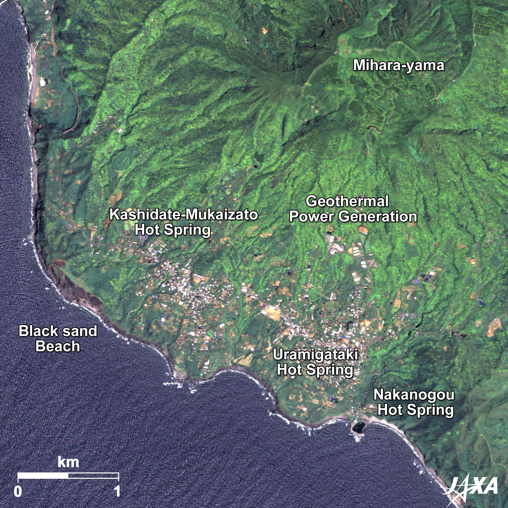 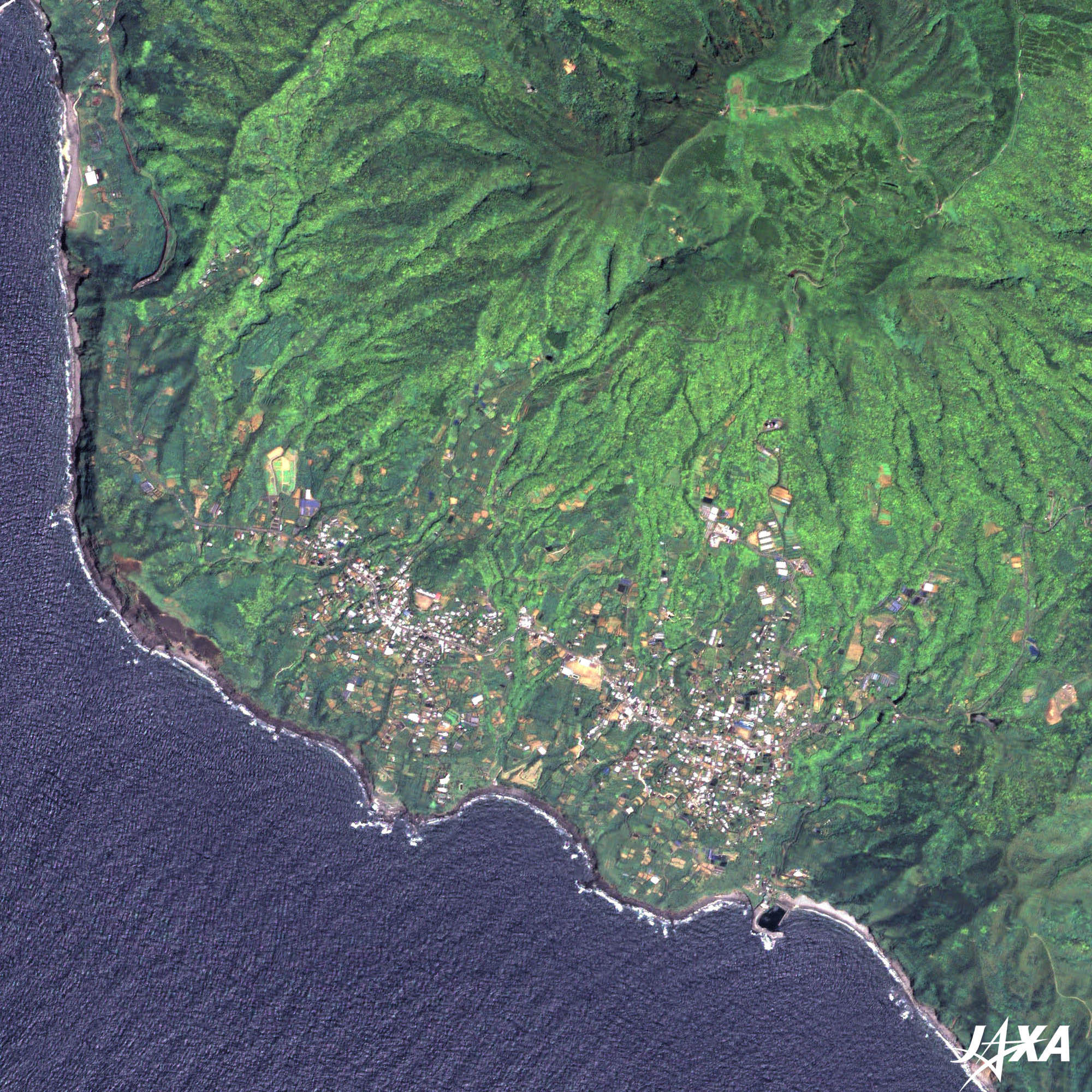
Fig. 6. Hot Springs and Geothermal Plant at Mihara-yama
A rich groundwater system brought by Mihara-yama’s volcanic activity benefits its people with hot springs and geothermal power generation, both of which use groundwater heated by geothermal energy. Seven hot springs and one geothermal power station are all located on the southwestern mountainside of Mihara-yama. The geothermal power station helped by wind power generation can meet the electricity demands of the night. The mechanism of geothermal power generation is the utilization of steam jet energy derived from the strong evaporation of high-temperature and high-pressure water pumped from deep underground. Geothermal power is hoped to be a “clean energy” that will help to reduce CO2 emitted from the burning of fossil fuels. In addition, horticulture reuses the hot water from geothermal power generation. The historic transformation of the two volcanoes has brought many benefits to the people and wild lives in Hachijo Island. Explanation of the Images:
AVNIR-2 has four observation bands. The color composite images of Fig. 1 and Fig. 2 are produced by assigning red to Band 3 (610 to 690 nm), green to Band 2 (520 to 600 nm), and blue to Band 1 (420 to 500 nm). The resulting images have natural coloring as if seen by the naked eye. In the above figures, green is assigned to the sum of 95 percent of Band 2 and 5 percent of Band 4 (760 to 890 nm), which improves the visibility of vegetation. Thus, the following colors designate ground objects:
PRISM is an optical sensor for observing ground surfaces with visible and near-infrared signals in the 520- to 770-nanometer (one-billionth of a meter) band. The image is monochromatic but has a higher resolution. PRISM has three independent optical systems to acquire images in the view of nadir, forward, and backward simultaneously. Only the nadir images are used in these figures. The above AVNIR-2 color composite image is decomposed into, hue, saturation, and intensity. The intensity portion is replaced by PRISM data. The hue, saturation, and intensity data are then reversed into a color image. This color image has a virtual 2.5-m resolution. A color image composed by combining a higher resolution monochromatic image and a lower resolution color image is called a pan-sharpened image. |


