Seen from Space 2010
Lushun and Dalian: Two Ports on the Liaodong Peninsula
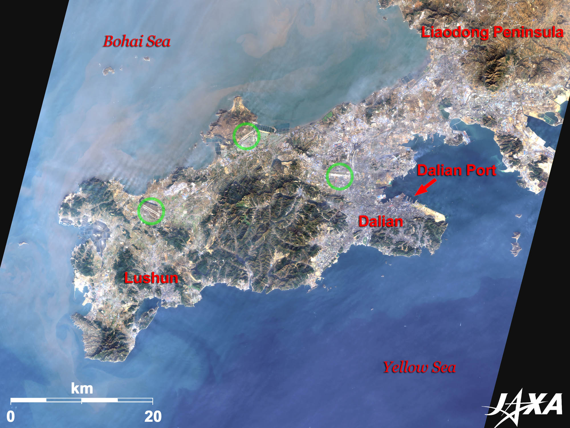 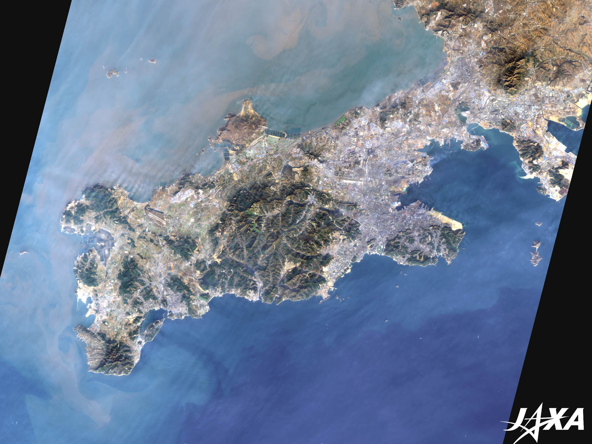 Fig. 1. Lushun and Dalian on the Tip of the Liaodong Peninsula
Figure 1 depicts the southern tip of the Liaodong Peninsula in China as observed by ALOS (“Daichi”) in November 2009. The peninsula juts out toward the Shandong Peninsula located at the opposite coast of the Bohai Sea. The difference in ocean colors between the north side and south side of the peninsula indicates that turbid water flows into the south from the north. Lushun is located on the left and Dalian is on the right of the central mountain massif. Three airports (indicated by green circles) are also visible. The rightmost one is Dalian Airport (Dalian Zhoushuizi International Airport). The bright portion on the cape to the east of Dalian is an area under development. 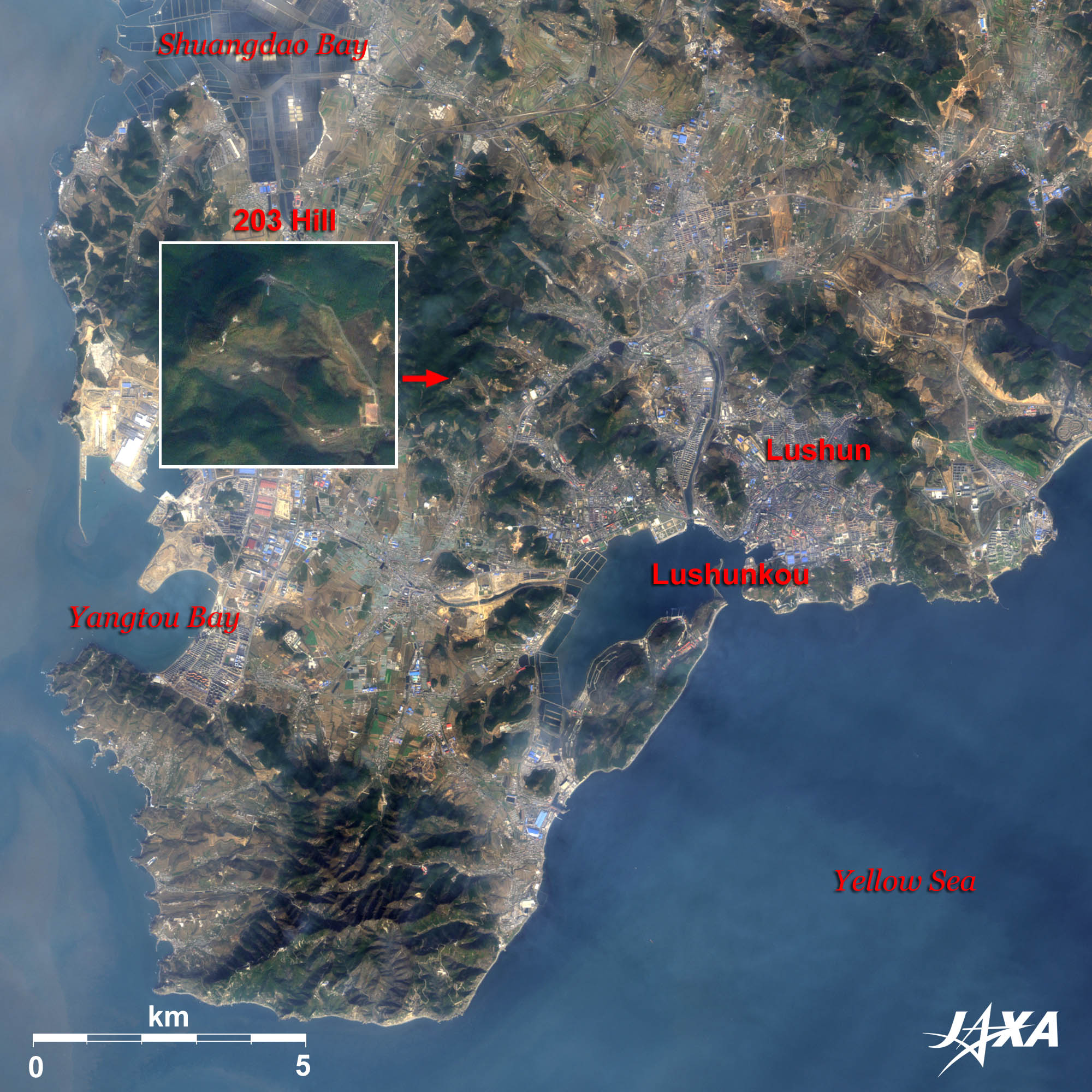 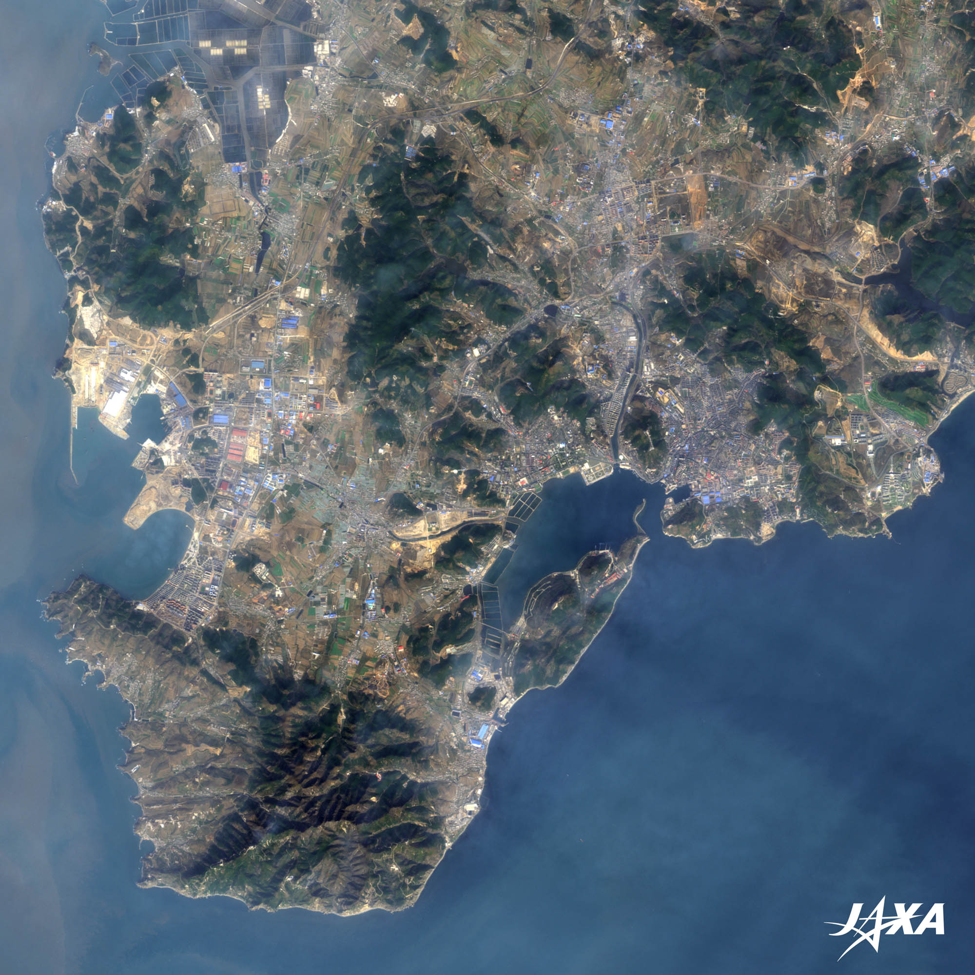
Fig. 2. Enlarged Image of Lushun
Lushun (kmz, 4.05 MB, Low Resolution) as seen on Google Earth Figure 2 presents an enlarged image of Lushun. Lushun once merged with Dalian and was called Luda, but today, it is incorporated by Dalian and serves as Lushunkou District of Dalian City. Development is also in progress at the western area facing the Bohai Sea. 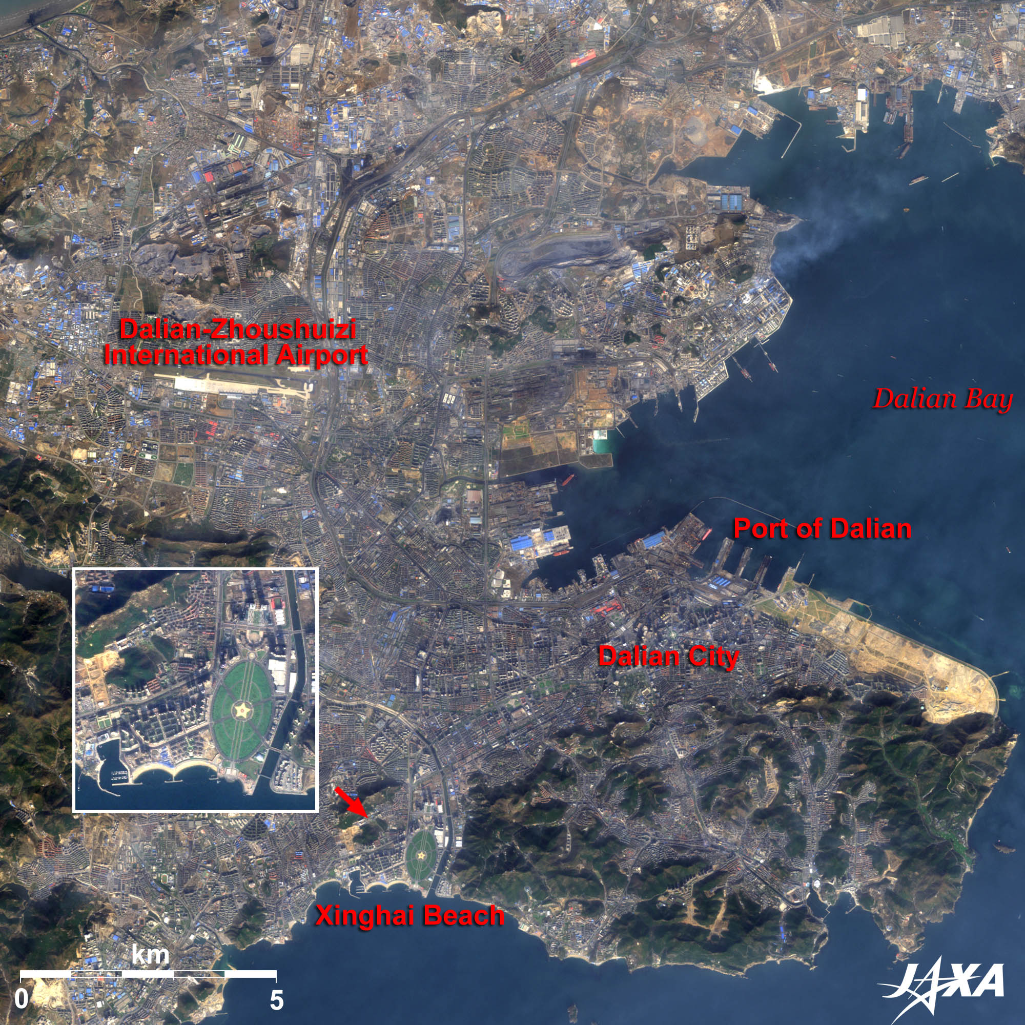
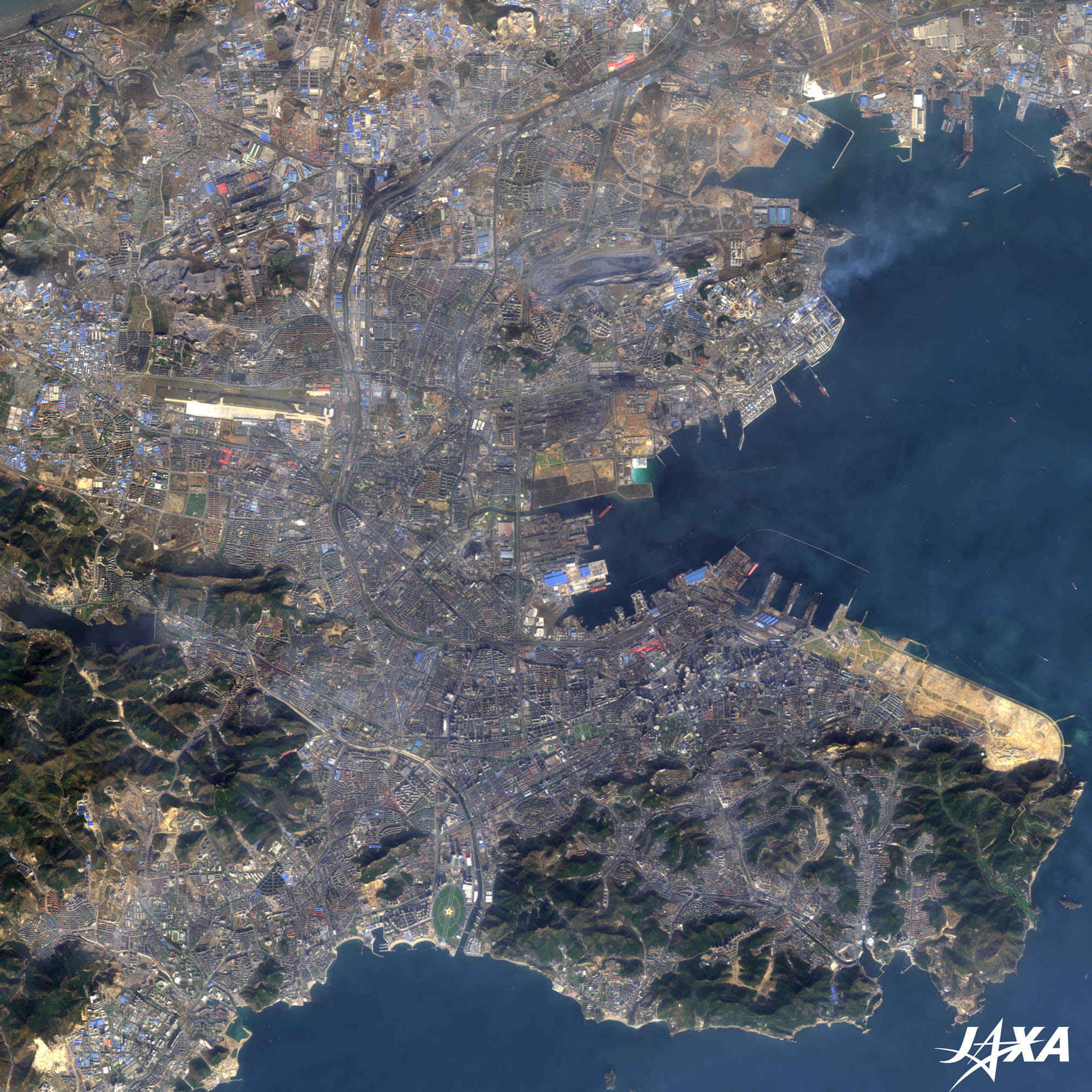
Fig. 3. Enlarged Image of Dalian
Dalian (kmz, 4.65 MB, Low Resolution) as seen on Google Earth Figure 3 is an enlarged image of Dalian. Dalian Zhoushuizi International Airport is visible at the upper left and the Port of Dalian is located to the right. At the end of nineteenth century, Russia wanted to acquire an ice-free port in the Far East and began construction of the Port of Dalian. After the Russo-Japanese War, Japan took over this trade. Since this port was the gateway to northern China, ferries connected Japan and Dalian. Railway tracks were extended to the piers allowing passengers to disembark from the second deck and board a train from the ground floor. 
Opening of LushunLushun was off-limits to foreigners for many years. Although, in 1996, the northwestern section of the town, including 203 Hill, was opened and at the end of 2009, the city was more thoroughly opened, apart from military facilities and their surroundings. Investments by Japanese companies and increased tourism from Japan are highly welcomed by the city.
Dalian’s Environmental Model Area Development PlanFrom December 1996 to March 2000, Kitakyushu City in Japan and the Japan International Cooperation Agency (JICA) made an investigation and prepared a master plan for development and environmental improvement of the area under the Official Development Assistance (ODA) Charter. It is a comprehensive improvement plan, targeting 2010, with regard to atmospheric and water pollution, and technologies have been transferred to the experts of Dalian. Dalian has been tackling pollution problems caused by automobiles and waste, and it is now well known as an environmentally advanced city in China. Images of ALOS (Daichi) are used on the “JAL MAP” web page. You see satellite images when you click on the “Satellite Image” button at the upper right of the map. The background image then changes to a satellite image. You can see Dalian on this site as well. Explanation of the Images:
AVNIR-2 has four observation bands. The color composite images are usually produced by assigning red to Band 3 (610 to 690 nm), green to Band 2 (520 to 600 nm), and blue to Band 1 (420 to 500 nm). In the above images, green is assigned to the sum of 90 percent of Band 2 and 10 percent of Band 4 (760 to 890nm), which improves the visibility of vegetation and the resulting images have natural coloring as if seen by the naked eye. Thus, each color indicates the following ground objects:
|


