Seen from Space 2010
Angel Falls: The World’s Highest Waterfall
|
Today, when science and technology are deemed highly developed, people may think that mankind’s explorations have reached every corner of the Earth. Nevertheless, there are still hidden places where people can hardly set foot. The Guiana Highlands may be the king of such mysterious places. 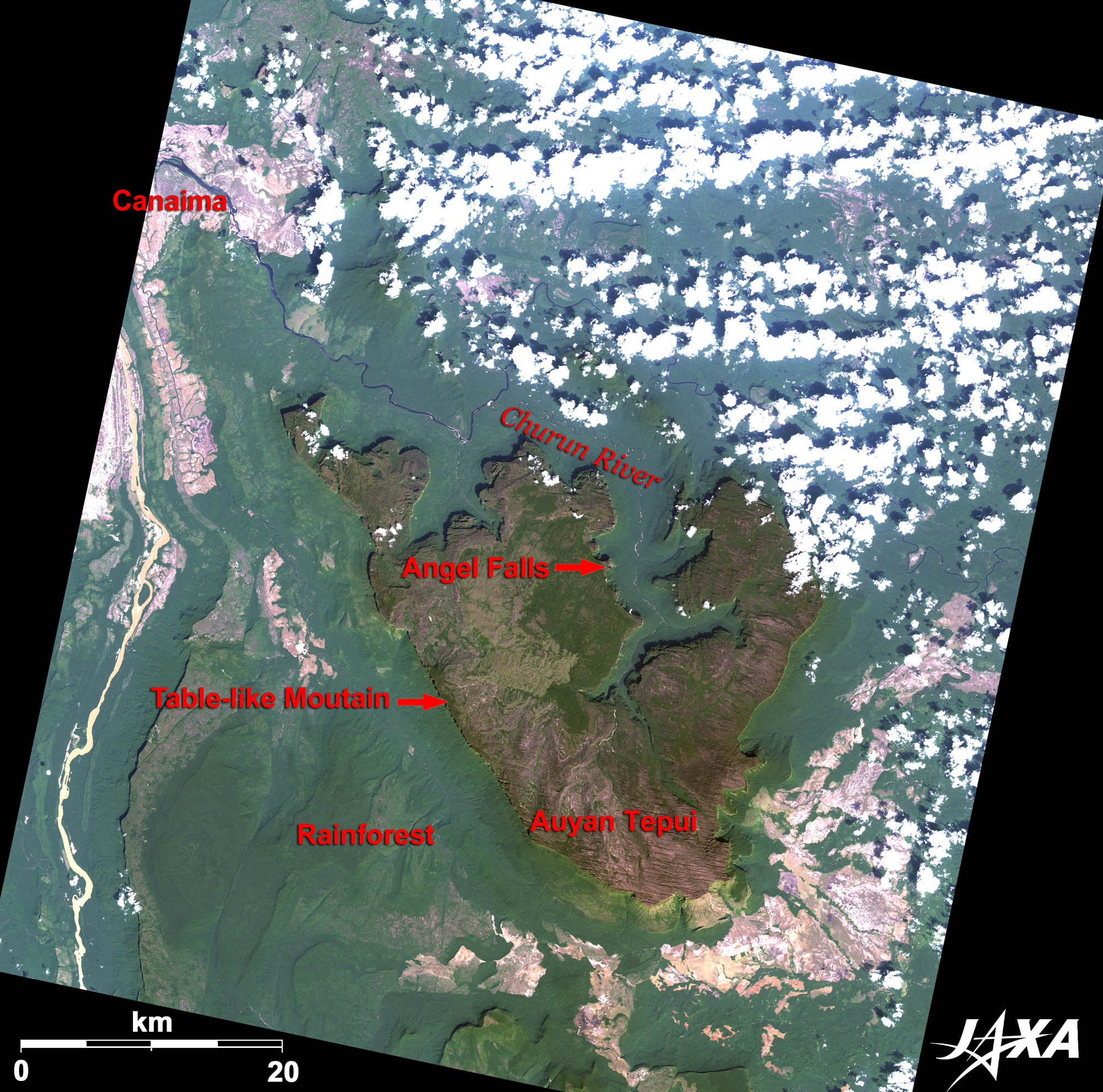 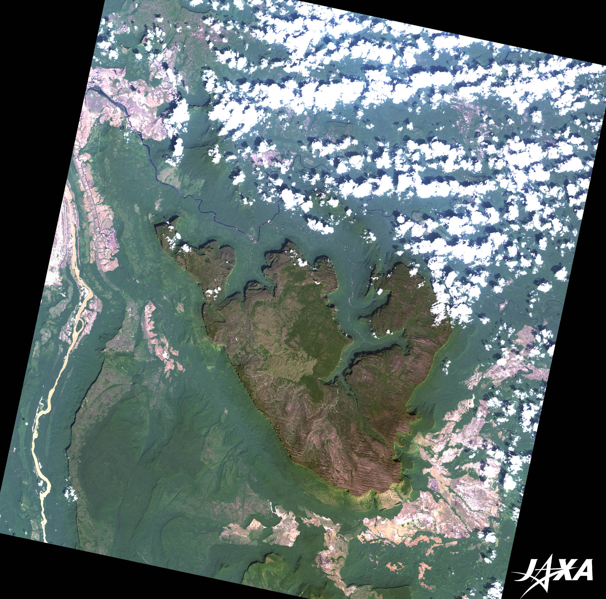 Fig. 1. Angel Falls and Its Vicinity
Figure 1 depicts Angel Falls and its vicinity as observed by ALOS (“Daichi”) in December 2009. The Guiana Highlands are located in northern South America, extending over Columbia, Venezuela, Guyana, Surinam, French Guiana, and Brazil. More than 100 isolated table-like mountains (mesas) tower above the Amazon rainforest, and cover a total area of about 30,000 km2, which is equivalent to the size of Belgium. The dark green and brown area in the center of the image is one such mesa, called “tepui,” (“House of the Gods”) in the native tongue. These geological features are the remains of the hard rock bed of an ancient large plateau that was eroded by rain, etc., over the course of Earth’s history. The rims of these tepuis are sheer cliffs about 1,000 meters high. 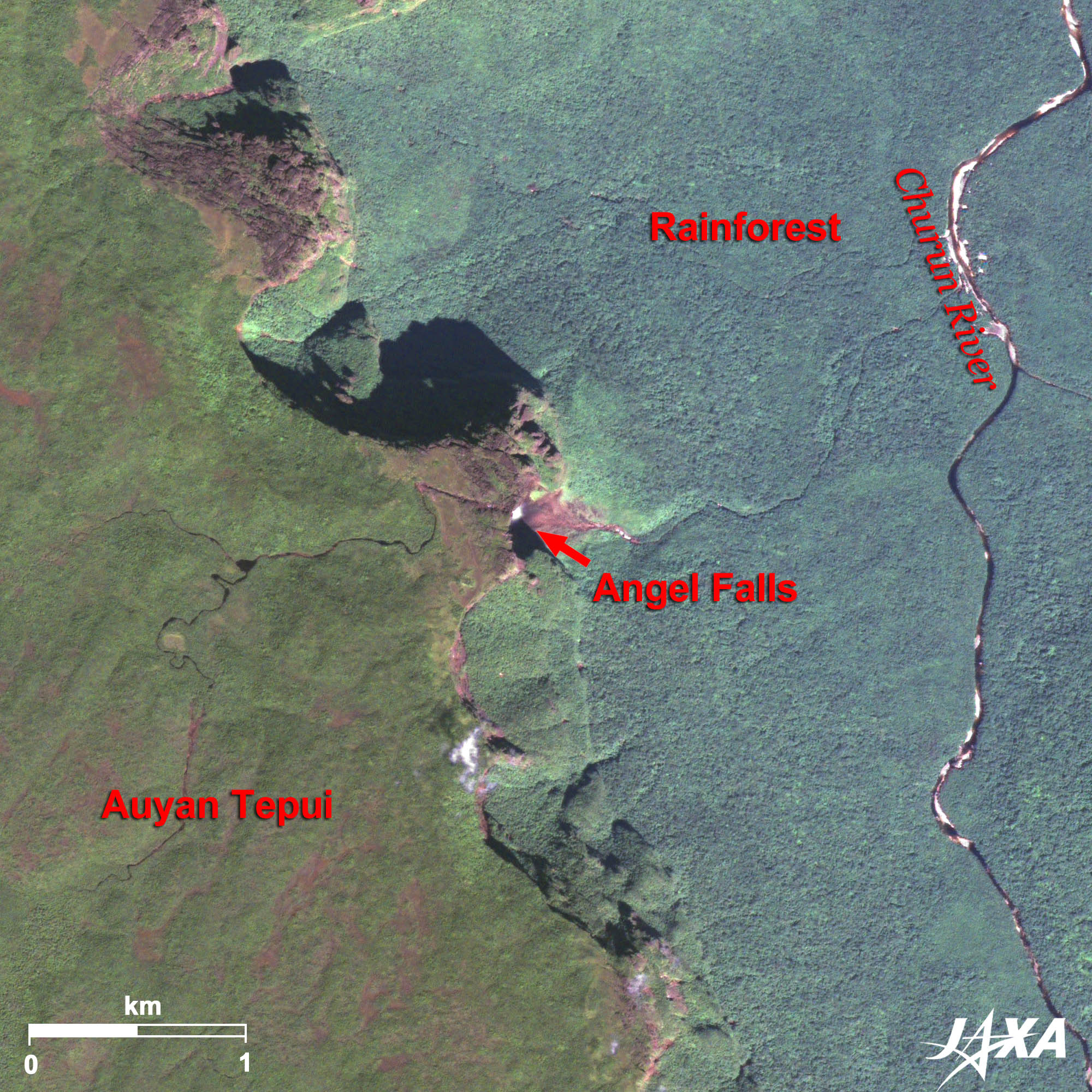  Fig. 2. Enlarged Image of Angel Falls
Angel Falls (kmz, 4.36 MB, High Resolution) as seen on Google Earth Angel Falls is the highest (978 meters) and most spectacular waterfall in the world with an uninterrupted descent of 800 meters. Figure 2 clearly show the white plume of the waterfall. If you listen closely, you may even hear the roaring sound. However, it has no basin because the height of the falls is so great that much of the water evaporates or is carried away as a fine mist before reaching the bottom. 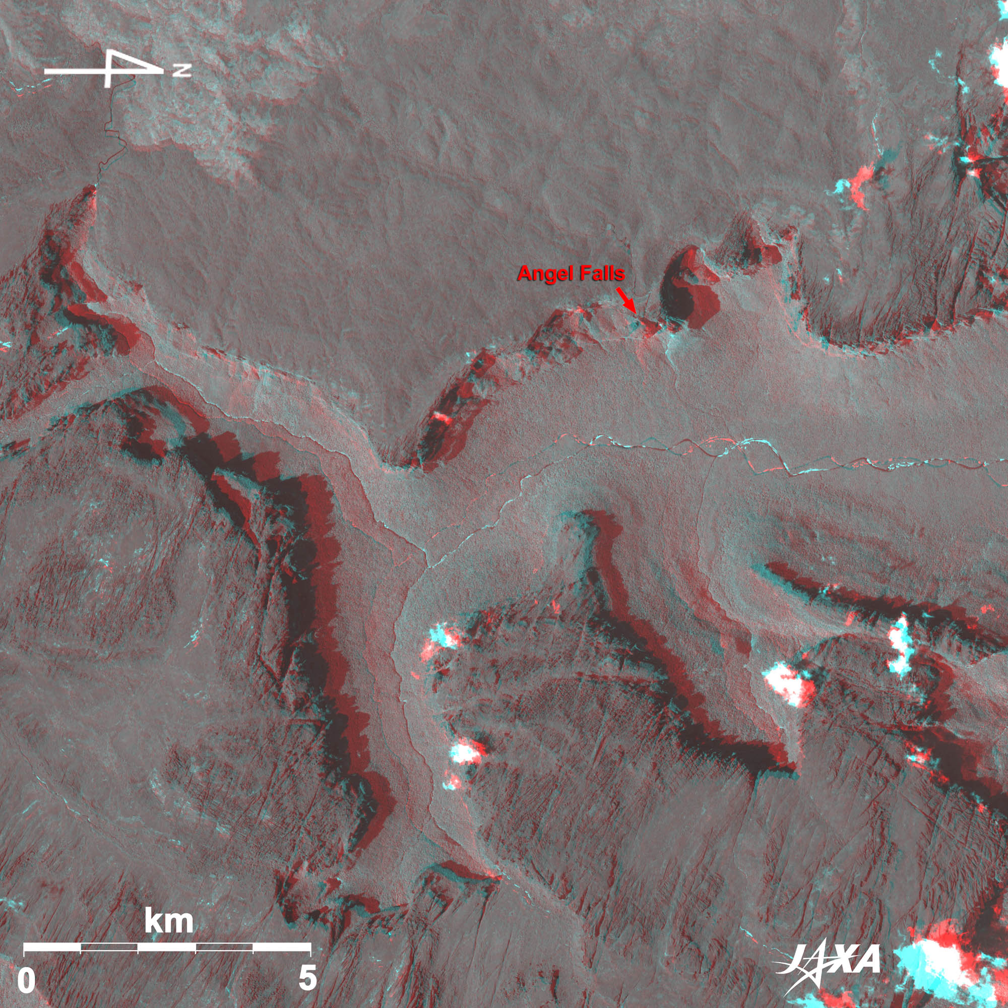 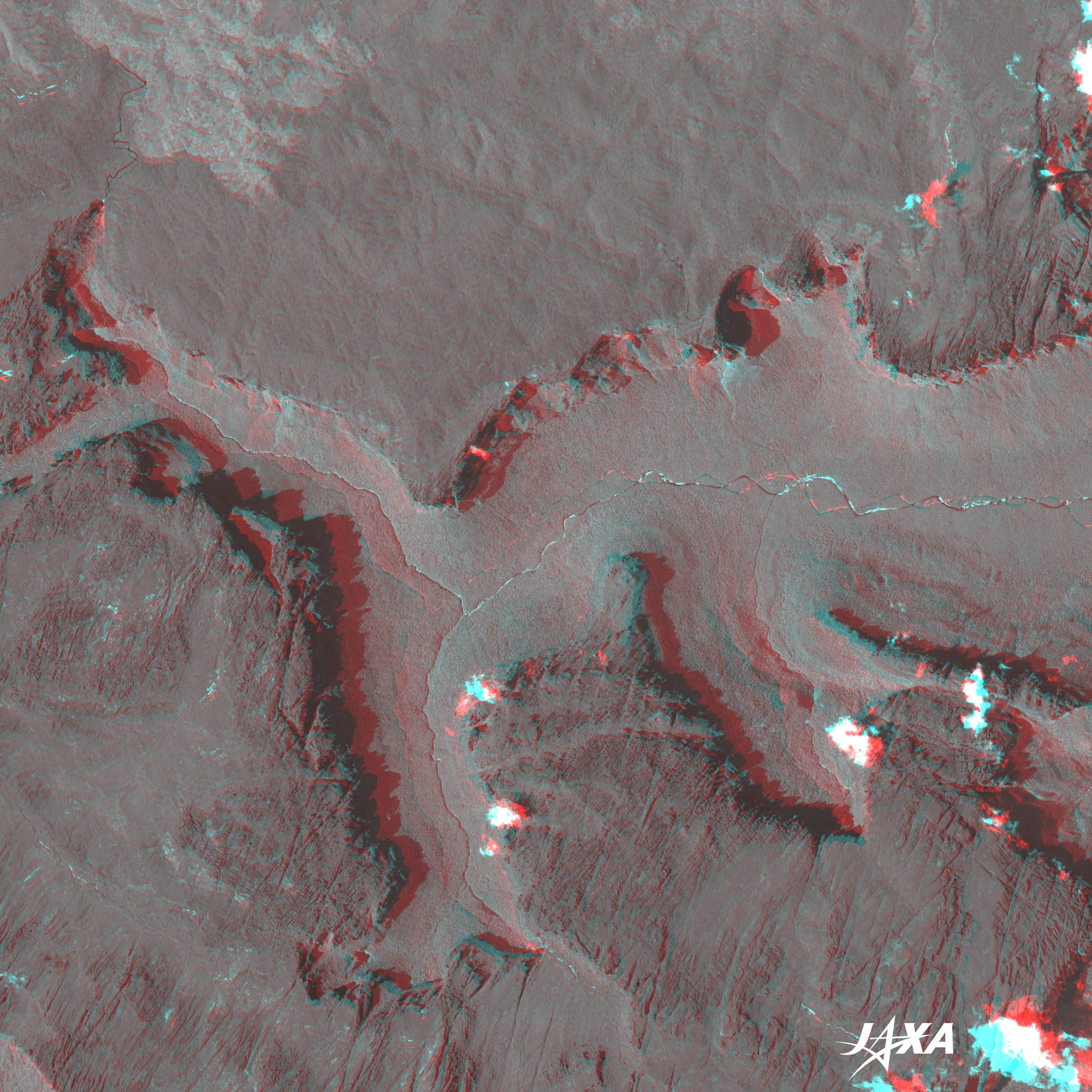 Fig. 3. Three-Dimensional View of Angel Falls
(Staring at the image for a long time may cause eye-strain. A color print is available in PDF. PDF files for the left and right eyes are also available for stereoscopic viewing.) The table-like mountain and Angel Falls can be enjoyed in 3D if viewed with a blue glass over the right eye and a red glass over the left eye. The difference of heights between the top of the table-like mountain and the valley, and dissipating water during the fall might also be recognized. Note that upward is north in Fig. 1 and 2, whereas the right hand side is north in Fig. 3, a result of the flight direction of the satellite. 
Mr. Angel Found the World’s Highest Waterfall at “Devil’s Mountain”In its indigenous language, Auyantepui means “Devil’s Mountain.” It is not hard to imagine that this mountain, mostly hidden in the clouds, is a sacred place for the indigenous people. The opposing names Angel Falls and Devil’s Mountain are interesting, but the falls are simply named after their discoverer. In 1937, American explorer Jimmie (James) Angel and his companions found this great waterfall when they flew over the mountain searching for a gold ore bed. They landed atop Auyantepui but the airplane was damaged in the marshy ground and was unable to take off. They were forced to descend the tepui on foot and after 11 days of hard walking returned to civilization. The news of their adventure spread and Angel Falls became known worldwide.
President of Venezuela Claims “Angel Falls” To Be RenamedA small ripple involving the name of Angel Falls spread around the world in January 2010 when President Hugo Chavez of Venezuela claimed that Angel Falls should be renamed. President Chavez is known as a radical leftist, and is appealing for the building of “Socialism of the 21st century.” After his assumption to power in 1999, the name of the country was changed from “The Republic of Venezuela” to “The Bolivarian Republic of Venezuela.” According to The Guardian, he was reported to have said: “This is ours, long before Angel ever arrived there… this is indigenous property,” and insisted on changing the name to “Kerepakupai Meru,” which in the indigenous language means “Waterfall of the Deepest Place.” Reference Sites:
Explanation of the Images:
AVNIR-2 has four observation bands. The composite images are usually produced by assigning red to Band 3 (610 to 690 nm), green to Band 2 (520 to 600 nm), and blue to Band 1 (420 to 500 nm). The resulting images have natural coloring as if seen by the naked eye. Thus, the following colors designate ground objects:
PRISM is an optical sensor for observing ground surfaces with visible and near-infrared signals in the 520- to 770-nanometer (one-billionth of a meter) band. The acquired image is monochrome. PRISM has three independent optical systems (telescopes) to acquire images for nadir, forward, and backward views simultaneously. Only the nadir image was used in this article. Figure 3 combines nadir (red) and forward (green and blue) images of PRISM. The left eye sees the nadir image, and the right eye sees forward image, which means the left side corresponds to the satellite flight direction pointing south. Related Sites
|


