Seen from Space 2009
Countries of the Uesugi Warlords During the Warring States Period of Japan
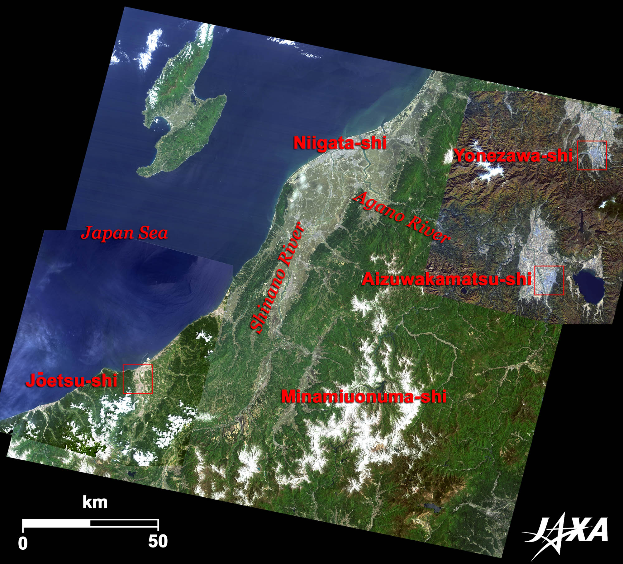 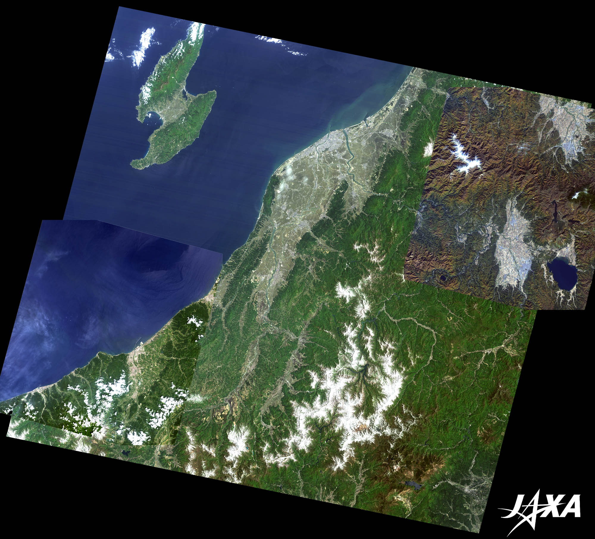 Fig. 1. Niigata Prefecture and Its Surroundings
Figure 1 shows Niigata Prefecture and its surroundings. An image of Jōetsu-shi (city) captured by ALOS (Daichi) in August 2008, and images including Aizuwakamatsu-shi and Yonezawa-shi in November 2008 are laid over the image of Niigata Prefecture as observed by Landsat 5 in May 1993. The Niigata Plain is visible as gray in the middle of the image, and is known as a good rice-producing area of Japan. Niigata-shi is located at the mouths of the Agano River and the Shinano River, which flow into the Sea of Japan. During the Warring States period in Japan (around 1490-1570), feudal warlords, Uesugi Kenshin and Naoe Kanetsugu, dominated the state called Echigo (an old name of Niigata Prefecture). Jōetsu-shi, located about 110 km southwest of Niigata-shi, is observable at the lower left of the image. Aizuwakamatsu-shi and Yonezawa-shi are located about 90 km east of Niigata-shi. Naoe Kanetsugu was born at Minamiuonuma-shi, Niigata, as the first son of a vassal of Nagao Masakage (the castellan of Sakado Castle in Minamiuonuma-shi). At the age of six, Kanetsugu served as a page of the son of Masakage (Nagao Kagekatsu). Kanetsugu then moved to the Kasugayama (Mt. Kasuga) Castle in Naoetsu-shi, following Kagekatsu who was adopted by Uesugi Kenshin (a feudal lord of the state). Naoetsu-shi and Takada-shi merged into Jōetsu-shi in 1971. 
Jōetsu-shi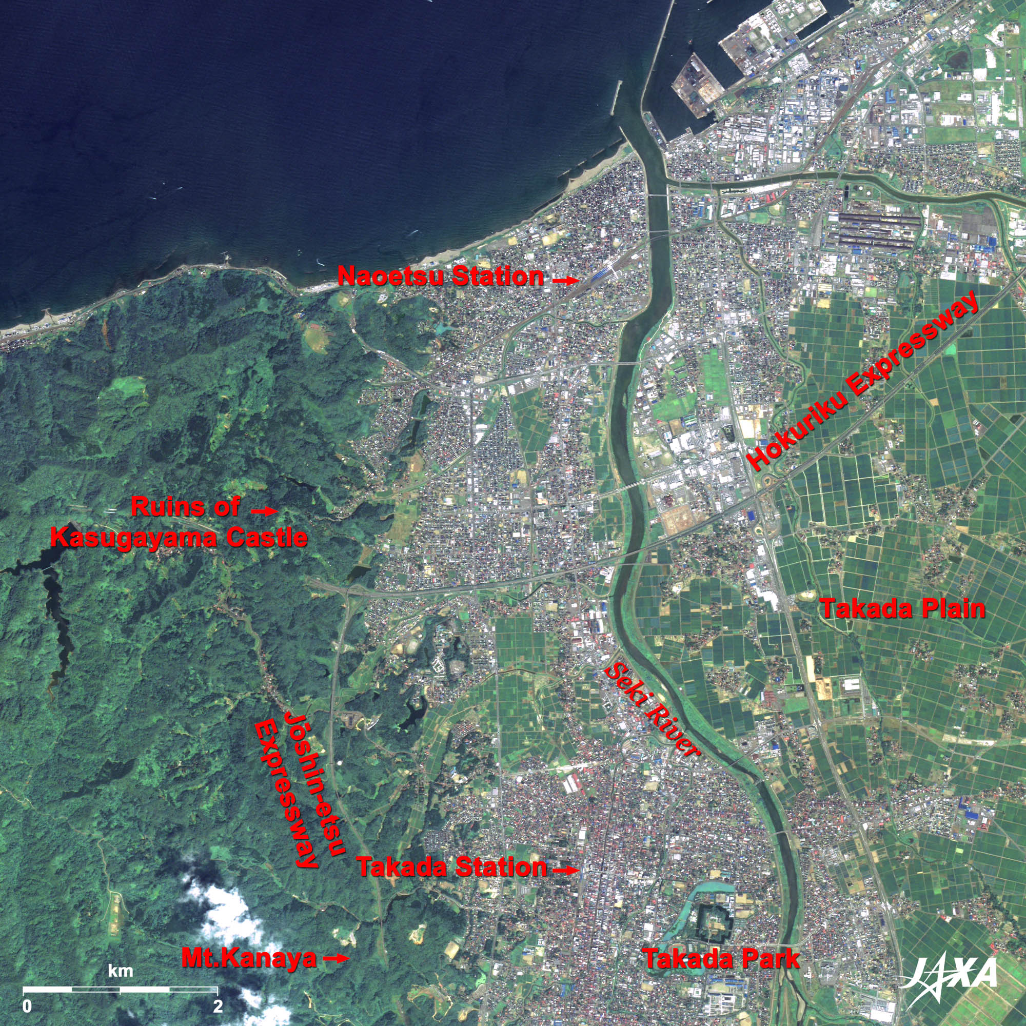  Fig. 2. Jōetsu-shi and Its Surroundings
Jōetsu-shi (kmz, 5.20 MB, Low Resolution) as seen on Google Earth Figure 2 is an image of Jōetsu-shi and its surroundings. Urban areas of Naoetsu and Takada are located on the western side of the Takada Plain. The plain was developed at the mouth of the Seki River, which flows in the middle of the image. The ruins of Kasugayama Castle, where Uesugi Kenshin resided, is located on Kasugayama (Mt. Kasuga), overlooking urban Jōetsu-shi to the east. Mt. Kanaya, located south of the castle, is where western-style skiing was first introduced to Japan in 1911. The castle ruins at the bottom of the image belong to Takada Castle, which was built for Matsudaira Tadateru, the sixth son of Tokugawa Ieyasu (founder of the Tokugawa Shogunate). It is now part of a park.
Aizuwakamatsu-shi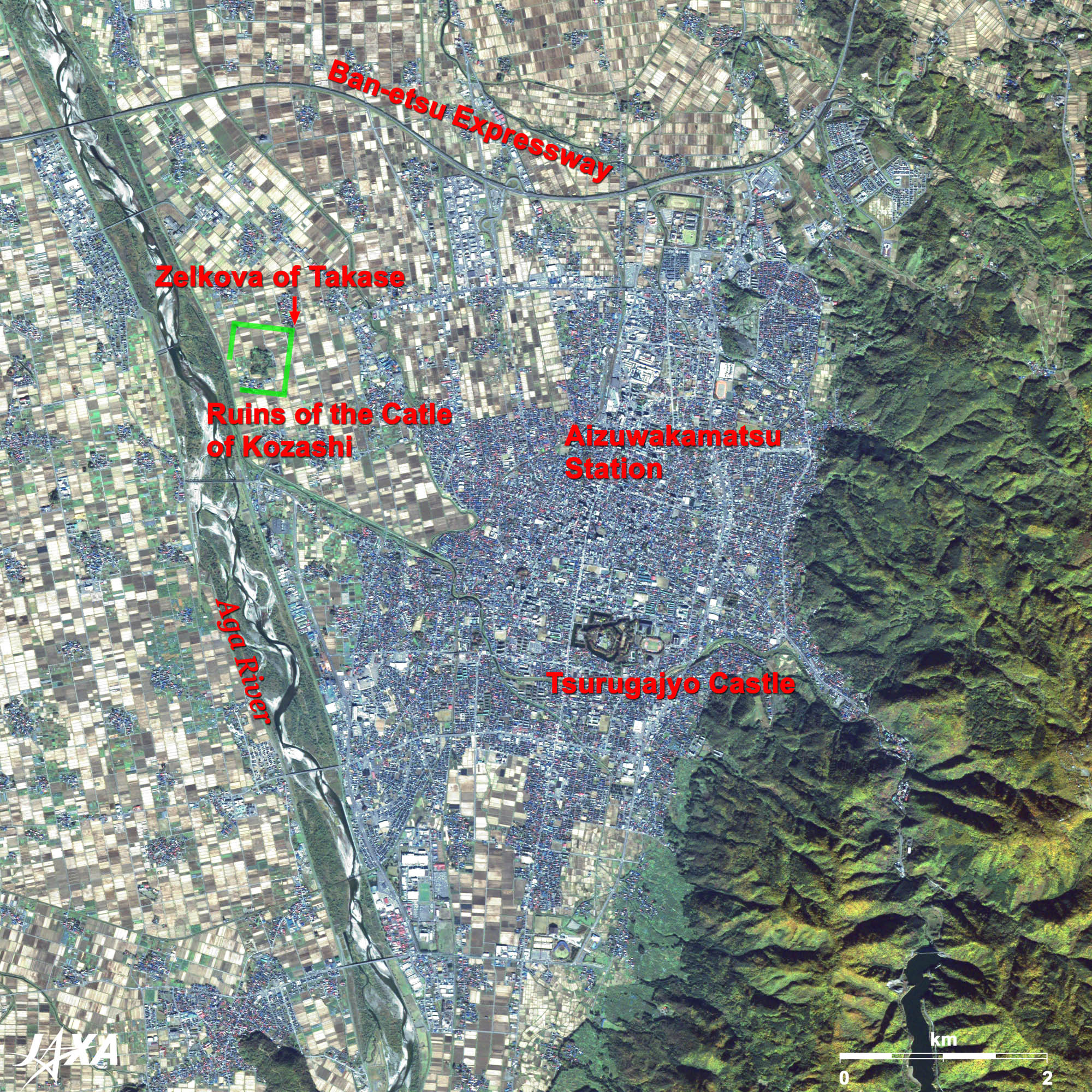 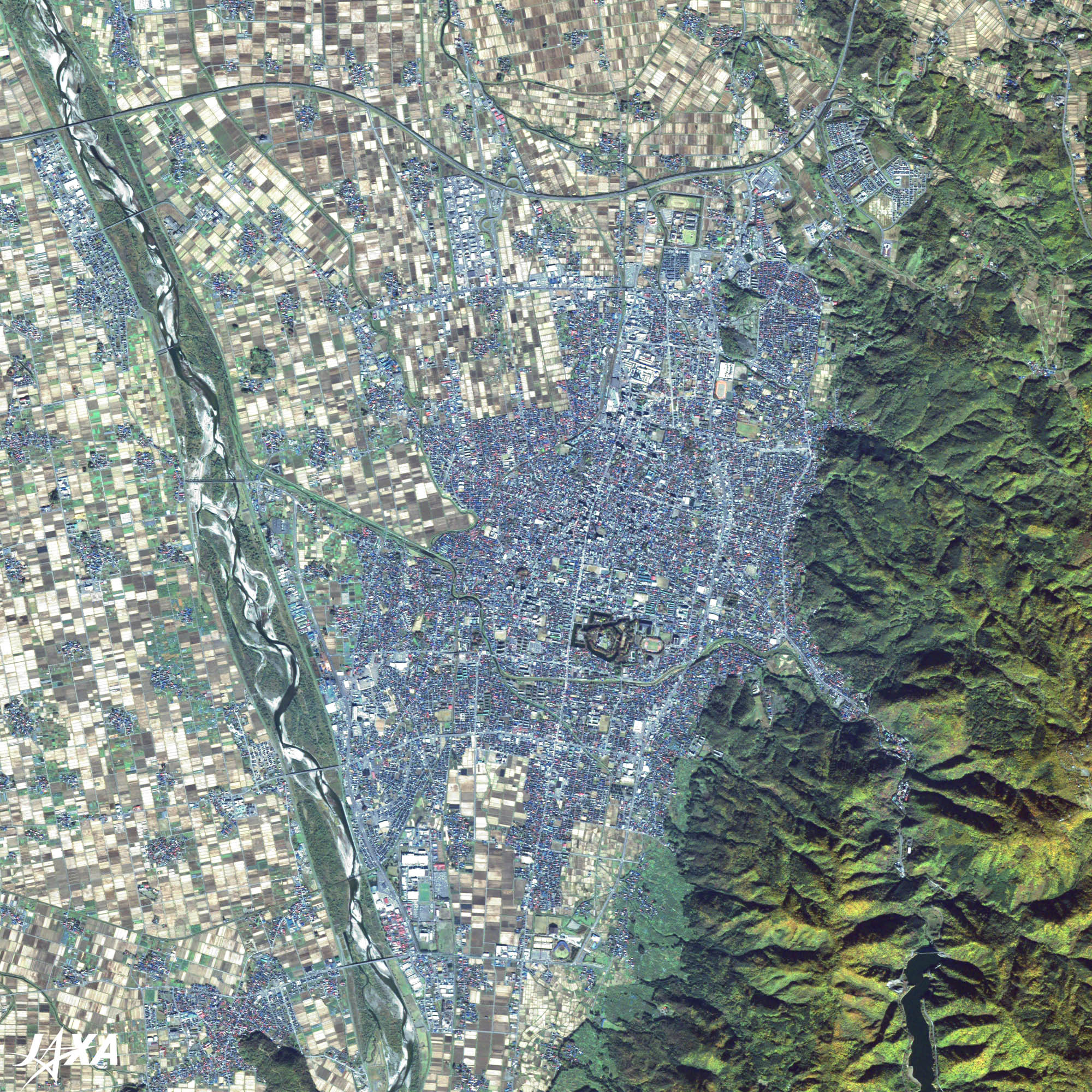 Fig. 3. Aizuwakamatsu-shi and Its Surroundings
Aizuwakamatsu-shi (kmz, 4.75 MB, Low Resolution) as seen on Google Earth Figure 3 is an image of Aizuwakamatsu-shi and its surroundings in Fukushima Prefecture. Aizuwakamatsu-shi, located at the eastern edge of Aizu Basin, is visible as bluish grey. At the center of the city, you can see the ruins of Wakamatsu Castle, also known as Tsurugajo Castle. It is now part of a park as well. After the death of Hideyoshi, Uesugi Kagekatsu decided to build a new castle in the northwest of Wakamatsu Castle, along the Aga River. However, construction was interrupted when Tokugawa Ieyasu invaded the district. You can see the ruins of the earthwork fortification at the four corners of the secondary part of the castle. This castle appears larger than Wakamatsu Castle. The northwestern direction of the castle was thought to be unlucky; therefore, a large zelkova tree was planted as an amulet. This tree is called the “Zelkova of Takase”.
Yonezawa-shi 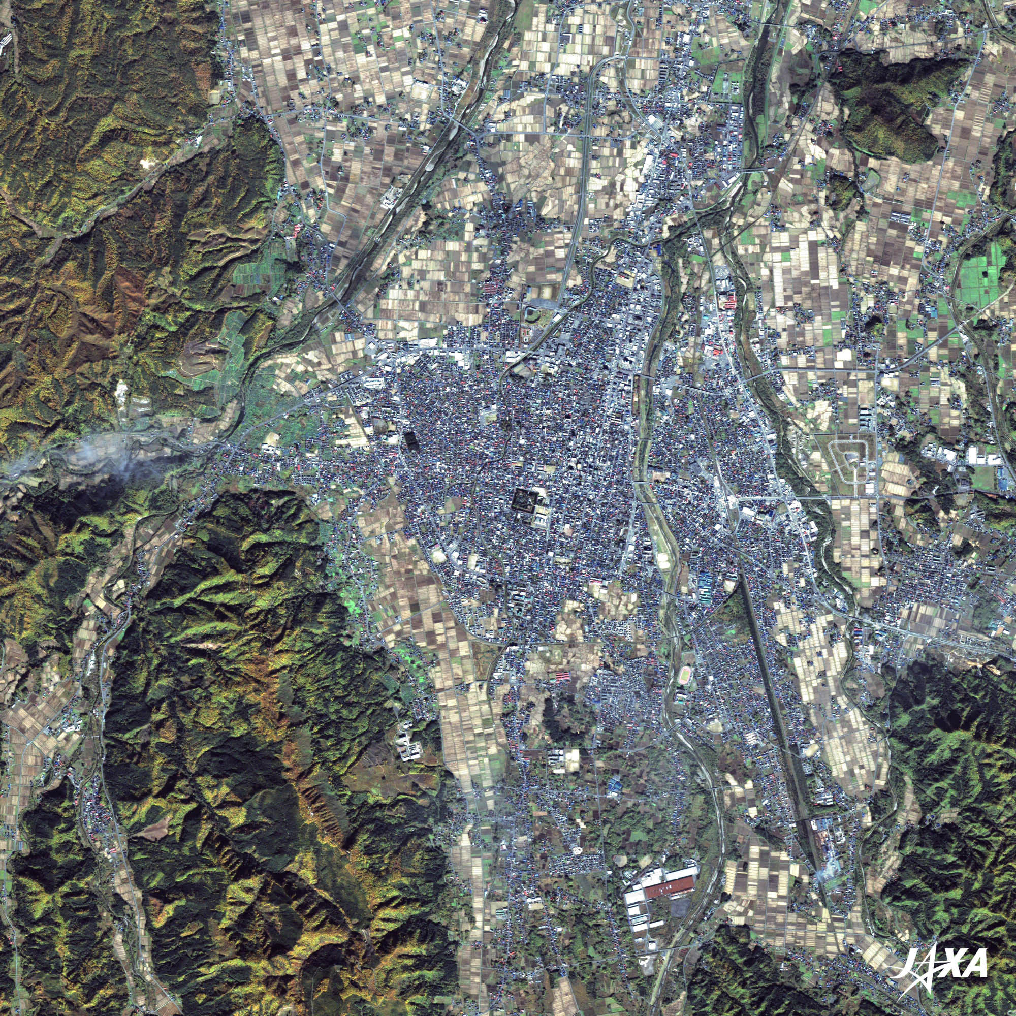 Fig. 4. Yonezawa-shi and Its Surroundings
Yonezawa-shi (kmz, 5.19 MB, Low Resolution) as seen on Google Earth Figure 4 is an image of Yonezawa-shi and its surroundings. Yonezawa-shi is located about 50 km north of Aizuwakamatsu-shi, and is visible as bluish grey in the middle of the image. It is located at the southern edge of Yonezawa Basin. Kanetsugu started construction of a new castle town and made efforts to control floods. He built an embankment along the Matsukawa River, which protected the town against floods many times. Thus, Kanetsugu built the foundation of the present city. Some portions of the embankment have now been converted into Naoetei Park. Images of ALOS (Daichi) are used on the “goo maps” web page (NTT Resonant Group). You see satellite images when you click on the “aerial” button at the upper-left of the map. The background image then changes to a satellite image. Explanation of the Images: (Click the imaged twice to enlarge)
AVNIR-2 has four observation bands. The color composite images are produced by assigning red to Band 3 (610 to 690 nm), green to Band 2 (520 to 600 nm) and blue to Band 1 (420 to 500 nm). The resulting images have natural coloring as if seen by the naked eye. Each color indicates the following ground objects:
PRISM is an optical sensor for observing ground surfaces with visible and near-infrared signals in the 520- to 770- nanometer (one-billionth of a meter) band. The image is monochromatic but has a higher resolution. PRISM has three independent optical systems to acquire images in the view of nadir, forward and backward simultaneously. Only the nadir image is used in these figures.
The Landsat image is downloaded without charge from the Global Land Facility (GLCF) Earth Science Data Interface site at the University of Maryland. The color composite image is produced by assigning red to Band 3 (630-690 nm), green to Band 2 (520-600 nm) and blue to Band 1 (450-520 nm). The resulting image has natural coloring as if seen by the naked eye. |


