Seen from Space 2009
Lhasa, Tibet: The Center of Tibetan Culture and Buddhism
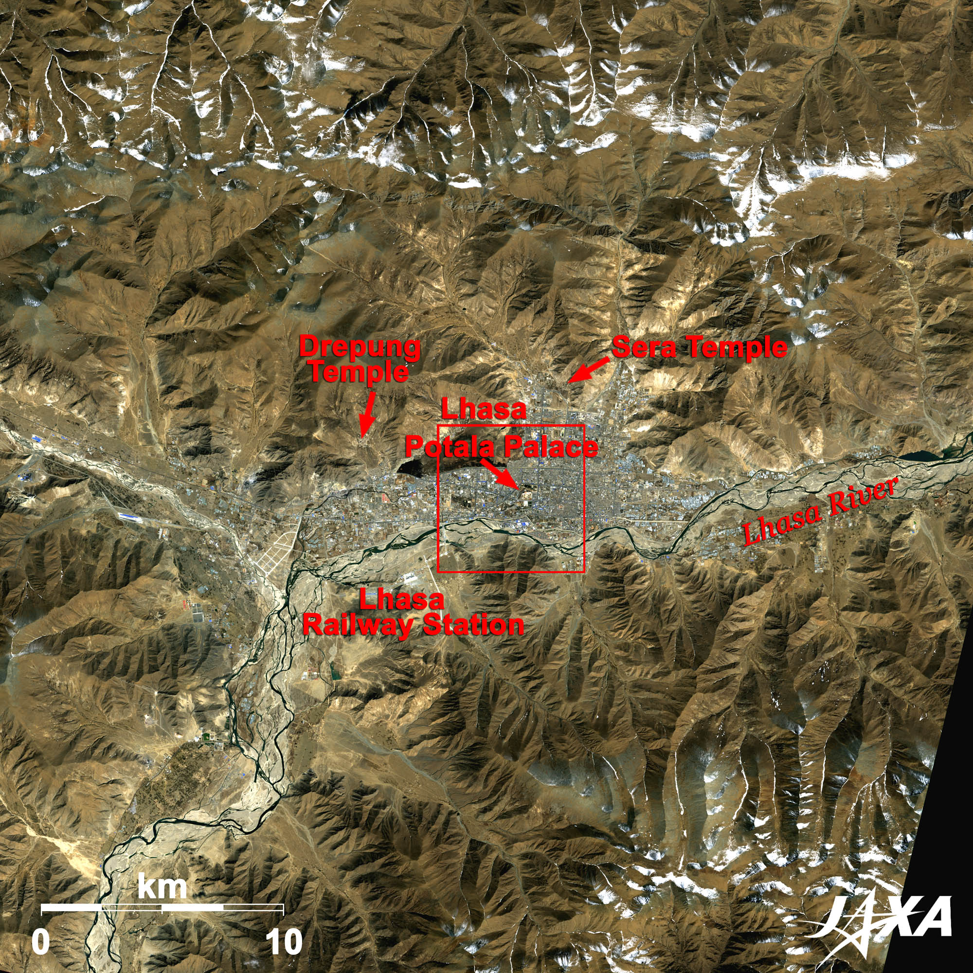 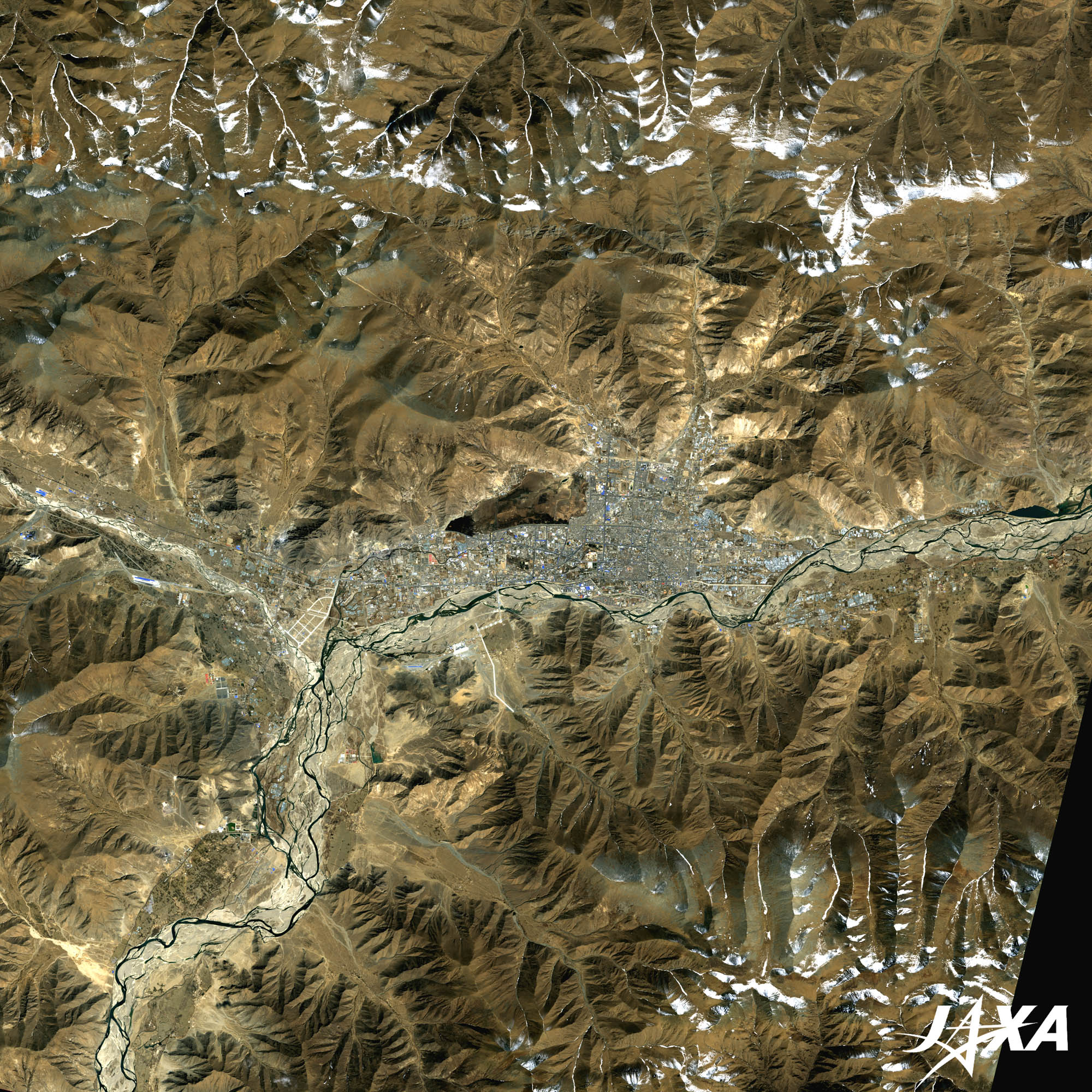 Fig. 1. Lhasa and Its Surroundings
Figure 1 shows Lhasa, the capital of the Tibet Autonomous Region, in the People’s Republic of China, and its surroundings as observed by ALOS (Daichi) in March 2007. Lhasa is located on the Lhasa River, which flows in the middle of the image. As you see, Lhasa is surrounded by the mountains of the Tibetan Plateau. It is one of the highest cities in the world with an altitude of 3,650 meters. The Lhasa River flows about 50 km to the southwest (lower left of the image), then joins the great Yarlung Zangbo River, which flows to the east.  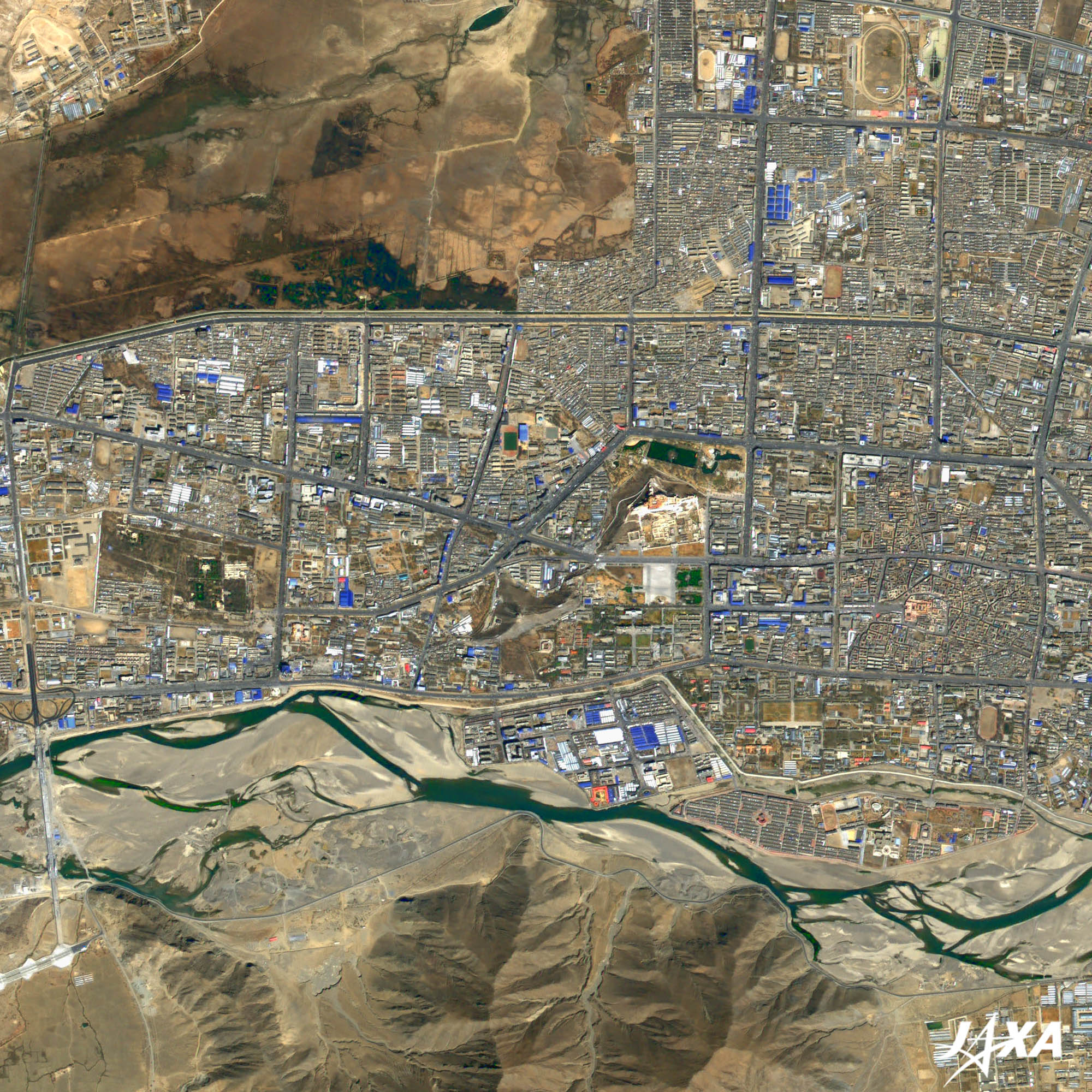 Fig. 2. Central Part of Lhasa
Lhasa(kmz, 5.26 MB, Low Resolution) as seen on Google Earth. Figure 2 shows the central part of Lhasa. Jokhang Temple, surrounded by a wall, is visible at the right side of the image. The Jokhang is composed of the main Jokhang temple and Tulnang, which surrounds the main temple. Jokhang Temple was constructed in the middle of the seventh century. It is the first temple of Tibetan Buddhism. This temple is the holiest and most important one in Tibet. It is said to have been constructed in dedication to the statues of Buddha that were brought by a princess of the Tang dynasty of China who came to marry a Tibetan prince. The Potala Palace, which was constructed on the south face of a Marpo Ri hill, is visible at the center of the image. It extends about 360 meters east and west, and about 300 meters north and south. It was named after Mt. Potala, where the Buddhist Goddess of Mercy was said to live. The Potala Palace was first constructed in the middle of seventh century. It was then expanded in the seventeenth century and became a winter residence of the Dalai Lama, a lineage of religious leaders of Tibetan Buddhism. Today the palace has been converted into a museum and is partly open to the public. The Norbulingka Palace is visible at the left side of the image and is covered by green. The Norbulingka was built in the middle of the eighteenth century as a summer palace of the Dalai Lama. 
Tibetan Buddhism and JapaneseLhasa is the center of Tibetan Buddhism. The Tibetan Buddhist scriptures were said to retain old Buddhist scriptures. Kawaguchi Ekai, a Japanese Buddhism scholar, visited Lhasa, traveling over Indian Nepal. Tada Tokan also visited Lhasa, climbing over the Himalayas in 1913. He stayed there for 10 years to study Buddhism. He brought back over 24,000 texts, including the Tibetan Daizokyo (one of the basic Buddhist scriptures), which were not to be removed. They studied at the Sera temple, which is located about 8 km north of Lhasa. The Qingzang railway between Xining, the capital of the Qinghai Province, and Lhasa opened in July 2006. The highest point of the railway is 5,072 meters, higher than that of the Peru railway. At the end of August (June 30 on the Tibetan calendar), the Shoton Festival, the largest festival in Tibet, takes place. We hope Lhasa develops further as the central city of Tibetan culture and Buddhism.
Shoton Festival“Sho” means “yoghurt” and “Ton” means “festival” in Tibetan, therefore it is called the “Yoghurt Festival”. During the month of June, Monks practice asceticism in the monasteries. At the end of the asceticism, locals gave yoghurt to the monks. Explanation of the Images: (Click the imaged twice to enlarge)
Figure 1 and Figure 2 are pan-sharpened images combining an AVNIR-2 image and a PRISM image.
PRISM is an optical sensor for observing ground surfaces with visible and near-infrared signals in the 520- to 770-nanometer (one billionth of a meter) band. The image is monochromatic but has a higher resolution. PRISM has three independent optical systems to acquire images in the view of nadir, forward, and backward simultaneously. Only the nadir image is used in these figures. |


