ページの先頭です。
本文へジャンプする。
【Important Notices】This page is an archive page of information published in the past. Since the update has been completed, it may contain broken links or outdated information. For the latest information, please use the new site Earth-graphy (earth.jaxa.jp).
ここからサイト内共通メニューです。
サイト内共通メニューを読み飛ばす。
サイト内共通メニューここまで。
ここから本文です。

Seen from Space 2009


Fraser Island – The World's Largest "Sand Island" in Australia


  • caption on
  • caption off
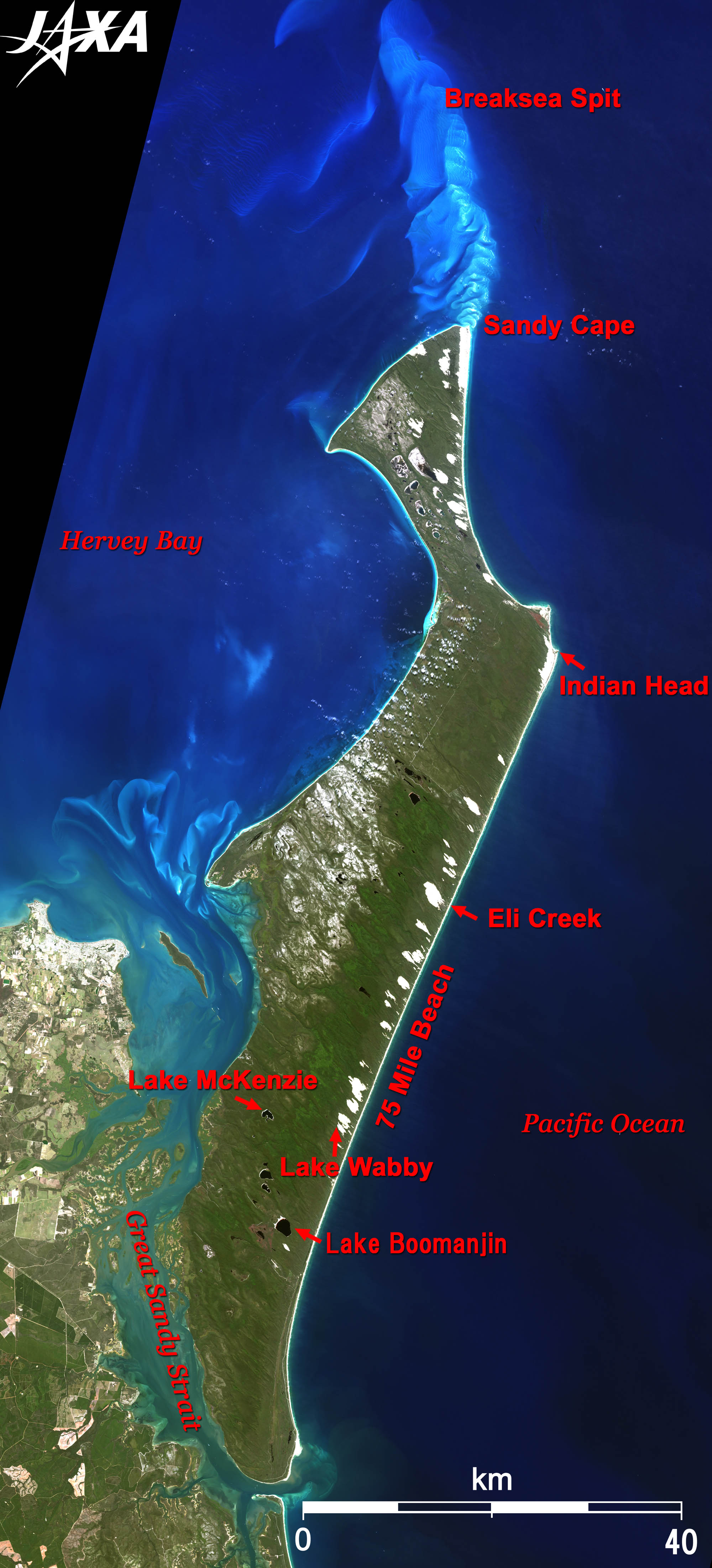
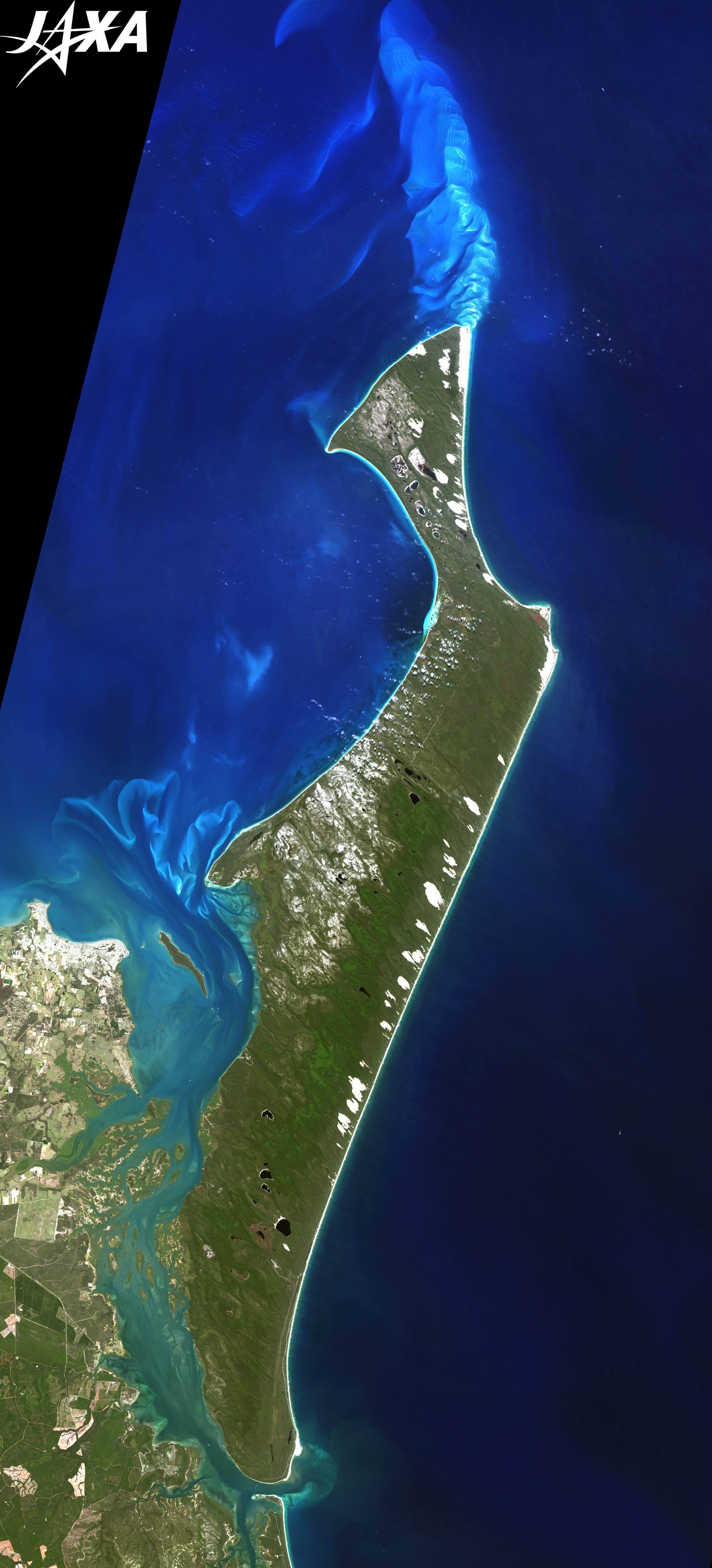
Fig. 1. Fraser Island
Fraser Island(kmz, 7.21MB, Low Resolution) as seen on Google Earth.

Fraser Island, "The Sand Island"

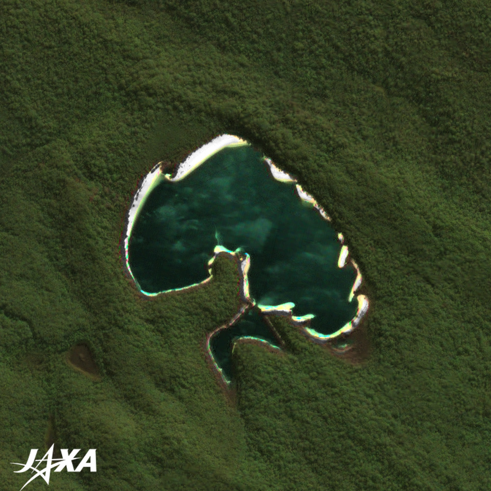
Figure 1 depicts Fraser Island as observed in September 2008. Fraser Island, located in the middle of the east coast of Australia, is formed by sand. Sand from the east coast of Australia, eroded by heavy rain more than 140,000 years ago, deposited off the east coast and created "Sand Island". (There is another view that the sands came from Antarctica.)
Fraser Island, with an area of 184,000 hectares, is 120 km long from north to south, and 25 km wide, east to west. It is located about 250 km north of Brisbane, the third largest city in Australia. The island is mostly covered by tropical rain forests and looks green. Long sandy beaches surrounding the island and dotted sand dunes reveals that the island is made of sand.
Many wild animals, such as dingoes (wild dogs native to Australia), wallaby (a smaller macropus), and hundreds of various wild birds, live in the forests. The island was registered to the World Heritage List for its valuable natural environment in 1992. The Great Sandy Strait separating the east coast and Fraser Island is recognized by the Convention on Wetlands of International Importance and was declared a Ramsar site in 1999.

  • caption on
  • caption off
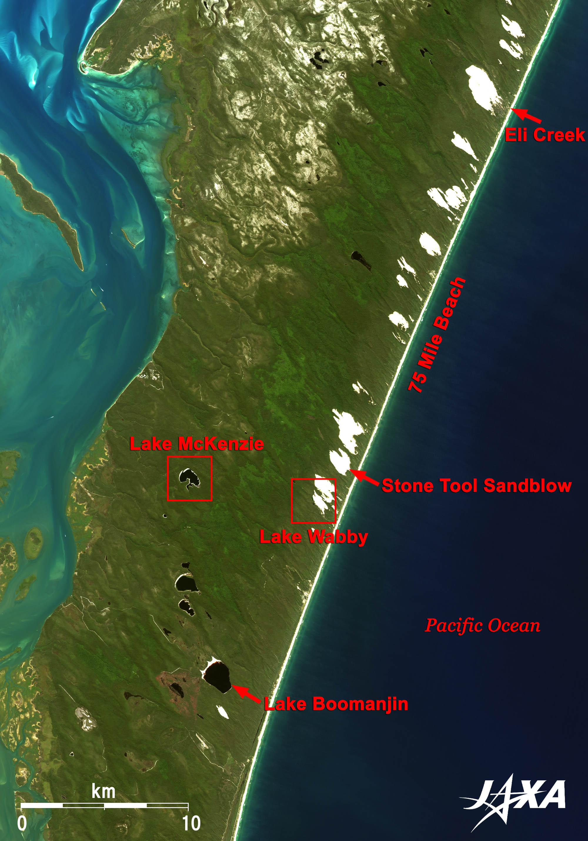
Fig. 2. Close-up Image of Central Fraser Island
  • caption on
  • caption off
  1. Fig. 3. Lake McKenzie
  2. Fig. 4. Lake Wabby


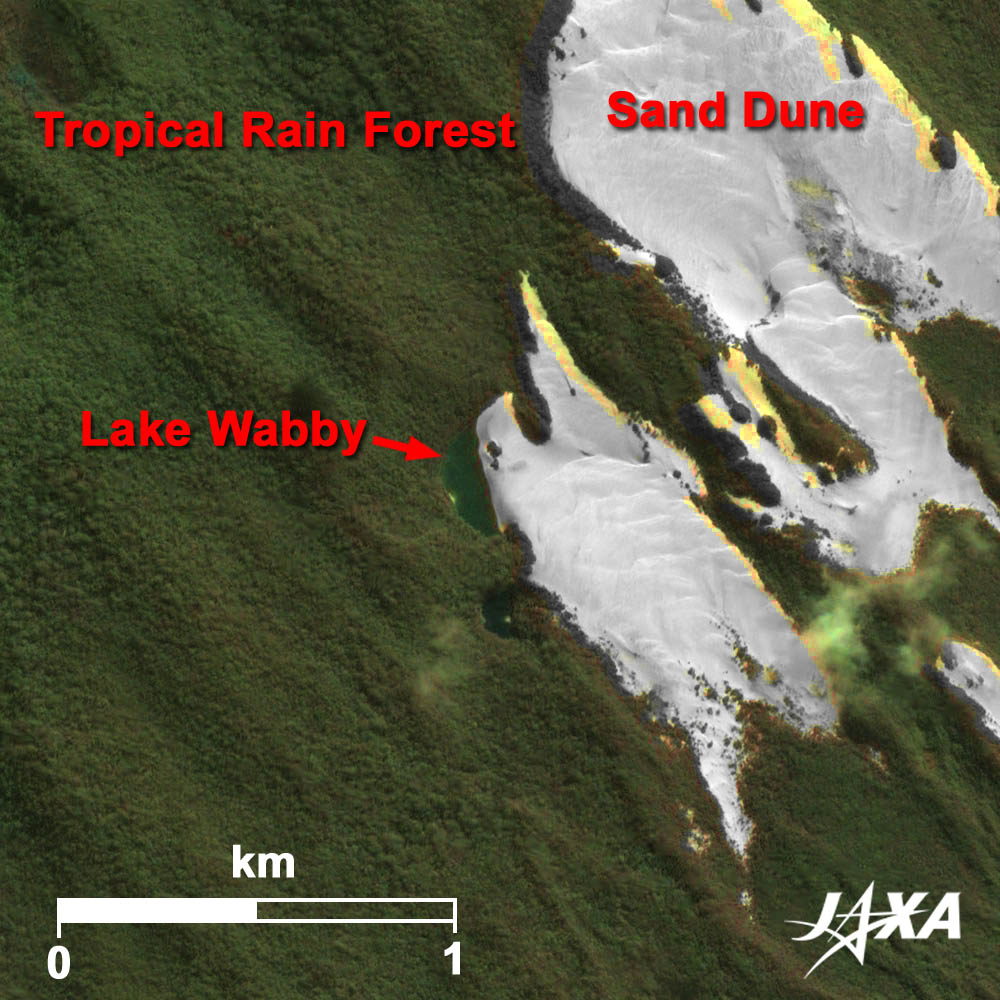
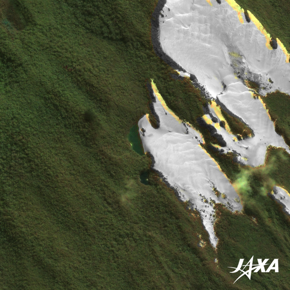
The Wonder of Sand Island

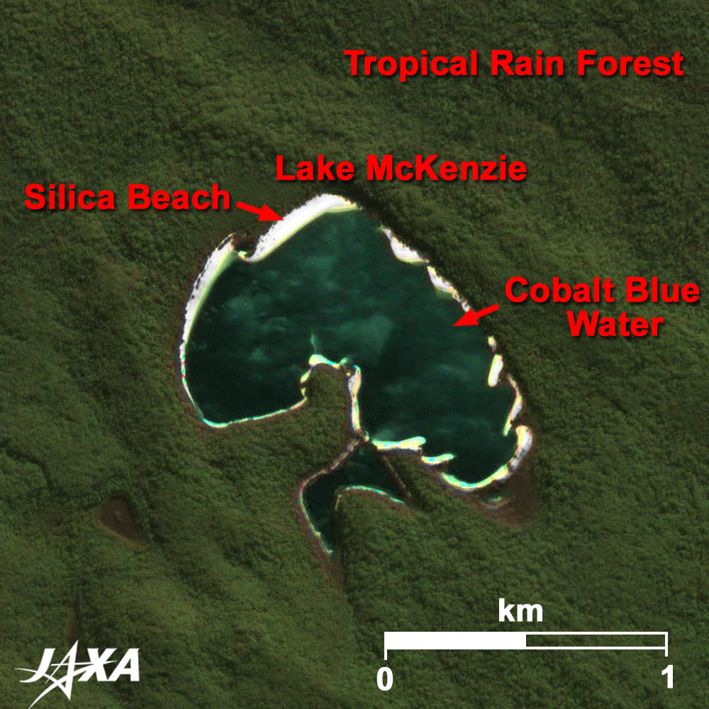
This sandy island covered by tropical rain forests has more than one hundred freshwater lakes and many creeks. Despite the sands that make up the island, a huge amount of sand absorbs and stores enough rain in the groundwater layer, thus enabling rich tropical rain forests to grow.
Three types of lakes occur on this island: perched lakes, barrage lakes, and window lakes.
Perched lakes develop above sea level. These lakes, which have pure white silica beaches and cobalt blue water, collect rainwater and develop on the ill-drained, impervious layer of depression (commonly called "coffee rock") over the sand dune. Lake McKenzie‘s water (Fig.3) is one of the purist and most transparent in the world. Lake Boomanjin in the south is the world’s largest perched lake.
Barrage lakes form when a mobile sand dune dams a watercourse. Lake Wabby (Fig.4) is a typical example, which can be seen on the limb of the sand dune.
Window lakes, generally at low elevations, form where the ground surface drops below the water table level through erosion by rainstorms and fills with groundwater. They are usually very small and cannot be seen in the image, but are called "window lakes" as their water surfaces look like the windows.
A lot of water stored in the groundwater layer wells up everywhere on the island. Many creeks carry clear, pure water to the east and the west coasts of the island. Eli Creek is the largest creek on the east coast of the island with a flow of 4.2 million liters per hour.

Sand Island is Alive

Sand dunes located on the east coast of the island are always moving. Sandblows form when strong southeasterly winds break through the vegetation cover, driving sand from the eroding dunes. They engulf forests in their path, at rates of up to 1 m each year. Sometimes, the old buried forests appear in the course of the sand movement toward inland. The sand dune, where Aborigine’s stone tools were found, is named "The Stone Tool Sandblow".
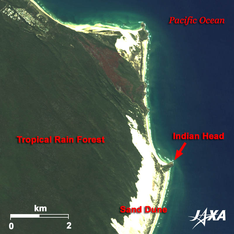
  • caption on
  • caption off
Fig. 5. Indian Head

A Straight Coast of Sand Island

There are three rock formations in the northeast coast of the island. Indian Head is a 60-meter-high steep rock cape that was formed by igneous rock through ancient volcanic activities. The mostly straight coast line of more than 100 km starting from here to the south is commonly called "Seventy-Five Mile Beach". Four-wheel-drive vehicles running on the beach must follow the road rules. Light-planes sometimes use this beach, as well.

Ecotourism of Sand Island

Ecotourism is the system of returning profits from sightseeing business to preserving the natural environment of an area. The Australian government is one of the first in the world to actively promote ecotourism. Fraser Island is a ranking resort in the Eco Certification Program of Ecotourism Australia for its environmentally friendly eco-resorts and various eco-tours that provide environmental education to the visitors.


Explanation of the Images:


(Click the images twice to enlarge.)
Satellite: Advanced Land-Observing Satellite (ALOS) (Daichi)
Sensor: Advanced Visible and Near Infrared Radiometer-2 (AVNIR-2) (Figures 1 through 5) and
Panchromatic Remote-Sensing Instrument for Stereo Mapping (PRISM) (Figures 3 and 4)
Date: 2345 (UTC) on September 28, 2008(AVNIR-2)
0002 (UTC) on June 8, 2007(PRISM)
Ground resolution: 10 m (AVNIR-2) and 2.5 m (PRISM)
Map Projection: Universal Transversal Mercator (UTM)

AVNIR-2 has four observation bands. The composite images are usually produced by assigning red to Band 3 (610 to 690 nm), green to Band 2 (520 to 600 nm), and blue to Band 1 (420 to 500 nm). The resulting images have natural coloring as if seen by the naked eye. Thus, the following colors designate ground objects:

Green: Tropical rain forests
Light green: Grass fields
Blue: Water surfaces
White: Sands

(Figures 3 and 4)
PRISM is an optical sensor for observing ground surfaces with visible and near-infrared signals in the 520 to 770 nano-meter (one-billionth of a meter) band. The acquired image is monochrome. PRISM has three independent optical systems (telescopes) to acquire images for nadir, forward, and backward views at the same time. Only the nadir image was used in this article.
The above AVNIR-2 composite image was then transformed into hue, saturation and intensity, and the intensity was replaced by the PRISM image. The hue, saturation and intensity data were then reversed into a color image. As a result, a virtual 2.5-m ground-resolution color image was obtained. This kind of high-resolution color image, composed by combining the higher resolution monochrome image and the lower resolution color image, is called a pan-sharpened image.

本文ここまで。
image:Satellite Navigator
image:Satellite Applications and Operations Center(SAOC)
Earth Data Collection by JAXA Satellites
image:ページTOP