Seen from Space 2008
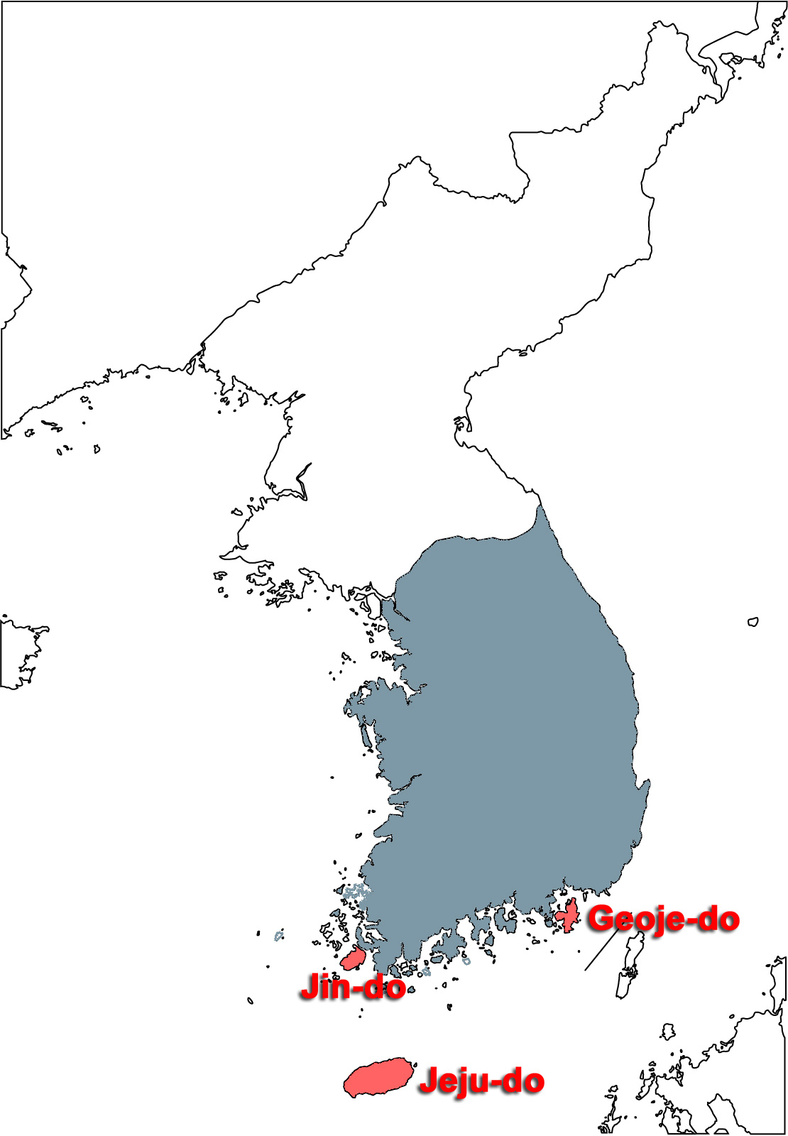
Three Islands in the Republic of Korea - Jin-do, Geoje-do and Jeju-do
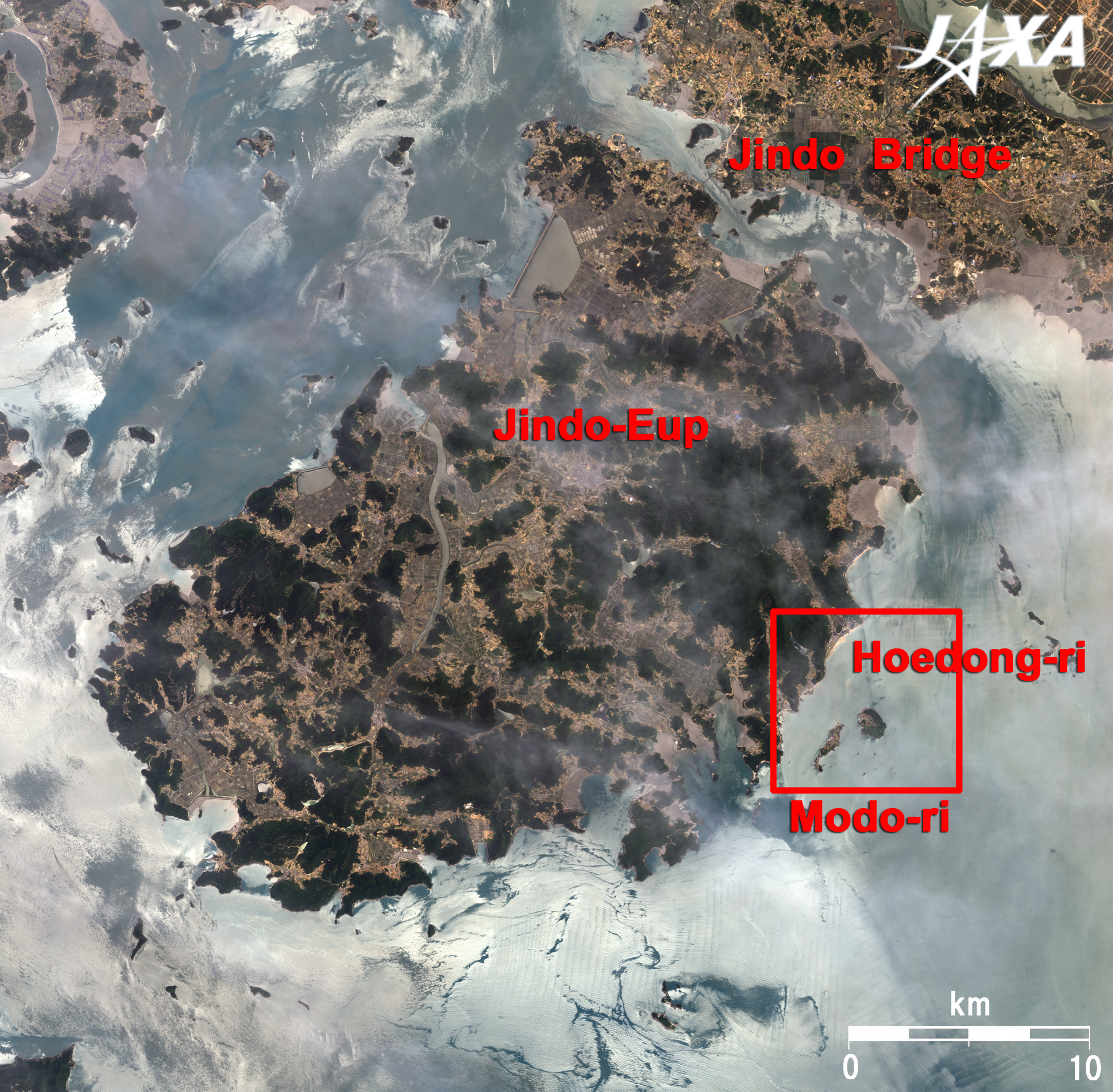
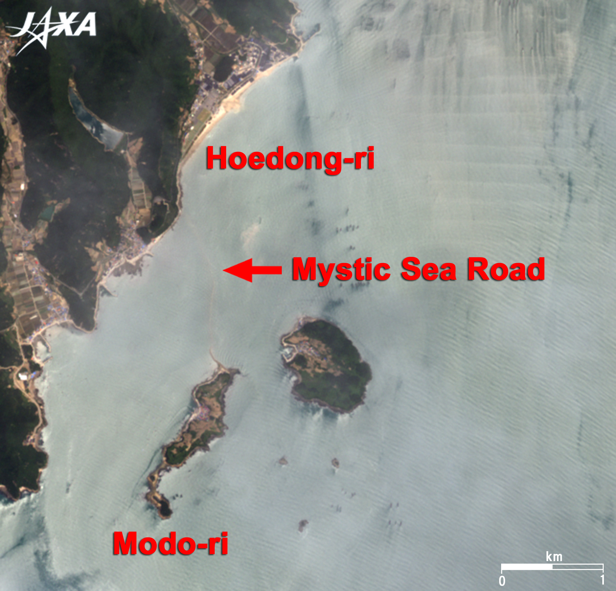
Jin-do is located in Jindo County, Jeollanam-do (South Jeolla) Province, at the southwestern end of the Koran Peninsula. The island is separated from the Peninsula by the 300m-wide Myeongnyang (also known as Uldulmok) Strait and is connected by the twin 484m-long Jindo Bridges completed in 1984 and 2005. The fast current and large whirlpools, similar to those of Akashi strait in Japan, make ship passage difficult. You can see the drift of tide at Jindo Bridge in the figure. The Mystic Sea Road (Moses' Miracle), a 2.8km-long and 40m-wide sandbar, appears between Hoedong-ri southeast Jin-do and Modo-ri off Jin-do every Spring Tide in April or May. The Mystic Sea Road Festival is held every May. The last Festival was held on 5 to 7 May 2008. It takes six hours from Seoul and six and a half hours from Busan by bus to the bus terminal in central Jin-do, Jindo-Eup. It also takes a half hour to Hoedong-ri by bus. A separated family meet again on the mystic road in an old Korean tale. Japanese singer Yoshimi Tendo sang the song "Jindo Story," based on such meeting. This made Jindo famous in Japan thereafter.
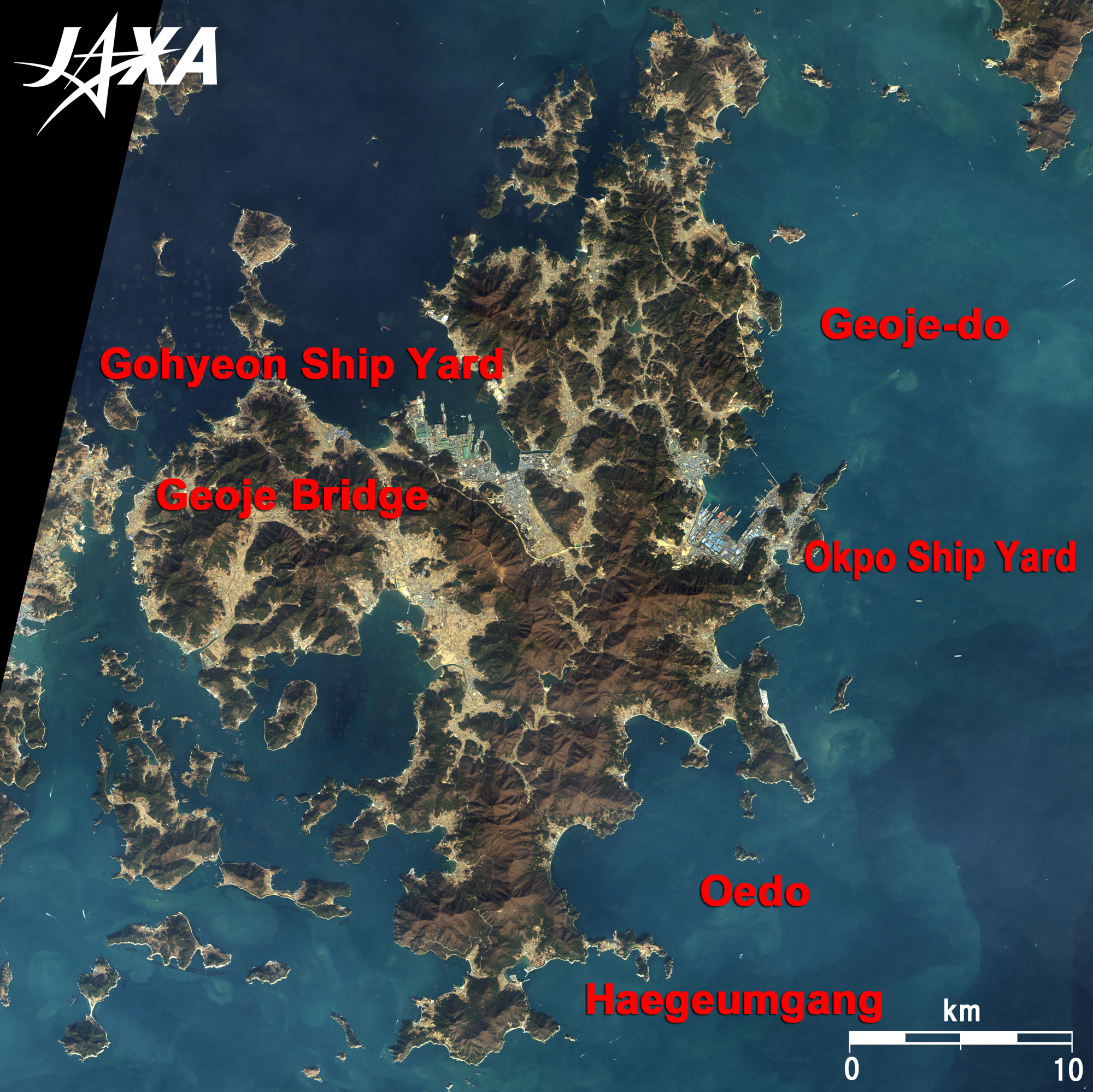
The 800m-wide Gyeonnaeryang Strait separates Geoje-do from the Korean Peninsula, but Geoje Bridge and other bridges connect with the peninsula. It takes three hours from Busan by car. The Korean remake movie, "My girl and I/ Parang love," from the famous Japanese novel, drama and movie, "Socrates in love" was shot on this island. The small Oedo Island is located 4km southeast of Geoje. The island appears in the last scene of the Winter Sonata, a Korean TV drama, and is well known in Japan. It is located in Hallyeo Haesang National Park, which is famous for its beautiful coast line. The entire island is a western-style marine and botanical garden. The scene in which Yujin, the heroin in the drama, and Joon Sang meet again at a house designed by her, is very moving. The house actually exists but cannot be entered as it is a private house. The distant view of Haegumkang and other islands and sea is very beautiful in the last scene of the drama. Oedo Island is the nearest island to Japan, and is not far from Japanese Tsushima Island.
Jeju-do is a rare volcanic island in Korea. Mt. Halla in the center of the island is 1,950m above sea level and last erupted in the 11th century. The Sungsan Ilchulbong or Sunrise Peak on the eastern end of the island is a 5,000-year-old tuff cone (600m in diameter) in a circular depression. It is covered by grass and is famous for its beautiful sunrises. The Geomunoreum lava tube system, including Geomunoreum, Manjangul, Gimnyeonggul and Yongcheondonggul, is located on the northeastern part of the island. With a length of 13,422m, Manjangul is the longest lava tube in the world. These spots were registered on the World Heritage list of the United Nations Educational, Scientific and Cultural Organization (UNESCO) as Jeju Volcanic Island and Lava Tubes in 2007. Jeju International Airport is located on the northern end of the island. The airport has flights from Narita, Nagoya and Fukuoka airports in Japan. It takes three hours to fly from Narita and one hour from Fukuoka. On the north of the island is Jeju City, and on the south is Seogwipo City. Seogwipo City is the southern end of Korea. In addition to these two cities, Jeju-do also had Bukjeju-gun and Namjeju-gun in the eastern and western parts of the island as enclaves. The Jungmun district in Seogwipo City is one of the most popular tourist resort areas in the Republic of Korea and has many luxury hotels with beautiful white beaches and cliffs. Jeju Island has beautiful scenery, convention centers, and major hotels necessary for a resort. The island was previously famous for its golf courses and casinos but is now best known for its settings for Korean movies and TV dramas. The TV drama, All-in, based on a real gambler, was shot on this island. Seopjikoji is a beautiful cape south of Seongsan Ilchulbong and was the setting for the convent in which the heroin of the drama, Su-yeon, grew up. The wind blows strongly on Jeju Island. The contrast of strong wind, cliffs and sea were depicted in the drama. Two settings for "The Story of the First King’s Four Gods," a Korean TV historical fantasy drama based on old Korean myths, are located near Manjangul cave on the eastern part of the island.
|