| |
 |
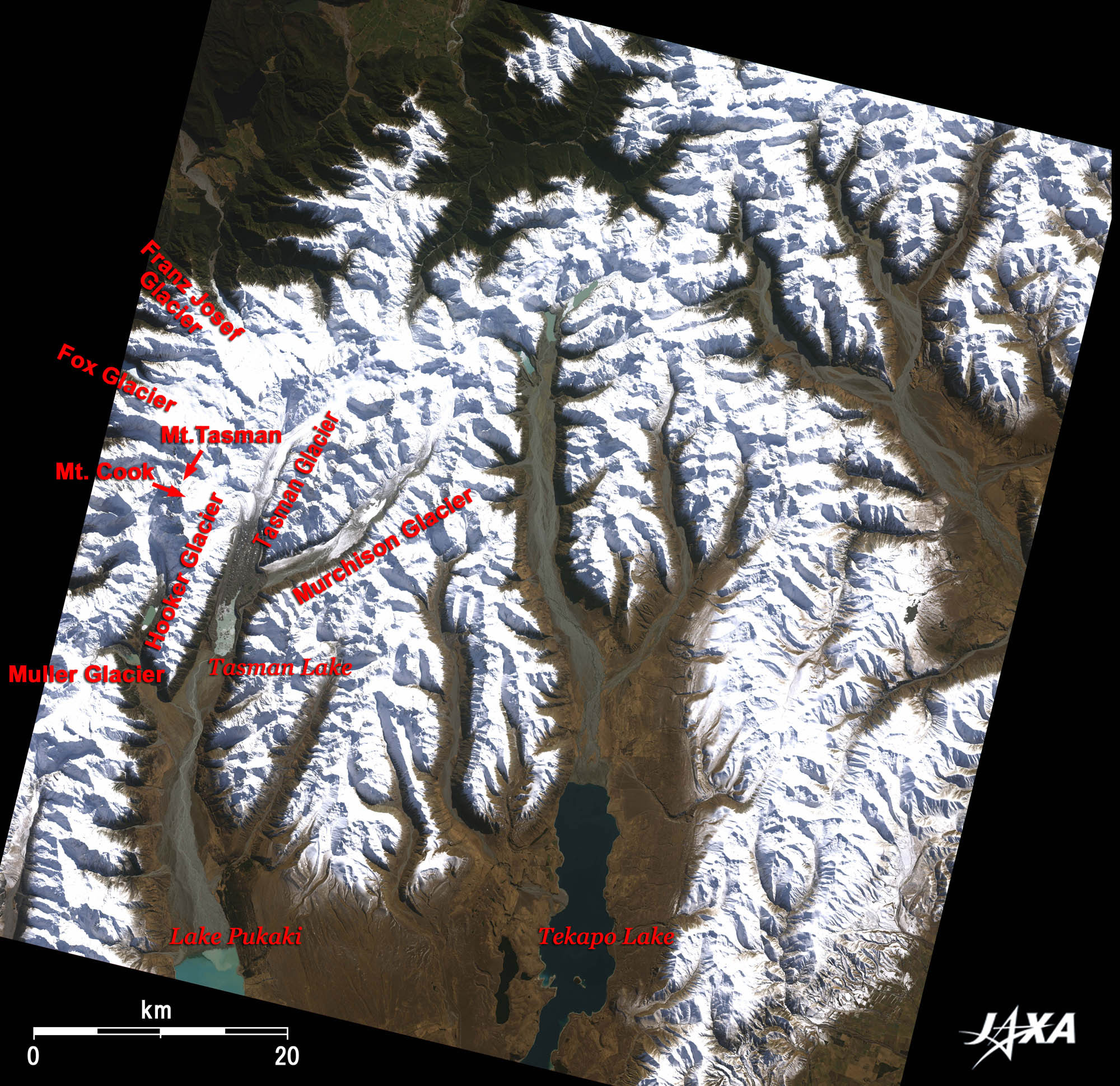
| Fig. 1 Glaciers in the Southern Alps of South Island -New Zealand |
Figure 1 depicts the west side of the South Island of New Zealand as observed by the satellite "Daichi" ( ALOS) on August 14, 2007, in the winter of the southern hemisphere. A chain of 3,000-m-class mountains in the Southern Alps mountain range lies diagonally across the South Island from southwest to northeast. The area covering the central portion of the Southern Alps mountain range, including the highest summit (Mt. Aoraki (Mount Cook; 3,754 m)) in the Aoraki/Mount Cook National Park, was registered as a World Heritage site of the United Nations Educational, Scientific and Cultural Organization (UNESCO) in 1990 as Te Wahipounamu South Westland.
The white area is Tasman Glacier (the largest glacier in New Zealand (500 m deep and 4 km wide). Hooker, Mueller, and Murchison Glaciers flow through the "U"-shaped glacial valleys and snowfields covering the Southern Alps mountain range.
In the past 30 years, about 11% of the glaciers were lost in the Southern Alps and receded remarkably. Tasman Glacier has receded 5 km in the past three decades and shortened to its present 23 km.
Lake Tasman is located downstream of the Tasman and Murchison Glaciers. The water flows over the terminal moraine formed by the deposition of glacial materials, flows down to the south into the Tasman River on the east of Mount Cook, and empties into Lake Pukaki (480 m above sea level), which appears clear blue.
Fox Glacier and Franz Josef Glacier in the Westland National Park are also seen north of Mount Cook in Fig. 1. Franz Josef Glacier was named after the Austrian Emperor, as the area was explored by an Austrian geographer.
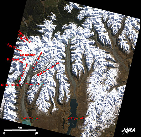
The three images of Fig. 2 compare the area centered on Lake Tasman. The left image was obtained in 1994 by the satellite "Fuyo-1 (JERS-1)"; the central and right images were obtained in 2006 and 2007 by "Daichi." Lake Tasman was recently formed (1987) as a proglacial lake. Its area has become three times larger than that in 1994. Icebergs, which melt and fall from the glacier, are visible floating on the lake.
In the South Island of New Zealand, a humid maritime atmosphere causes westerly, easterly and southerly winds to bring precipitation to both sides of the Southern Alps mountain range throughout the year, which results in a small temperature difference between summer and winter. Therefore, the glaciers maintain their mass even at comparatively low elevations of 1,000 m. However, they recently seem to be suffering from the serious effects of global warming.
Glaciers are an important source of freshwater to the regional inhabitants but also bring disasters. Monitoring glaciers using Earth-observation satellites is important for predicting Glacial Lake Outburst Floods (GLOF) and for estimating the glacier runoff for water supply for hydropower.
JAXA is conducting applications research using Earth-observation data for flood monitoring and forecasting, forest and land disasters, forest and eco-system distribution mapping, and so on.
| *1 Moraine refers to any glacially formed accumulation of unconsolidated debris that has been plucked off the valley floor as a glacier flows through a valley. Glacier lake outburst flooding caused when the moraine collapses has recently become a concern. |
Explanation of the Images:
Fig. 1 and two rightmost images of Fig. 2. Click the images twice to enlarge.
AVNIR-2 has four observation bands. Figure 1 and the two rightmost images of Fig. 2 are produced by assigning red to Band 3 (610 to 690 nm), green to Band 2 (520 to 600 nm), and blue to Band 1 (420 to 500 nm). The resulting images have natural coloring as if seen by the naked eye. Thus, colors designate the following ground objects.
| Dark green: |
Forests |
| Dark brown: |
Grass fields |
| Blue: |
Water surfaces |
| White: |
Snow, ice fields, or clouds |
| Dark grey: |
Glacier |
| Black: |
Area with no data |
Left image of Fig. 2. Click the image twice to enlarge.
Composite images are usually produced by assigning red to visible Band 2 (630 to 690 nm), green to near-infrared Band 3 (760 to 860 nm), and blue to visible Band 1 (520 to 600 nm) of VNIR. In the left image of Fig. 2, green is assigned to the sum of 75% of Band 2 and 25% of Band 3. The resulting images have natural coloring as if seen by the naked eye. In these images, snow and ice are white or light purple, forests are dark green, and grasslands are bright green.
|
|