| |
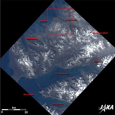 |
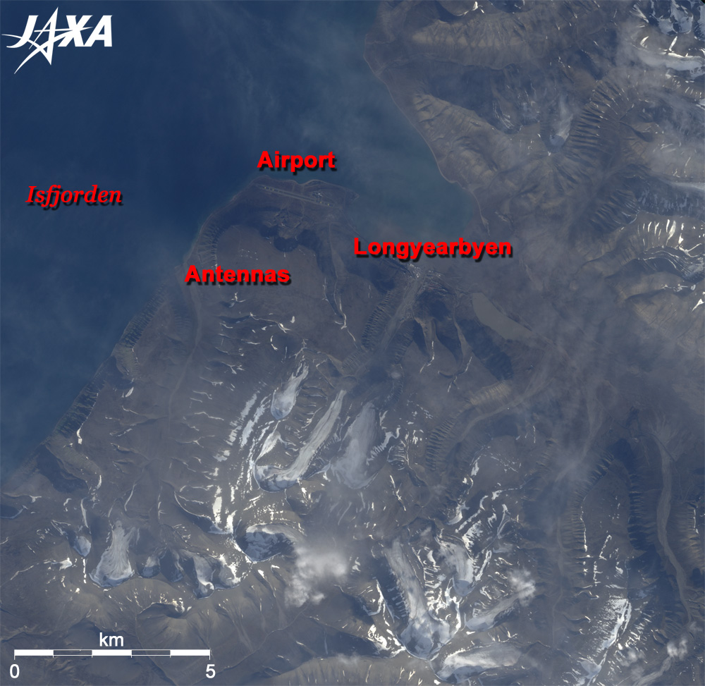
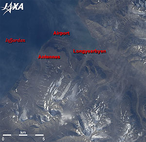
Fig. 1 Longyearbyen and its vicinity on Spitsbergen Island in Svalbard Archipelago
Svalbard (kmz, 796KB, Low Resolution) is seen from Google Earth. |
Figure 1 depicts Longyearbyen (population 2,000), the largest settlement in the Svalbard archipelago in the Kingdom of Norway, and its vicinity as observed by the Advanced Visible and Near-Infrared Radiometer-2 (AVNIR-2) on board the Advanced Land Observing Satellite (ALOS) "Daichi" in August 2006. The Svalbard Archipelago is located at 78° north in the Arctic Circle, 2,000km north of Oslo and 1,000km north of the Norwegian mainland of the Scandinavian peninsula. The entire area of the archipelago is one-sixth the area of Japan, and 60% of the area is covered by glaciers. The northernmost fixed-domicile residents live there, but that is the Kingdom of Polar Bears, and the white bears reign over humans. Norwegians call the polar bear the Ice Bear. About 2,000 bears inhabit the archipelago. The International Union for the Conservation of Nature and Natural Resources (IUCN) listed the bears as a threatened species in 2006.
The Dutch explorer Willem Barents discovered Svalbard in 1596, and he called the archipelago Spitsbergen, meaning "jagged mountains." You can see the jagged peaks and fjords in Fig. 1. The fjord in upper portion of Fig. 1 is part of Isfjord, which is also called the vast ice fjord. In the 1890s, Norwegians started coal mining. Norway's sovereignty was recognized by the Paris (Svalbard) Treaty of 1920. Five years later, Norway officially took over the territory, and the archipelago was named Svalbard. Now only the largest island in the Svalbard archipelago is called Spitsbergen.
The treaty only partly demilitarizes Svalbard. The other member nations of the Treaty retained the rights to their settlements. Svalbard is now a town of scientists and engineers for arctic biology, arctic geophysics and space development, rather than a coal-mining town because it is warmer here near the North pole, due to the warm Mexican gulf current; temperatures reach -14°C in winter and 6°C in summer.
In addition, the Norwegian government is planning to build a "doomsday vault" seed bank, also known as Svalbard Global Seed Vault, on Spitsbergen Island, to prevent important agricultural and wild plants from becoming rare or extinct in the event of a global disaster. The building construction began this March, and three million seeds will be stored.
 |
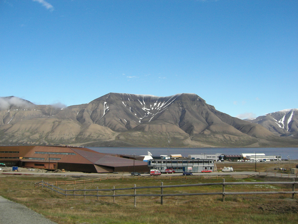
| Fig. 2 Close-up view of Longyearbyen |
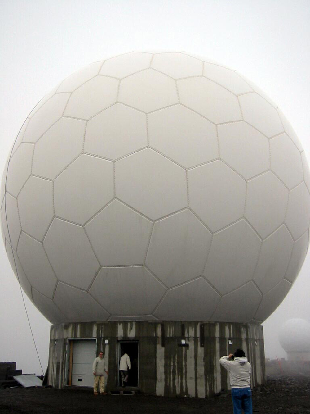
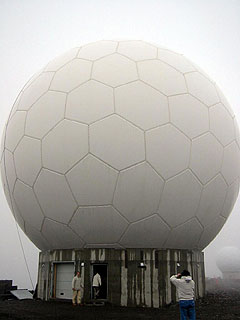
Figure 2 presents a close-up view of Longyearbyen on Spitsbergen Island. You can see some white domes and the Longyearbyen (Svalbard) domestic airport with regular flights to and from Tromsø, the largest town in the Arctic Circle, and Oslo, the capitol of Norway. These domes are the antennas for space communication. The football-shaped cover is called a radome and protects antennas from snow and wind. Longyearbyen has been in the spotlight recently as the northernmost space development town because this town is an excellent receiving station from general Earth-observation satellites due to its proximity to the North Pole. For example, a Japanese Earth station, Hatoyama in Saitama Prefecture in Japan, can receive the data of Daichi, the current Japanese Earth-observation satellite, only four times (total 30 minutes) a day, but Svalbard station can receive 14 times (total two hours) a day. (However, Daichi utilizes the Kodama, Japanese data relay satellite, instead of Svalbard and can receive a total of seven hours of data a day.) In addition to Longyearbyen, other towns include Ny-Ålesund (population 40, the Norwegian Polar Institute), Barentsburg (population 500, Russian coal-mining settlement and Russia has extraterritorial rights), and Sveagruva (population 200, Norwegian coal-mining settlement) on Spitsbergen Island, but no road connects these towns; ships or snow mobiles are needed.
 |
 |
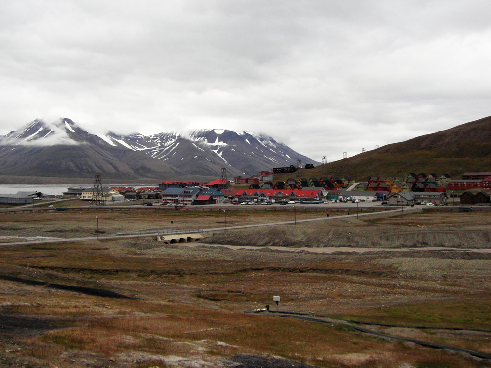
| Fig. 3 Longyearbyen (1) |
Fig. 4 Longyearbyen (2) |
 |
 |
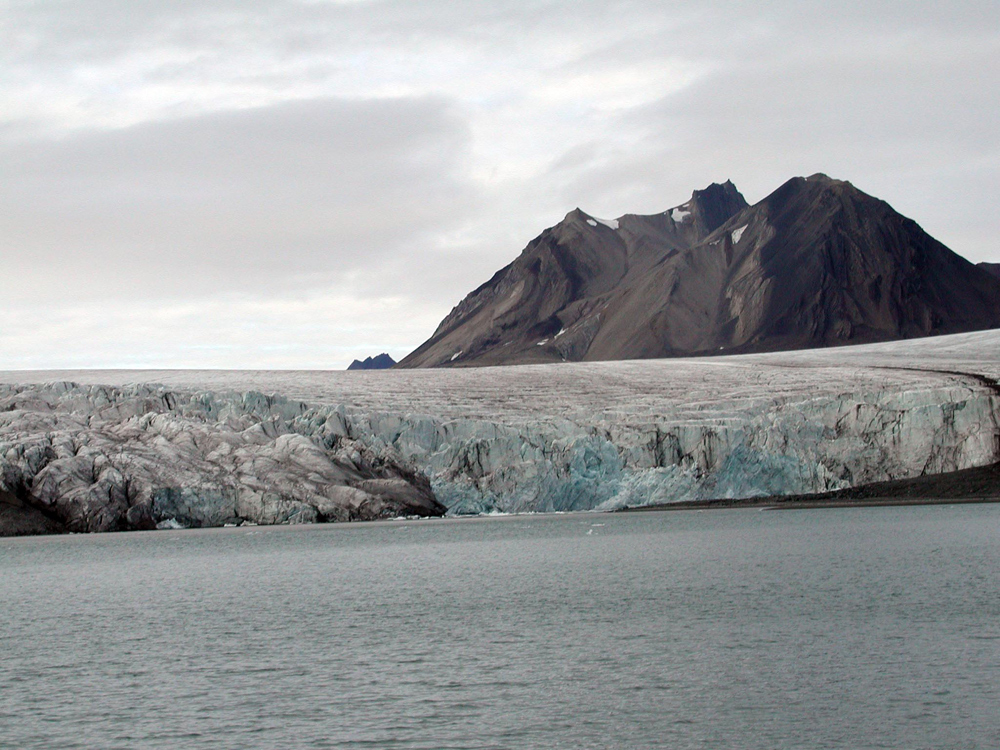
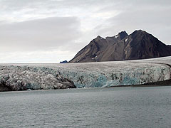
| Fig. 5 Glacier in Spitsbergen Island |
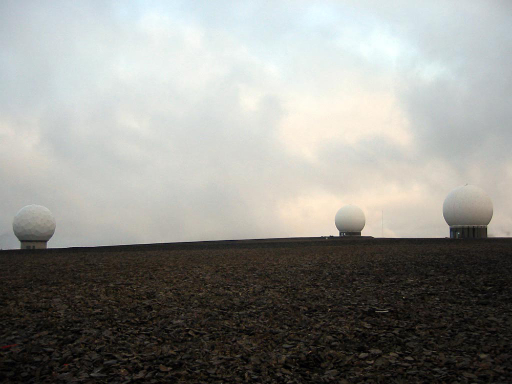
Fig. 6 Antennas for Space communication |
 |
 |
| Fig. 7 Radome |
Fig. 8 Longyearbyen (3) |
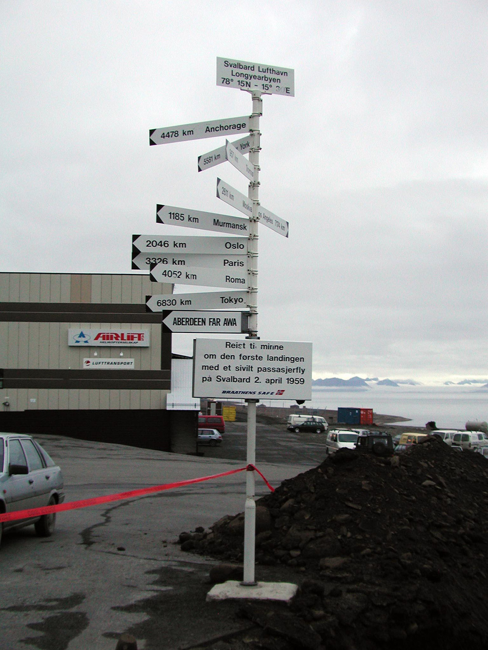
Photographs in Figs. 3 to 8 were taken by JAXA personnel who visited Svalbard and are planning to utilize a ground station there for Greenhouse Gases Observing Satellite "GOSAT" (to be launched next summer). Figures 3 and 4 are scenes of Longyearbyen where persons related to space development have come after the coal-mining town prospered. Figure 5 is a photograph of the Peterman Glacier flowing into the Barents Sea from Spitsbergen Island. Figures 6 and 7 are photographs of the radome, including the space communication antenna for GOSAT. The signs in Fig. 8 indicate that it is 6,830km to Tokyo and 2,046km to Oslo.
Explanation of the Images:
Figs. 1 and 2
AVNIR-2 has four observation bands. The composite image was produced by assigning red to Band 3 (610 to 690nm), green to Band 2 (520 to 600nm), and blue to Band 1 (420 to 500nm). The resulting image has natural coloring as if seen by the naked eye. The ground objects are distinguished by the following colors.
| Brown: |
Mountains, rocks or bare lands |
| Deep Blue,Blue: |
Sea |
| Grey: |
Town area or Glaciers |
| White: |
Glaciers or Snow |
| Black: |
Area with no data |
|
 |
|