| |
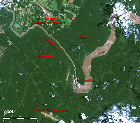 |
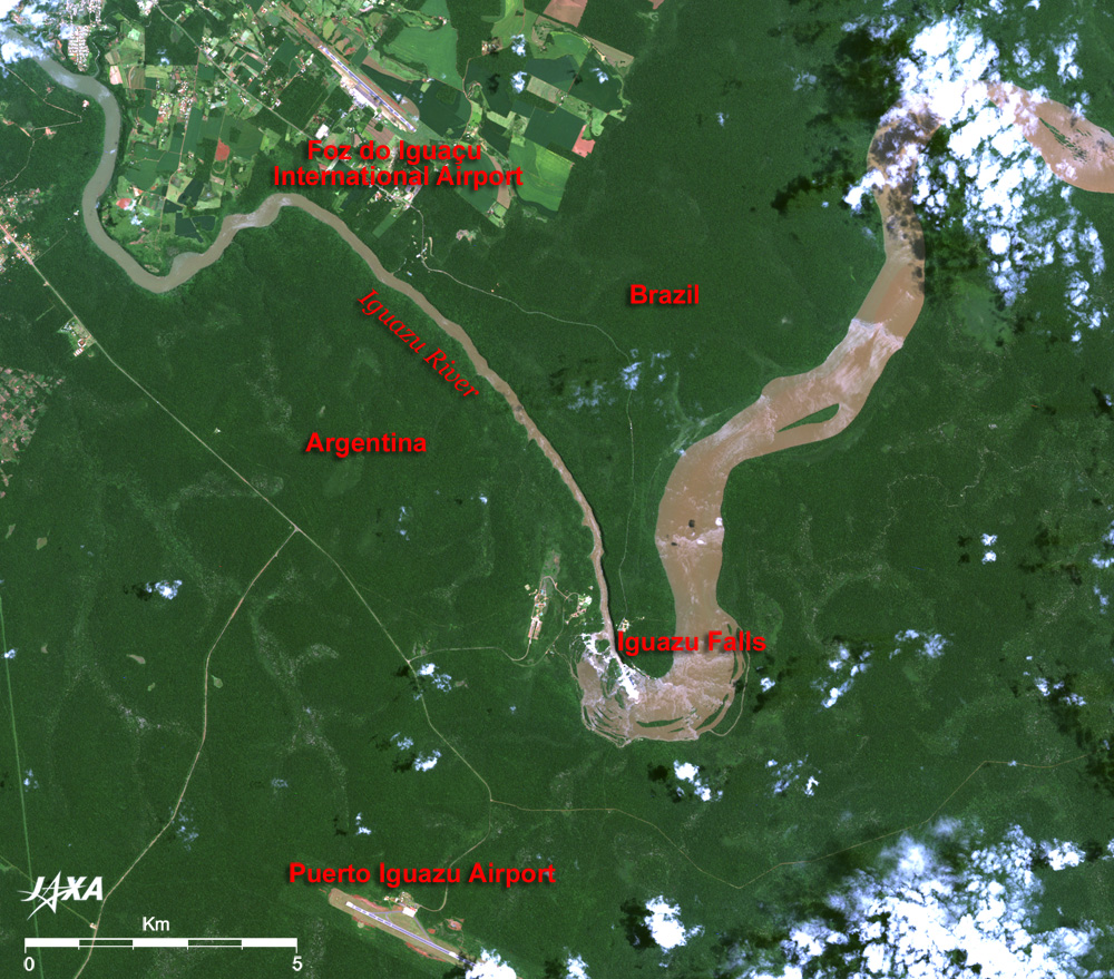
Fig.1 Iguazu Falls and its vicinity
Iguazu Falls (kmz,1.3MB,Low Resolution) is seen from Google Earth.
(Full image) |
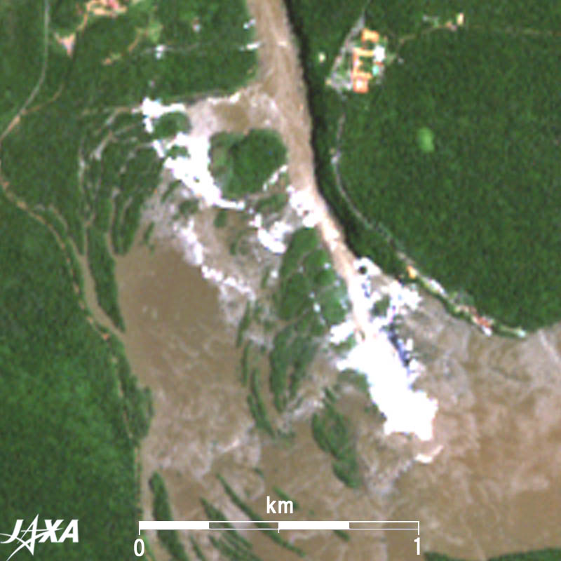
Figure 1 depicts the vicinity of Iguazu (Portuguese, Iguaçu; Spanish, Iguazú) Falls as observed by the Advanced Visible and Near Infrared Radiometer-2 (AVNIR-2) on board the Advanced Land Observing Satellite (ALOS) "Daichi" in January 2007. The Iguazu River flowing along the borders of Argentina and Brazil makes a big bend in the center of the figure. The white portion of the bend is Iguazu Falls. It is one of the world's three major waterfalls, along with Niagara Falls and Victoria Falls, and consists of many waterfalls along the 4km-long, 80m-high sheer cliff. The upstream (upper right) of the river is wide and muddied with red earth eroded by the river. The water runs high in January in the middle of the rainy season extending from November to February, and the waterfall looks particularly powerful.
Foz do Iguaçu International Airport in Brazil (upper part) and Puerto Iguazu Airport in Argentina (lower part) are visible in the figure.
Iguazu National Park is shared by two countries; Brazil occupies a 1,850km2 area, and Argentina occupies a 680km2 area. Most of the area in the figure looks dark green as Iguazu Falls is surrounded by subtropical rain forest. The clouds of spray rising from the waterfall basin pour into the surrounding area and have created a treasure-rich ecosystem of fauna and flora.
Iguazu Falls in Argentina was added to the list of the World Heritage sites of the United Nations Educational, Scientific and Cultural Organization (UNESCO) in 1984 and that in Brazil was added in 1986.
 |
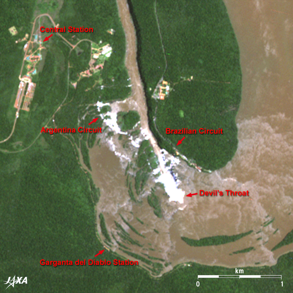
| Fig.2 Close-up Image of Iguazu Falls |
Iguazu means "Big Water" in the aboriginal language and expresses well the great waterfall system consisting of more than 270 waterfalls along the 4km-wide cliff. Visitors can enjoy waterfall trekking along the sidewalks around the waterfalls. The most impressive waterfall is the "Devil's Throat" located farthest upstream of the horseshoe-shaped cliff. It is observable from both Argentina and Brazil. An Argentina sightseeing tramcar runs from the central station to the Devil's Throat terminal station, and a sidewalk for viewing the waterfall extends from each station.
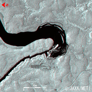 |
Fig.3 Three-Dimensional View of Iguazu Falls (North is to the left.)
(Staring at the image for a long time may cause eye-strain. A color print is available in pdf format. Pdf files for the left and right eyes are also available for stereoscopic viewing.) |
Figure 3 is a 3-D view centering on Iguazu Falls as observed by the Visible and Near Infrared Radiometer on board the Japanese Earth Resources Satellite-1 (JERS-1) "Fuyo-1" in July 1997. The leisurely flowing wide stream drops from the cliff of Iguazu Falls down into a narrow gorge.
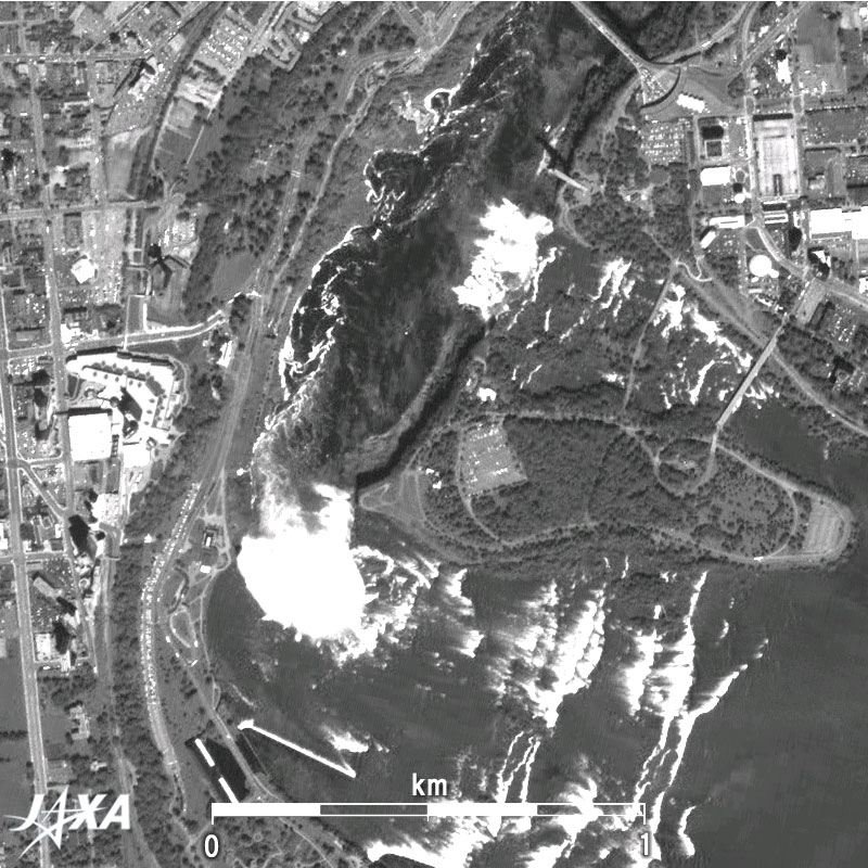
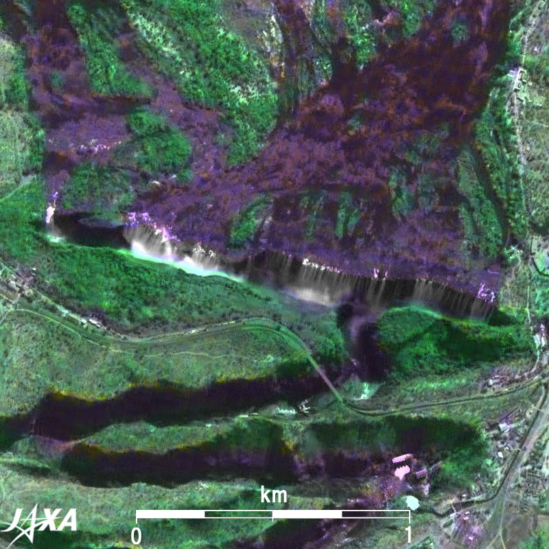
Figures 4 through 6 compare Niagara Falls, Victoria Falls, and Iguazu Falls in the same scale. While the Canadian Falls of Niagara, which is 56m high and 675m wide, is not as large as the other two, it is renowned for the average amount of water flow through the year, freezing falls in mid-winter, and one of the greatest sightseeing spots of the world. Victoria Falls is the largest among the three with its 1,700m-wide straight cliff and 105m vertical drop. Although the horseshoe shaped cliff is hidden behind the clouds of spray in Fig. 6, the 4km-wide Iguazu Falls with about 300 waterfalls of various sizes along the horseshoe shaped cliff is the largest of the three. Its 80m-high cliff is the second highest after Victoria Falls.
Explanation of the Images:
Figs. 1, 2, 6, and full image
AVNIR-2 has four observation bands. The composite images are usually produced by assigning red to Band 3 (610 to 690nm), green to Band 2 (520 to 600nm), and blue to Band 1 (420 to 500nm). The resulting image has natural coloring as if seen by the naked eye. Thus the ground objects are distinguished by the following colors.
| Deep green: |
Forests |
| Green or khaki: |
Grass fields, farms |
| Grey: |
City area or roads |
| Blue or Brown: |
Water surfaces |
| White: |
Cloud or waterfalls |
| Black: |
Area with no data |
Fig. 3
Figure 3 combines forward (red) and nadir (green and blue) images of VNIR. The left eye sees the forward image, and the right eye sees nadir image, which means the right side corresponds to the satellite flight direction (south) and left side corresponds to north. Note that upward is north in Figs. 1 and 2, but left is north in Fig. 3.
Fig. 4
Fig. 5
|
 |
|