Seen from Space 2007
Cape Town: Birthplace of the Republic of South Africa
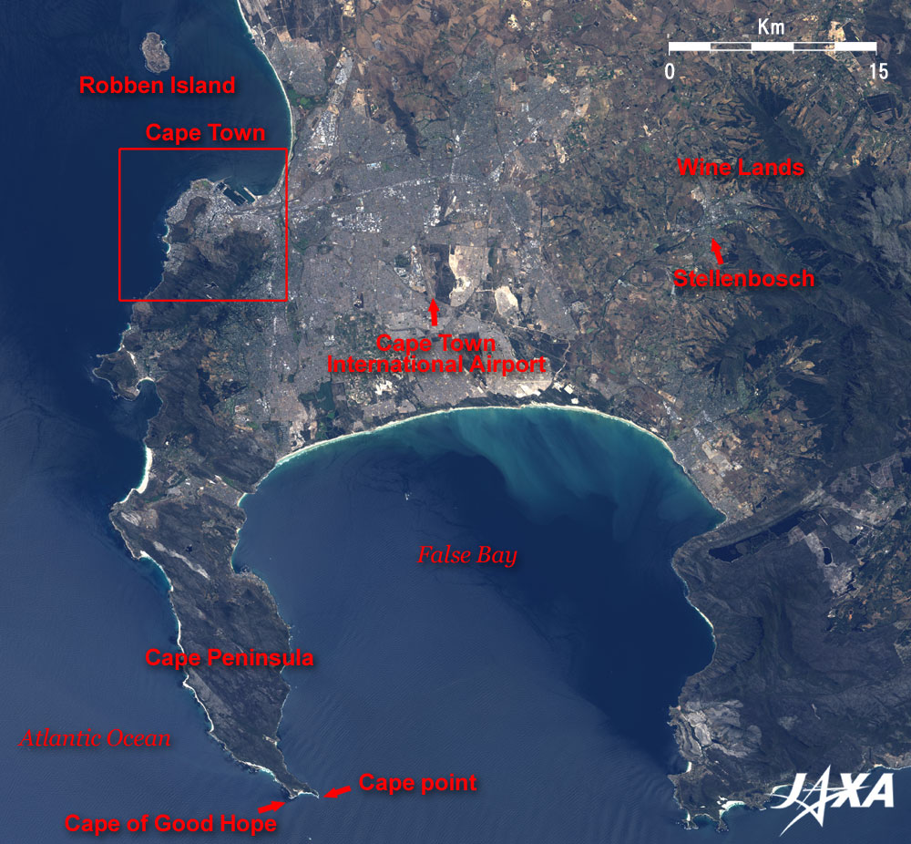
Cape Town is located at the northern end of Cape Peninsula, which curves and stretches toward the south. The Atlantic Ocean is on the left side of this peninsula; False Bay is on the right side. It is the dry season in December, and this image on the whole appears dark brown because of the dead vegetation. The " Cape Floral Region Protected Areas" located at the head of Cape Peninsula was added to the World Heritage list of the United Nations Educational, Scientific and Cultural Organization (UNESCO) in 2004. Cape Town is the second largest city next to Johannesburg in the Republic of South Africa that is located at the south end of the African Continent. Cape Town is the legislative capital of South Africa, where the National Parliament is located. Cape Town was originally established as a maritime replenishment station for the Dutch East India Company in 1652, and as the origin of this country, this city is also called the "Mother City." The Cape of Good Hope is located at the south end of Cape Peninsula and about 50km south of Cape Town. The Cape of Good Hope was once believed to be the southernmost point of the African Continent. However, as is obvious in this image, Cape Point is located slightly further south, and Cape Agulhas, which is located about 150km east-southeast of the Cape of Good Hope, is actually the southernmost tip of the African Continent. Cape Agulhas is the geographical parting line of the Atlantic and Indian Oceans; the western part is the Atlantic Ocean and the eastern part is the Indian Ocean. Oceanographically speaking, the confluence of the two ocean currents, the warm Agulhas Current of the Indian Ocean and the cold Benguela Current of the Atlantic Ocean, is located somewhere between Cape Point and Cape Agulhas and fluctuates considerably from time to time. The island located in the Atlantic about 12km north of Cape Town is Robben Island, where a special prison for black prisoners, mainly political prisoners, was located in the Apartheid era (1971-91). Mr. Nelson Rolihlahla Mandela was also imprisoned there. This prison became a museum in 1997 and the " Robben Island" was registered in the UNESCO World Heritage list in 1999. The Cape Town International Airport is about 15km east of Cape Town, and Stellenbosch, the second oldest town next to Cape Town, is located about 35km east and was established in 1659. The region around Stellenbosch has a Mediterranean climate and the soil is fertile; grapes for making wine were grown from the beginning of this town. Currently, there are many wineries in this region, and it is called Cape Winelands. The quality of South African wine has improved considerably in the last decade, and the Stellenbosch area is the center of wine production and is especially famous for its red wine.
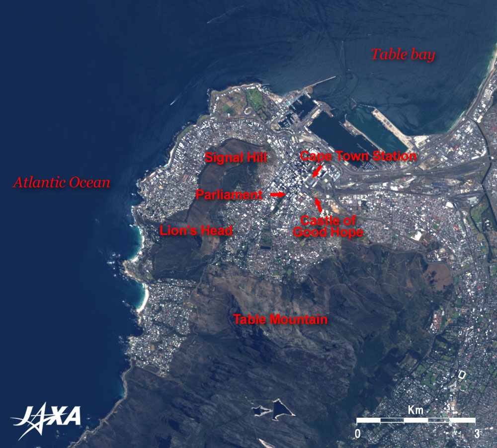
The Castle of Good Hope, a pentagonal fortification, lies to the south of the Cape Town railway station. This castle was built as a fortification for the governor of the Dutch East India Company and now houses the regional headquarters of the South African Army in the Western Cape. One side of the pentagonal wall is 175m long. The House of Parliament is also located nearby.
|