| |
 |
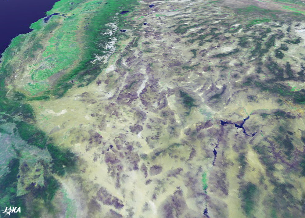
| Fig. 1 Satellite image "PilotView" (*) |
When viewing the Earth using satellite imagery, we can see many dynamic expressions that cannot be seen using a map. We also see large-scaled landform characteristics that cannot be photographed using the standard methods. The Earth seen from a distance of 700 to 800 kilometers using a satellite shows us just how unique it really is. At this time, we would like to explore the Earth by focusing on certain areas of this satellite imagery.
 |
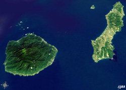 |
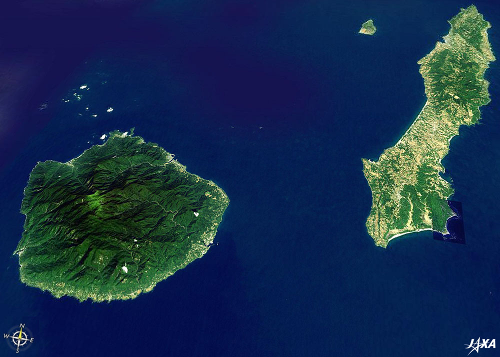
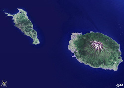
| Fig. 2a Rebun Is. and Rishiri Is. |
Fig. 2b Tanegashima Is. and Yakushima Is. |
First, let's look at the northern and southern ends of the long, thin Japanese islands. Figure 2a depicts Rebun Island on the left and Rishiri Island on the right, located on the northern tip of Hokkaido in the Sea of Japan. Figure 2b depicts Tanegashima Island on the right and Yakushima Island on the left, located south of Kagoshima Prefecture. It is interesting that these islands located separately on the northern and southern tips of Japan, consist of a similar combination of long, thin and flat islands and rugged round islands. On Rishiri Island, there is the Rishiri Fuji mountain that is 1,721 meters high, and Rebun Island has a continuous low ridge and Rebundake that is 490 meters high. Miyanouradake on Yakushima Island is 1,936 meters high, the highest mountain in Kyushu, while Tanegashima Island is a district with gentle hills with the highest point being 282 meters above sea level.
 |
 |
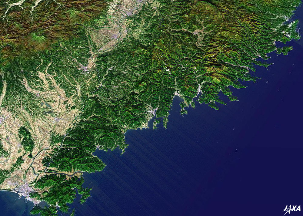
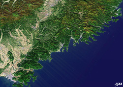
| Fig. 3a Rias coastline of Sanriku |
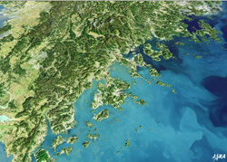
Fig. 3b Rias coastline south of Korea |
Next, let's look at the coastline of Japan and neighboring Korea. Figure 3a illustrates how the coastline of Sanriku stretches on the Pacific Ocean side of Iwate. Figure 3b depicts how the coastline spreads on the East China Sea side, south of Korea. The coastline of Rias is shaped by the rise and fall of the sea and from the sinking rugged landforms near the coast, causing the complex coastal forms in bays, capes and islands. As you can see from this image of the Rias coastline south of Korea, there are many islands, including Kojedo Island, Namheedo Island, Wando Island, and Chindo Island. In contrast, the Rias coastline of Sanriku has a continuous cape and bay, with almost no visible land. This is also an interesting difference.
 |
 |
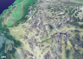 |
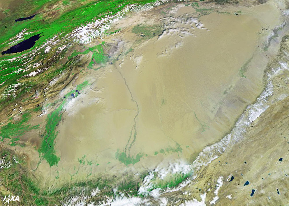
| Fig. 4a Taklimakan desert |
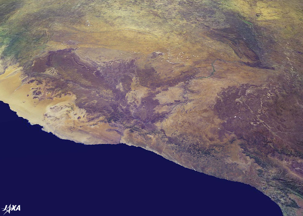
Fig. 4b Namib desert |
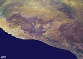
Fig. 4c Death Valley desert |
Finally, let's take a closer look at the deserts in China, Namibia, and the United States. Figure 4a depicts the world's second largest desert, the Taklimakan, spread across the Hsinchiang Uighur Autonomous Region in western China. It is a sandy desert located between the northern and southern routes of the old Silk Road. We can also see what appears to be a beautiful sand carpet spreading out to the oasis around the Hotan River. Figure 4b illustrates how the Namib desert in Namibia extends its spindly presence along the western coastline of southern Africa. This desert is said to be the oldest and most arid, and we can see red desert hills and many rocky outcrops. Figure 4c presents Death Valley desert, which is a salty desert expanse across parts of California and Nevada in the United States. This barren desert was formed by the deposition of salt in the soil, and we can see white areas here and there where the salt has been distributed. Although we call these areas deserts, each one of them has its own unique characteristics and a different harsh environment.
When we look at specific areas on the Earth, and compare places far and near, we can discover many unexpected similarities and differences. Looking at the Earth in its entirety, we can rediscover the fact that there are no national borders and that the Earth is one place for all of us to share. We sincerely hope that the various satellite images, including the images introduced in "Seen from Space," will attract the attention of many people throughout the world and lead to an increase in interest and understanding of our planet Earth.
(*) "PilotView" is a digital globe established and published by JAXA.
Currently, the system isn't supported nor provided.
|
Explanation of the images:
Fig. 2a-3b
Fig. 4a-4c
|
|
|