Seen from Space 2005
Green Carpet Surrounds Lake Chad; the Lake in the Sahara Desert
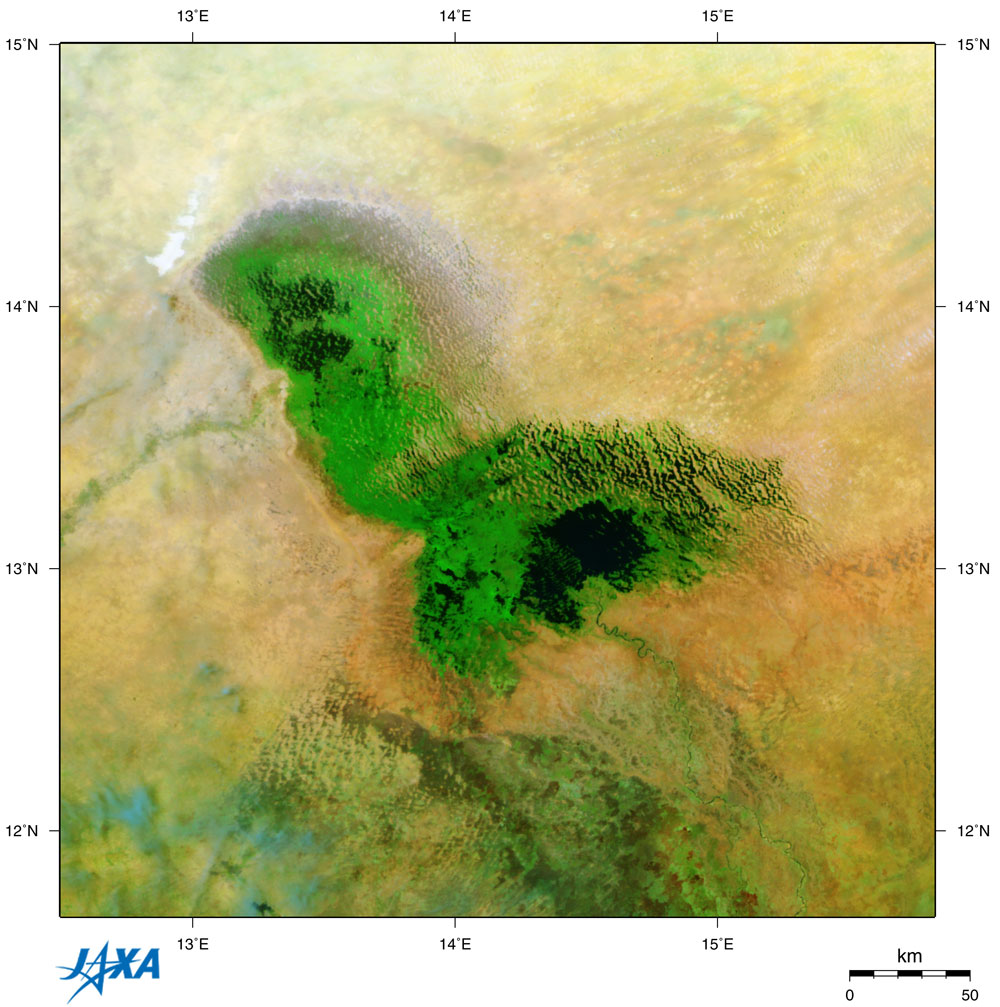
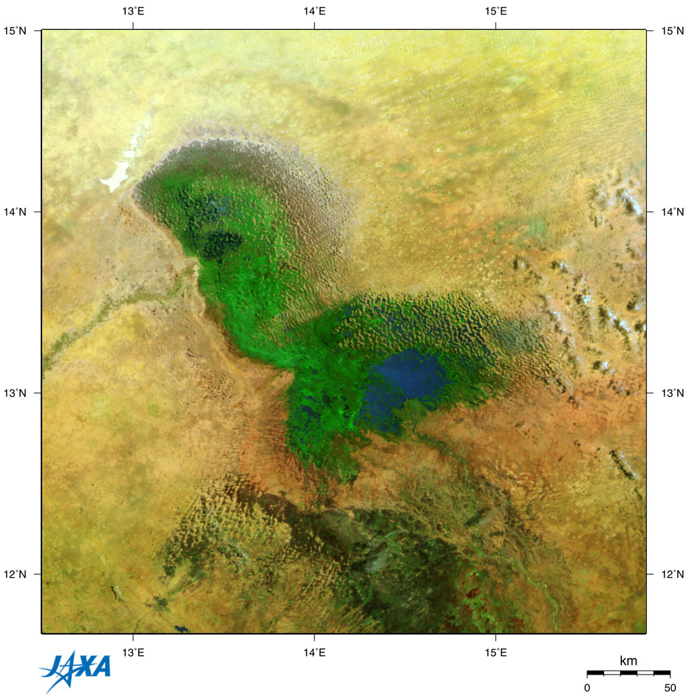
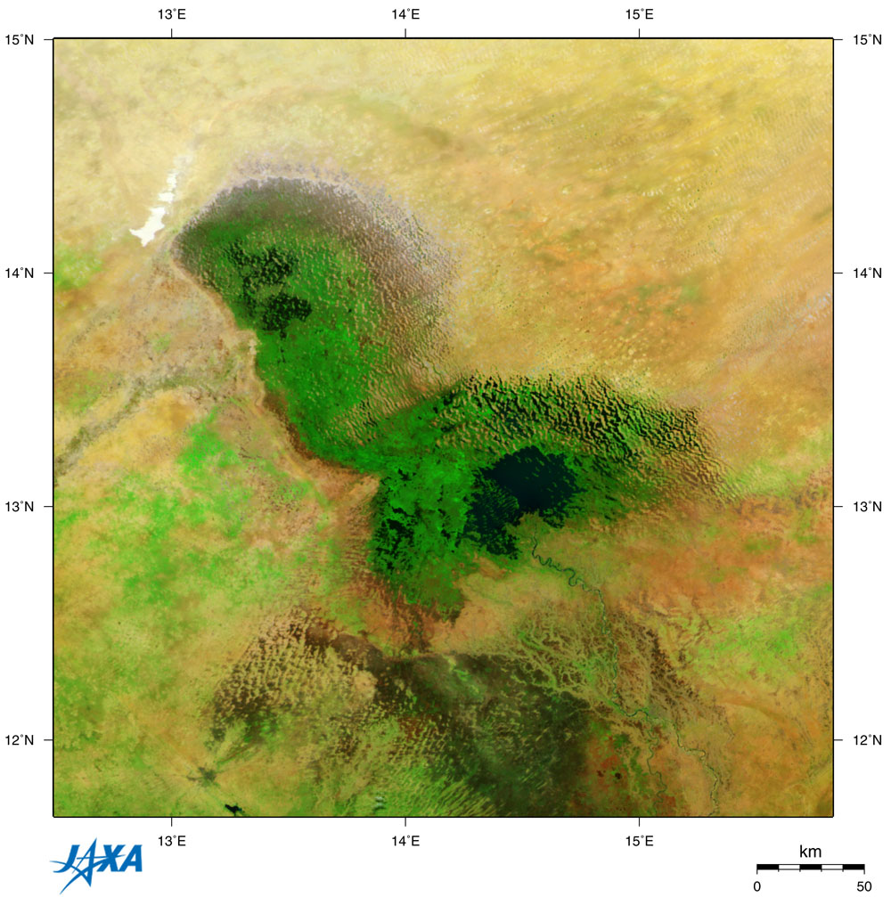
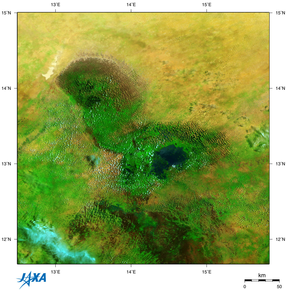
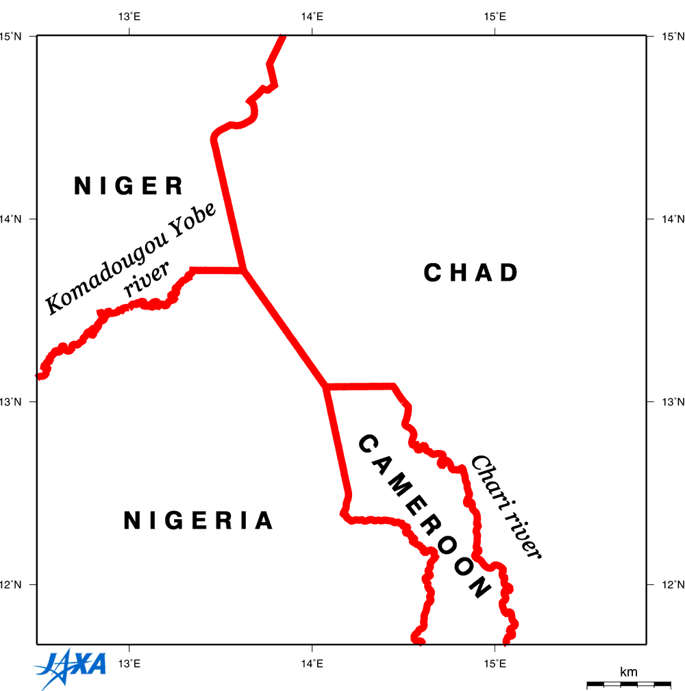
GLI captured a green carpet surrounding Lake Chad, located in central Africa and the southernmost end of the Sahara Desert. The rainy season lasts from June to September at Lake Chad. During the rainy season (Figs. 3 and. 4) the green vegetation becomes more vivid, and the coverage spreads extensively compared with the dry season (Figs. 1 and 2). In Figs. 1 to 4, green represents vegetation; black or deep blue is water surface; yellow, red, or pink is soil; and white or light blue denotes clouds. The main water surface in the present Lake Chad is only a part of the image's center (black or deep blue), there are also grasslands in the surrounding and northern areas, and marshes in the north. The green stripe extend ing from the southeast toward Lake Chad in each figure is vegetation around the Chari River , and the green stripe from the west to the marsh in Lake Chad is vegetation around the Komadougou Yobe River . You can see a detailed pleat-like structure on the north and northeast sides of Lake Chad , indicated by confused black and white colors. This is the remains of one of the innumerable dunes formed when Lake Chad dried up; hills dry up and look whitish, but valleys are still damp, and so have some vegetation and look blackish . Lake Chad is a freshwater lake extending over four countries ( Chad , Cameroon , Nigeria , and Niger ) and once boasted of being Africa 's fourth ranked lake surface area of approximately 25,000 square km ( early 1960s). However, at present the lake surface covers only 1,600 square km (still 2.4 times larger than Lake Biwa in Japan ) at the end of the dry season (Fig. 2), which means it shrank to one fifteenth of it's previous area. Since Lake Chad is located in the inland arid region, the water level changes on a large scale by season and year. Also, historically, since it is shallow, the lake surface area varies extensively with the change of the water level. Approximately 10,000 years ago, when the Sahara desert was damper than now, Lake Chad was as large as the present Bodele Depression and p oured into the Atlantic Ocean via the Benoue river from the southwest side. The lake's surface area was one million square kilometers, three times larger than the present Caspian Sea . Fossil analysis has proven that the water level changed greatly in 1,000 years, drying up six times. The water level dropped around 1908, and the lake was divided into two lakes. The water level rose in the early 1960s to a surface area of 25,000 square km. However, the amount of rain rapidly decreased in this region after the latter half of 1960s. Irrigation plans were advanced, and water from the Chari and other rivers poured into Lake Chad . The water level then rapidly decreased to the present level. References: (1) National Astronomical Observatory, Rika Nenpyo FY15 (Chronological Scientific Tables) Maruzen, 2002(Japanese only) (2) Lake Biwa Research Institute, Lakes of the World: Enlarged and revised edition. Jinbun Shoin, 2001 (Japanese only) (3)Science for a changing world(USGS)EARTHSHOTS: SATELLITE IMAGES OF ENVIRONMENTAL CHANGE
Related sites: Appendix: The oldest satellite image of Lake Chad: In 1957, the first artificial satellite in history was launched and subsequently took photographs of the Earth's surface from space. The 1963 image of "Science for a changing world (USGS)" is the oldest image of Lake Chad observed from space. Please refer to the following sites. Why Lake Chad is a freshwater lake: Lake Chad is considered a freshwater lake even though there is no river that flows out and it is located in the arid region, because the water of the Chari river (the main river feeding into Lake Chad) contains very little salinity, the vegetation growing in a vast marsh around the lake absorbs salinity, and 5 to 10% of the water oozing out from underground conducts salinity. Formation of Bodele Depression, including Lake Chad: The African continent is very old, having been formed by the breakup of Gondwana, a super continent, 180 to 90 million years ago. Gondwana existed 600 million years ago (around the end of the Pre-Cambrian). During the breakup, there were some pressures to the crust causing the African continent to bend. Around the Bodele Depression (the water basin of present Lake Chad), the Ahaggar Massif in the northwest, the Tibesti Massif in the north, the Enedi Massif in the east, the Massif de l'Adamoua in the south, and the Joss plateau in the southwest, upheaved, resulting in the Bodele Depression. |
|||||||||||||||||||||||||||||||||