Seen from Space 2004
Mysterious River Advances through Desert
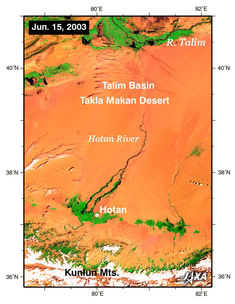
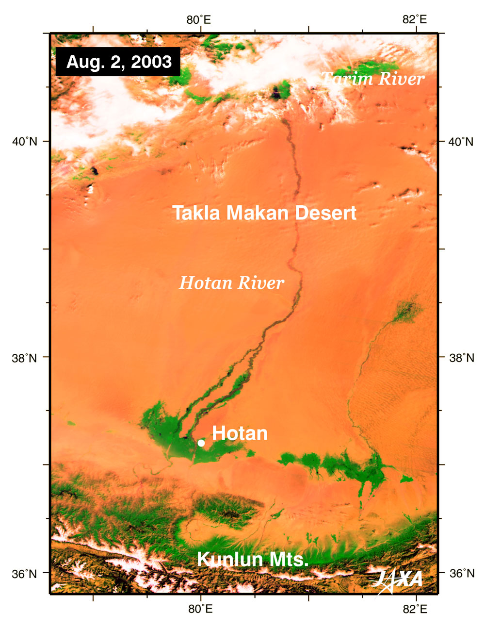
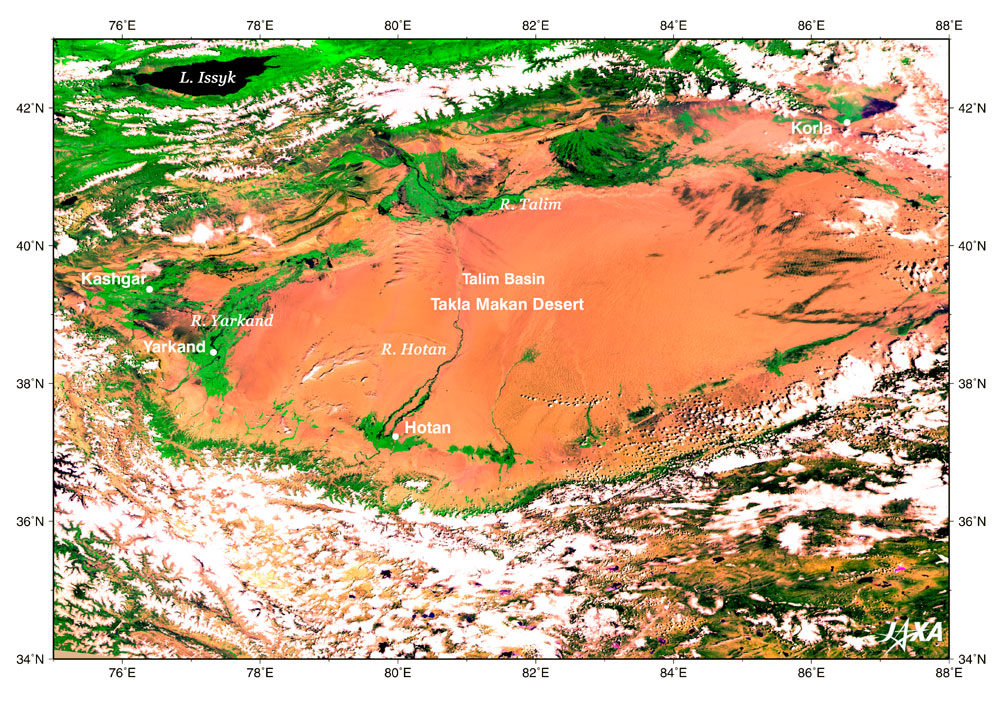
In the Sinking-Uighur Autonomous Region, an inland area of China, a mysterious river appears in the dry desert area only during the summer season and crosses the large desert for about three months. An underground stream that flows out of snow water of the Kunlun Mountains, which are covered by ice and snow, forms an oasis several scores of kilometers from the foot of the mountains. Several streams originating from that oasis thread deep canyons and flow toward the Tarim Basin until they become a large river called the Hotan River. Every June, the Hotan River's increased water volume causes it to advance slowly at the speed of a human walking through the Taklamakan Desert. It expands in the vast Tarim Basin and reaches the Tarim River flowing from the northern Tarim Basin in August. During this period, the river flows to the north more than 500 kilometers, crossing the Taklamakan Desert longitudinally. Figure 1 and 2 present images of the Hotan River acquired on June 15, 2003 (Aug. 2, 2003) by the Global Imager (GLI) on the global observation satellite "Midori II." These images are constructed using data of the near-infrared channel, which can detect plants. In these images, water areas are black; vegetation, green; and snow and clouds, white. Brown portions occupying most of the images correspond to bare land with no plants, such as deserts. These images reveal that the H otan River , which disappeared in the middle of the Taklamakan Desert on June 15, reached the Tarim River flowing through the northern part of the desert on Aug. 2. The snow on the Kunlun Mountains (white) has decreased considerably, and the green on the mountain foothills has expanded. The desert around Hotan, an oasis city on the route to the Hotan River, is dotted with green belts. The South Road of the Western Region, a trade road used from ancient ages, constitutes a section of the Silk Road while connecting these oases.
Related sites: |
|||||||||||||||||