Seen from Space 2004
Version upgrade and new release of AMSR-E geophysical products
|
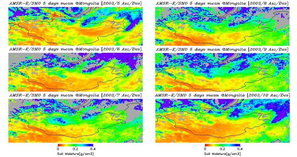
JAXA has started releasing version-upgrades and several new geophysical products of AMSR-E operating on the Aqua satellite from March 12, 2004. New geophysical products include soil moisture, snow depth, and integrated cloud liquid water. This is the first time for us to release AMSR and AMSR-E soil moisture (*1) products. The amount of soil moisture affects evaporation from land surfaces and controls heat and water fluxes into the atmosphere. Although observing the soil moisture plays an important role in improving the process model for global climate change prediction and in providing useful information to regional agricultural production management, wide-area and quantitative measurement have been difficult. Figure 1 (*2) illustrates the seasonal change of the AMSR-E soil moisture around the Mongolian plateau from May to October 2003. Colors changing from blue to red indicate increasing soil moisture content.
Since in-situ measurements of soil moisture for validating satellite observations are still scarce, field measurements (*3) of weather and hydrological parameters including soil moisture are now being performed through cooperation between the World Climate Research Program (WCRP), JAXA, and the Institute of Meteorology and Hydrology (IMH) of Mongolia, as a part of the Coordinated Enhanced Observing Period (CEOP). This field measurement consists of continuous monitoring at several stations and multipoint moving observations to obtain area information during the predetermined Intensive Observing Periods (IOP). Since the surface condition of the Mongolian plateau is relatively uniform for wide areas, better comparison of the coarse resolution data by AMSR-E with the in-situ measurements is possible. This was the major reason for selecting the Mongolian plateau. The AMSR-E soil moisture estimates are validated by using the in-situ data obtained by this field measurement.
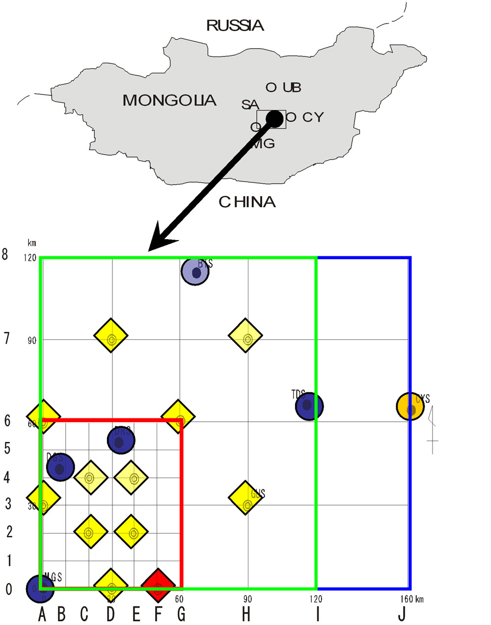
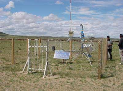
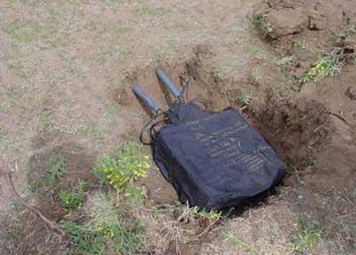
Figure 2 depicts the deployed locations of the Auto Weather Station (AWS) and the Automatic Station for Soil Hydrology (ASSH) in Mongolia. Deployed conditions of AWS and ASSH are illustrated in Fig. 3. During the IOPs, strenuous efforts were made to obtain the wide-area in-situ measurements by driving along the trackless paths using 4x4 cars. You can find more detailed information about the field measurement in the Mongolian plateau at the following website. For general information including product description and contact point, please visit the websites below. Related web page -- Soil moisture observation from satellites now practical -- (*1) Weight of liquid water in unit volume of soil (*2) Visualized by using AMSR-E soil moisture product (retrieval algorithm was developed by Professor Toshio Koike at the University of Tokyo). Each image is generated by averaging five days data at the beginning of a month. (*3)Principal investigator is Professor Ichirow Kaihotsu at the Hiroshima University. |