Seen from Space 2004
Soil Moisture Maps of Mongol Plateau
--Soil Moisture Observation from Satellites Now Practical--
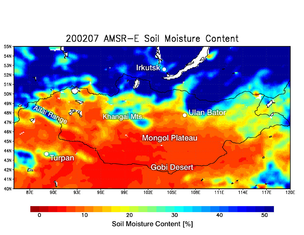
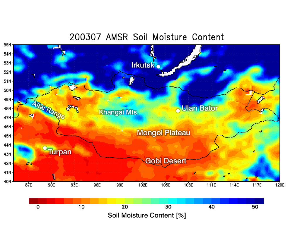
AMSR and AMSR-E have observed soil moisture (*1) extensively and quantitatively, an accomplishment that has been difficult until now (*2). Image 1 is a soil moisture map of Mongol Plateau acquired in July 2002 by AMSR-E; Image 2 is a soil moisture map acquired in July 2003 by AMSR. Red indicates little soil moisture and blue indicates much soil moisture. Comparing Images 1 and 2, we can see that the soil moisture of Mongol Plateau in 2003 exceeds that of 2002. The blue area above Mongolia is forest land in Siberia. According to reports from the scene, the winter of 2002 had more snow than the winter of 2003, and there was more rain than usual, which is consistent with the results from AMSR and AMSR-E data. Soil moisture plays an important role in regional agriculture management as well as in improvement of models to predict global climates. The AMSR/AMSR-E soil moisture product will also contribute to grazing and cultivation in Mongolia.
(*1) The percentage of volume of water included in soil per unit. The percentage of water at the saturation point, where soil cannot absorb any more water, is about 50%. (*2) AMSR has a 2-meter-diameter mirror, which is the biggest of all radiometers (AMSR-E has a 1.6-meter mirror). Both AMSR and AMSR-E have low-frequency channels at 6.9 GHz that can observe soil moisture, with acceptable spatial resolution of 40km×70km for AMSR and 43km×75km for AMSR-E. |