Seen from Space 2004
Coming of Pack Ice Season
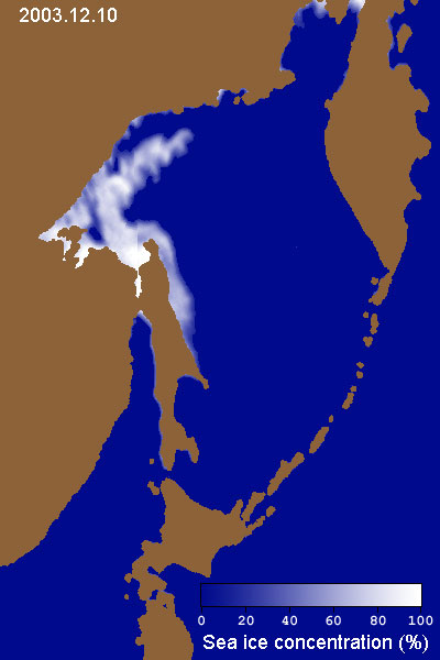
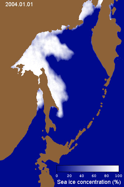
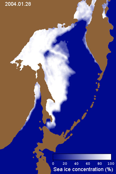
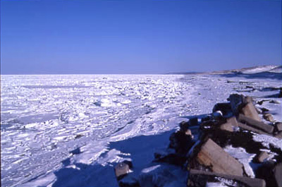
On January 28, pack ice came alongside the pier in Esashi-cho, a town on the coast of the Sea of Okhotsk in Hokkaido. In November of 2003, the north portion of the Sea of Okhotsk began to freeze, and the frozen area gradually extended south. AMSR-E Images 1, 2, and 3 illustrate this process. Also, we can see that half of the Sea of Okhotsk was already covered with pack ice on January 28 (Image 3).
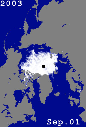
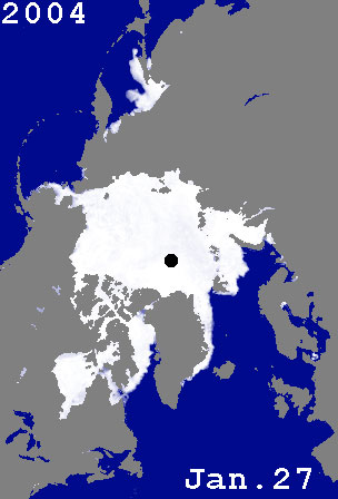
AMSR-E Images 4 and 5 depict the sea-ice distribution in the northern hemisphere, observed from above the North Pole, on September 1, 2003, and January 27, 2004. (The black circle in the center of the image is an area that AMSR-E cannot observe.) Image 4 reveals perennial ice, or sea ice that remains frozen during summer. In the northern hemisphere, the area of perennial ice is shrinking during the summer; researchers are investigating the connection to global warming. The Sea of Okhotsk is a typical sea area, making sea ice every year, despite its low latitudes. It is surrounded by continents and islands, and much freshwater pours into the area from the River Amur running through Siberia. It has a typical layer structure, with the salt level suddenly changing between the sea surface and deep layers. It is thought that this structure has some relationship with the forming of sea ice. We update the pack-ice distribution in the Sea of Okhotsk daily in the "Pack-Ice Flash Report." In addition to AMSR-E images, we have included NASA MODIS images from January 29. Previous topics about sea ice and ice pack |
||||||||||||||||||||||||||||