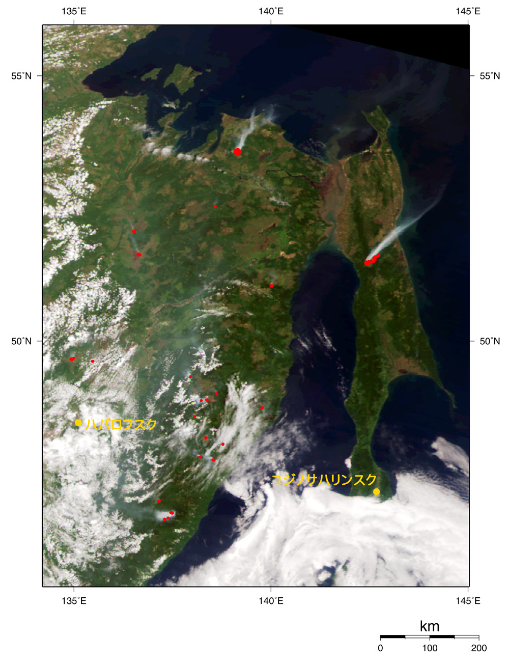
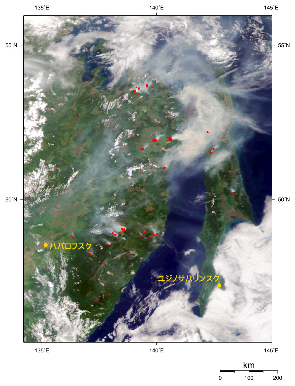
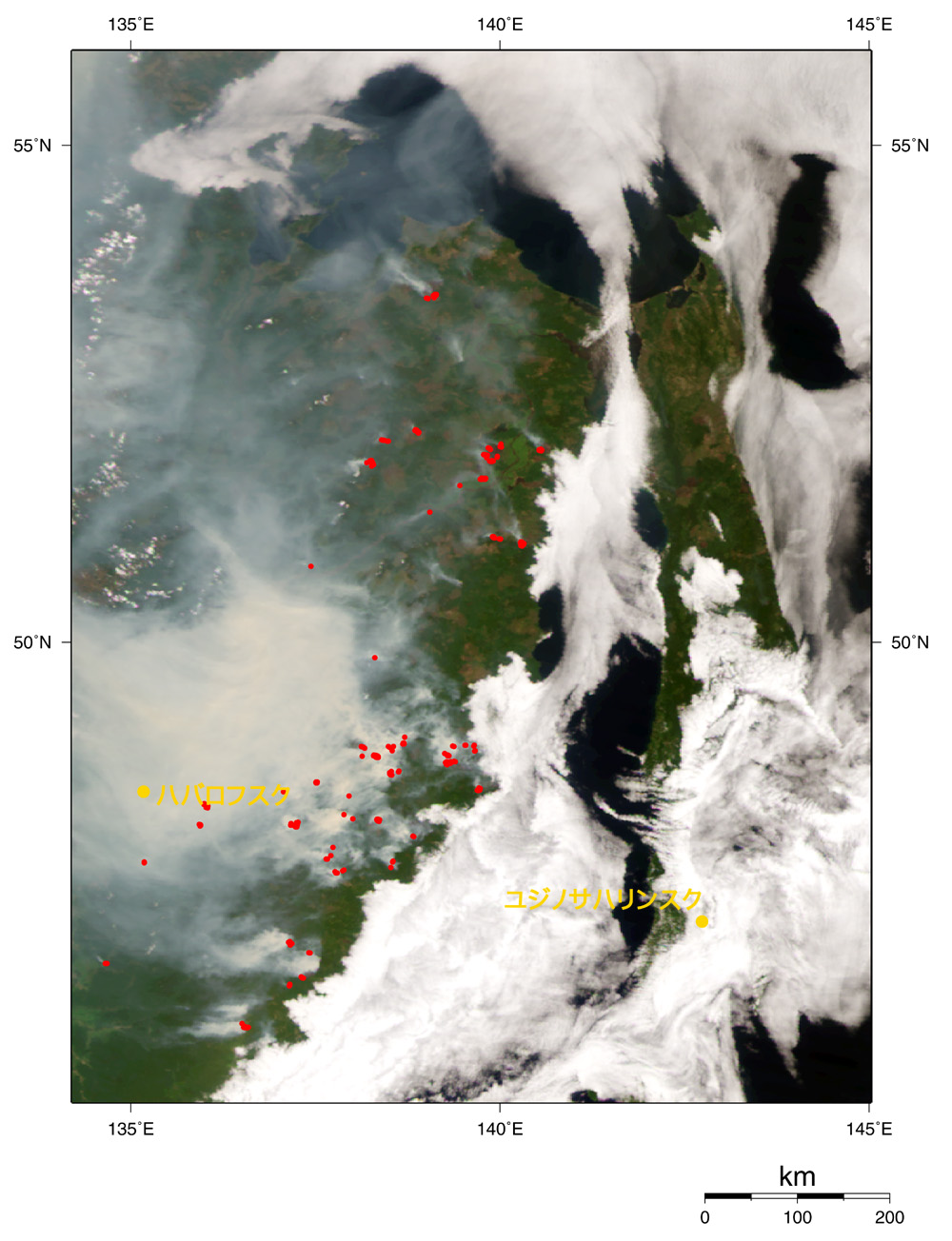
Forest fires in Sakhalin, Khabarovsk, and Primorskii in eastern Siberia are spreading rapidly. Red dots, which indicate burning spots, increased on July 17 and 26 compared to the image on July 1, and gray smoke is gradually growing darker. The white over the sea indicates mist.
According to a local report, 80 forest fires have already been registered in Sakhalin alone, and the affected area has approached twenty thousand hectares since the beginning of this year. Three hundred people have worked to extinguish the fires for over a month without a day off, but they have made little progress because of the lack of bulldozers, helicopters, and fuel. In the Amur area, wild animals such as brown bears, black bears, and tigers are leaving the forests for residential districts to escape from the fire and influence civil life by foraging in city garbage heaps.
The latest report of the Russian Emergencies Ministry states that over two million hectares, 1.1 times as big as Shikoku, have burned throughout Russia this year and the forest conflagrations are still increasing in spite of the efforts of seven thousand fire fighters.
Most of this area is composed of taiga. In spite of annual forest fires, they cannot implement fire-prevention measures due to the severely restricted budget since the disintegration of Soviet Union in 1991. Furthermore, they cut down the forest to acquire foreign currency, which increases deforestation.
 See the related articles See the related articles
|