Recent 3-day recurrent period × 4-way operation patterns:
(3-day) limited calibration and validation site
(3-day) sun glint, calibration and validation site, RA target observations
(3-day) sun glint and limited calibration and validation site
(3-day) sun glint, calibration and validation site, RA target observations
Glint Observation Operation
Since Aug. 2, 2010
The image motion compensation is enabled during glint observation.
Before May 6, 2013
As the glint areas change with the direction of the earth's axis, glint observation points were planned at different seasons (every two months), by calculating the satellite positions from which the specular points can be observed.
Since May 6, 2013
In order to extend the area of glint observation, glint observation points are determined with the summer and the winter geometries where the inclination of the earth's axis towards the sun becomes maximum, and are fixed throughout the year. The latitude range for glint observation was further extended three times in increments of 3 degrees on Sep. 10, 2014, Jun. 2, 2015, and Jan. 5, 2016 (, by not only tracking the exact specular points but also tracking along the principal plane of the specular reflection).
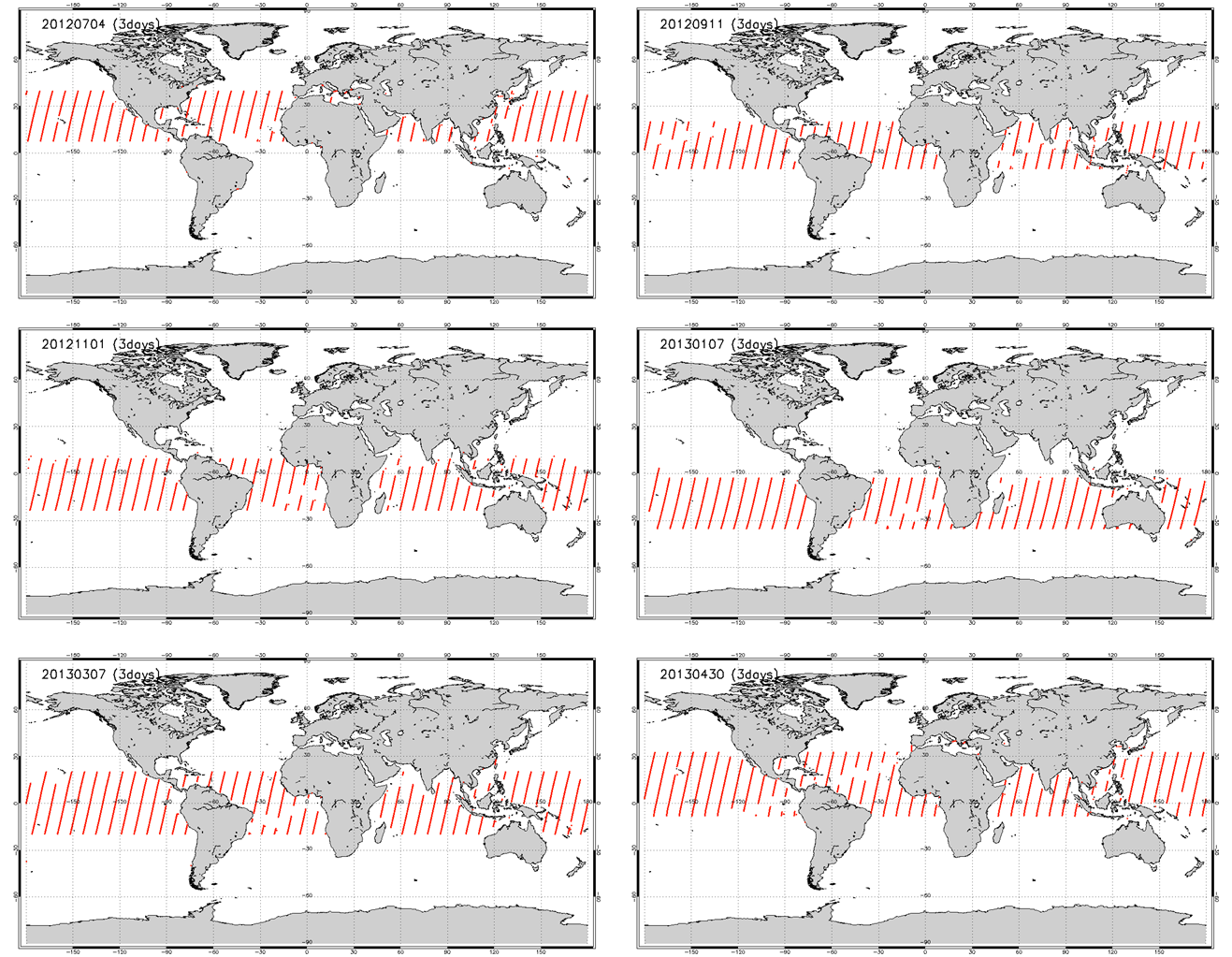 Example of 3-day glint observation points before May 6, 2013. Different glint observation plans were used for different seasons.
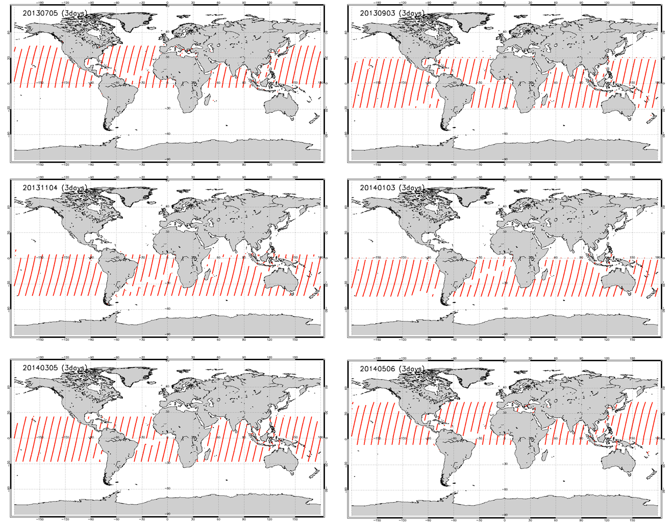 Example of 3-day glint observation points after May 6, 2013. A common glint observation plan was used throughout the year.
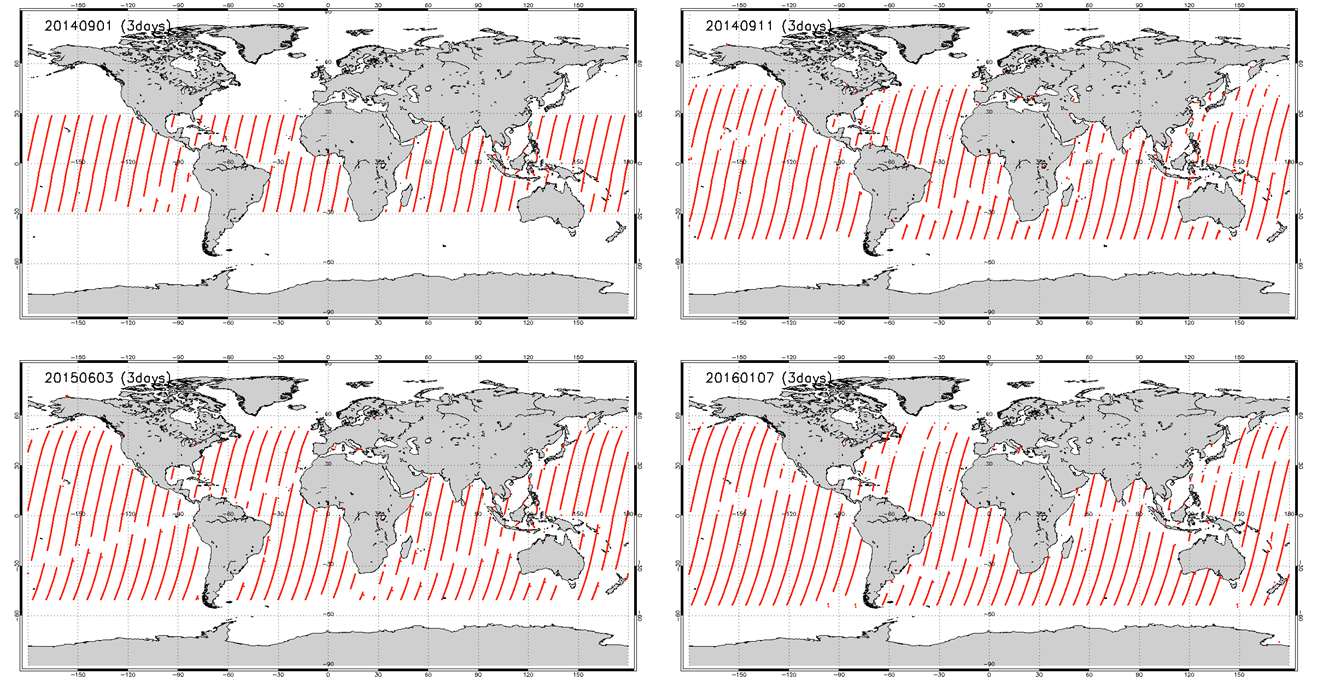 Incremental extension of the glint observation coverage. Each map shows an example of 3-day glint observation points for different latitude limits; upper-left: before extensions, upper-right: after 1st extension on Sep. 10, 2014, lower-left: after 2nd extension on Jun. 2, 2015, lower-right: after 3rd extension on Jan. 5, 2016.