AMSR Data Catalog: Cryosphere
Advanced Microwave Scanning Radiomter AMSR Series
  • Sea Ice Concentration
  • High-resolution Sea Ice Concentration
  • Detection of Thin Sea Ice
  • Sea Ice Motion Vector
  • Sea Ice Thickness
    (< 20cm)
  • Sea Ice Thickness
    (>= 20cm)
  • Data Catalog
  • Cryosphere
  • Sea Ice Concentration

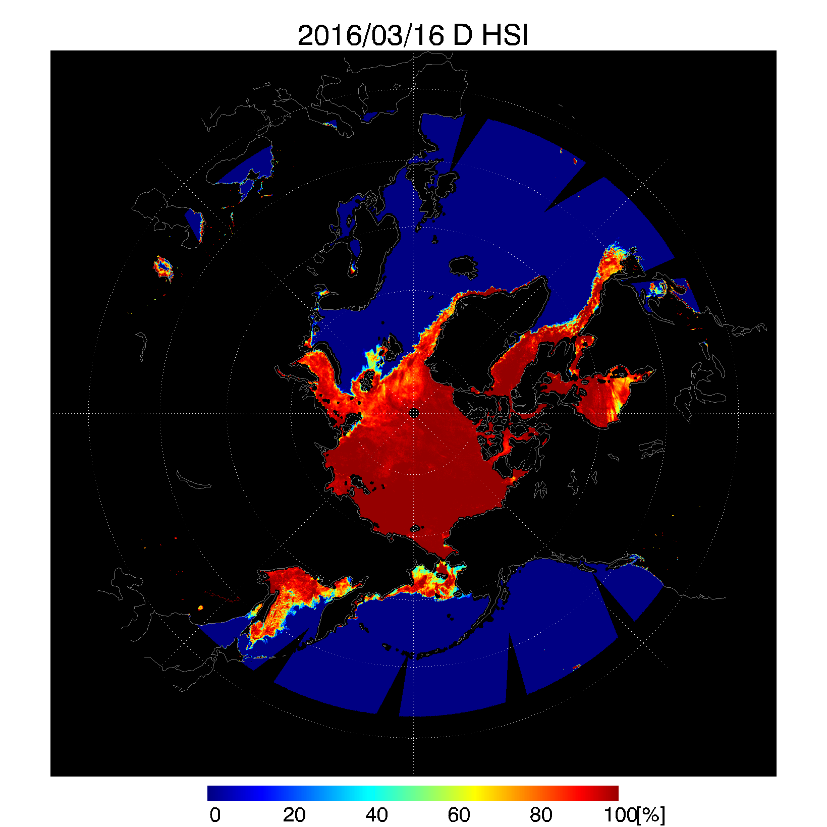
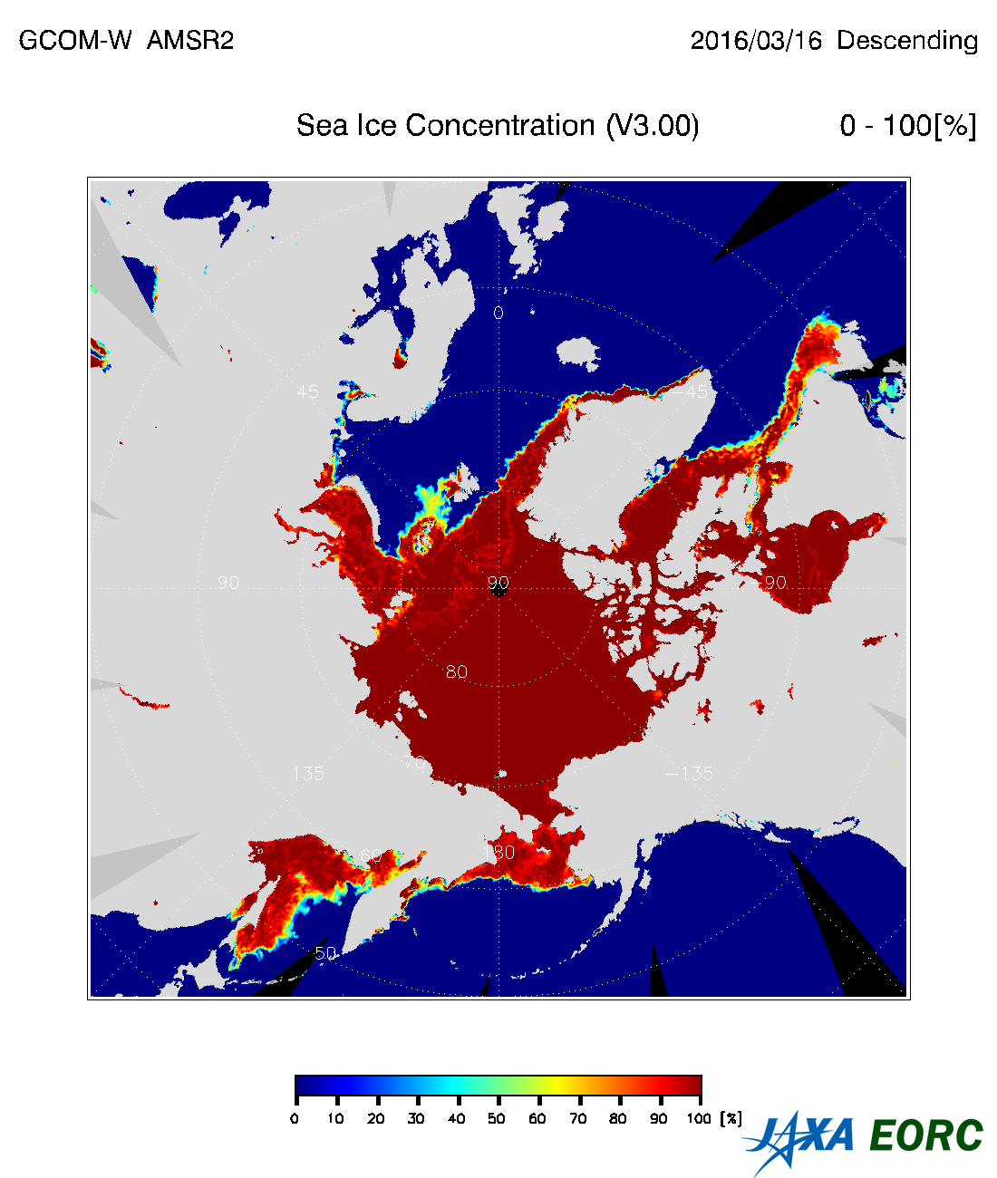
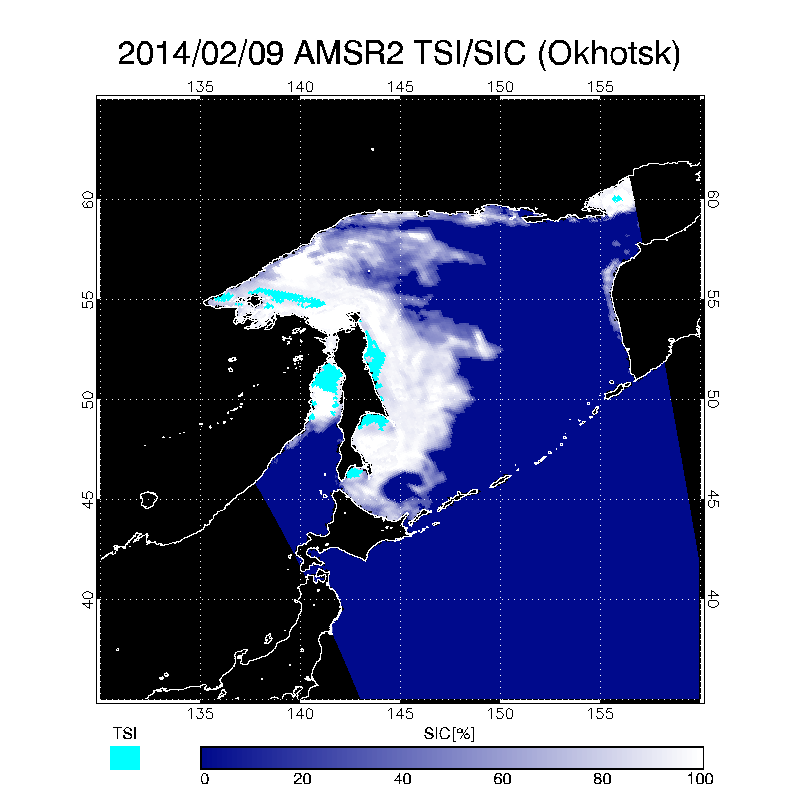
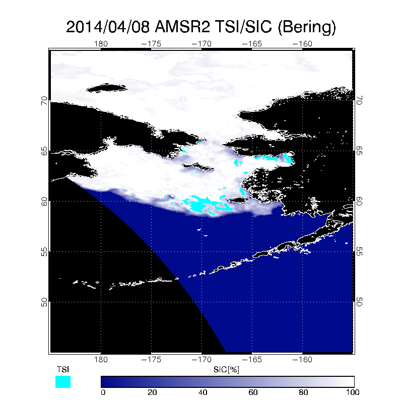
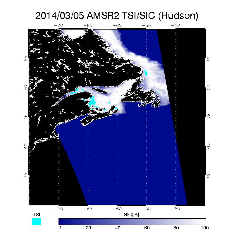
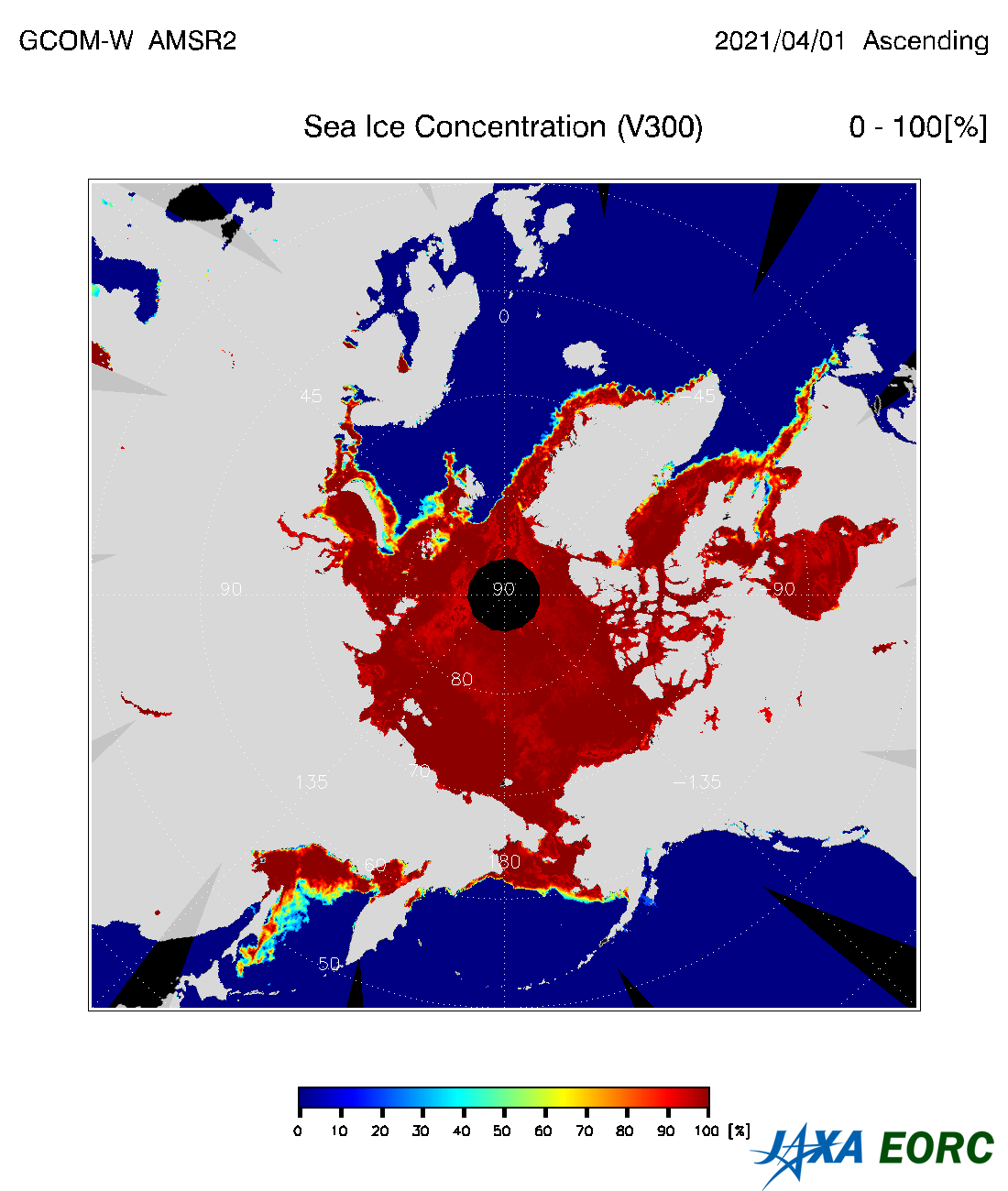
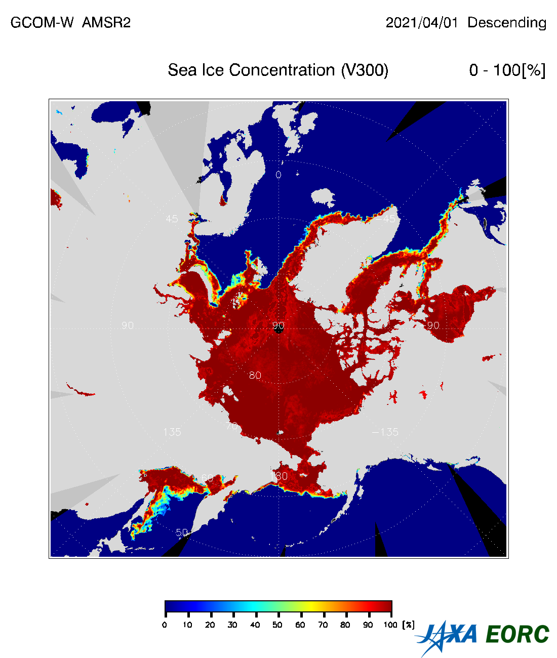
Sea Ice Concentration
(Standard Product)

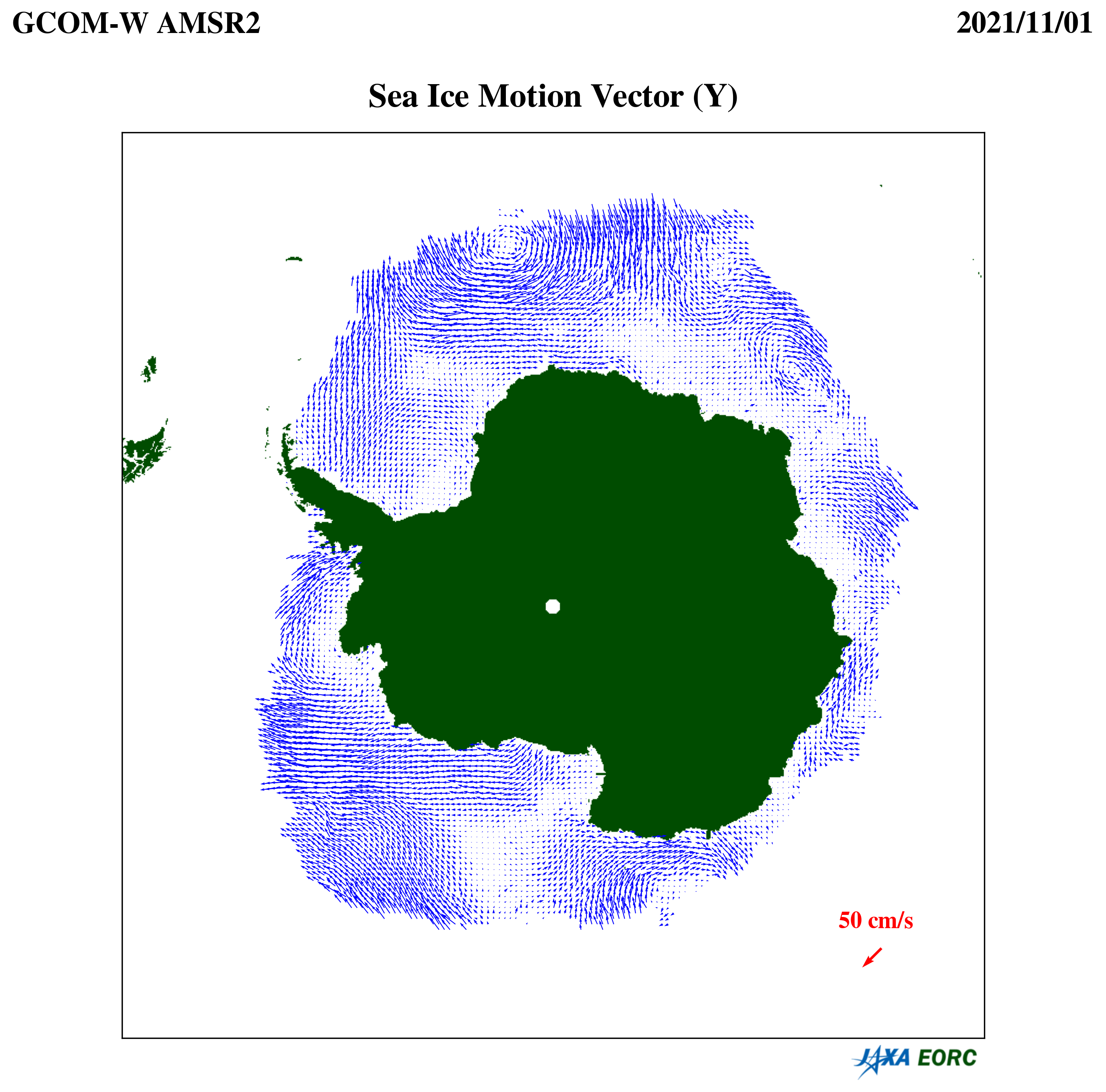
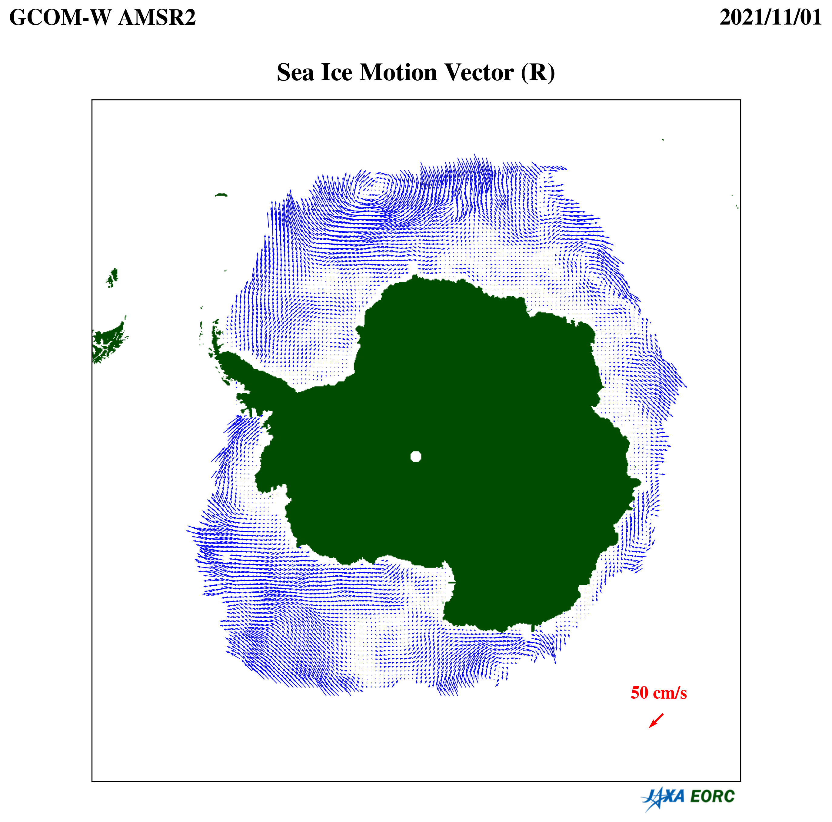
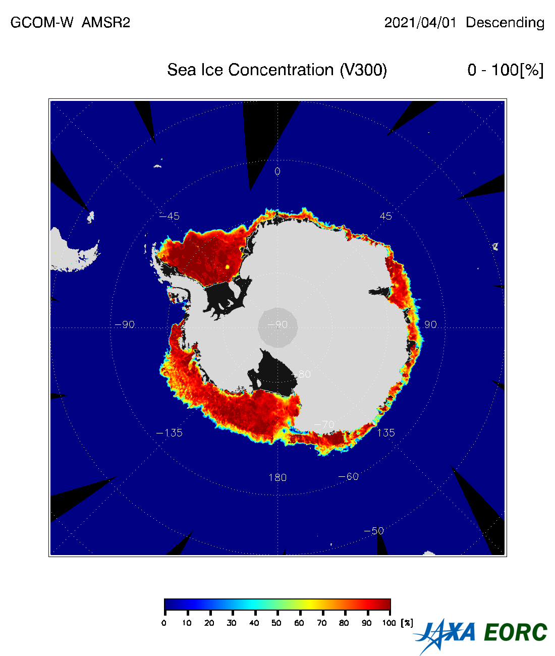
Sea Ice Concentration (SIC) product stores percentage of sea ice coverage within target ocean area. 
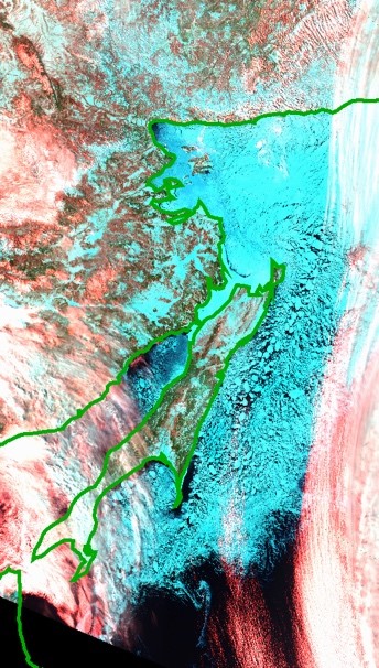
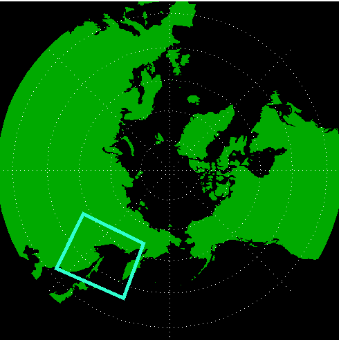
Coverage of the product is over the ocean around Arctic and Antarctic Sea, and unit is [%]. There is no sea ice within pixel area when sea ice concentration is 0%, and all pixel area is covered by sea ice when it shows 100%. We can learn distribution of sea ice immediately using this product, and it become more and more important because of recent decrease of Arctic sea ice cover.
  • Arctic

    Arctic

    April 1, 2021 Ascending

  • Arctic

    Arctic

    April 1, 2021 Descending

  • Antarctic

    Antarctica

    April 1, 2021 Ascending

  • Antarctic

    Antarctica

    April 1, 2021 Descending

Product Overview

Product Overview

Product Name Sea Ice Concentration
Product Type Standard Product
Processing Level L2 (Swath data *2) and L3 (Grid data: Polar stereo NH/SH)
Product ID SIC
Spec.*1 Area Polar region over ocean
Spatial Resolution approx. 15 km
Accuracy Requirement ±10 %*3
Range 0 〜 100 %
Latest Version AMSR2: ver. 3.0
2017-03-01 release

AMSR-E: ver.8
2019-07-05 release
Product Period AMSR2: July 2012 〜
AMSR-E: July 2002 〜 October 2011
Data Download Globe Portal System (G-Portal)
Data Format HDF5 AMSR2 Higher Level Format
2.7MB
Stored Data Sea Ice Concentration [%]
Data Quality Flag L2 SIC Quality Flag
250KB
Algorithm Version v3.0 (Algorithm Description,
3.9MB PDF page 58
)
Validation Result AMSR2 Products Update
1.5MB PDF page 9
  1. The specifications are defined in the AMSR2 Mission Requirement. The required accuracy is the standard accuracy of standard product defined in the mission requirement.
  2. Swath data is a format in which data for each footprint is stored in a two-dimensional array (observation points in scanning direction x number of scanning lines) in order of observation time.
  3. Accuracy is expressed in absolute value of sea ice concentration (%).
Reference

Reference

Comiso, J., Sea ice microwave emissivities from satellite passive microwave and infrared observations, Journal of Geophysical Research, 1983, doi: 10.1029/JC088iC12p07686
Comiso, J.C., D. Cavalieri, C. Parkinson, and P. Gloersen,, Passive microwave algorithms for sea ice concentration: A comparison of two techniques, Remote Sensing of the Env., 1997, doi: 10.1016/S0034-4257(96)00220-9
Comiso, J. C. and F. Nishio, Trends in the sea ice cover using enhanced and compatible AMSR-E, SSM/I, and SMMR data, Journal of Geophysical Research, 2008, doi: 10.1029/2007JC004257
Revision History

Revision History

July 5, 2019
AMSR-E Standard Product SIC ver. 8 release (HDF5 AMSR2 Higher Level Format)
Reprocessing by applying the AMSR2 algorithm
Extention of swath width from 196 points to 243 points
Compliant with AMSR2 HDF5 format
March 1, 2017
AMSR2 Standard Product SIC ver. 3.0
AMSR2 Products Update
1.5MB PDF page 9
Back Number
▸
March 26, 2015
AMSR2 Standard Product SIC ver. 2.0/2.1
AMSR2 L2 Product
12MB PDF page 31
July 9, 2013
AMSR2 Standard Product SIC ver. 1.0
AMSR2 L2 Product
3.7MB PDF page 19
September 29, 2011
AMSR-E Standard Product SIC ver. 7 release
March 12, 2007
AMSR-E Standard Product SIC ver. 5 release
March 15, 2006
AMSR-E Standard Product SIC ver. 4 release
March 1, 2005
AMSR-E Standard Product SIC ver. 3 release
September 19, 2003
AMSR-E Standard Product SIC ver. 1 release
  • Data Catalog
  • Cryosphere
  • High-resolution Sea Ice Concentration

High-resolution Sea Ice Concentration
(Research Product)

High-resolution Sea Ice Concentration (HSI) product stores percentage of sea ice coverage within target ocean area. Its unit is [%]. There is no sea ice within pixel area when sea ice concentration is 0%, and all pixel area is covered by sea ice when it shows 100%.
Feasure of HSI
Sea Ice Concentration product as AMSR2 standard product detects the ratio of the sea ice area in each pixel with 15 km spatial resolution. By the limitation of the spatial resolution, it is sometimes difficult to monitor detail distribution of the sea ice. High-resolution sea ice concentration product detects the ratio of the sea ice area in each pixel with 5 km spatial resolution mainly using the 89GHz vertical and horizontal polarization brightness temperature based on the characteristics of the brightness temperature and its polarization difference.

  • MODIS False Color Image


  • HSI

    March 16, 2016


  • SIC

    March 16, 2016

  • Okhotsk Sea

Validation Method
In the validation we compared the sea ice concentration with detected by Aqua/MODIS visible reflectance data (Band1: 620-670nm, Band3: 459-479nm, band4: 545-565nm).
Product area open to the public
We focused on the only Arctic sea in the initially algorithm development phase, however in the publish phase, we expanded the target area to 43N including Okhotsk sea
Product Overview

Product Overview

Product Name High-resolution Sea Ice Concentration
Product Type Research Product
Processing Level L2 (Swath data *2) and L3 (Grid data: Polar stereo NH)
Product ID HSI
Spec.*1 Area Polar region over ocean *3
Spatial Resolution approx. 5 km
Accuracy Requirement ±15 %*4
Range 0 〜 100 %
Latest Version AMSR2: ver. 1.0
2021-04-21 release
Product Period AMSR2: July 2012 〜
Data Download GCOM-W Research Product Distribution Service
Data Format HDF5 AMSR2 Higher Level Format
2.7MB
Stored Data Sea Ice Concentration [%]
Data Quality Flag L2 HSI Quality Flag
244KB
Algorithm Version v1.0 (Liu, J., G. Heygster, and G. Spreen, 2018, )
Validation Result AMSR2 Research Product Validation result of the High-resolution sea ice concentration
913KB
  1. The specifications are defined in the AMSR2 Mission Requirement. The required accuracy is the goal accuracy of reseach product defined in the mission requirement.
  2. Swath data is a format in which data for each footprint is stored in a two-dimensional array (observation points in scanning direction x number of scanning lines) in order of observation time.
  3. HSI in the Southern Hemisphere is under development.
  4. Accuracy is expressed in absolute value of sea ice concentration (%).
Reference

Reference

Spreen, G., L. Kaleschke, and G. Heygster, Sea ice remote sensing using AMSR-E 89-GHz channels, Journal of The Remote Sensing Society of Japan , 2008, doi: 10.11440/rssj.29.226
Heygster, G., H. Wiebe, G. Spreen, and L. Kaleschke, AMSR-E Geolocation and Validation of Sea Ice Concentrations Based on GHz Data, Geophysical Research Letters, 2009, doi: 10.1029/2005JC003384
Liu, J., G. Heygster, and G. Spreen, Atmospheric Correction of Sea Ice Concentration Retrieval for 89 GHz AMSR-E Observations, IEEE Journal of Selected Topics in Applied Earth Observations and Remote Sensing, 2018, doi: 10.1109/JSTARS.2018.2805193
Revision History

Revision History

April 21, 2021
AMSR2 Research Product HSI ver. 1.0
AMSR2 Research Product Validation result of the High-resolution sea ice concentration
913KB
  • Data Catalog
  • Cryosphere
  • Detection of Thin Sea Ice

Detection of Thin Sea Ice
(Research Product)

Detection of Thin Sea Ice product (TSI) can detect the area where sea ice thickness is up to 30 cm in pixels whose SIC values are more than 90%.
Feature of TSI
Sea Ice Concentration product (SIC) in the standard product does not discriminate pixels of which most parts are occupied by sea ice. TSI is retrieved from the feature space of 18-GHz V and 18-GHz V - 18-GHz H brightness temparatures.
TSI was originally developed for the Sea of Okhotsk, but it was confirmed that its performance is good also in the Bering Sea and the Hudson Bay.
  • Sea of Okhotsk

    Sea of Okhotsk

    Febuary 9, 2014

  • Bering Sea

    Bering Sea

    April 8, 2014

  • Hudwon Bay

    Hudson Bay

    March 5, 2014

Validation Method
TSI product was verified using the thin sea ice area retrieved by the MODIS reflectance of Band 1 (620nm-670nm) and Band 2 (841nm-876nm).
Product Overview

Product Overview

Product Name Detection of Thin Sea Ice
Product Type Research Product
Processing Level L2 (Swath data *2) and L3 (Grid data: Polar stereo NH/SH)
Product ID TSI
Spec.*1 Area Okhotsk Sea, Bering Sea, Hudson Bay
Spatial Resolution approx. 15 km
Accuracy Requirement 80 %*3
Range 0:Sea Ice, 1: Thin Sea Ice
Latest Version AMSR2: ver. 1.0
2019-01-24 release
Product Period AMSR2: July 2012 〜
Data Download GCOM-W Research Product Distribution Service
Data Format HDF5 AMSR2 Higher Level Format
2.7MB
Stored Data (1) Thin sea ice flag, (2) Sea Ice Concentration [%] *4
Data Quality Flag L2 TSI Quality Flag
244KB
Algorithm Version v1.0 (Cho, K., et al., 2019)
Validation Result AMSR2 Research Product (Thin Sea Ice Detection) Validation Results
602KB
  1. The specifications are defined in the AMSR2 Mission Requirement. The required accuracy is the goal accuracy of reseach product defined in the mission requirement.
  2. Swath data is a format in which data for each footprint is stored in a two-dimensional array (observation points in scanning direction x number of scanning lines) in order of observation time.
  3. Sea ice area (≦ 30 cm) is defined as thin ice area. A flag representing whether thin ice area is dominant in a pixel is stored in a product. Accuracy is expressed in right answer rate (%).
  4. The second layer of data stores the SIC [%] of the standard product.
Reference

Reference

Cho, K., and K. Naoki, Evaluation of AMSR2 Thin Ice Area Extraction Algorithm Applied to the Sea Ice Zones of the Northern Hemisphere, Proceedings of the 40th Asian Conference on Remote Sensing, 2019, https://a-a-r-s.org/proceeding/ACRS2019/TuSS4-1.pdf
Revision History

Revision History

January 31, 2019
AMSR2 Research Product TSI ver. 1.0
AMSR2 Research Product (Thin Sea Ice Detection) Validation Results
602KB
  • Data Catalog
  • Cryosphere
  • Sea Ice Motion Vector

Sea Ice Motion Vector
(Research Product)

Sea ice motion vector (SIM), in a unit of cm/s, is a research product to monitor daily sea ice circulations in polar oceans. This product is an essential physical parameter to quantify air-ocean momentum exchanges in polar oceans and is detected by calculating spatial lag correlations between pixel arrays on successive brightness temperature imageries.
To improve retrieval performances, two different products are provided using two algorithms. For more information on the algorithms, see "Validation Results"
Arctic products are now available to the public in advance.
  • Ascending

    Arctic

    SIM(Y)

  • Descending

    Arctic

    SIM(R)

Product Overview

Product Overview

Product Name Sea Ice Motion Vector
Product Type Research Product Research Product
Processing Level L2 (Swath data *2) and L3 (Grid data: Polar stereo NH) L2 (Swath data *2) and L3 (Grid data: Polar stereo NH)
Product ID SIM(Y) SIM(R)
Spec.*1 Area Polar region over ocean Polar region over ocean
Spatial Resolution approx. 50 km approx. 50 km
Accuracy Requirement ±6 cm*2 ±6 cm*2
Range 0 〜 40 cm/s 0 〜 40 cm/s
Latest Version AMSR2: ver. 1.0
2022-03-14 release
AMSR2: ver. 1.0
2022-03-14 release
Product Period AMSR2: July 2012 〜 AMSR2: July 2012 〜
Data Download GCOM-W Research Product Distribution Service GCOM-W Research Product Distribution Service
Data Format HDF5 AMSR2 SIM Format
242KB
HDF5 AMSR2 SIM Format
242KB
Stored Data U componet, V component, Eastward component, Northward compoment [cm/s] U componet, V component, Eastward component, Northward compoment [cm/s]
Data Quality Flag Please refer to HDF5 AMSR2 SIM Format Please refer to HDF5 AMSR2 SIM Format
Algorithm Version SIM(Y): v1.0
Yoshizawa, E.,et al., 2022
Shimada, K., et al., 2006
SIM(R): v1.0
Kimura, N. et al., 2013
Validation Result SIM Validation Result
2.3MB
SIM Validation Result
2.3MB
  1. The specifications are defined in the AMSR2 Mission Requirement. The required accuracy is the goal accuracy of reseach product defined in the mission requirement.
  2. The two components of accuracy are the latitude component and the longitude component.
Reference

Reference

SIM(Y): Yoshizawa, E., Kamoshida, T., Shimada, T, Sea Ice Motion Vector Retrievals from AMSR2 89-GHz Data: Validation Algorithm with Simultaneous Multichannel Observations, 2022, doi: 10.1175/JTECH-D-22-0049.1
SIM(R): Kimura, N., A. Nishimura, Y. Tanaka, and H. Yamaguchi,, Influence of winter sea-ice motion on summer ice cover in the Arctic , Polar Research, 2013, doi: 10.3402/polar.v32i0.20193
SIM(Y): Shimada, K., T. Kamoshida, M. Itoh, S. Nishino, E. Carmack, F. McLaughlin, S. Zimmermann, A. Proshutinsky, Pacific Ocean Inflow: influence on catastrophic reduction of sea ice cover in the Arctic Ocean, Geophysical Research Letters, 2006, doi: 10.1029/2005GL025624
Revision History

Revision History

March 14, 2022
AMSR2 Research Product SIM ver. 1.0
SIM Validaiton Result
2.3MB
  • Data Catalog
  • Cryosphere
  • Sea Ice Thickness ( < 20 cm )

Sea Ice Thickness ( < 20 cm )
(Research Product, Under Development)

Thickness of sea ice up to 20cm, and unit is "cm". We are currently preparing for the release of the product.
Product Overview

Product Overview

Product Name Sea Ice Thickness ( < 20 cm )
Product Type Research Product
Processing Level L2 (Swath data *2) and L3 (Grid data: Polar stereo NH/SH)
Product ID SIT
Spec.*1 Area Polar region over ocean
Spatial Resolution approx. 15 km
Accuracy Requirement Release Criteria: Thin solid ice:±10cm, Active frazil:±3cm
Range 0 〜20 cm
Latest Version
Product Period
Data Download
Data Format
Stored Data
Data Quality Flag
Algorithm Version
Validation Result
  1. The specifications are defined in the AMSR2 Mission Requirement. The required accuracy is the goal accuracy of reseach product defined in the mission requirement.
  2. Swath data is a format in which data for each footprint is stored in a two-dimensional array (observation points in scanning direction x number of scanning lines) in order of observation time.
Reference

Reference

Revision History

Revision History

  • Data Catalog
  • Cryosphere
  • Sea Ice Thickness ( >= 20 cm )

Sea Ice Thickness ( >= 20 cm )
(Research Product, Under Development)

Thickness of sea ice over 20cm, and unit is "cm". We are currently preparing for the release of the produc
Product Overview

Product Overview

Product Name Sea Ice Thickness ( >= 20 cm )
Product Type Research Product
Processing Level L2 (Swath data *2) and L3 (Grid data: Polar stereo NH/SH)
Product ID SIT
Spec.*1 Area Polar region over ocean
Spatial Resolution apprix. 15 km
Accuracy Requirement Release Criteria ±20 cm
Range 0 〜20 cm
Latest Version
Product Period
Data Download
Data Format
Stored Data
Data Quality Flag
Algorithm Version
Validation Result
  1. The specifications are defined in the AMSR2 Mission Requirement. The required accuracy is the goal accuracy of reseach product defined in the mission requirement.
  2. Swath data is a format in which data for each footprint is stored in a two-dimensional array (observation points in scanning direction x number of scanning lines) in order of observation time.
Reference

Reference

Revision History

Revision History