On November 20, 2013, Japan Coast Guard found a new island (200 meters diameter) with volcanic smoke had emerged near by Nishinoshima Island (Located in 1,000km south of Tokyo, and 130km west of Chichijima Island in the Ogasawara Islands).
The new island has grown by lava flows day by day. It was found that the new island has merged Nishinoshima Island on December 26, 2013. And volcanic eruptions still continue now on January 10, 2014.
The Japan Aerospace Exploration Agency (JAXA) conducted research and development of the disaster monitoring by satellite in collaboration with the Italian Space Agency (ASI).
In this report, we introduce the images of around Nishinoshima Island observed by COSMO-SkyMed (*1) under the framework.
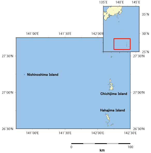
Fig.1: Location of the Ogasawara Islands
(Chichijima Island and Hahajima Island) and Nishinoshima Island
Figure 1 shows the location of Ogasawara Islands (Chichijima Island and Hahajima Island) and Nishinoshima Island.
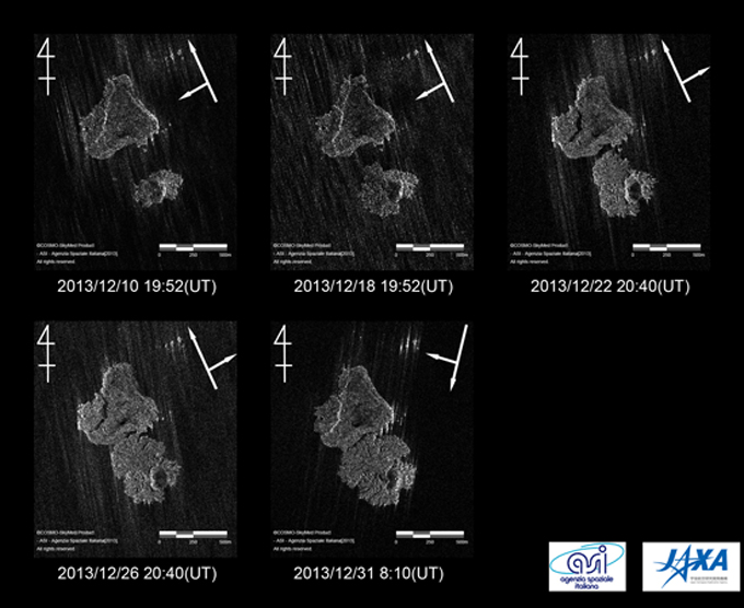
Fig.2: Time-series analysis at the near of Nishinoshima Island by COSMO-SkyMed data.
(Click to View Enlarged Image)
A long arrow shows the satellite direction, and a short arrow shows the beam illumination in each image.
| Upper left : Observed by Dec 10, 2013 |
| Upper center : Observed by Dec 18, 2013 |
| Upper right : Observed by Dec 22, 2013 |
| Lower left : Observed by Dec 26, 2013 |
| Lower right : Observed by Dec 31, 2013 |
Figure 2 shows the time-series images of COSMO-SkyMed in the sea around of Nishinoshima Island. The new island has expanded and merged with Nishinoshima from December 10 to 31, 2013.
JAXA will continue the observation and analysis at this area in collaboration with the Italian Space Agency (ASI).
(*1) COSMO-SkyMed equipped with X-band synthetic aperture radar (SAR) is the earth observation satellite which has been developed and operated by the Italian Space Agency (ASI), in cooperation with the Italian Ministry of Defence and e-geos company.
The observation principle of this radar is similar to the L-band Synthetic Aperture Radar, PALSAR on board the Advanced Land Observing Satellite "Daichi" of (ALOS), but its wavelength is different from that of the PALSAR.
©JAXA EORC
Copyright©1997- JAXA EORC All rights reserved.