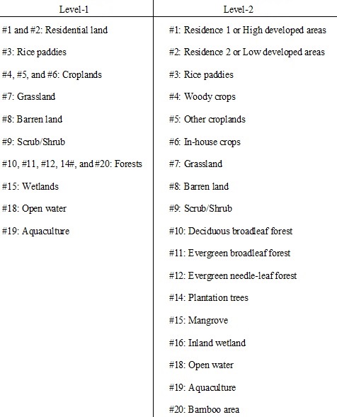
Dataset
Annual Land-Use and Land-Cover Maps across Mainland Vietnam from 1990 to 2020
(Released in September 2021 / Version 21.09)
Download product
User registration is required to download the data. Please click here about download and user registration details.
1. Summary
2. Data used for creating the map
- Data 1: Sentinel-1 SAR GRD
- Data 2: Sentinel-2 MSI Level-2A
- Data 3: Landsat 8 OLI (Collection 1)
- Data 4: Landsat 7 ETM+ (Collection 1)
- Data 5: Landsat 5 and 4 TM (Collection 1)
- Data 6: Ground survey data, inventory data, and visual interpretation of satellite data (130,000 sites)
- Data 7: ALOS PRISM Digital Surface Model (AW3D DSM) are used to calculate slope, aspect, and elevation
- Data 8: Covariates and indices derived from the data 2, 3, 4, and 5
- Data 9: Ancillary data including distance to rivers, coastlines, transport systems, and buildings
3. Classification algorithm
Random Forest with post-classification optimization [References 1 and 2]
4. Data format
| Period of coverage | 1990 to 2020 (each year) |
|---|---|
| Coordinate system | Geographic latitude and longitude coordinates (WGS84) |
| File size | 27,916 pixels x 55,526 lines |
| Mesh size | 0.000269494524118 degree × 0.000269494524118 degree (corresponding to approximately 30 m × 30 m) |
| Directory and file naming convention |
1990_2020VNM_v21.09_L1 |--
(In the above case, the product created for the Vietnam area in the years 1990 to 2020, released in September 2021(level 1), refers to a range of 22 to 23 degrees north latitude and 105 to 106 degrees east longitude.)- "VLUCD" indicates the coordinate of the Vietnam-wide land use/cover database. - "L1" indicates level one of the map with 10 different classes of primary dominant land use/cover in Vietnam. - "30m" indicates the 30-m spatial resolution of the map. - "2020" indicates the mapping year that is 2020. |
| Format | GeoTIFF format |
| Number of files (file x period x level) |
1 x 31 x 2 |
The value of each pixel indicates a single classified land cover type. It depends on the level of the map as follows:
5. Accuracy assessment
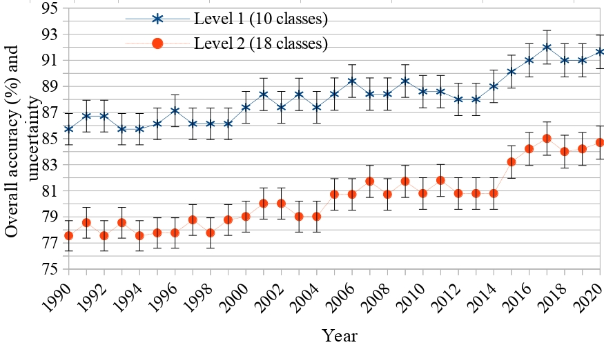
Figure 1. The overall accuracy (OA) and uncertainty of the Vietnam-wide annual land use/cover maps. The OA is estimated by using a confusion matrix and a stratified random sampling method with independent samples (1050 sites/LULC class). Bars indicate the uncertainties of the OA measured with a 95% confidence interval.
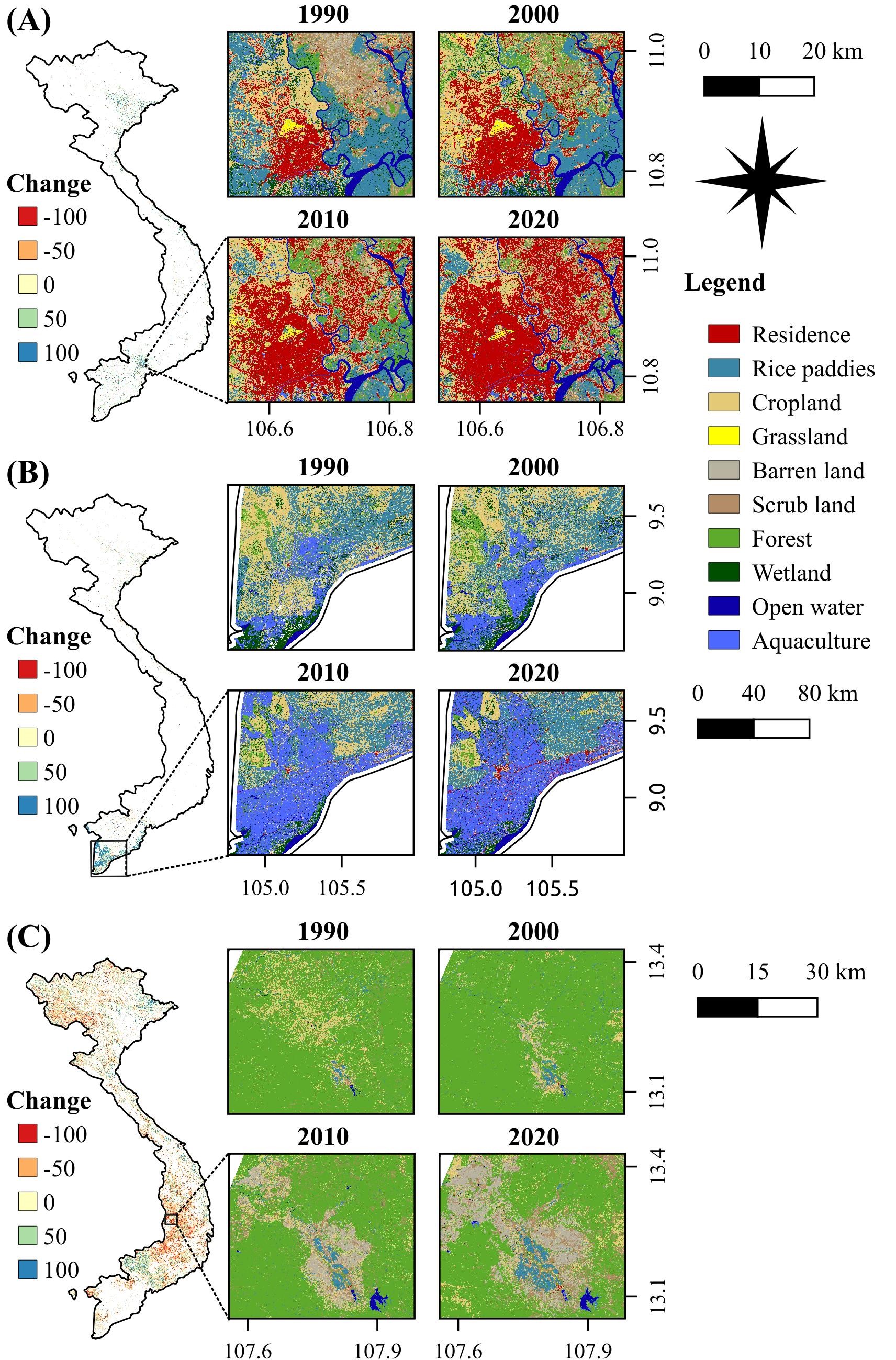
Figure 2. Spatial-temporal dynamics (left) and change pattern (right) of several dominant land types, namely the residential land (A), aquaculture land (B), and forests land (C) in Vietnam from 1990 to 2020.
6. References
- Phan, D. C. et al. First comprehensive quantification of annual land use/cover from 1990 to 2020 across mainland Vietnam. Sci. Rep. 11, (2021) DOI: 10.1038/s41598-021-89034-5
- Phan, D. C. et al. Ensemble learning updating classifier for accurate land cover assessment in tropical cloudy areas. Geocarto Int. 1?18 (2021) DOI:10.1080/10106049.2021.1878292
- Phan, D. C. et al. JAXA high-resolution land use/land cover map for Central Vietnam in 2007 and 2017. Remote Sens. 10, 1406 (2018) DOI: 10.3390/rs10091406
Acknowledgements
- AW3D30 data were provided by courtesy of JAXA and support from the Remote Sensing Technology Renter of Japan
- Multi-temporal Landsat and SRTM data provided by courtesy of the U.S. Geological Survey
- Base map and data from OpenStreetMap and OpenStreetMap Foundation. Data archives and processing services provided by courtesy of Google Earth Engine, General Statistics Office of Vietnam, and World Pop
- The Project for Human Resource Development Scholarship by Japanese Grant Aid (JDS)