ALOS-2
Observation results of Supersites
Observation results of Supersites
You can check the observation results of ALOS-2 Supersites from the MAP below.
The types of Supersites are as follows.
Details of observation results of Supersites
Overview
Observation results of Supersites shows the number of observations for each scene during the period 2014/8/4~2025/12/7. The results are summarized in the KML and JPEG format for each observation Site Name respectively.
Observation Mode
SM1(StripMap 3m), SM2(StripMap 6m), SM3(StripMap 10m)and W2(ScanSAR)are included.
Information stored in KML files
The following table shows the contents of KML files.
| No. | Definition | Contents |
| 1 | Path number | 001~207 |
| 2 | Frame number | 0000~7190 |
| 3 | Number of observations | 1~Over 60 |
| 4 | Beam number | Ex.) F2-5 |
| 5 | Orbit direction | A:Ascending D:Descending |
| 6 | Observation direction | R:Right looking L:Left looking |
Beam Number
The following table shows the relationship between the beam number and observation mode/off-nadir angle.
| Beam Number | Observation mode | Off-nadir angle (deg) |
| U2-6 | SM1 (StripMap 3m) | 29.1 |
| U2-7 | 32.7 | |
| U2-8 | 35.4 | |
| U2-9 | 38.2 | |
| FP6-3 | SM2 (StripMap 6m) | 18.0 |
| FP6-4 | 21.9 | |
| FP6-5 | 25.6 | |
| FP6-6 | 29.1 | |
| FP6-7 | 32.7 | |
| F2-5 | SM3 (StripMap 10m) | 28.2 |
| F2-6 | 32.7 | |
| F2-7 | 36.2 | |
| F3-8 | 39.3 | |
| F3-9 | 41.9 | |
| F3-10 | 44.3 | |
| W2 | ScanSAR | 34.9 |
Definition of KML file name
The definitions of KML file name are as follows;
{Site Name}_{Beam Number}_{A/D※1}_{R/L※2}_
{The first observation day in storage data※3}_{The last observation day in storage data※4}.kml
※1
A:Ascending
D:Descending
※2
R:Right looking
L:Left looking
※3/4
Observation results period of this time
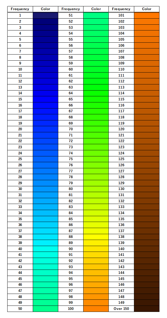
Legend of color
The legend below shows the relationship between the color in the KML files and the number of observations.
